Weather Thursday
14 responses | 0 likes
Started by metmike - March 14, 2019, 12:46 p.m.

Merry March 14th!   Do something to warm somebody's heart today. Don't just think about it........do it. Then think about it.............and how you just made somebody's world a tiny bit better. 


Our local chess tournament on Saturday got some great coverage:

https://www.courierpress.com/story/news/local/2019/03/09/spring-chess-tournament-opens-young-minds-new-possibilities/3097513002/

 Scroll down and  enjoy the latest comprehensive weather to the max. Here's the latest weather..... occurring because of the natural physical laws in our atmosphere.


Here are the latest hazards across the country.


Purple/Pink/blue on land is cold/Winter weather. Brown is wind,  Green is flooding. Gray is fog.  Reddish is a red flag advisory.  

Go to the link below, then hit the location/county on the map for details.

                          https://www.spc.noaa.gov/  Go to "hazards"                                                                                     


Wind map    Hit this with your cursor: 

US Weather Current Temperatures Map

US Weather Wind Chill Map


      Wind map     Press down on this on the left with your cursor!

Legend


Current Jet Stream


Winter Weather

https://www.wpc.ncep.noaa.gov/wwd/winter_wx.shtml


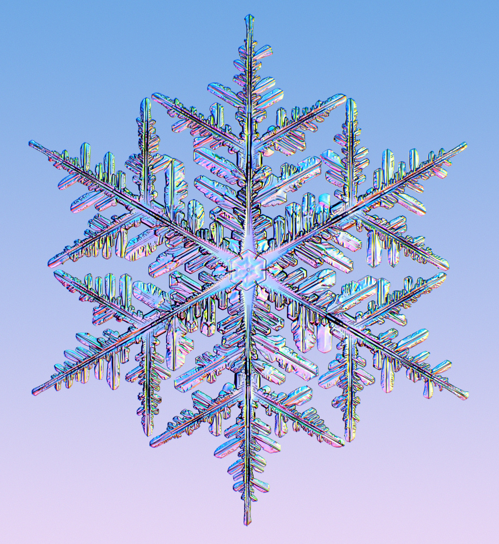
Image result for image of snowflakes


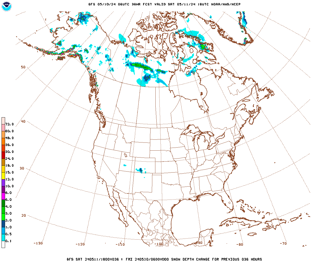
Snowfall the next day:


Forecast Hour:  036
Image URL: http://mag.ncep.noaa.gov/data/gfs/06/namer/snodpth_chng/gfs_namer_036_snodpth_chng.gif


gfs_namer_036_snodpth_chng.gif

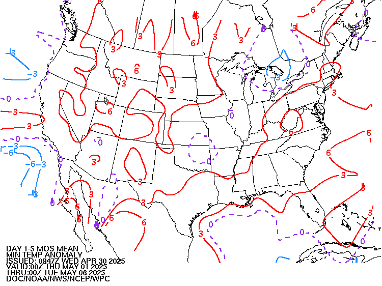
Low Temperatures Tomorrow Morning

Comments
By metmike - March 14, 2019, 12:47 p.m.
Like Reply

Warm surge moves east, then back to near average!


By metmike - March 14, 2019, 12:48 p.m.
Like Reply

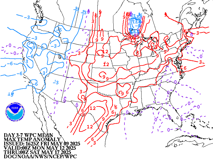
Highs for days 3-7:


Not much change from late this week onward.


http://www.wpc.ncep.noaa.gov/medr/DAY3_MAX_filled.gif

http://www.wpc.ncep.noaa.gov/medr/DAY4_MAX_filled.gifhttp://www.wpc.ncep.noaa.gov/medr/DAY5_MAX_filled.gifhttp://www.wpc.ncep.noaa.gov/medr/DAY6_MAX_filled.gifhttps://www.wpc.ncep.noaa.gov/medr/DAY7_MAX_filled.gif

By metmike - March 14, 2019, 12:48 p.m.
Like Reply

How do these days 3-7 temperatures compare to average at this time of year?


Close to average and minor fluctuations for the first time in awhile.


https://www.wpc.ncep.noaa.gov/medr/medr_mean.shtml


http://www.wpc.ncep.noaa.gov/medr/hpcmaxwbg.gif


https://www.wpc.ncep.noaa.gov/medr/95Bwbg.gif

By metmike - March 14, 2019, 12:50 p.m.
Like Reply

Weather maps for days 3-7 below


Tranquil......Pacific origin High pressure and a couple of weak cold fronts.https://www.wpc.ncep.noaa.gov/medr/5dayfcst_wbg_conus.gif


By metmike - March 14, 2019, 12:51 p.m.
Like Reply
By metmike - March 14, 2019, 12:52 p.m.
Like Reply

Severe Storm Outlook

https://www.spc.noaa.gov/products/outlook/


Current Day 1 Outlook
        1300 UTC Day 1 Outlook             
                Forecaster: Edwards/Goss
Issued: 11/1254Z
Valid: 11/1300Z - 12/1200Z
Forecast Risk of Severe Storms: Marginal Risk        
      
          Current Day 2 Outlook
          0600 UTC Day 2 Outlook               
                Forecaster: Gleason
By metmike - March 14, 2019, 12:54 p.m.
Like Reply

Current Dew Points


Moisture in green that temporarily surged northward,  is being swept out and will be replaced by dry air!
  
Current Dew Points


Latest radar loop


http://www.nws.noaa.gov/radar_tab.php

Doppler Radar National Mosaic Loop


Full resolution version loop (3400x1700 pixels - 2.2mb)


Central Great Lakes sector loop
Go to: Most Recent Image

Precipitation the past 24 hours


You can go to this link to see precipitation totals from recent time periods:


https://water.weather.gov/precip/


                              Go to precipitation, then scroll down to pick a time frame. Hit states to get the borders to see locations better. Under products, you can hit "observed" or "Percent of normal"      

+++++++++++++++++++++++++++++++++++++++++++++++


  +++++++++++++++++++++++++++++++++++++

Precipitation compared to average for the last 7, 14, 30 and 60 days. 


Usually not updated for previous day until late the next day.

https://www.atmos.illinois.edu/~snodgrss/Ag_Wx.html

http://weather.agribleservices.com/ahps/7_day_percent.png


http://weather.agribleservices.com/ahps/14_day_percent.png

http://weather.agribleservices.com/ahps/30_day_percent.pnghttp://weather.agribleservices.com/ahps/60_day_percent.png

By metmike - March 14, 2019, 1:02 p.m.
Like Reply

The top map is the Canadian ensemble average, the maps below are the individual members that make up the average

+++++++++++++++++++++++++++++++++++++++++

Each member is like the parent, Canadian model operational model.......with a slight tweek/variation in parameters. Since we know the equations to represent the physics of the atmosphere in the models are not perfect, its useful to vary some of the equations that are uncertain(can make a difference) to see if it effects the outcome and how.

The average of all these variations(ensembles) often yields a better tool for forecasting. It's always more consistent. The individual operational model, like each individual ensemble member can vary greatly from run to run.........and represent an extreme end of the spectrum at times. The ensemble average of all the members, because it averages the extremes.............from opposite ends of the spectrum.........changes much less from run to run.

End of week 2....................12z ensembles from THURSDAY:
Analysis starting from a week ago, ending with today:


Last Monday:  Still very mild, zonal Pacific flow. Some minor/subtle changes in the Northeast(from a few solutions) that might cause more troughing/cooling that need to be watched to see if they amount to anything down the road.

Tuesday: Several solutions showing more troughing East. The mean still looks zonal and mild but the changes continue to be slight and in the colder direction. 

Wednesday:  Around the same as Tuesday. Overall a mild zonal look to the mean but with some subtle ridge/west, tough/east tendencies, that on some solutions, is amplified enough to engage northern stream cold. 

Thursday: Back to being milder again. Zonal Pacific west to east flow prevalent on the majority but not all solutions. The upper level low in Northeast Canada is too far north on most solutions to impart northern stream cold very far southward into the US. 

Friday: The ridge west/trough east(downstream) couplet that was least apparent on the Canadian models shows up better today in Canada, which is where its capable of generating cold air.  However, this is offset by several solutions with an undercutting, milder flow. Today's overnight solution is a bit colder than yesterday's.

Sunday:  Much milder, west to east,  Pacific flow has overwhelmed and is undercutting any northern stream influence. The ridge/west, trough east couplet is barely seen on a small minority. 

Monday: Same much milder, west to east, Pacific flow as yesterday. 

Tuesday: Similar to the last 2 days. Very mild mean. 

Wednesday: The much milder, new pattern featuring mild Pacific flow that spreads from west to east across the country keeps looking impressive.

Thursday: No changes........very mild using updated 12z model run.

360h GZ 500 forecast valid on Mar 29, 2019 12 UTC

GZ 500 forecastGZ 500 forecastGZ 500 forecastGZ 500 forecast

By metmike - March 14, 2019, 1:04 p.m.
Like Reply

0Z GFS Ensembles at 2 weeks:

Analysis,  starting with a week ago:


Last Monday: Unlike the Canadian ensembles, the GFS ensembles are more bullish with the northern stream. Some of them build a ridge/west, trough/east(downstream) couplet that would usher in the cold from Canada. This was mentioned on Sunday afternoon in a special update when it first started showing up............but that doesn't mean that it will happen. Just an interesting new development for what the models think(guess) will be happening in 2 weeks.

Tuesday: Still moving in the colder direction on the majority of solutions with more troughing in the Northeast noted on all of them now.

Wednesday: Ridge west/trough east is slightly less amplified today on several of the solutions(less northern stream connection) but still the main feature to be watching at the end of week 2.

Thursday: Ridge west/trough east couplet vs undercutting Pacific flow is the battle. Overnight models were a tad  milder in the center of the country and shifted to cold from the northern stream farther east, to the far Northeast US from the couplet mentioned.

Friday: The 12z solution yesterday amplified the ridge west/trough east feature and this continued early last night on the 0z solutions seen below..........which is much colder than 24 hours ago. The solutions below are are dominated by the Northern Stream , some are very cold in the Midwest/East. However, the 06z run early this morning was not quite as cold.

Sunday:  The trough with any ridge/west, trough east northern stream influence is way up in Central to Northeast Canada, leaving the US in mild Pacific air.

Monday: Similar to yesterday.

Tuesday: Still very mild

Wenesday: Still very mild but with a couple of outliers that want to over amplify a northern stream low/trough and drive it into Southeast Canada from the ridge/west, trough/east couplet in the higher latitudes.

Thursday: Very mild. Pretty uniform agreement.

http://mp1.met.psu.edu/~fxg1/ENSHGT_0z/f360.gif

By metmike - March 14, 2019, 1:06 p.m.
Like Reply

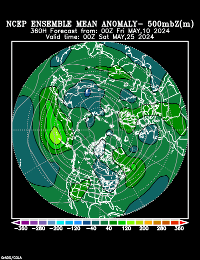
Ensemble mean(average of all the individual solutions above)


Last Monday:  Upper level ridge building along the West Coast into Canada with troughing and coolingdownstream......at the end of 2 weeks. This is cooler for that period than the last several days. The Euro ensembles started this on Saturday Night and the Sun PM GFS ensembles caught on as noted on the special Weather Sunday update yesterday ahead of the natural gas open, then following it.  This doesn't mean it will happen........just that a few more model solutions show it.........while others still do not.

Tuesday: You can see the modest upper level ridge in W.Canada and trough downstream on the anomaly below. Turning cold again in the east and during the late parts of March if this is right.

Wednesday: Similar to yesterday but the anomalies are a tad weaker.

Thursday: Actually, the ridge/west, trough/east couplet today looks a bit stronger but the downstream upper level trough/low anomaly is much farther east...........in Eastern Canada.......which allows more of the warmth from the western ridge to push farther east and the cold from the downstream trough to be mainly in Southeast Canada vs south of the border.

Friday: This product had not been updated as of Friday Morning.

Sunday: Weak ridging west and troughing in Eastern/Northeastern Canada(where cold will be, just north of Northeast US.

Monday: Far Western North American ridge anomaly is more impressive today, however the down stream trough is in Northeastern Canada as much of the US has positive anomolies, all the way to the East Coast................so the Pacific warmth will likely be widespread. 

Tuesday: Still very mild in the US with Pacific flow, with a ridge/west, trough/east couplet way up in Canada that will be much too far north to bring northern stream flow or cold this far south..........but something to watch.

Wednesday: The big upper level ridge in Western North America builds all the way north........to Siberia but the downstream trough is waaaay to far north for any northern stream derived dynamics to get as far south as the US. This may just represent a seasonal migration northward of the jet stream and position of the main weather features. Mild Pacific flow dominates here. 

Thursday: Ridge west also extends farther east with positive upper level height anomalies into the Plains and eastward.  Very mild Pacific air spreads across the country.

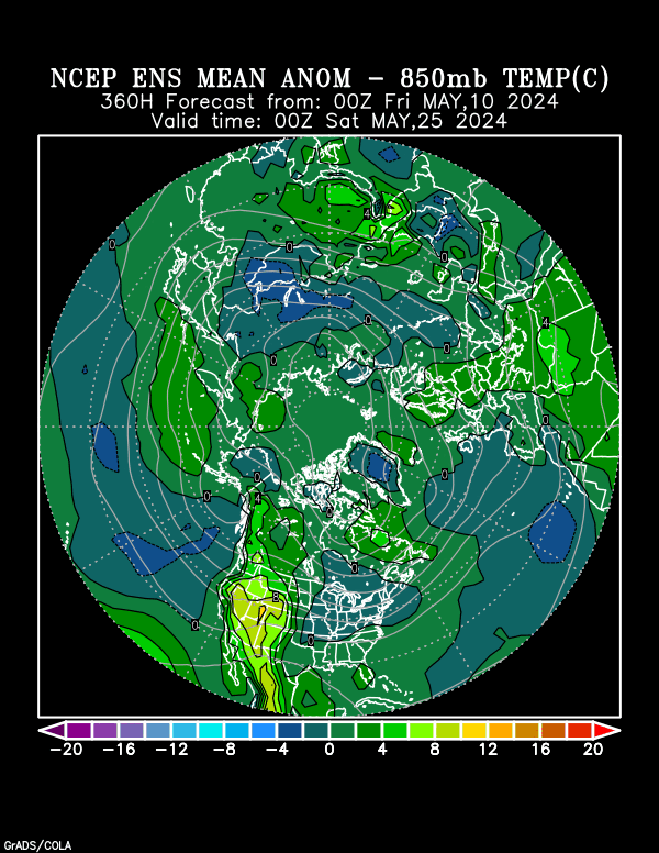
NCEP Ensemble t = 360 hour forecast

NCEP Ensemble t = 360 hour forecast producthttps://www.esrl.noaa.gov/psd/map/images/ens/t850anom_f360_nhbg.gif

By metmike - March 14, 2019, 1:09 p.m.
Like Reply

Latest, updated graph/forecast for AO and NAO here, including an explanation of how to interpret them. 

Previous analysis, with the latest day at the bottom for late week 2 period.


Last Monday: AO drops faster in week 2, now with numerous solutions solidly negative..........increasing chances for cold in the high latitudes to be transported towards the mid latitudes during the 2nd part of March. However, the very wide spread indicated uncertainty/low confidence. NAO has increasing spread and uncertainty on both sides of zero. PNA too but the trend for the PNA is up and most solutions are now positive at the end of 2 weeks vs previously around zero. This has also elevated the chances for cold to penetrate south vs the last few days using these indices.

Tuesday: AO continues to look more favorable for cold to move from high latitudes to mid latitudes in late March. Going from positive in week 1 and plunging in week 2, to negative by the end. NAO around zero. PNA increasing to positive which enhances the chance of cold penetrating into the US, east of the Rockies. 

Wednesday:  AO only drops to zero now at the end of week 2..............less favorable for frigid air to travel from high to mid latitudes. NAO stays a bit positive............also less favorable for cold. PNA is a bit positive, which still favors cold. None of the indices are very powerful forecast tools right today.

Thursday: AO which is positive, drops but only close to zero. NAO stays a bit positive, PNA also positive.........favorable for a ridge and warmth in the West. Other than that, nothing profound.

Friday: AO goes from positive to near zero. NAO is a tad positive. PNA is enough positive to favor a ridge West.

Sunday: AO stays positive, NAO positive...........NOT favorable for cold to travel from high to mid latitudes. PNA is positive, favorable for warmth/ridging in the West.

Monday: AO positive, NAO positive..........unfavorable to cold to move southward into the US from higher latitudes. PNA does get solidly positive because of the ridging in the West.

Tuesday: Indices today are becoming volatile at the end of week 2. AO positive but drops to near zero at the end of 2 weeks. NAO also falling but still a bit positive. The wide spread means a bit more uncertainty and a slight increase that cold could return at the end of March(but still unlikely). PNA positive but falling. It's getting too late in the heating season for cold to make a big difference.

Wednesday: Positive AO and NAO make cold air intrusions unlikely. Positive PNA means ridging and warmth in the West.

Thursday: Positive AO and NAO still make very cold air intrusions unlikely. Positive PNA because of the ridge in the West..........which expands eastward.

The link below, now has the PNA index added at the bottom:


https://www.marketforum.com/forum/topic/157

By metmike - March 14, 2019, 1:09 p.m.
Like Reply

National Weather Service 6-10 day, 8-14 day outlooks.

Updated this afternoon.............should continue to turn warmer. 


Temperature Probability

6 to 10 Day Outlook - Temperature Probability
 Precipitation Probability

  6 to 10 Day Outlook - Precipitation Probability


the 8-14 day outlooks
ArchivesAnalogsLines-Only FormatGIS Data

Temperature Probability

8 to 14 Day Outlook - Temperature Probability
8 to 14 Day Outlook - Precipitation Probability
By silverspiker - March 14, 2019, 3:49 p.m.
Like Reply

Another horse dies at Santa Anita, one day after the main track reopens   ....

March 14, 2019 10:49 A.M.

https://www.sandiegouniontribune.com/news/california/114443340-132.html


Santa Anita Park suffered a 22nd horse fatality since Dec. 22 on Thursday morning just one day after the main track was reopened for training. The horse suffered a severe injury and was euthanized. A track spokesman said a “major corporate announcement” is expected before noon.

Princess Lili B broke both front legs at the conclusion of a half-mile workout, as first reported by Brad Free of the Daily Racing Form and confirmed by The Times. Training will continue on the track, Free reported.

It was only the second day of training on the main track after Santa Anita suspended racing last week in response to the previous deaths.

No definitive reason for the rash of horse fatalities has been identified. After repeated inspections and dirt sampling, the rehiring of track consultant Dennis Moore and enhanced safety protocols, Santa Anita has been trying to move toward a resumption of racing on March 22.

In all, 196 horses safely worked out at the track on Wednesday, according to a Santa Anita spokesman — 112 on the main track and 84 on the training track, a softer course where there has yet to be a fatal injury during the winter/spring meet.

Sign up for our horse racing newsletter

Changes instituted by Santa Anita in response to the deaths included a requirement that trainers give 24-hour notice on workout requests so that veterinarians can review horses in advance and spot possible concerns.

Santa Anita continued to conduct training workouts after the injury Thursday. The track is expected to announce additional safety protocols to horsemen this afternoon.

The injuries, though, have many long-time horsemen voicing concerns.

“It’s mind-boggling to me,” said trainer Art Sherman, who trained Kentucky Derby winner California Chrome. “I’ve never seen this as long as I’ve been around. In horse racing, you’re always going to have accidents. I don’t know what to make of it. I’m at Los Alamitos, and we haven’t had any problem at all. It’s scary seeing all these breakdowns.”

MORE ON SANTA ANITA

The dirt on Santa Anita? That's being tested in wake of horse fatalities


By metmike - March 14, 2019, 8:19 p.m.
Like Reply

Extremely odd that all those horses sees have died!