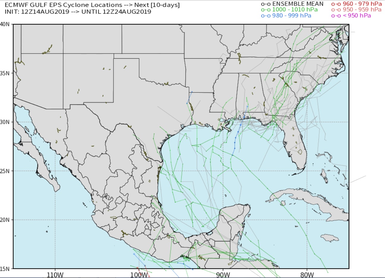
Heads up. The GFS the past few days has shown a strong system developing in the Gulf. As usual the GFS flip flops a lot and it is now absent. However the ensembles are now picking up on a threat in the Gulf with the EURO ensembles hinting at something as well. Five of the ensemble members develop what looks to be at least a tropical storm. Wind shear across the area is too strong for anything to develop at this time however, both the GFS and EURO Ensembles seem to relax that shear over the west central Gulf next week. Just thought anyone who is trading natural gas may want to know.
Thanks Grant! Time to get geared up for hurricane season!
As you know, NOAA updated their hurricane forecast last week, increasing the chance(slightly) for it to be more active........mainly because of the El Nino being gone(which really was expected).
El Nino's in the Pacific, affect wind patterns in the Atlantic and make them less favorable for hurricane's.
We are also still in what looks like an active part of a natural cycle in the Atlantic Ocean basin that started in around 1995.
https://pix11.com/2019/08/12/expect-more-hurricanes-than-usual-this-year-weather-experts-warn/
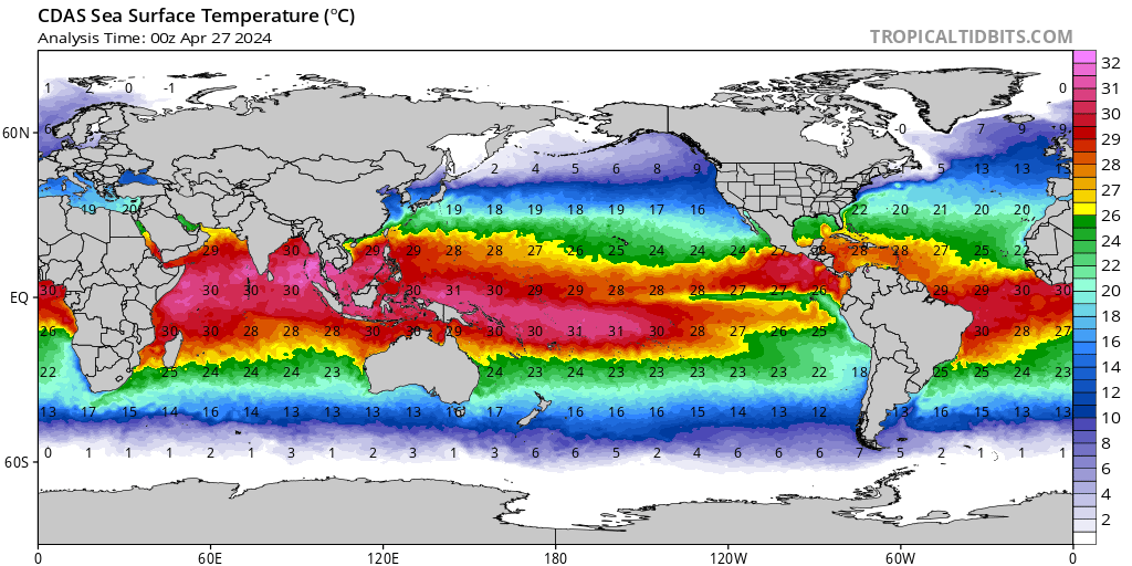
Another factor that could come into play is the warm ocean water temperatures right now. You need around 80 deg. F to help intensify a tropical storm(just under 27 deg.C) and the water is plenty warm for that from the Central Atlantic westward.
Let's take a closer look at some very warm temperatures in the Gulf of Mexico.
I see systems trying to develop over the next two weeks in the Atlantic struggling. Looks like a surge of African dust came off the coast with the trade winds and the shear is still fairly strong out there. It will have to be a busy September and October. But even if it isn't busy, it only takes one as we have all seen.
Yes the Gulf is very warm. Very favorable if the shear relaxes.
Thanks!
I greatly respect your expertise in this field (over mine) and am looking forward to your updates.
These maps are not the greatest but they show the current warmth. Most of the GOM is above 30(86 F) with a few spots above 31 deg.
I noticed some local temps around the Keys at 92 deg. That must be a record. Note the pocket of +31 deg (88 deg F) on the 2nd maps of the Southwest Atlantic!
Of course hot water can sit there for the entire hurricane season without a storm passing over it............which happens most of the time but should be get a favorable environment with a storm in those locations, it will have an opportunity for explosive intensity increases.
http://www.maineharbors.com/weather/seatemp.htm

![]()

![]()
Weaker shear over that area of 87 to 89 degree water off the Louisiana Coast could cause some issues. But the shear has to weaken.
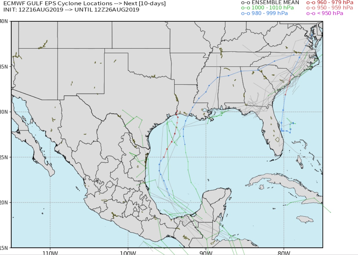
Models are still showing a disturbance but much farther west, hugging the Texas Coast. That would likely make development difficult if this trend is accurate.
The EURO Ensembles have one interesting run.
Thanks Grant!
Funny how we can go from being so quiet to suddenly, the tropics coming alive in just a few weeks.
Here's the date/satellite pix when we had the most hurricanes at once in the Atlantic.

That disturbance in the Gulf is still showing up as an area of heavier rain but no tropical development looks likely at this time. The shear looks stronger over that area of the Gulf as well.

