Watching Invest 99L, just E of the Lesser Antilles.
This has since become TS Karen and is still being watched for potential CONUS involvement.
https://www.nhc.noaa.gov/graphics_at2.shtml?start#contents
| Home Public Adv Fcst Adv Discussion Wind Probs Graphics Archive U.S. Watch/Warning Local Products |
| Wind Speed Probabilities | Arrival Time of Winds | Wind History | Warnings/Cone Interactive Map | Warnings/Cone Static Images | Warnings and Surface Wind |
Key Messages |
![[Key Messages]](https://www.nhc.noaa.gov/storm_graphics/AT12/refresh/AL122019_key_messages+png/144236_key_messages_sm.png)
Click Here for a Printer Friendly Graphic
EURO Ensembles for Karen. Pretty consistent forecast through day 5 then it's all over the place! I'm heading to Louisiana the 2nd through the 6th along the coast to fish, so I hope it stays well east.
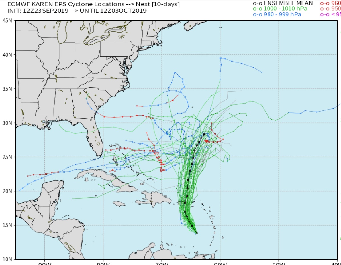
And here are the GFS Ensembles. A little more consistent that the Euro after day 5. Both the GFS and the EURO have a large dome of high pressure at 500MB which should keep it off the East coast. The Euro at times has hinted at a weakness in that 500mb dome and IF that happens Karen would try to ride the trough. That's why the ensembles for the EURO have more tracks into the Gulf.

Thanks Grant!
I hope you get good weather. When somebody is headed on a trip, they will often ask me what the weather is going to be like. Obviously no need to advise you on weather (-:
We are currently past the peak/mid point of the hurricane season in the Atlantic basin.
https://www.nhc.noaa.gov/climo/#bac

The official hurricane season for the Atlantic Basin (the Atlantic Ocean, the Caribbean Sea, and the Gulf of Mexico) is from 1 June to 30 November. As seen in the graph above, the peak of the season is from mid-August to late October. However, deadly hurricanes can occur anytime in the hurricane season.
Looking farther west: