Latest radar loop. At 6am, you can see the circulation of Alberto in central Alabama:
https://radar.weather.gov/Conus/index_loop.php
Full resolution version loop (3400x1700 pixels - 2.2mb) | Time of images: 0908 UTC 05/29/2018 through 1008 UTC 05/29/2018 |

Go to: Most Recent Image
You can go to this link to see rain totals from recent time periods:
https://water.weather.gov/precip/
Go to precipitation, then scroll down to pick a time frame. Hit states to get the borders to see locations better. Under products, you can hit %normal.
Note all the dry pockets for % normal over the past 14 days, especially in IL/IN and now w.IA and e.NE.. Rain makes grain now and lack of rain is bullish, more rain bearish in the forecasts.
Extended NWS.........pretty bullish but maybe overly bullish on rains? We're still holding the gaps higher from last nights open here at 6am.
| |||||
Temperature Probability  | |||||
Alberto was in central AL and is now just a remnant depression and weakening

As mentioned last night, we have a northwest flow situation and moderating temperatures on the week 2 models. Overnight that strengthened.
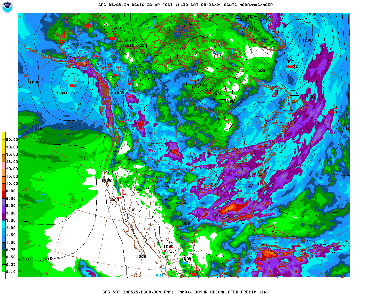
This was total 2 week precip on the last GFS. Liikely overdone but it shows what can happen with northwest to southeast flow....around the periphery of a heat ridge:
Forecast Hour: 384
Image URL: http://mag.ncep.noaa.gov/data/gfs/06/namer/precip_ptot/gfs_namer_384_precip_ptot.gif

mcfarm's(who is bone dry) NWS forecast:
Today
A 20 percent chance of showers and thunderstorms after 3pm. Partly sunny, with a high near 88. East wind 9 to 14 mph, with gusts as high as 20 mph.
Tonight
Showers and thunderstorms likely, mainly after 2am. Mostly cloudy, with a low around 71. East southeast wind around 8 mph. Chance of precipitation is 60%. New rainfall amounts of less than a tenth of an inch, except higher amounts possible in thunderstorms.
Wednesday
Showers and thunderstorms likely. Mostly cloudy, with a high near 81. Southeast wind 11 to 18 mph, with gusts as high as 31 mph. Chance of precipitation is 70%. New rainfall amounts between a quarter and half of an inch possible.
Wednesday Night
A 50 percent chance of showers and thunderstorms. Mostly cloudy, with a low around 69. South southwest wind 9 to 13 mph, with gusts as high as 22 mph. New rainfall amounts between a tenth and quarter of an inch, except higher amounts possible in thunderstorms.
Thursday
A 30 percent chance of showers and thunderstorms. Partly sunny, with a high near 86. Southwest wind 9 to 13 mph.
Thursday Night
A 30 percent chance of showers and thunderstorms, mainly before 2am. Partly cloudy, with a low around 69.
Friday
A slight chance of showers and thunderstorms before 8am, then a slight chance of showers and thunderstorms after 2pm. Mostly sunny, with a high near 87. Chance of precipitation is 20%.