
Friday morning radar fairly quiet but things will pick up:
https://radar.weather.gov/Conus/index_loop.php
| Time of images: 1228 UTC 06/01/2018 through 1338 UTC 06/01/2018 |

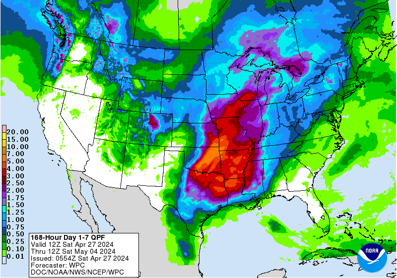
Lots of rain the next 7 days in some places, not as much in others....mcfarm ripped off again?
How much did you get the last 2 days mcfarm?
http://www.wpc.ncep.noaa.gov/qpf/fill_94qwbg.gif?1526306199054
http://www.wpc.ncep.noaa.gov/qpf/day2.shtml
http://www.wpc.ncep.noaa.gov/qpf/day3.shtml
http://www.wpc.ncep.noaa.gov/qpf/95ep48iwbg_fill.gif?1526306162
http://www.wpc.ncep.noaa.gov/qpf/97ep48iwbg_fill.gif?1526306162
Total accumulation
http://www.wpc.ncep.noaa.gov/qpf/p168i.gif?1526397762
6-10/8-14 day will be hot and dry again:
http://www.cpc.ncep.noaa.gov/products/predictions/610day/
http://www.cpc.ncep.noaa.gov/products/predictions/814day/index.php
Temperature Probability | ||
Precipitation Probability | ||
|
If this hot/dry weather does happen, the area of drought will likely expand northeast.
http://droughtmonitor.unl.edu/
The map below is the latest drought monitor. The one below that was from 3 months ago.......early March.


Severe Storm risk the next 8 days:
http://www.spc.noaa.gov/products/outlook/
| Current Convective Outlooks | |
|---|---|
Current Day 1 Outlook | Forecaster: Edwards/Smith Issued: 01/1259Z Valid: 01/1300Z - 02/1200Z Forecast Risk of Severe Storms: Enhanced Risk |
Current Day 2 Outlook | Forecaster: Picca Issued: 01/0544Z Valid: 02/1200Z - 03/1200Z Forecast Risk of Severe Storms: Slight Risk |
Current Day 3 Outlook | Forecaster: Picca Issued: 01/0729Z Valid: 03/1200Z - 04/1200Z Forecast Risk of Severe Storms: Marginal Risk |
Current Day 4-8 Outlook | Forecaster: Picca Issued: 01/0830Z Valid: 04/1200Z - 08/1200Z Note: A severe weather area depicted in the Day 4-8 period indicates a 15%, 30% or higher probability for severe thunderstorms (e.g. a 15%, 30% chance that a severe |
Excessive rain threat the next couple of days:
Current Day 1 Forecast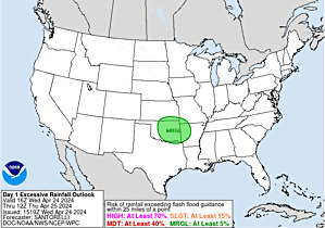 Valid 15Z 06/01/18 - 12Z 06/02/18 |
Day 1 Threat Area in Text Format
| Day 2 and Day 3 Forecasts |
Current Day 2 Forecast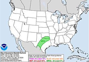 Valid 12Z 06/02/18 - 12Z 06/03/18 |
Day 2 Threat Area in Text Format
Current Day 3 Forecast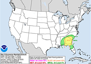 Valid 12Z 06/03/18 - 12Z 06/04/18 |
You can go to this link to see rain totals from recent time periods:
https://water.weather.gov/precip/
Go to precipitation, then scroll down to pick a time frame. Hit states to get the borders to see locations better. Under products, you can hit %normal.
Lots of dry pockets
I think it is safe to see that with the rain potential over the next couple days, it's going to be another week or 3 before we see much, if any drop in crop ratings.
We are supposed to get some rain this afternoon, we shall see. It's missed us here in Akron all week.
Thanks Jim,
Rains have underperformed models and forecast the past 2 months.
Much of the guidance turns it very warm(hot west) and dry in week 2................but the just out, 12z Canadian model still has rains coming early in week 2 with a powerful cold front surging south from Canada and a wet southern stream aimed at the Plains/WCB/SW belt from an upper low out west.
If this would verify, and get as far south as TX, cotton would be limit down for a couple of days.
Cotton prices have been soaring along with widespread 100+ heat in cotton country/TX
 Images created on Fri 01 Jun at 16:57Z
Here's that intense heat in W.TX. Some places approaching 110 degrees!
http://www.wpc.ncep.noaa.gov/medr/DAY5_MAX_filled.gif
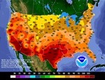
Day 5
[Contours Only]
yes Mike ,ripped to the bone. 2.10th one day and road got wet another. Kicker was when the front came thru it took down 4 trees in brothers yard which took 5 hours to clean all to watch the rain disappear again
Back to 1950, May of 2018 came in with the highest nationally averaged cooling degree days as well as lowest nationally averaged heating degree days on record for any May. The only cooler than normal were in S FL and the Southern Calif. coast.