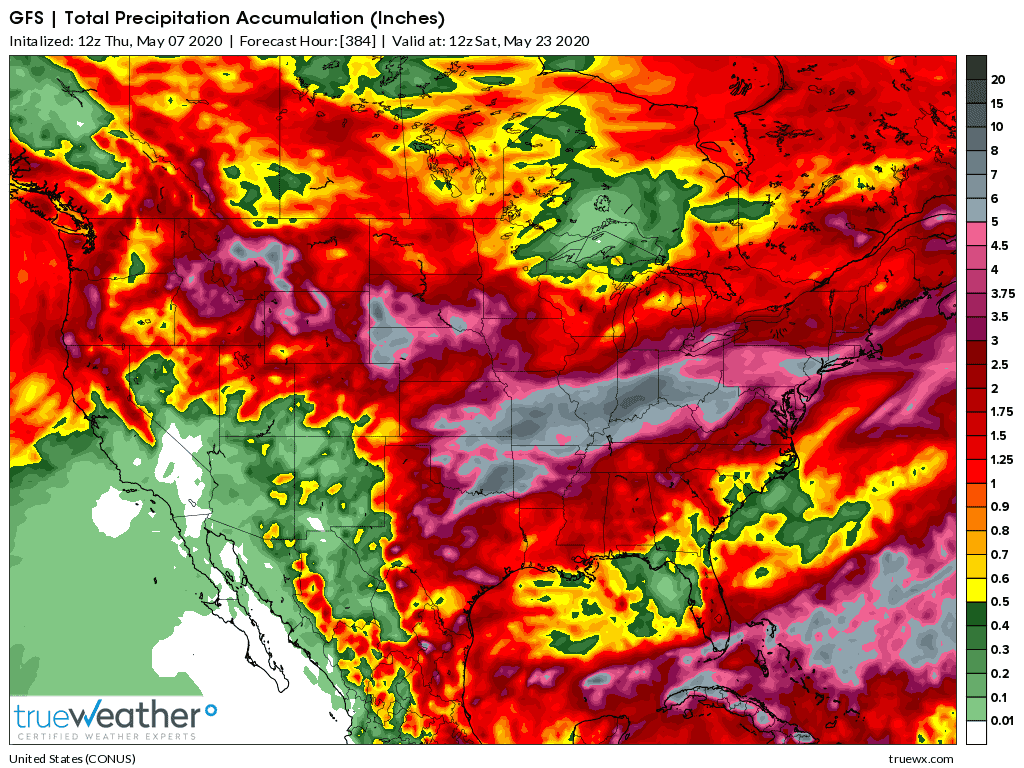
Latest 2 week forecast rains from the just updated 12z GFS.
The gray shade is 5"+ from the SE Plains to the S Midwest to the E Cornbelt/Ohio River Valley.
Latest 2 week rains from the just updated 0z GFS ensemble mean:
Thanks Mike for these weather warnings
Flooding in the Midwest again?
We stopped planting due to cold weather. We had snow squalls today. We are supposed to have freezing temps Monday night, but then should start to warm up. With one person healing from eye surgery, we will have a harder time getting crop planted. We hope to get most if not all planting completed before wet weather sets in.
YW!

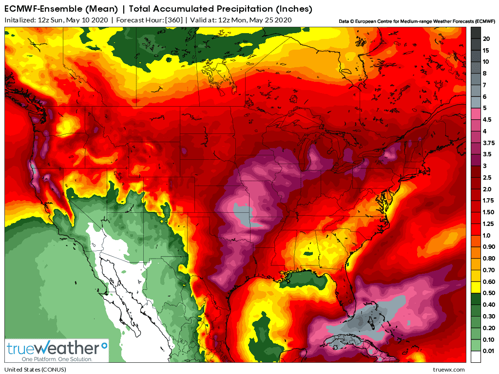
Latest 2 week rains below from the European model ensemble-12z.
Not as wet as last week but still the risk of some heavy rains.
It will depend on how far northwest an upper level, early season heat ridge builds, actually where the position is and how long it maintains as well as how much southern stream energy tracks on the west side and along the periphery.
The item that now REALLY stands out the most, is the amount of very warm air that will be coming north compared to how chilly it's been recently. A complete reversal of the recent pattern!