Some very good to excellent corn has green snap, hail and wind damage to a large area of corn fields. Any one of which is critical for plant production at this stage of growth. Many had wind and hail which just makes it worse. Almost all had green snap which, means the plants affected the stalk is broken in two with no hope of production, at this stage of re-production growth
Parts of Nebraska, Iowa, Illinios, all very high yield parts or the corn belt, with damage at critical pre-tassel-pollination stage of growth
Most are insurance claims but will have some affect on total corn production
This is more than just isolated fields. Very wide spread area of damage. Damage will be severe
Other places are still in drought conditions
We had over two inches of rain and the fields are not even muddy the next morning. Soil is like a sponge with 4" of pure dust on top, before rain
My grand father told me: Once the damage is done, then it will rain.
Our local basis is improving. That tells us what the big picture is. Last yrs corn in the bin are mostly sold and used up. One larger elevator still has old crop corn
New crop is variable depending on who got rain and when
Just starting to tassel
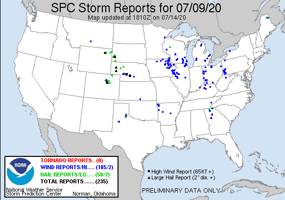
On July 9, we had storms blow through. No damage to our crops at home, but our farm in the next county had some corn flattened. Late yesterday , big storms just missed us to the north. Quad Cities TV was estimating 80-95 mph winds and heavy rain. The corn can't be looking good in that area, but as usual, the market looks at the big picture and won't care about regional disasters (Illinois)
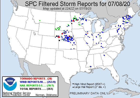
Blue triangles indicate a place where a 55+ mph wind occurred..
The market will not care about this and will gap lower on the open because the weather forecast has turned more bearish the last 2 days.

Rains the previous 24 hours from those storms and rains the last 7 days from storms.
On the 2nd map, those areas in the light shade of green that got at least an inch of rain should hold crop condition ratings. Areas in dark green will hold to possibly improve a tad.
The blue areas, which is not alot of area will deteriorate and in MO, the crops ratings could plunge by a large amount. The sw 1/3 to 1/2 of IA may also drop a bit with the n and ne parts of IA doing well.

