Weather Thursday
20 responses | 0 likes
Started by metmike - July 12, 2018, 10:17 a.m.
Comments
By metmike - July 12, 2018, 10:17 a.m.
Like Reply

Excessive Rainfall threat returning!


Current Day 1 ForecastCurrent Day 1 Excessive Rainfall Forecast

Day 1 Threat Area in Text Format  


Current Day 2 ForecastCurrent Day 2 Excessive Rainfall Forecast
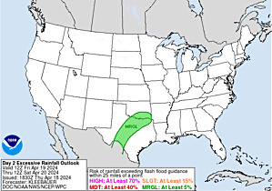

Day 3 forecast below

Current Day 3 Excessive Rainfall Forecast

By metmike - July 12, 2018, 10:18 a.m.
Like Reply

Severe Storm Risk.  Upper Midwest.   Press your cursor on the map for full screen.

https://www.spc.noaa.gov/products/outlook/

Current Day 1 Outlook
        1300 UTC Day 1 Outlook             
                Forecaster: Hart/Kerr
Issued: 18/1240Z
Valid: 18/1300Z - 19/1200Z
Forecast Risk of Severe Storms: Slight Risk        
      
          Current Day 2 Outlook
          0600 UTC Day 2 Outlook               
                Forecaster: Bunting
Issued: 18/0600Z
Valid: 19/1200Z - 20/1200Z
Forecast Risk of Severe Storms: Marginal Risk        
      
          Current Day 3 Outlook
          0600 UTC Day 3 Outlook               
                Forecaster: Bunting
Issued: 18/0731Z
Valid: 20/1200Z - 21/1200Z
Forecast Risk of Severe Storms: Marginal Risk
      
          Current Day 4-8 Outlook
          Day 4-8 Convective Outlook
By metmike - July 12, 2018, 10:20 a.m.
Like Reply

High Temperatures today and Friday.......hot in the center to Southeast.


By metmike - July 12, 2018, 10:21 a.m.
Like Reply

Dew points increasing northward in Miss River Valley.

Current Dew Points

By metmike - July 12, 2018, 10:21 a.m.
Like Reply

Heat and high humidity .....feels like temperature!

Current US Heat Index Map

By metmike - July 12, 2018, 10:23 a.m.
Like Reply

Highs days 3-7 shows  Cooling Midwest then Northeast.

http://www.wpc.ncep.noaa.gov/medr/DAY3_MAX_filled.gif

http://www.wpc.ncep.noaa.gov/medr/DAY4_MAX_filled.gifhttp://www.wpc.ncep.noaa.gov/medr/DAY5_MAX_filled.gifhttp://www.wpc.ncep.noaa.gov/medr/DAY6_MAX_filled.gifhttp://www.wpc.ncep.noaa.gov/medr/DAY7_MAX_filled.gif

By metmike - July 12, 2018, 10:24 a.m.
Like Reply

How do these temperatures compare to average at this time of year. Above average in the hottest time of year!:

High temperature departures:
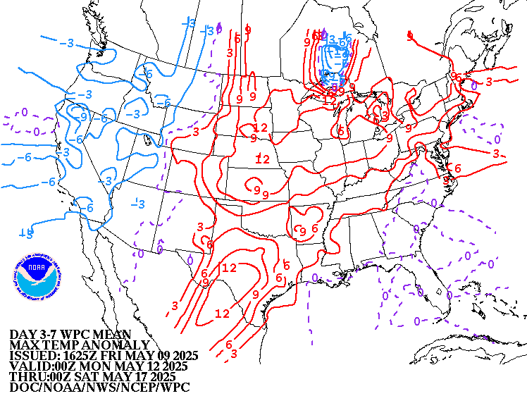
http://www.wpc.ncep.noaa.gov/medr/hpcmaxwbg.gif


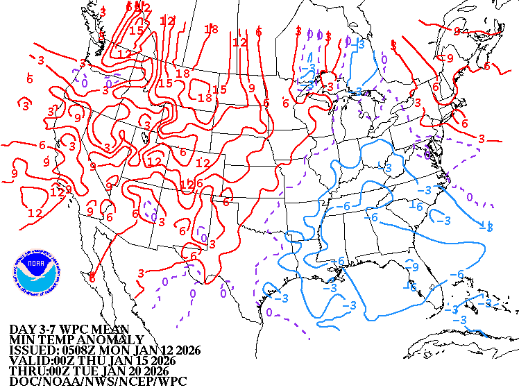
Low Temperature Departures:

http://www.wpc.ncep.noaa.gov/medr/hpcminwbg.gif

By metmike - July 12, 2018, 10:24 a.m.
Like Reply
By metmike - July 12, 2018, 10:24 a.m.
Like Reply

Here is the latest radar image. 

http://www.nws.noaa.gov/radar_tab.php

Doppler Radar National Mosaic Loop

By metmike - July 12, 2018, 10:25 a.m.
Like Reply


Satellite picture.


US Infrared Satellite Map

By metmike - July 12, 2018, 10:26 a.m.
Like Reply

Rains the past 24 hours.  Upper Midwest to SD.       

By metmike - July 12, 2018, 10:26 a.m.
Like Reply

You can go to this link to see rain totals from recent time periods:

https://water.weather.gov/precip/

Go to precipitation, then scroll down to pick a time frame. Hit states to get the borders to see locations better. Under products, you can hit "observed" or "Percent of normal"


By metmike - July 12, 2018, 10:27 a.m.
Like Reply
By metmike - July 12, 2018, 10:27 a.m.
Like Reply

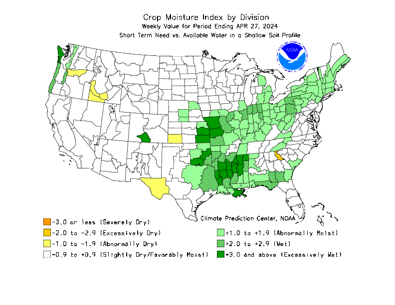
Missouri/Arkansas  to S.Plains in bad shape

http://www.cpc.ncep.noaa.gov/products/Soilmst_Monitoring/Figures/daily/curr.w.anom.daily.gif


http://www.cpc.ncep.noaa.gov/products/analysis_monitoring/regional_monitoring/cmi.gif

Drought Monitor

Drought Monitor for conus

By metmike - July 12, 2018, 3:07 p.m.
Like Reply

The longer range, week 3 and week 4 forecast cool north....hot south.

http://www.cpc.ncep.noaa.gov/products/people/mchen/CFSv2FCST/weekly/images/wk3.wk4_latest.NAsfcT.gif

Precip below:

http://www.cpc.ncep.noaa.gov/products/people/mchen/CFSv2FCST/weekly/images/wk3.wk4_latest.NAprec.gif

By metmike - July 12, 2018, 3:09 p.m.
Like Reply

Just updated day 7 then day  10 European operational model. Big heat ridge expands in the south, cool north:


Day 7 below:

Loading Maps...

Day 10 below:Loading Maps...

Day 10 below:
Loading Maps...

By metmike - July 12, 2018, 3:17 p.m.
Like Reply

The NWS extended forecasts are below.

 Cool Midwest, hot South and West.


Temperature Probability 6-10 day

6 to 10 Day Outlook - Temperature Probability
 Precipitation Probability

  6 to 10 Day Outlook - Precipitation Probability

Temperature Probability 8-14 day

8 to 14 Day Outlook - Temperature Probability
 Precipitation Probability

  8 to 14 Day Outlook - Precipitation Probability
By metmike - July 12, 2018, 6:17 p.m.
Like Reply

Extreme weather risk July 15-19.


http://www.cpc.ncep.noaa.gov/products/predictions/threats/hazards_d3_7_contours.png

By mcfarmer - July 12, 2018, 10:51 p.m.
Like Reply

Here in my little corner of NW Iowa excessive rainfall is needed. Our low ground is gone, just black dirt. The hills need rain to keep them going.


My worry is to loose the bottoms in June and the tops in July.

By metmike - July 13, 2018, 12:07 a.m.
Like Reply

Wonderful to hear from you McFarmer!


You should be getting plenty of rain over the next week. This was the last 18z GFS total rain forecast for 2 weeks:

Forecast Hour:  384
Image URL: http://mag.ncep.noaa.gov/data/gfs/18/namer/precip_ptot/gfs_namer_384_precip_ptot.gif
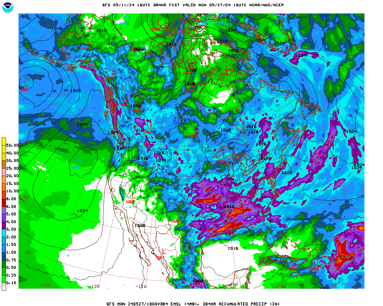
   

gfs_namer_384_precip_ptot.gif