There will be a zone of, especially light freezing rain/drizzle but maybe have some sleet for Southern Indiana thru Thursday mid-morning.
Then temperatures will warm up by noon.
It's likely the NWS will issue a weather advisory shortly, that will include Evansville for Wednesday Night thru Thursday Morning. This will likely cause cancellation of school on Thursday. Outside chance that it will just be a 2 hour delay if the temps are warming fast enough, early enough.
Elevated surfaces will likely be coated with ice later this evening well into Thursday Morning.
Main roads may be ok, because recent, very mild air temperatures have warmed soils and roads enough so they should be able to retain enough heat to NOT freeze.
Bridges and overpasses(elevated surfaces) will be at risk for turning icy. So will non treated, less traveled rural roads and side streets.
Temperatures should warm above freezing by mid/late morning, as the plain rain picks up and thaws things out, with temperatures still only in the mid-30's.
Look for at least 12 pages of updates to follow.
Here are some good links to follow this event live:
Local NWS for Evansville Indiana:

+++++++++++++++++++++++++++++++++++++++++++++++
This is the forecast from the NWS in Evansville. This seems reasonable.
https://www.weather.gov/pah/weatherstory
https://www.spc.noaa.gov/exper/mesoanalysis/new/viewsector.php?sector=20

https://www.spc.noaa.gov/exper/mesoanalysis/new/viewsector.php?sector=20#

https://www.spc.noaa.gov/exper/mesoanalysis/new/viewsector.php?sector=20#
https://www.wunderground.com/maps/radar/current

This link below provides some great data. Hit the center of the box below for the area that you want, then go to observation on the far left, then surface observations to get constantly updated surface observations.
 |
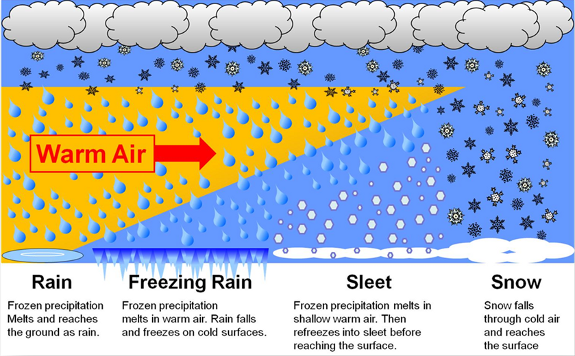
The difference between snow, sleet & freezing rain
https://www.youtube.com/watch?v=b0NLZGaFm8c
Freezing Rain and Sleet
https://www.weather.gov/rnk/Measure_Icing
Winter weather link from the NWS experts:
https://www.wpc.ncep.noaa.gov/wwd/winter_wx.shtml
Snowfall the next 3 days
Freezing rain/ice the next 3 days:
https://www.wpc.ncep.noaa.gov/wwd/winter_wx.shtml


https://weatherstreet.com/weather-forecast/Snow-Depth-US.htm
National Snow Analyses
https://www.nohrsc.noaa.gov/nsa/
Current Snow Depth
https://www.wunderground.com/maps/snow/snow-cover

Weather forecast maps from NOAA's Weather Prediction Center
https://www.wpc.ncep.noaa.gov/#page=ovw
Days 1, 2, 3 below. Save the links that I provide at Marketforum to use in the future!


As expected, they just issued the Winter Weather Advisory that includes Evansville. The time frame on the advisory is for the threat in ANY PART of the purple area.
It's from 4pm today/Wednesday to 6pm Thursday. Evansville's threat starts later than that starting point(this evening) and ends in the morning Thursday.
Here's a synopsis of what's going on.
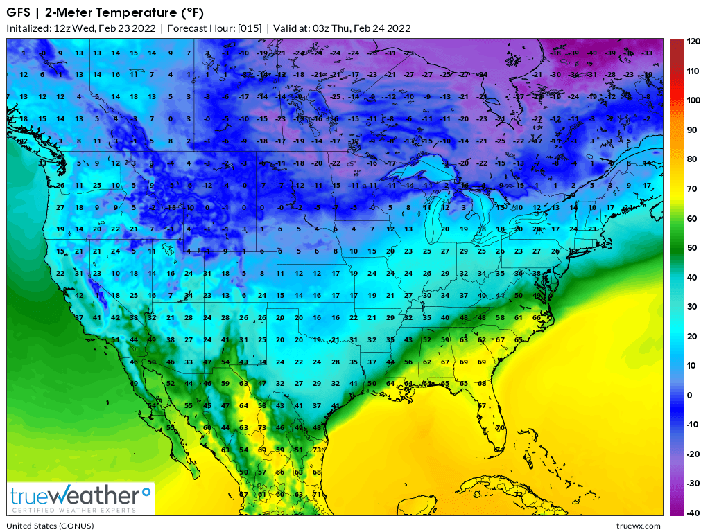
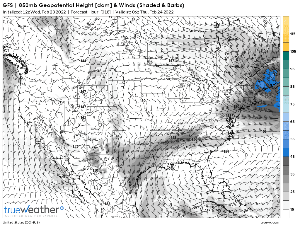
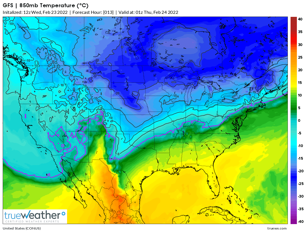
Winds at the surface have a strong northerly component because of a huge Canadian high pressure system driving down very cold air with its clockwise winds.....temperatures around/below freezing near the surface with cold, dense air hugging the ground.
https://www.wpc.ncep.noaa.gov/sfc/90fwbg.gif

https://www.spc.noaa.gov/exper/mesoanalysis/new/viewsector.php?sector=20
https://www.spc.noaa.gov/exper/mesoanalysis/new/viewsector.php?sector=20#
https://www.spc.noaa.gov/exper/mesoanalysis/new/viewsector.php?sector=20#
However, at 1 mile up, the 0 Deg.C isotherm(freezing is farther north because winds at 5,000 feet are from the south! So the precip will be falling as rain. If it freezes BEFORE hitting the ground......it becomes sleet.
This situation will only last thru mid morning Thursday, when the southerly flow at 1 mile up strengthens and brings up enough warmer air to warm the lower levels and temperature of the rain so that it stays liquid.
The maps below are close to midnight tonight.
Precip moving in a few hours earlier than I thought this morning, so elevated surfaces will get icy this evening.
Precip lets up late this evening but we will still have some very light frozen precip possible, including freezing drizzle overnight....... until Thursday morning when temps finally get above 32 degrees.
Most of the frozen precip fell yesterday evening. Both freezing rain and sleet.
Very light stuff overnight as expected.
The precip picked up again over the last 2 hours and with a rare thundershower and a temperature of 32 degrees last hour. Now at 33 and the high for the day.
Had this been a month ago or had temperatures been a few degrees colder, today would have been a major ice storm.
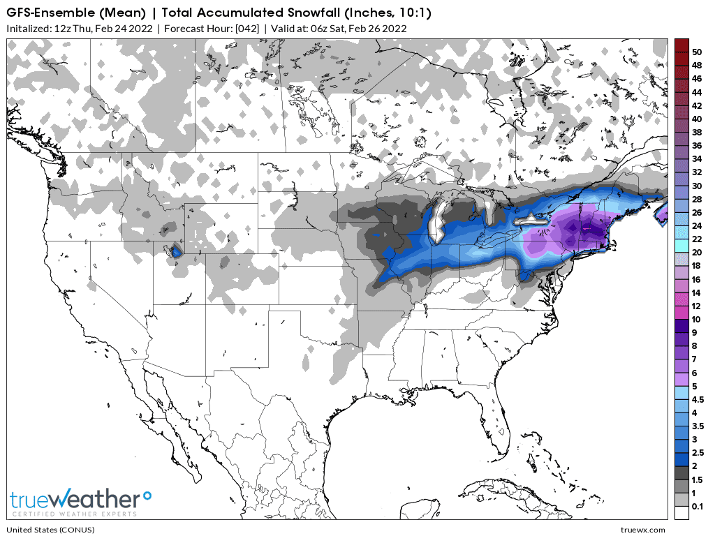
The Northeast will be getting the brunt of this SNOW storm. A few spots could get around 10 inches.
More for patrick that lives out there!
Snow the next 36 hours below.