Not all of the atmospheric rivers on this map actually made it to California, and many that did cross the boarder weakened considerably by the time they crossed state lines. At the start of this week, California had experienced 31 atmospheric rivers, which entered the state at the following strengths: 11 weak, 13 moderate, 6 strong, and 1 extreme, which hit California on Dec. 27 after landing in Oregon as exceptional — the strongest level.
+++++++++++++++++++++
Maps below
1. Drought Monitor BEFORE the beneficial moisture from the atmospheric rivers.
2. Drought Monitor AFTER the beneficial moisture from the atmospheric rivers.


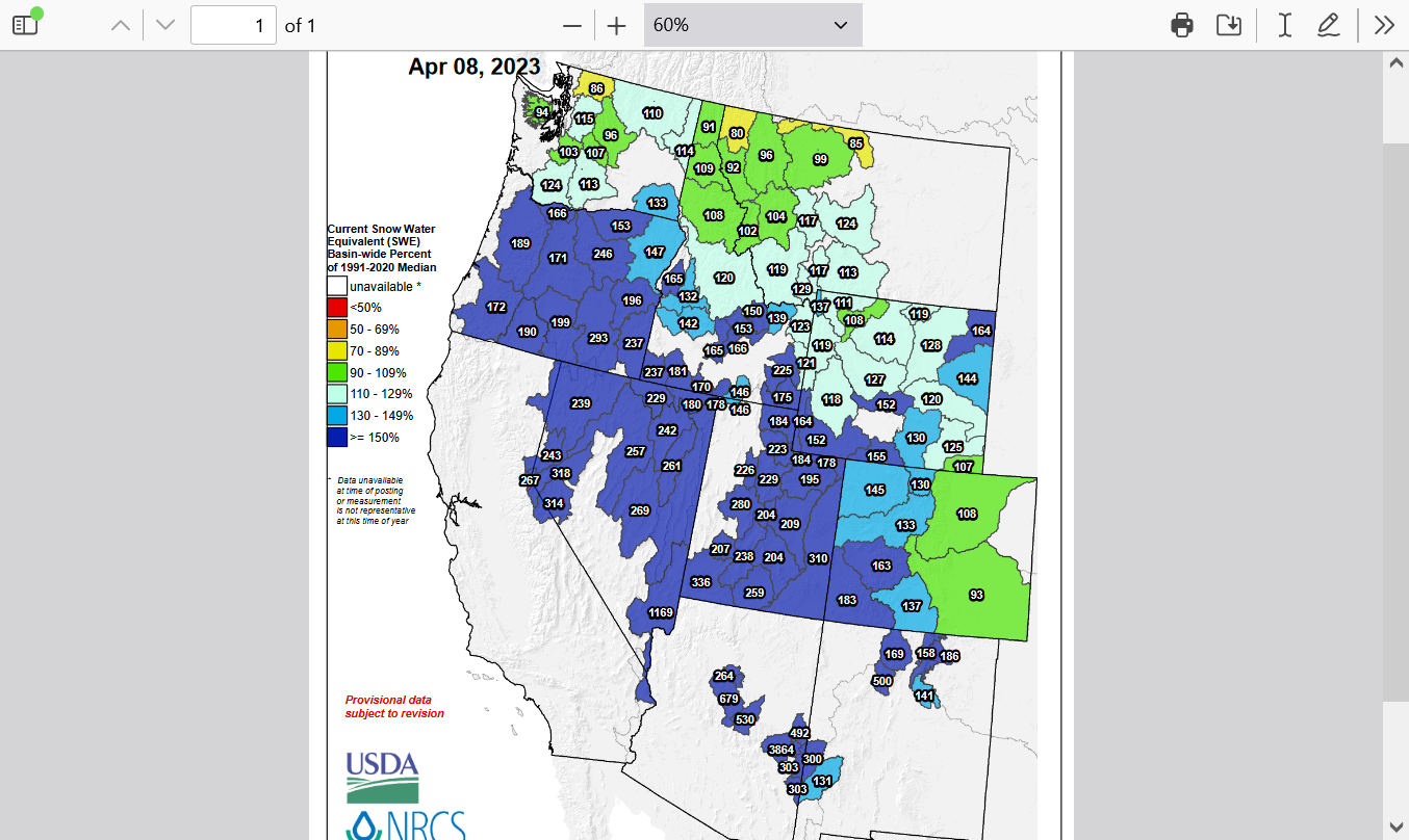
https://www.wcc.nrcs.usda.gov/ftpref/data/water/wcs/gis/maps/west_swepctnormal_update.pdf
Westwide SNOTEL Current Snow Water Equivalent (SWE) % of Normal