
All sorts of completely natural, extreme weather this week(none caused by climate change)!
This is the best place here to comprehensively track all the weather:
https://www.marketforum.com/forum/topic/83844/
I'll target specifics this week in this thread!
Anytime there are widespread severe thunderstorms and tornadoes, you can count on a powerful jet stream to be a key ingredient.
These are the current Jet steam winds at around 34,000 feet above the ground.
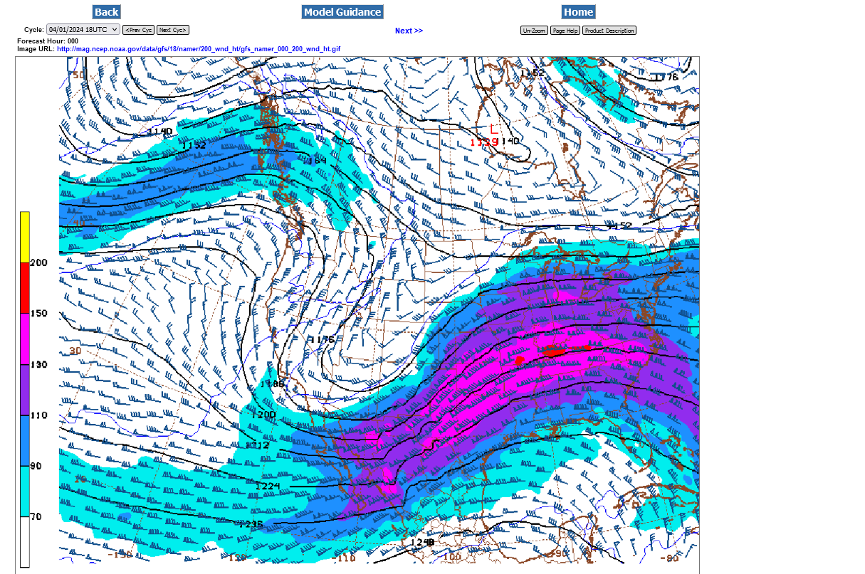
Here's a previous thread with more explaining about the jet stream:
https://www.marketforum.com/forum/topic/102510/#102521
+++++++++++++++++++++++
Severe Storm Risk......updated daily(days 1 and 2 twice daily).
https://www.spc.noaa.gov/products/outlook/
Current Day 1 Outlook | |
Current Day 2 Outlook |
Current Hazards at the link below.
Go to the link below, hit hazards box in the top right hand corner(it will also define all the color codes), if its not already in the hazards mode when you load the link.
Then you can hit any spot on the map, including where you live and it will go to that NWS with all the comprehensive local weather information for that/your county.

Hit the map below with your cursor/mouse to get the latest

| |
New radar product below
Go to: "Select View" then "Local Radar"
Hit the purple circle to see that local radar site
+++++++++++++++++++++++
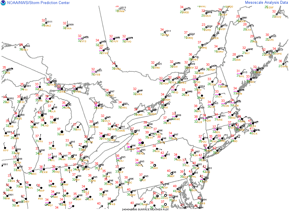
This link below provides some great data. After going to the link, hit "Mesoanalysis" then, the center of any box for the area that you want, then go to observation on the far left, then surface observations to get constantly updated surface observations or hit another of the dozens of choices.
 |
Current temperatures:
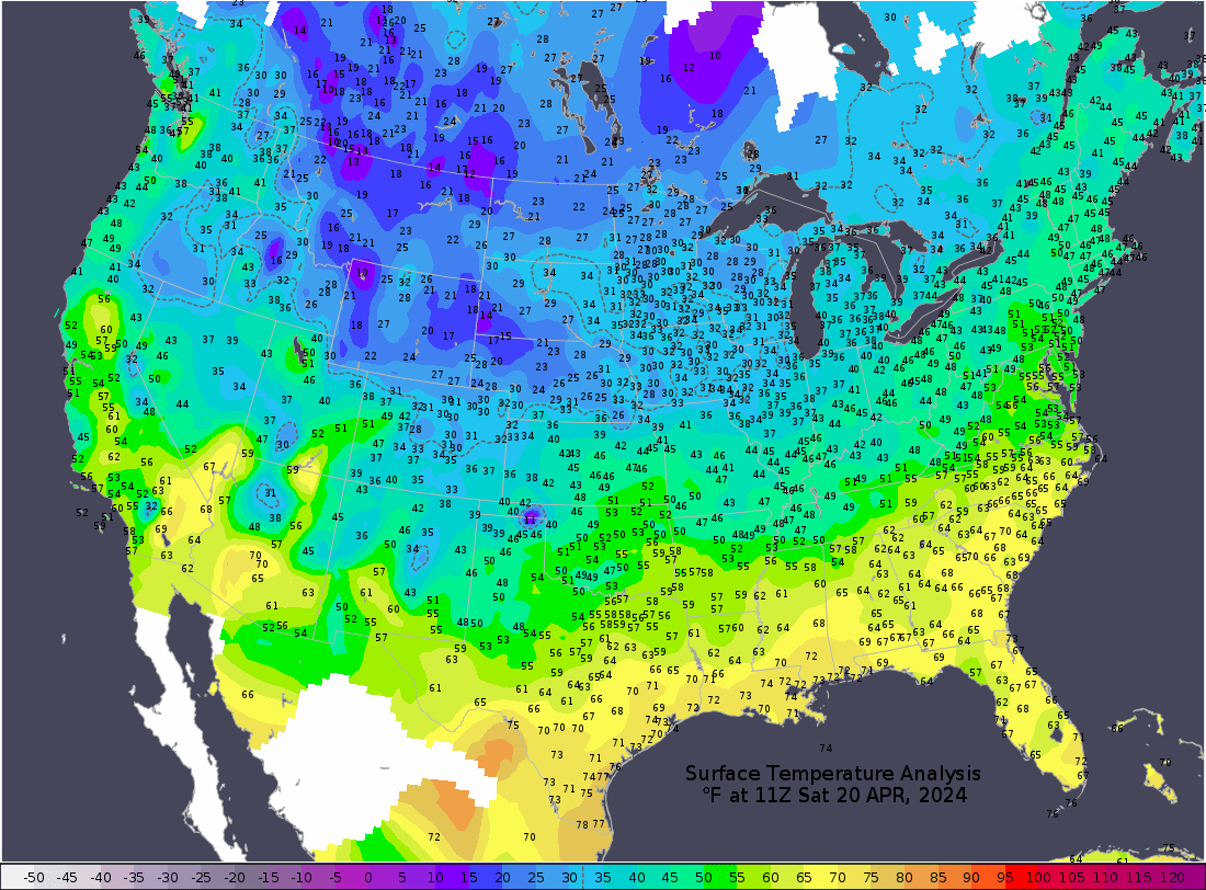
https://thermastor.com/dew-point-and-weather-maps/

Current Conditions below updated every few minutes.
UPPER MIDWEST
https://www.spc.noaa.gov/exper/mesoanalysis/new/viewsector.php?sector=13#


https://www.spc.noaa.gov/exper/mesoanalysis/new/viewsector.php?sector=13#

LOWER MIDWEST
https://www.spc.noaa.gov/exper/mesoanalysis/new/viewsector.php?sector=20

https://www.spc.noaa.gov/exper/mesoanalysis/new/viewsector.php?sector=20#

https://www.spc.noaa.gov/exper/mesoanalysis/new/viewsector.php?sector=20# 
Precip:
Day 1 below:
http://www.wpc.ncep.noaa.gov/qpf/fill_94qwbg.gif?1526306199054

Day 2 below:
http://www.wpc.ncep.noaa.gov/qpf/fill_98qwbg.gif?1528293750112

Day 3 below:
http://www.wpc.ncep.noaa.gov/qpf/fill_99qwbg.gif?1528293842764

Excessive rain threat.
https://www.wpc.ncep.noaa.gov/qpf/excess_rain.shtml
Current Day 1 Forecast
Day 1 Threat Area in Text Format
Current Day 2 Forecast |
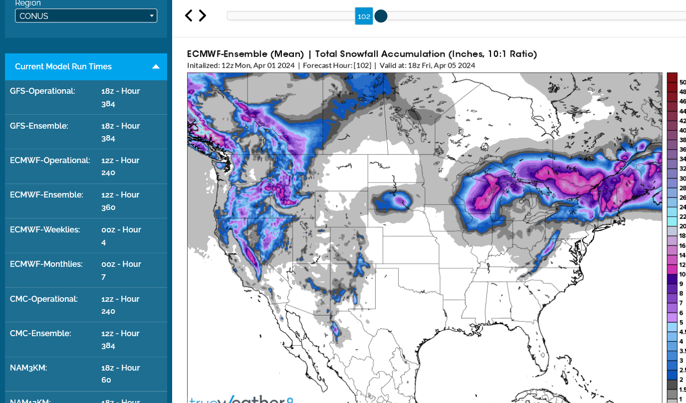
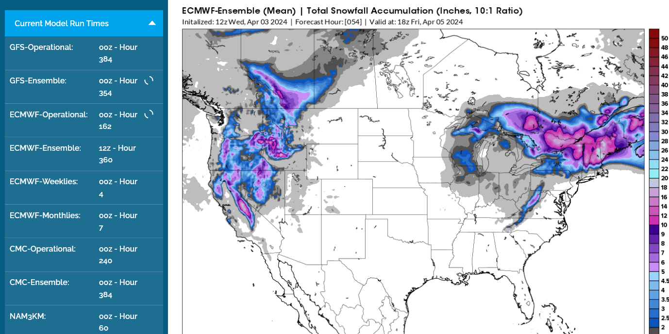
Total Snow forecast thru Friday from the last 12z European Ensemble forecast:
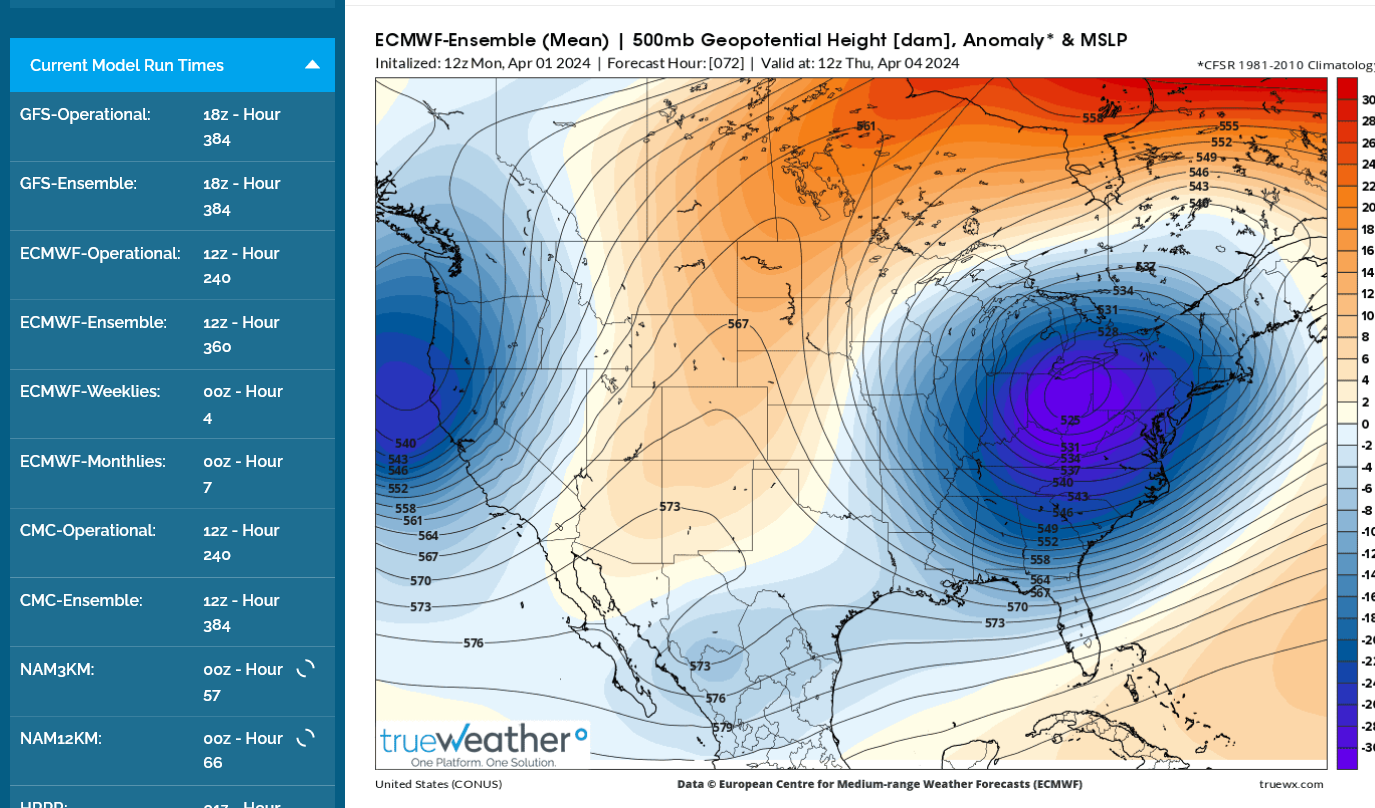
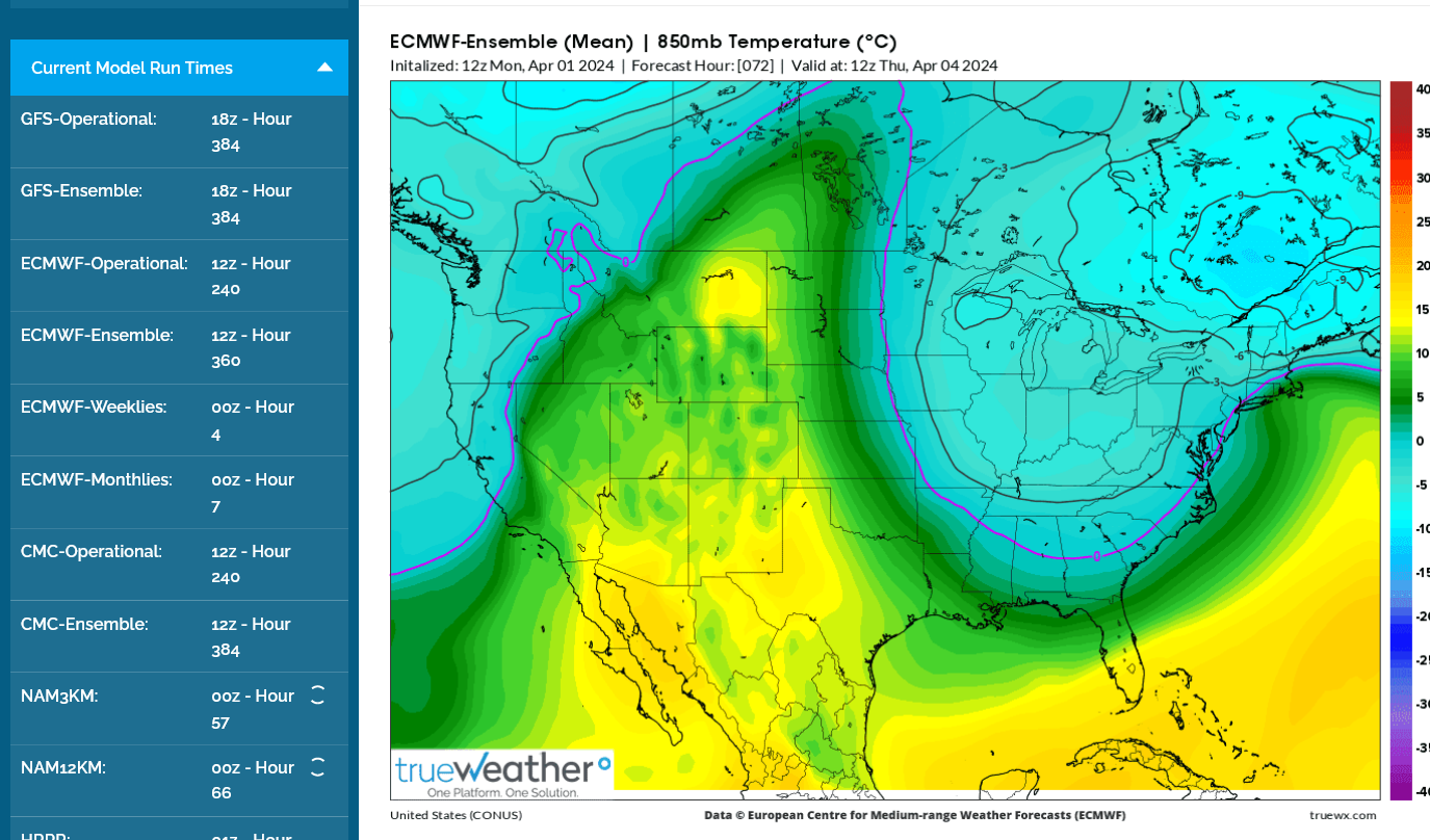
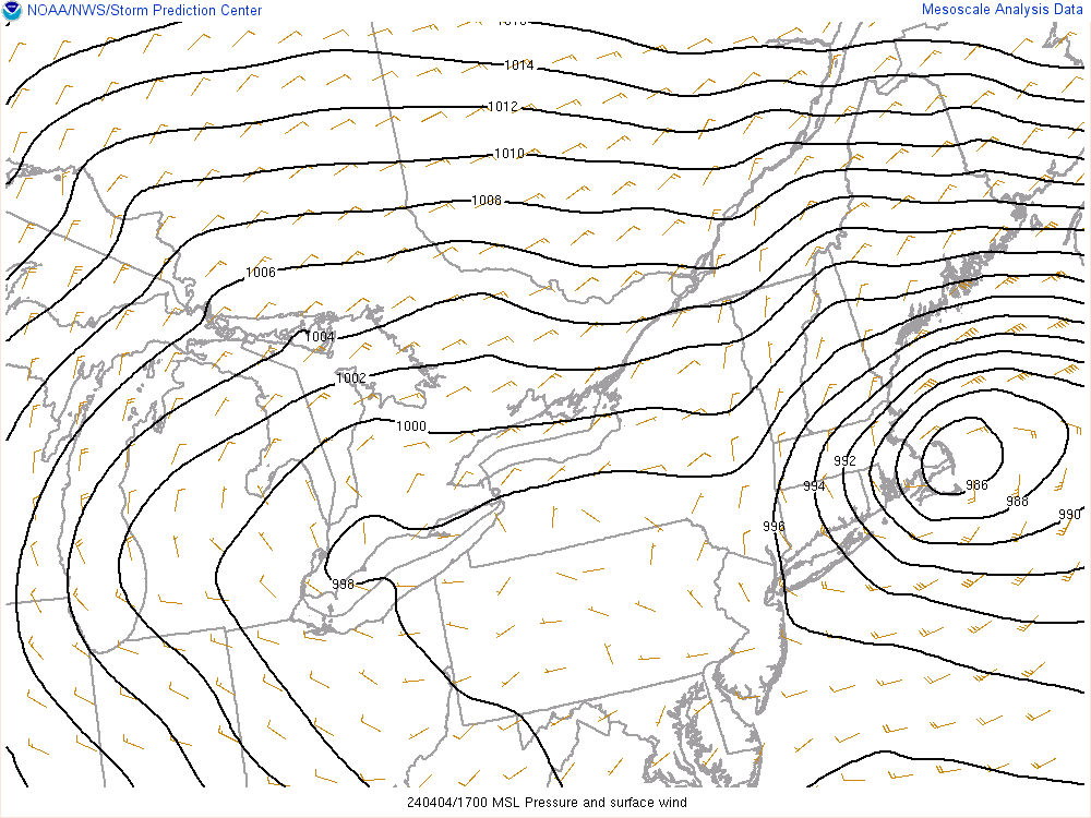
This is what the storm will look like on Thursday when it dumping heavy snow in the Northeast. Extremely deep 500 mb low(which is around 18,000 feet up and half way up in the atmosphere.
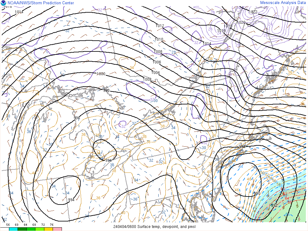
850 mb temps (around 1 mile up) help determine the rain/snow line. When we are this late in the cold season, 850 temps need to be a bit COLDER than 0 Deg. C for snow to keep it from melting on the way down.
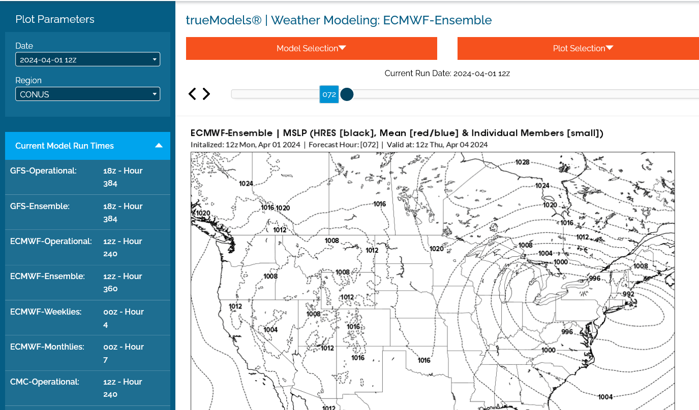
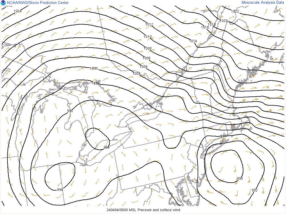
Here is the surface pressure pattern with the well developed low pressure in the Northeast.
Local forecast for Evansville IN.
Click a location below for detailed forecast.
Last Map Update: Mon, Apr. 1, 2024 at 9:17:04 pm CDT

These are the links for the NWS forecast offices for the rest of Indiana:
Indiana
Indianapolis
Nrn. Indiana
We’ve been without power for almost 4 hours now so I can’t show new graphics or information other than to post words from the IPad.
Fortunately, the graphics above do a wonderful job tracking ongoing weather and are constantly being updated.
One important item to note.
Evansville is on the western edge of severe weather risk today, which means the risk is early and before the storms have had a chance to mature.
That equates to the next couple of hours, with some developing storms to our west.
The page above this one has a wonderful radar loop with constantly updated images. It’s perfect to monitor our late morning threat From these storms about to pass the the next couple of hours.
its extremely unlikely for them to have tornadoes. They need more time to grow.
They have no history of severe weather yet, which means they would have to strengthen quickly before noon.
After that, watch out EAST of Evansville AFTER noon but we will be out of harms way.
The back edge of severe weather risk will be thru Evansville before noon.
These current non severe storms over us will likely grow as they push well east of us and become severe this afternoon.
Make that, JUST AFTER 11am for the back edge of severe weather risk to pass by.
Watch out Atlanta area as well as much of W GA /E AL especially overnight, an extra dangerous time since at night. Dewpoints look to hold way up in the upper 60s until the storms reach these areas thus providing a lot of fuel.
Thanks Larry,
Good points on nocturnal severe weather Threats. The atmosphere calms down at night but strong tornadoes can still happen and when people are sleeping they can be more vulnerable for violent tornado events.
well have to try to follow this one as long as possible until the better it’s run out in my iPads and cell I’m using to tether off them.
I may go tot he car to recharge them
Ok, I was a few hours early calling off the severe weather threat in Evansville with my assumptions and not on my computer from power being out. Sorry about that But these new storms passing right now haven't generated severe weather yet but will shortly, maybe here but they are not mature yet so they will hit us early on……..then really clobber areas to our east.
This tornado warning is from radar rotation. No severe weather reported yet And no history.
That storm has passed and now for sure all threat is over by every standard.
Conyers, GA, an eastern suburb of Atlanta, got hit with a tornado very late Tuesday. The radar signature was very scary with a clearcut circulation. Hopefully nobody got hurt!
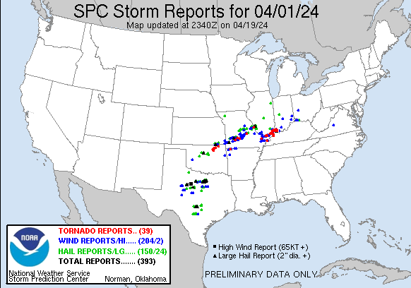
I WAS UP UNTIL AROUND 4:00 THIS MORNING, WATCHIN' ALL KINDS OF RADAR IMAGES. WHAT A SLEW OF STORMS THERE WERE. DOES ANYONE HAVE AN EXACT COUNT OF CONFIRMED TORNADOES?
Thanks, Jean!
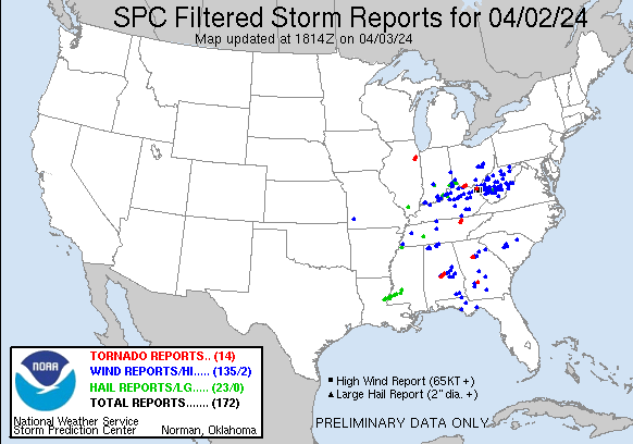
You came to the exact right place to get an answer to that question:
This was the severe weather from 7am Tue to 7am Wed. You can go to this link and see each individual report.
https://www.spc.noaa.gov/climo/reports/yesterday.html
https://www.spc.noaa.gov/climo/reports/240402_rpts.html
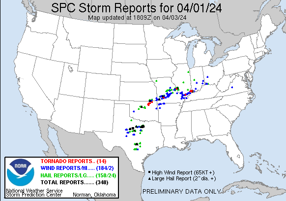
This was the reported severe weather from the previous day, 7am Mon to 7am Tue. We got hit at 6am Tue. 2 hours later and it would have been reported on the map above for the next day.
https://www.spc.noaa.gov/climo/reports/240401_rpts.html
https://www.spc.noaa.gov/climo/reports/240401_rpts.gif
We finally got our power back late in the day yesterday. We were limping along with no power and horrible cell phone service.
Makes us all appreciate the technology. And its not even like we had nothing at all.
After sunset, we had the living room and kitchen lit with candles. School was cancelled for Vanderburgh county. Good thing because a massive tree was blocking our way to get out of the subdivision and for me to get to chess at Scott Elementary School.
Our oldest son, Quinn who's living with us had to miss work because he couldn't get out.
After getting out and driving around, I could see all the cut up trees down in our area, which was a local hot spot for damage in the state of Indiana. Luckily just a bunch of small limbs and branches that will take 30 minutes to pick up on our property. We've had to cut up a dozen trees that fell in the past, several that were massive but nothing this time.
A first was the portable basketball goal. It was picked up and thrown 20 feet from the driveway. The southwest wind was perpendicular to the backboard and that acted like the sail on a sailboat to catch the wind.
Nor'easter!!!
Total snow forecast from the 12z European Ensemble.
New radar product below
Go to: "Select View" then "Local Radar"
Hit the purple circle to see that local radar site
+++++++++++++++++++++++
This link below provides some great data. After going to the link, hit "Mesoanalysis" then, the center of any box for the area that you want, then go to observation on the far left, then surface observations to get constantly updated surface observations or hit another of the dozens of choices.
| |
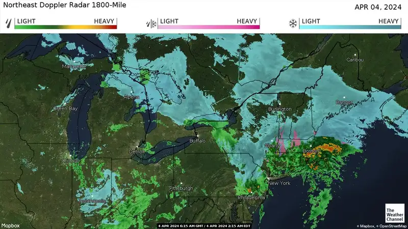
On some of these products below, you need to go to the link for the latest image
https://weather.com/maps/usnortheastdopplerradar
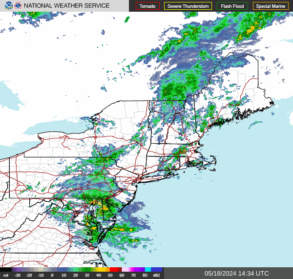
https://radar.weather.gov/region/northeast/standard
1. 1st map was shortly after midnight 4-4-24
2. 2nd map was from noon 4-4-24
https://www.spc.noaa.gov/exper/mesoanalysis/new/viewsector.php?sector=16&parm=ttd&underlay=1&source=1#


 Weather Map