
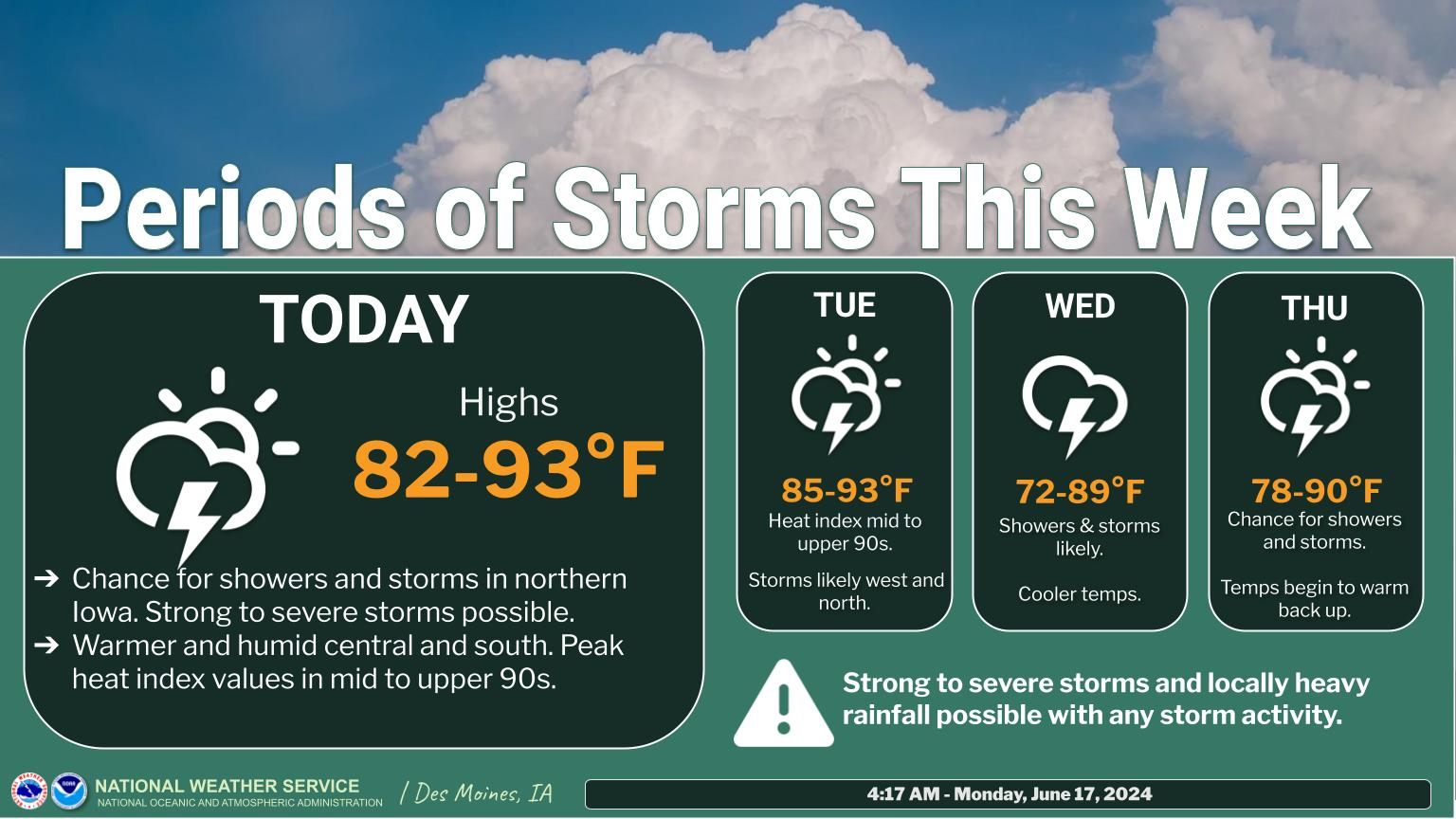
We'll see a great deal of severe weather the next 4 days!
Monday looks like the worst day:
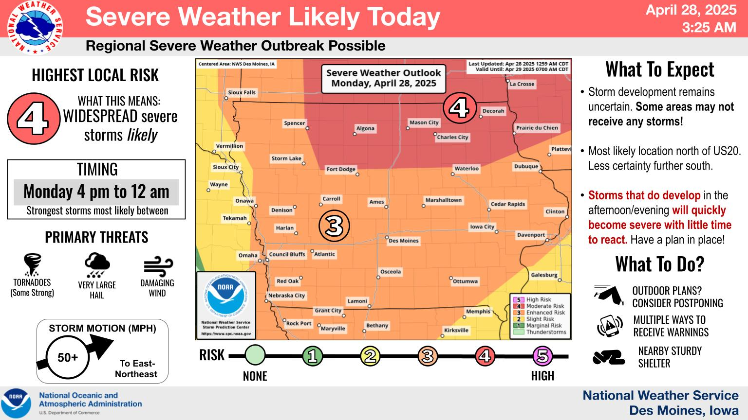
11am update: The Storm Prediction Center just updated their Monday forecast to include an area of HIGH risk in OK/KS!
.SUMMARY... Numerous severe thunderstorms are expected to develop and move eastward Monday afternoon through Monday night across parts of the southern/central Plains. Multiple intense, long-track tornadoes, very large to giant hail, and severe/damaging winds all appear likely.
Re: Re: Re: Re: Re: Weather May 2022
Severe Storm Risk......updated daily(days 1 and 2 twice daily).
https://www.spc.noaa.gov/products/outlook/
Current Day 1 Outlook | |
Current Day 2 Outlook | |
Current Day 3 Outlook | |
Current Day 4-8 Outlook |
All the comprehensive, constantly updated weather maps:
A key factor in all severe weather outbreaks is the jet stream.
The stronger the jet stream is, the greater the lift coming from mid/upper level dynamics(low level lift is modulated by surface temps/moisture) and the stronger the wind shear potential(especially for tornadoes).
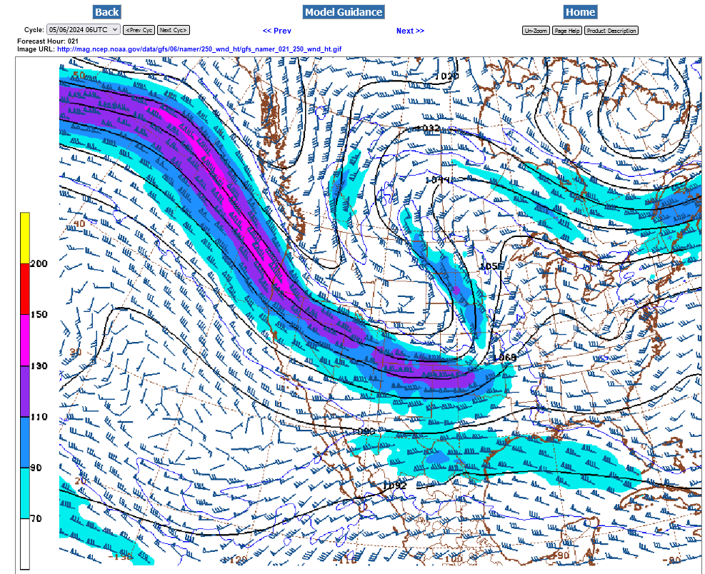
Here's the 250 mb jet stream around 34,000 feet late Monday. The pink, 130+ kt jet streak is the equivalent of around 150+ mph. Pretty potent which should lead to some violent tornadoes on Monday.
This jet stream is digging into the base of a deep trough that's forming in the Central US, which will put much of the Plains/Midwest in an extremely favorable position, (underneath the jet stream) for widespread severe weather this week.
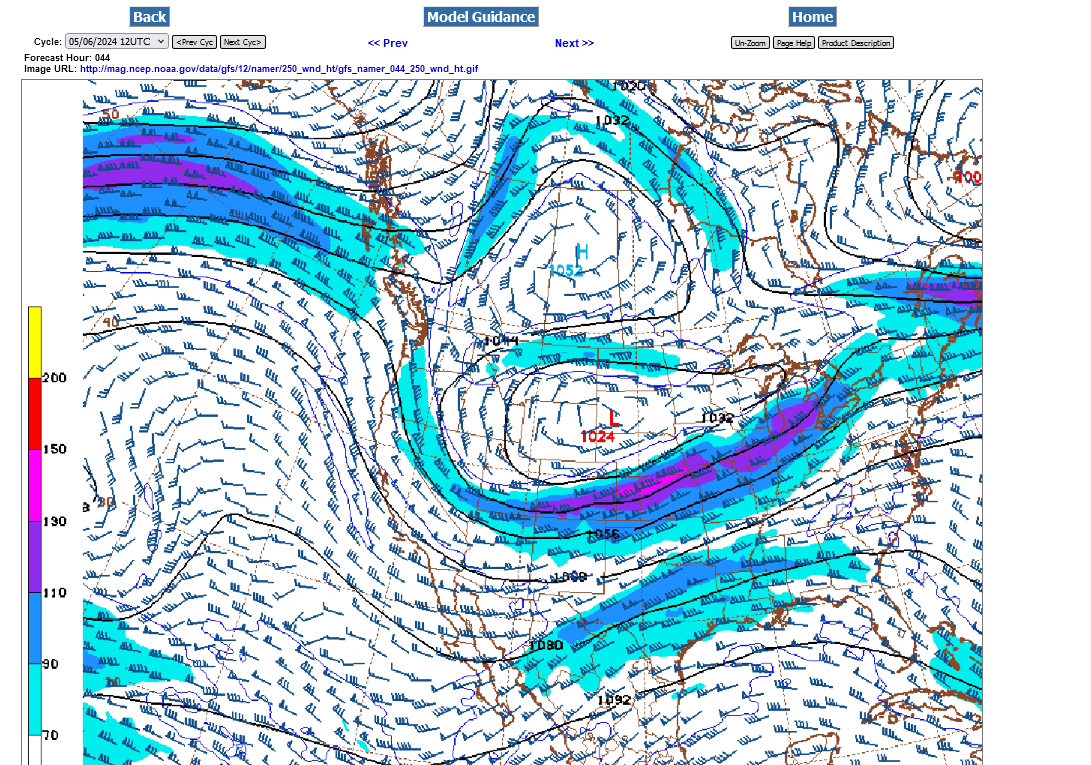
It will weaken some on Tue-Thu as it tracks eastward so the weather won't be AS severe.
++++++++++++++++++
Wednesday Morning Jet Stream Forecast below:
+++++++++++++++++++
Here's more on the jet stream:
We can already measure and track the weather associated with this:
You can scroll down and get almost the entire comprehensive weather picture updated constantly here.
Current Hazards at the link below.
Go to the link below, hit hazards box in the top right hand corner(it will also define all the color codes), if its not already in the hazards mode when you load the link.
Then you can hit any spot on the map, including where you live and it will go to that NWS with all the comprehensive local weather information for that/your county.

New radar product below
Go to: "Select View" then "Local Radar"
Hit the purple circle to see that local radar site
+++++++++++++++++++++++
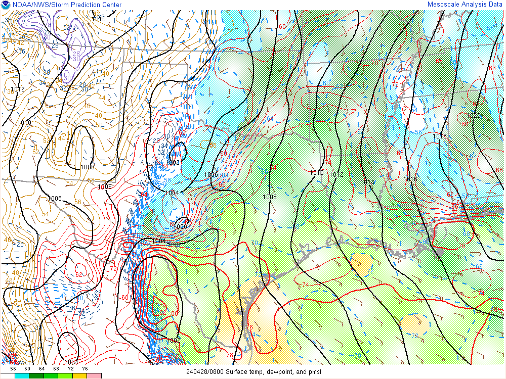
This link below provides some great data. After going to the link, hit "Mesoanalysis" then, the center of any box for the area that you want, then go to observation on the far left, then surface observations to get constantly updated surface observations or hit another of the dozens of choices.
 |
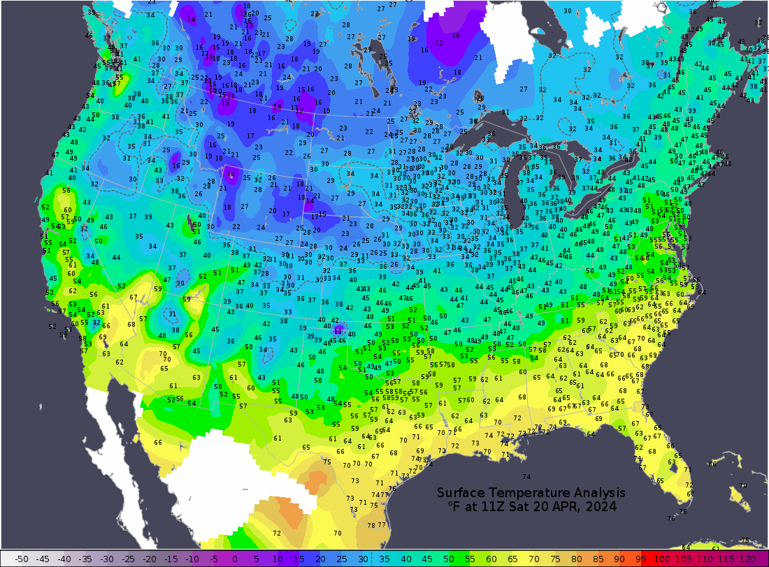
Current temperatures:
https://thermastor.com/dew-point-and-weather-maps/

Current Conditions below updated every few minutes.
UPPER MIDWEST
https://www.spc.noaa.gov/exper/mesoanalysis/new/viewsector.php?sector=13#


https://www.spc.noaa.gov/exper/mesoanalysis/new/viewsector.php?sector=13#

LOWER MIDWEST
https://www.spc.noaa.gov/exper/mesoanalysis/new/viewsector.php?sector=20

https://www.spc.noaa.gov/exper/mesoanalysis/new/viewsector.php?sector=20#

https://www.spc.noaa.gov/exper/mesoanalysis/new/viewsector.php?sector=20# 
SOUTHCENTRAL
https://www.spc.noaa.gov/exper/mesoanalysis/new/viewsector.php?sector=15#
SOUTHEAST
https://www.spc.noaa.gov/exper/mesoanalysis/new/viewsector.php?sector=18#

OK/N.TX:

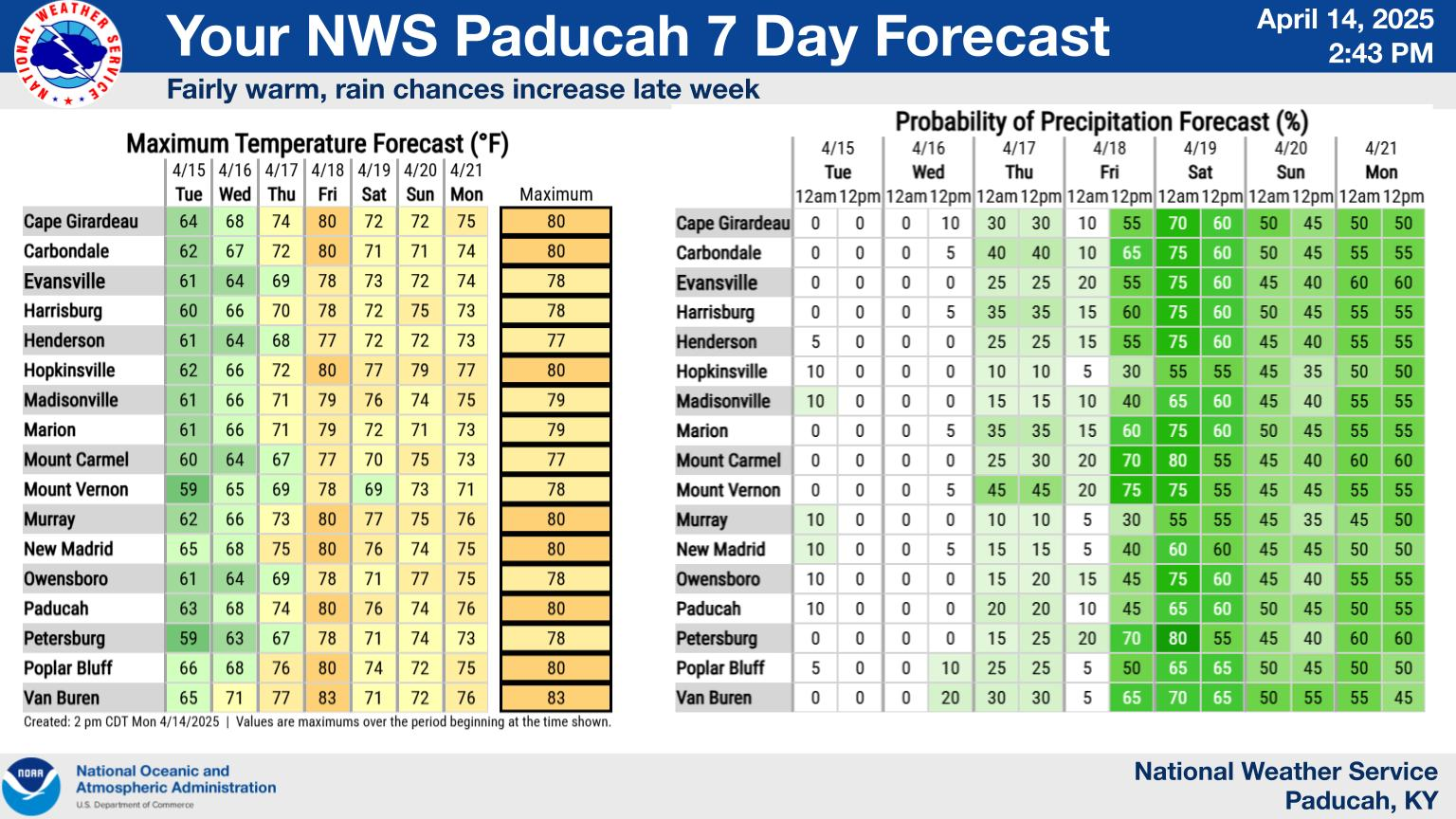
Click a location below for detailed forecast.
+++++
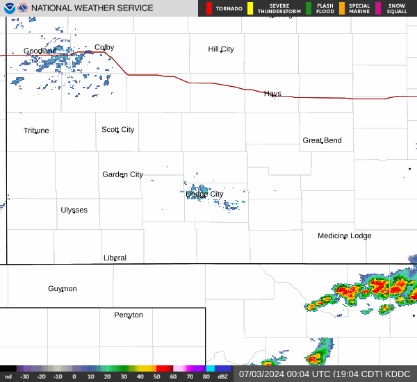
NWS Forecast Office Dodge City, KS (southwest)
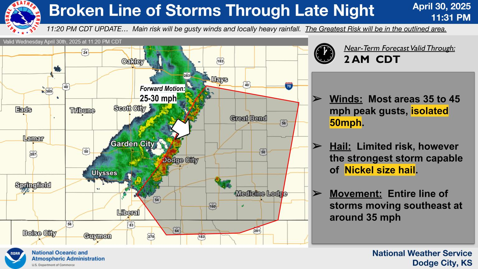
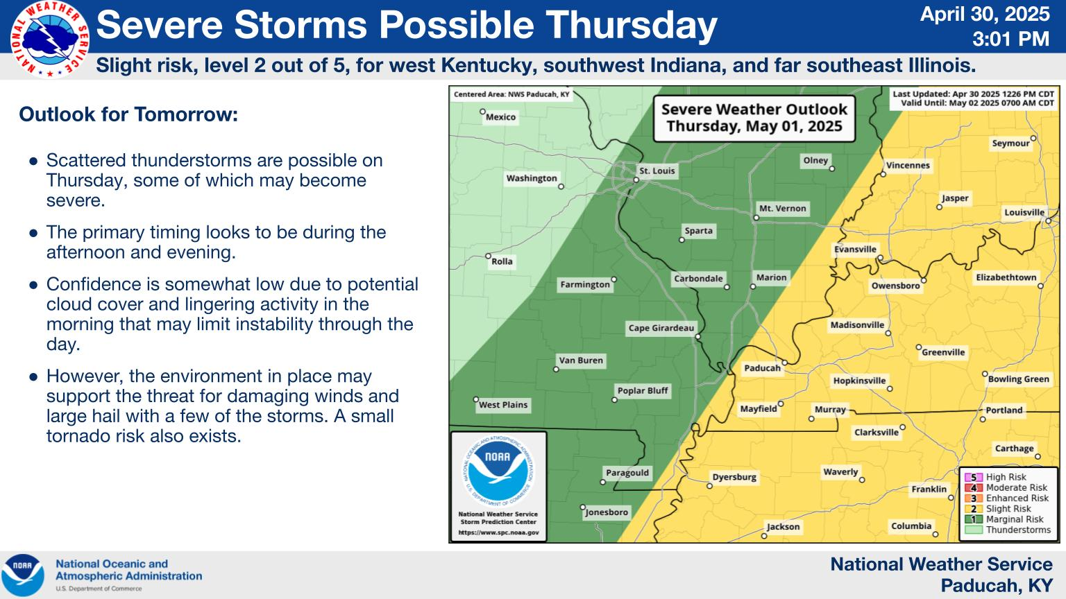
Severe Thunderstorm Risk Improving

+++++++++++++
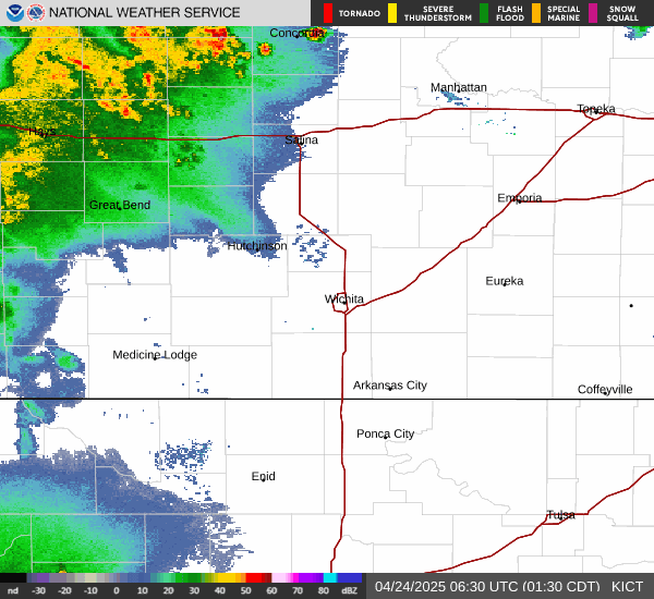
Witchita, KS(southeast)
Click a location below for detailed forecast.
+++++++++++++++++++++++++++
+++++++++++++++
NWS Forecast Office Kansas City, MO Click a location below for detailed forecast.


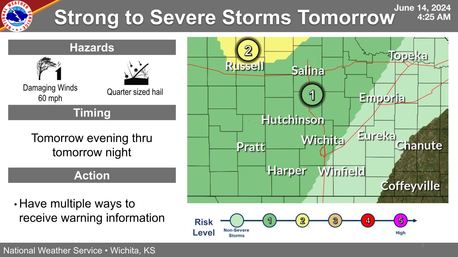
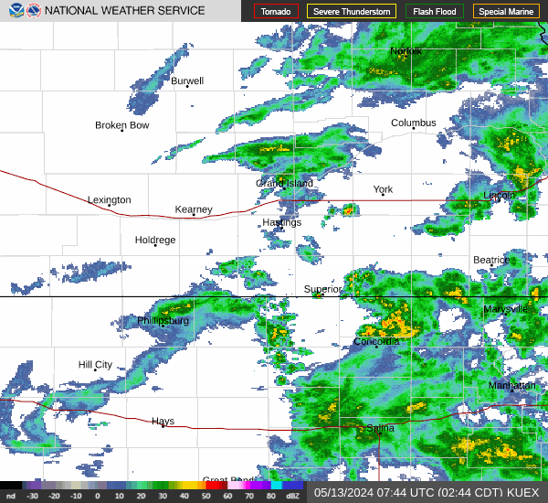
Tracking farther east on Tuesday/Wednesday:
Click a location below for detailed forecast.


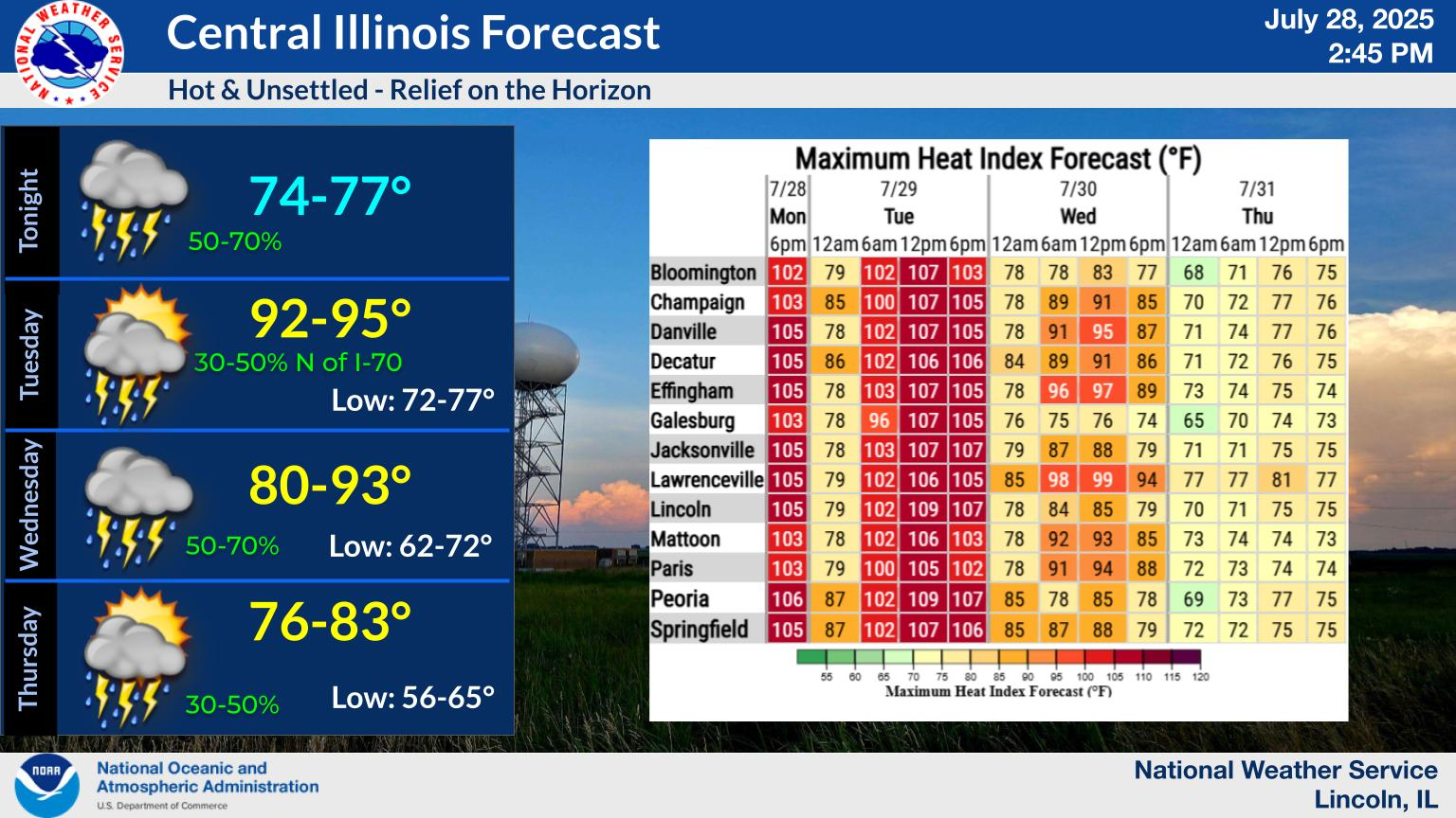
Central Illinois
NWS Forecast Office Lincoln, IL
Click a location below for detailed forecast.


Click a location below for detailed forecast.

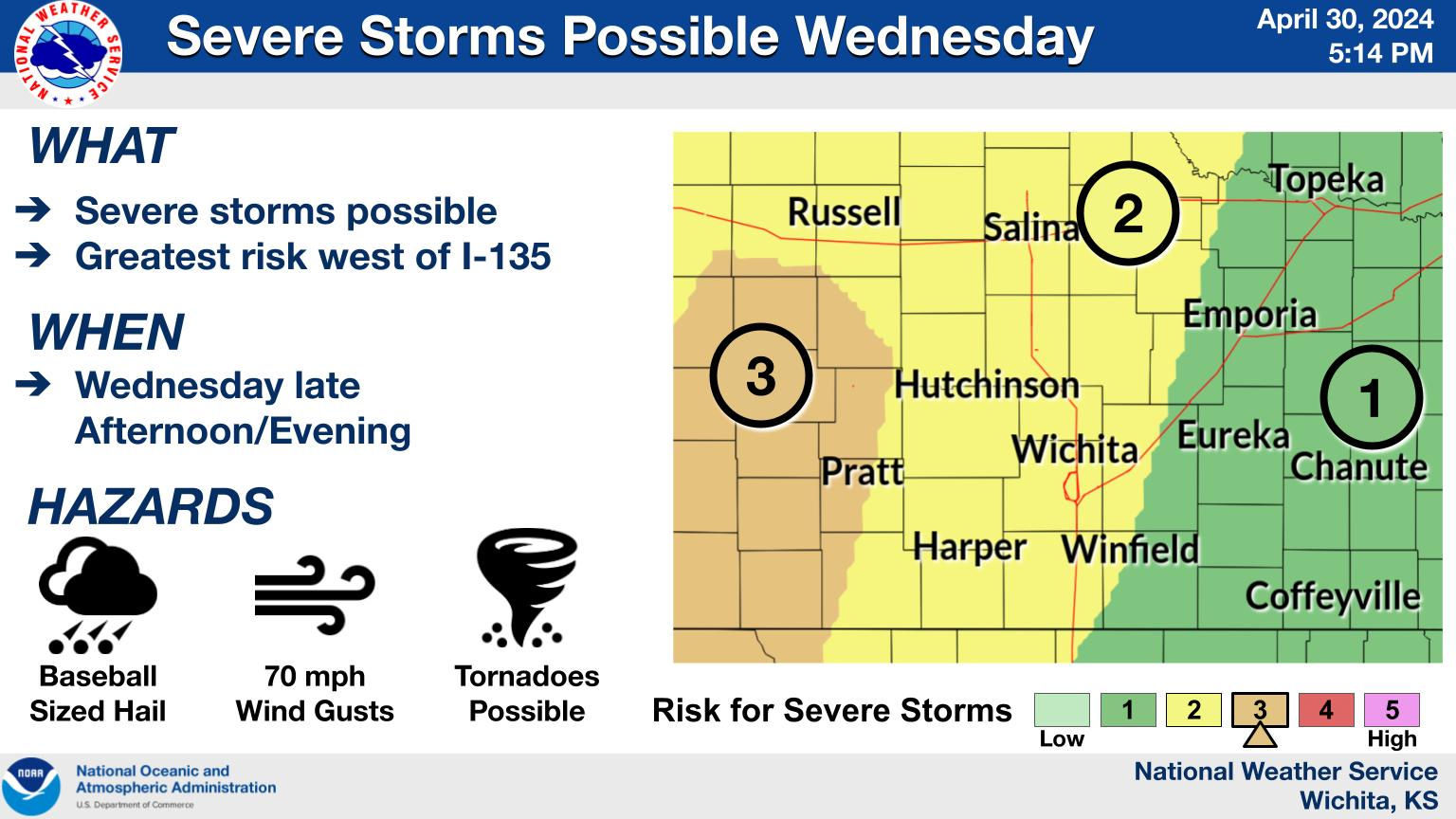
Even farther east on Tue/Wed:
NWS Forecast Office Indianapolis, IN
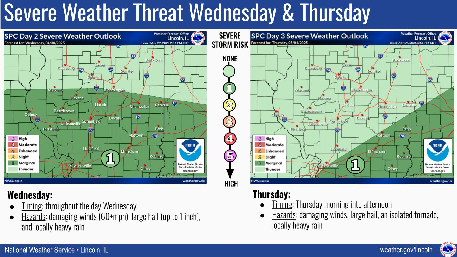
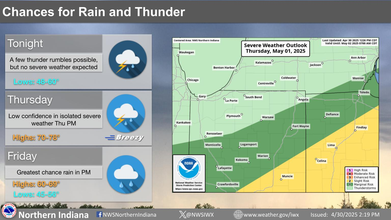
Wednesday's Severe Weather Threat
Another round of severe weather is expected Wednesday afternoon and evening, with the greatest threat for Central and Southern Indiana. All hazards are on the table with damaging winds being the greatest threat. Continue checking back for updates at weather.gov/ind. #inwx
Click a location below for detailed forecast.

NWS Forecast Office, Northern Indiana
| Text Product Selector (Selected product opens in new window) | |
Monday's storm reports. This will sound odd but the number of violent tornadoes in OK/KS was LESS than feared. Anytime the Storm Prediction has the HIGH risk category, it can end up being really bad:
https://www.spc.noaa.gov/climo/reports/yesterday.html
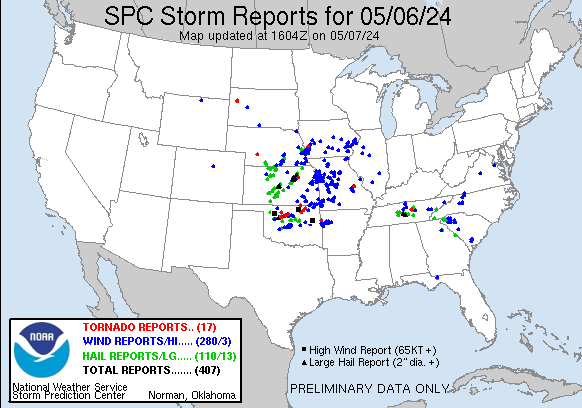
The most damaging storms hit in Oklahoma.
https://abcnews.go.com/US/us-weather-tornadoes-may-7-tuesday/story?id=109984037
See our new weather thread updated to focus on threatened areas:
Severe weather #2 May 7-8
Started by metmike - May 7, 2024, 8:58 p.m.
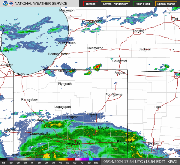
 Local Radar
 Weather Map

