Update early Wednesday afternoon: Tornado watch in Evansville until 9pm Wednesday -worst weather should be SOUTH of Evansville.
+++++++++++++++
Details below:
https://www.marketforum.com/forum/topic/103838/#103841
+++++++++++++++
Previous thread:
Severe weather May 6-8, 2024
https://www.marketforum.com/forum/topic/103789/
++++++++++++++++++++
Since the storm zone has shifted east today, we're updating to a new thread to focus on the areas farther east.
+++++++++++++++++++++++++++++
5-8-24: We're adding areas farther south!
Re: Re: Re: Re: Re: Weather May 2022
Severe Storm Risk......updated daily(days 1 and 2 twice daily).
https://www.spc.noaa.gov/products/outlook/
Current Day 1 Outlook | |
Current Day 2 Outlook | |
Current Day 3 Outlook | |
Current Day 4-8 Outlook |
All the comprehensive, constantly updated weather maps:
You can scroll down and get almost the entire comprehensive weather picture updated constantly here.
Current Hazards at the link below.
Go to the link below, hit hazards box in the top right hand corner(it will also define all the color codes), if its not already in the hazards mode when you load the link.
Then you can hit any spot on the map, including where you live and it will go to that NWS with all the comprehensive local weather information for that/your county.

New radar product below
Go to: "Select View" then "Local Radar"
Hit the purple circle to see that local radar site
+++++++++++++++++++++++
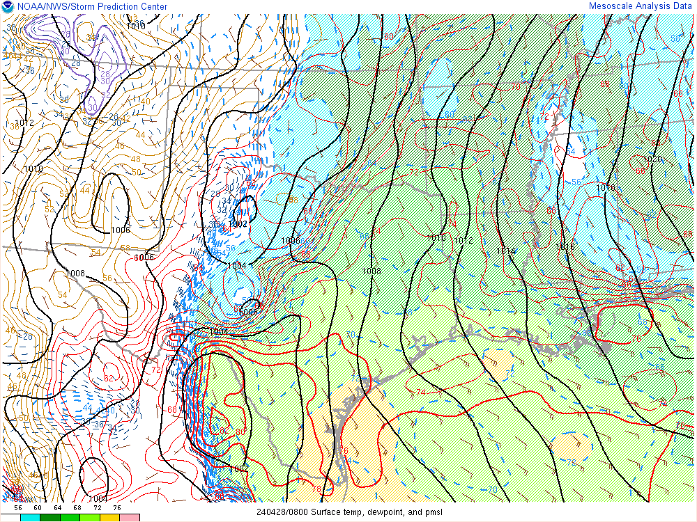
This link below provides some great data. After going to the link, hit "Mesoanalysis" then, the center of any box for the area that you want, then go to observation on the far left, then surface observations to get constantly updated surface observations or hit another of the dozens of choices.
 |
Current temperatures:
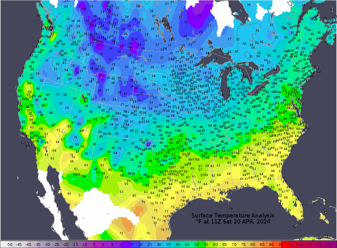
https://thermastor.com/dew-point-and-weather-maps/

Current Conditions below updated every few minutes.
UPPER MIDWEST
https://www.spc.noaa.gov/exper/mesoanalysis/new/viewsector.php?sector=13#


https://www.spc.noaa.gov/exper/mesoanalysis/new/viewsector.php?sector=13#

LOWER MIDWEST
https://www.spc.noaa.gov/exper/mesoanalysis/new/viewsector.php?sector=20

https://www.spc.noaa.gov/exper/mesoanalysis/new/viewsector.php?sector=20#

https://www.spc.noaa.gov/exper/mesoanalysis/new/viewsector.php?sector=20# 
SOUTHCENTRAL
https://www.spc.noaa.gov/exper/mesoanalysis/new/viewsector.php?sector=15#
SOUTHEAST
https://www.spc.noaa.gov/exper/mesoanalysis/new/viewsector.php?sector=18#


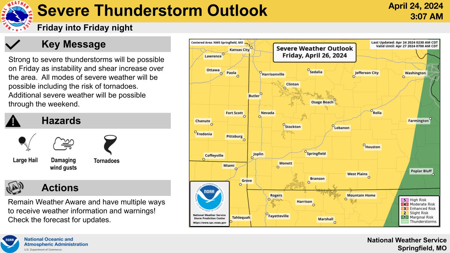
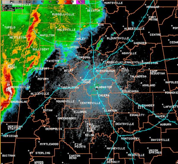
Central Missouri Storms This Morning
The highest threat for severe storms through 11am is across central Missouri, especially the Lake of the Ozarks area. Remain weather aware this morning. Areas further south will eventually see storms. Maintain situational awareness today as the severe event will evolve further south with time.
Click a location below for detailed forecast.


++++++++++++++++++++++
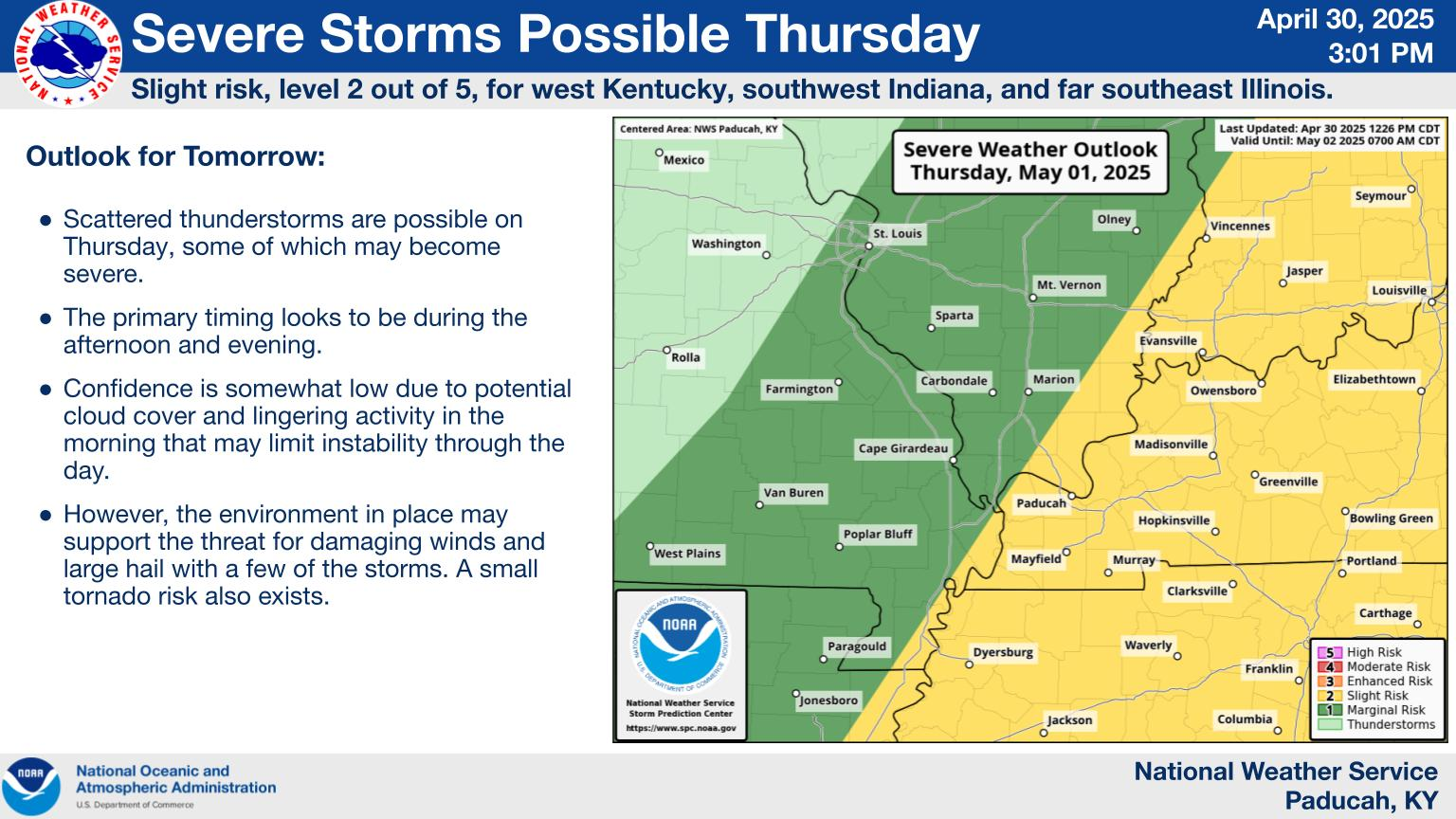
NWS Forecast Office Paducah, KY
1pm update: Tornado watch until 9pm-worst weather should be SOUTH of Evansville.
Click a location below for detailed forecast.

Even farther east on Tue/Wed:
NWS Forecast Office Indianapolis, IN
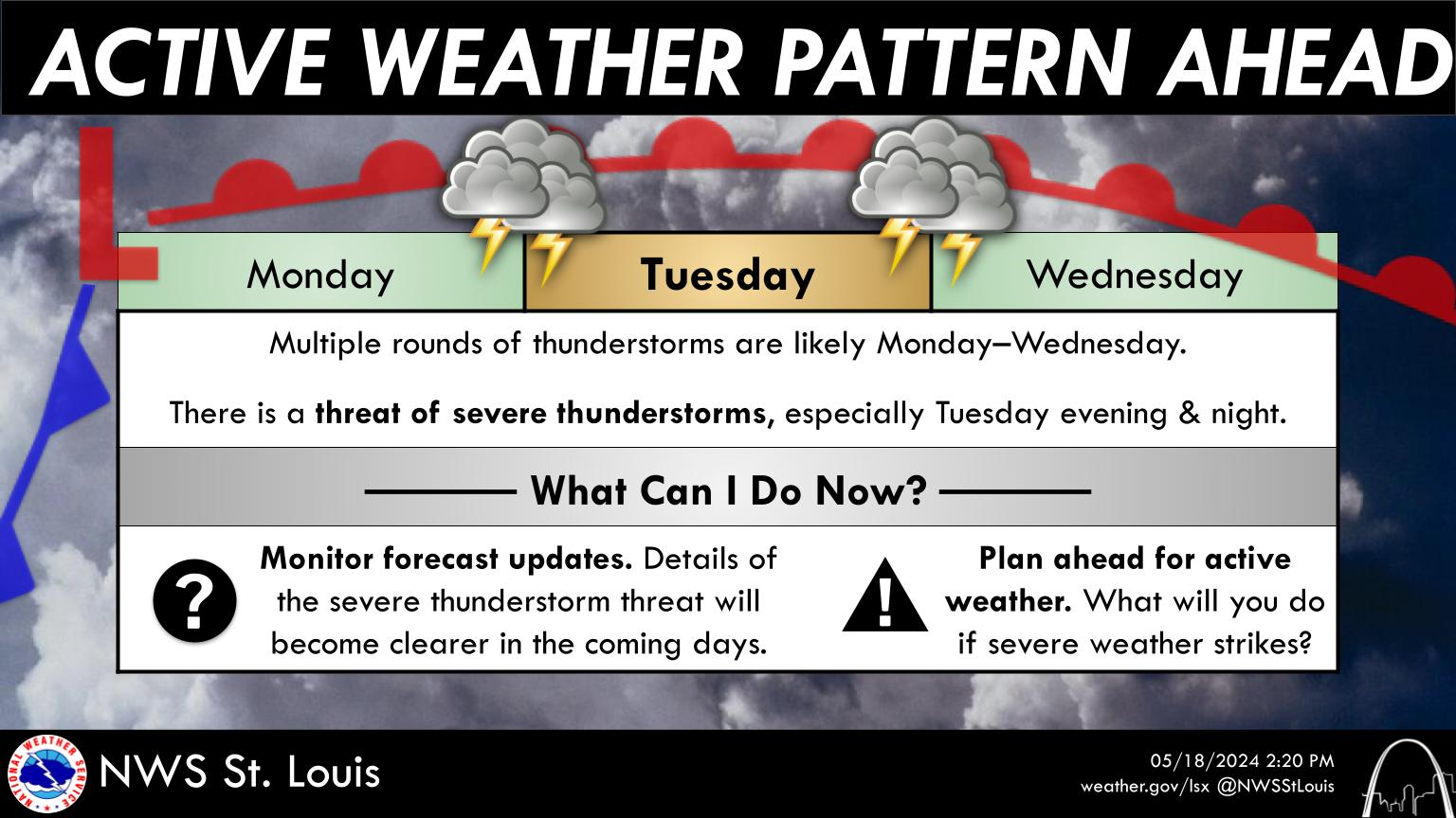
Wednesday's Severe Weather Threat
Another round of severe weather is expected Wednesday afternoon and evening, with the greatest threat for Central and Southern Indiana. All hazards are on the table with damaging winds being the greatest threat. Continue checking back for updates at weather.gov/ind. #inwx
Click a location below for detailed forecast.

NWS Forecast Office, Northern Indiana
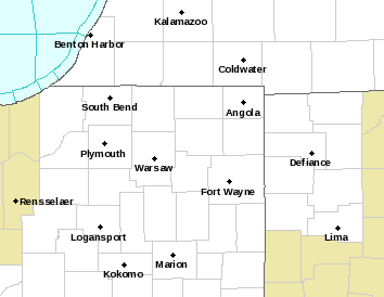
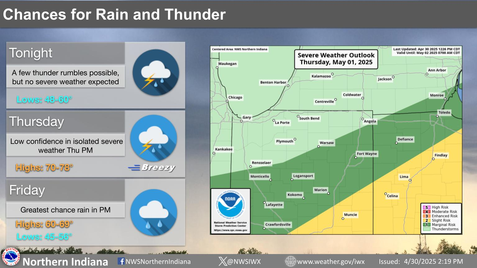


Severe Thunderstorms are already occurring early this morning and will likely continue into the early afternoon. Several rounds of severe thunderstorms are likely between now and Thursday morning.

| Text Product Selector (Selected product opens in new window) | |
Areas farther south:
Shreveport, LA

There's a Enhanced Risk (Level 3 of 5) and a Slight Risk (Level 2 of 5) for severe thunderstorms across most of the Four State Region later today, this evening and into the overnight hours tonight. Damaging thunderstorm wind gusts and large hail will be the primary threats, followed by an isolated tornado threat.

+++++++++++++++++

L

Severe storms will be possible throughout the day today. All storm modes. Remain weather aware and have ways to receive warnings (and ways that will wake you up!)
 NWS Nashville (KOHX) Radar Loop

++++++++++++++++

Strong to severe thunderstorms are expected Wednesday night (after midnight) into early Thursday morning. Large hail, damaging winds, and tornadoes are the main hazards. Flash flooding may also become a risk due to locally excessive rainfall.

+++++++++++

UPDATE: Strong to severe thunderstorms will be possible tonight into early Thursday morning. The dark green indicates a Marginal Risk (Level 1 out of 5) for severe weather while far west- central Georgia is under a Slight Risk (Level 2 out of 5) for severe weather. Damaging wind gusts of at least 60 mph will be the primary hazard, but a brief tornado cannot be ruled out.

MIKE... DID YOU GET ANY OF THAT NOT SO GOOD WEATHER, YESTERDAY?
I SAT HERE WATCHING IT SKIRTING RIGHT PASSED MY LITTLE CORNER OF THE WORLD.
Jean,
Nothing here!
In fact, I was a bit surprised when the Storm Prediction Center issued a tornado watch for our area late in the evening, that included W.KY and S.IL.
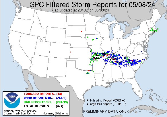
https://www.spc.noaa.gov/climo/reports/yesterday.html

Tonight may get bad just south of us in Evansville IN.
https://www.spc.noaa.gov/products/outlook/
| Current Day 1 Outlook | |
| Current Day 2 Outlook |
MIKE...... THERE WERE NUMEROUS TORNADOES IN MY NECCO-DA-WOODS, BUT... THE LOCAL STORM REPORTS AREN'T SHOWING UP ON THE NWS. I CAN GET #1, BUT THE OTHER PAGES COME UP "NO REPORT"
Not sure what's going on for you, Jean.
The reports in your area for severe thunderstorms when they occurred are "possible tornadoes" when they happened in the dark and maybe those turned into tornadoes after daylight came and the damage pattern was more clear?
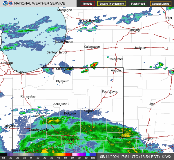
Latest tornado watches in red. It's become clear late this morning, that most if not all the severe weather this afternoon will be SOUTH of Evansville:

The rain cooled air from the earlier storms has STABILIZED the air mass in the Evansville area. This has greatly reduced the lift from warm, buoyant air that storms use to generate and grow stronger!
We have some severe storms to our west that will hopefully WEAKEN as they hit the rain cooled air:
https://www.accuweather.com/en/us/evansville/47713/weather-radar/328789
1. Latest radar: 7:15pm
2. Projected radar: 8:45pm
ps: this is an Accuweather product NOT my forecast. We can check in 90 minutes to see how well it did!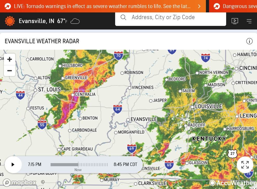

+++++++++++++++++++++
Let's see how the Accuweather weather radar forecast did:
1. 8:45pm-current radar-their forecast was not that good?
2. 10:15pm-new forecast-rapid weakening to below severe levels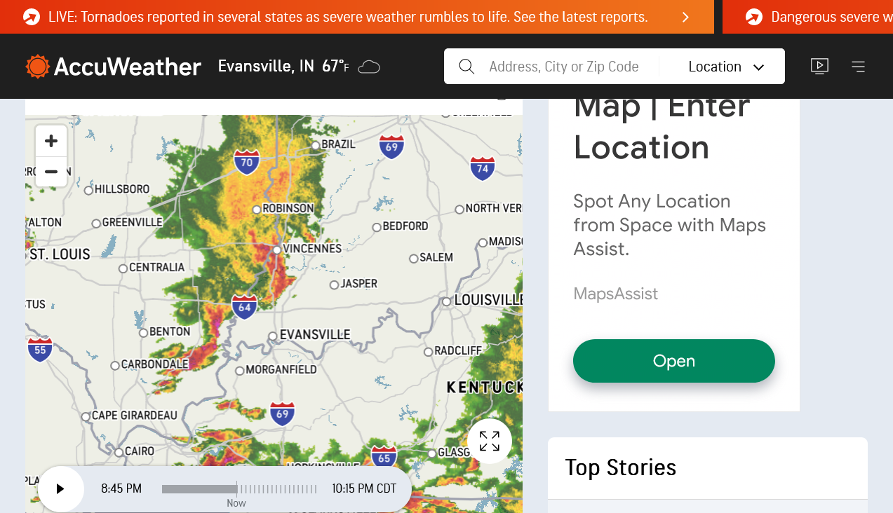

This guy does a nice job covering the storms in the areas getting clobbered. We can thank Jean for this source!
Thanks, Jean!!
No severe weather reported in Indiana today, as of 7:30pm!
Severe Storms approaching S. Indiana from the west, so that could change.

Dark Reds are flash flood warnings(they should change that color to green).
Bright red is a tornado warning.
Oranges are severe thunderstorm warnings.
The risk of a tornado is low with these storms.
MY FORECAST
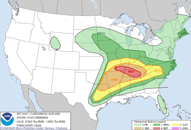
The Storm Prediction Center has adjusted their risks farther south. Evansville now in the slight risk.
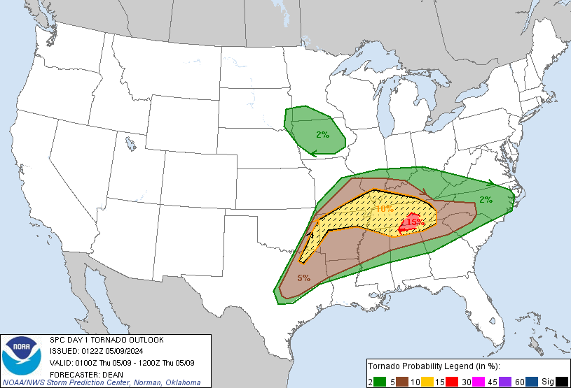
1. High Wind Risk just under 30%
2. Tornado Risk 5%

The severe thunderstorm warning for the Evansville area was cancelled before it expired as the storms have weakened in the more stable, rain cooled air.
Hold on............a new line of storms has formed in S.MO and is moving into S.IL and is aimed at our area.
Hopefully, they will weaken before they get here.
1 last round to go )-: Highest threat south of Evansville again.
Widespread severe weather yesterday/Wednesday. Mostly high winds. Only 3 high wind reports/damage in the state of Indiana. All 3 were in the late evening.
One of the strangest things happened. Our Evansville Vanderburgh School Corporation, suddenly announced, late in the morning that all schools would be dismissing 1 hour early and all after school activities would be cancelled.
I get that they want to protect students and increase safety. However, this made no sense from the latest meteorology going on at the time.
1. Evansville was only in a level 3 out of 5 risk. The 4 out of 5 risk (moderate) was SOUTH of Evansville.
2. This was already known the evening of the day before. On Wednesday morning it had become pretty obvious that the severe weather risk that afternoon would be mainly for areas SOUTH of Evansville. If they were waiting to see what was developing on Wednesday morning to make the call........the call should have been to use the regular school schedule.
3. Out of the blue, late morning they suddenly announced that thousands of the kids were coming home an hour early. With all weather indicators pointing towards the severe weather NOT targeting Evansville at that time(going south).
https://www.spc.noaa.gov/climo/reports/yesterday.html
https://www.npr.org/2024/05/09/1250135938/deadly-tornadoes-southeast-storms
++++++++++++++
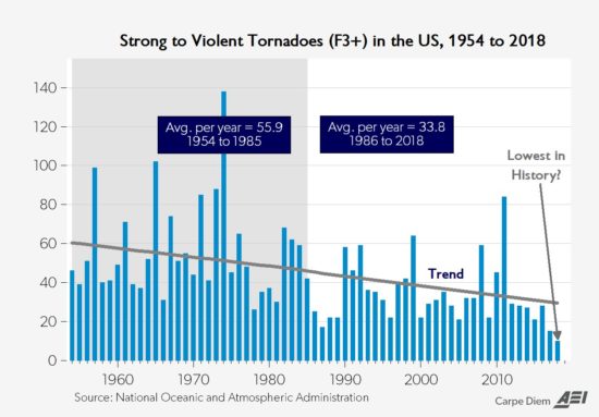
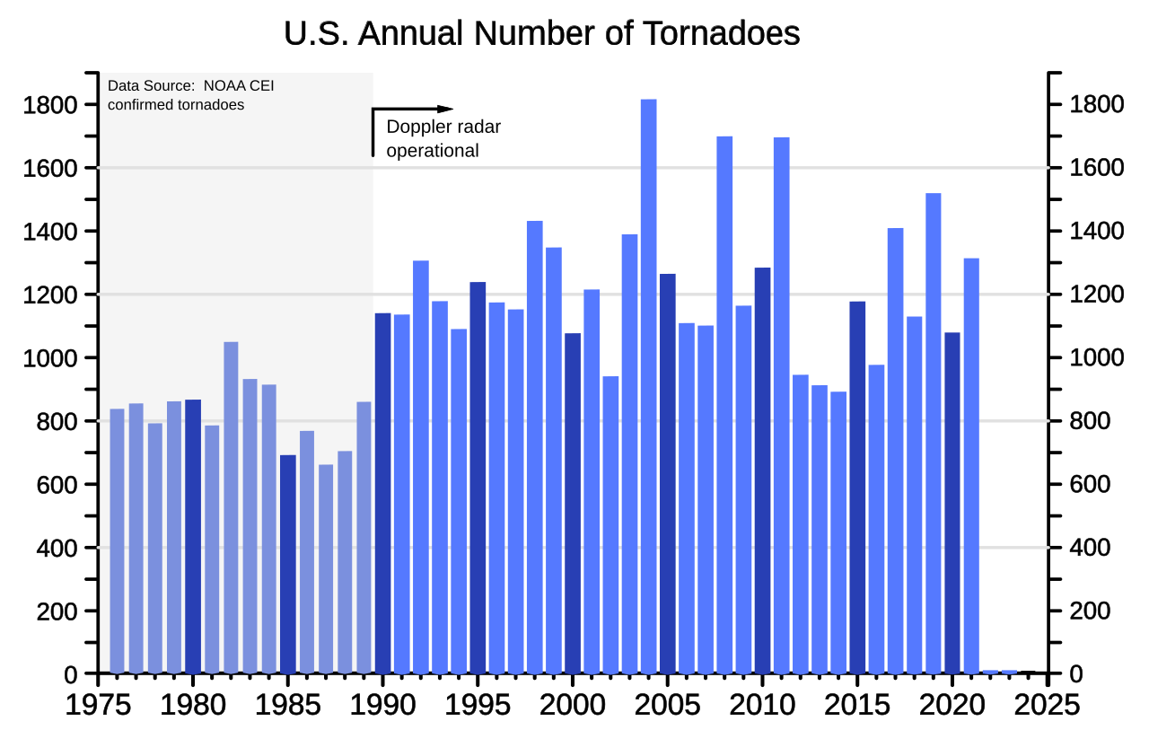
NO, NO, NO! Tornadoes are NOT more frequent! It's the opposite with the violent, most deadly tornadoes.
Meteorology 101 tells us what happens when the planet sees the temperature of the highest latitudes (coldest places) warmed up the most.

Global warming reduces the meridional temperature gradient(by warming the coldest places/higher latitudes) the most. This weakens cold fronts and jet streams. This has cause a REDUCTION in the most violent tornadoes.
+++++++++++++
May 29th, 2019 by Roy W. Spencer, Ph. D.
https://www.drroyspencer.com/2019/05/recent-tornadoes-are-due-to-unusually-cold-weather/
+++++++++++++++++
https://en.wikipedia.org/wiki/Tornado
Doppler weather radar systems can detect mesocyclones within a supercell thunderstorm. This allows meteorologists to predict tornado formations throughout thunderstorms.[106]

+++++++++++++
https://inside.nssl.noaa.gov/nsslnews/2009/03/us-annual-tornado-death-tolls-1875-present/
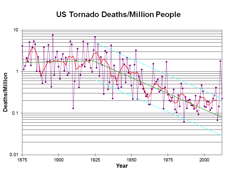
The graph above is only thru 2012.
Great Tri State Tornado 99 years ago
Started by metmike - March 18, 2024, 2:38 p.m.
https://www.marketforum.com/forum/topic/102699/
++++++++++++++++
https://en.wikipedia.org/wiki/List_of_tornadoes_causing_100_or_more_deaths
++++++++
https://gitnux.org/tornado-statistics/
++++++++++
Tornadoes come from mainly two types of thunderstorms: supercell and non-supercell.
https://www.nssl.noaa.gov/education/svrwx101/tornadoes/types/
QLCS tornadoes are associated with lines of strong thunderstorms, and frequently occur during late night and early morning hours. [+]
Squall Line/Bow Echo/QLCS
https://www.weather.gov/lmk/squallbow
 Weather Map
 Local Radar

 Local Radar
 Regional Radar
 Shreveport Radar
 Local Radar