
Per records, there hasn’t been a TS+ anywhere near the lower 48 on or even near Election Day. Hopefully that won’t change in 2024. Ensembles are actually suggesting a slight chance for that to occur.
Can you imagine the media coverage that day for the two things converging should this occur? And what about the conspiracy theorists?
Thanks, Larry!
warmer water increases the chances slightly VS historical odds.
One would think that with the warmer water temperatures the past 30 years, that the number of hurricanes to hit the United States in November would have gone up.
NOPE!
3 hurricanes have hit the US(Florida) the past century during the month of November.
1.The last one, Nicole hit in 2022 as a minimal hurricane.
https://www.weather.gov/tbw/HurricaneNicole
2. The previous (2nd) one and strongest of the 3 was Hurricane Kate that hit Florida in 1985.
https://en.wikipedia.org/wiki/Hurricane_Kate_(1985)
3. The 1st one hit Florida in 1935. The "Yankee Hurricane(before they got names).
https://en.wikipedia.org/wiki/1935_Yankee_hurricane
That was the same year of the 1935 Great Labor Day hurricane that hit Florida, which is considered the strongest hurricane in history to make landfall in the United States.
https://www.islamoradatimes.com/the-1935-labor-day-hurricane/
https://preview.weather.gov/media/tbw/paig/PresAmHurricane1935.pdf
+++++++++++++++
Which of these hurricanes were/was greatly impacted by climate change and which ones were from natural variation?
Answer: All of them were from natural variation. Climate change, could have played a very small role in 2022 and even that one, was almost entirely from natural variation(despite what the media stated).
If/when we have additional November hurricanes like those in the past, we WILL hear about how they could not have happened if not for the climate crisis!
Because the warmer water is farther south in November, that's where almost all the November hurricanes have occurred.
https://www.accuweather.com/en/hurricane/the-most-notorious-november-atlantic-hurricanes/602213
A total of 50 hurricanes formed in November, but only three of those made landfall in the United States
https://www.newsweek.com/hurricane-kristy-strongest-storm-planet-1975042
https://www.newsweek.com/how-tropical-storm-nadine-became-hurricane-kristy-1973992
https://www.nhc.noaa.gov/graphics_ep2.shtml?start#contents
Wind history below:
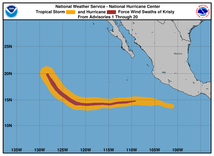
Forecast: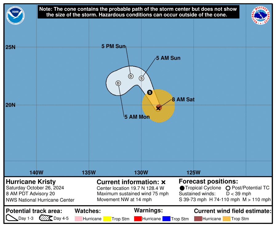
https://www.nhc.noaa.gov/gtwo.php?basin=atlc&fdays=7

https://en.wikipedia.org/wiki/2024_Atlantic_hurricane_season
14 named storms so far!

Tropical Weather Outlook
NWS National Hurricane Center Miami FL
200 PM EDT Sun Oct 27 2024
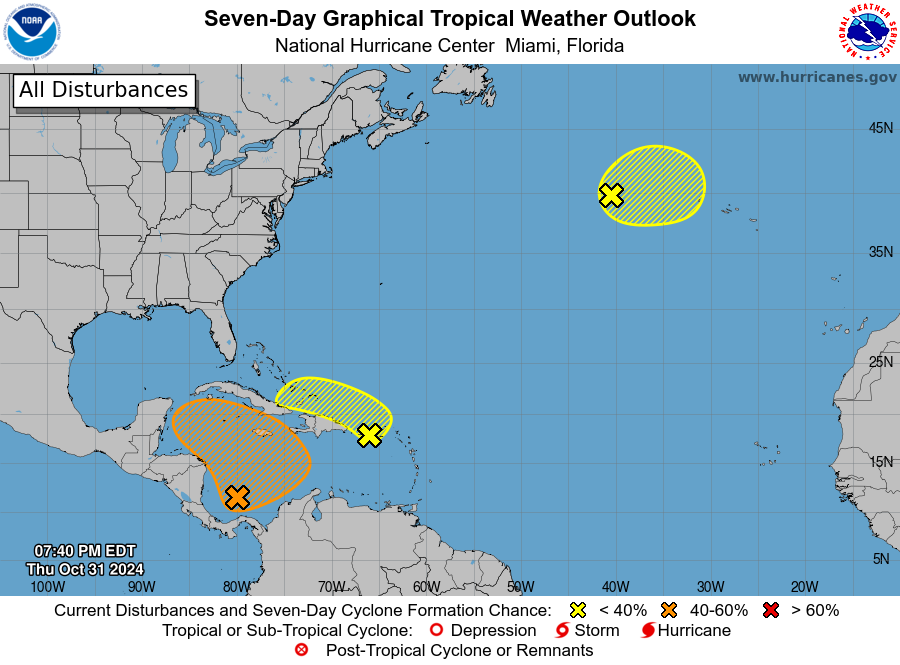
For the North Atlantic...Caribbean Sea and the Gulf of Mexico:
1. Southwestern Caribbean Sea:
A broad area of low pressure is likely to develop over the
southwestern Caribbean Sea in a few days. Gradual development is
possible thereafter, and a tropical depression could form late this
week or over the weekend when the system begins to drift northward
or northeastward over the southwestern and south-central Caribbean
Sea.
* Formation chance through 48 hours...low...near 0 percent.
* Formation chance through 7 days...medium...40 percent.
Forecaster Cangialosi
Thanks, Larry!
Still at 40% chance.
Up to 60% chance now!
https://www.nhc.noaa.gov/gtwo.php?basin=atlc&fdays=7
++++++++++
https://www.youtube.com/watch?v=9p8dvfH1SYs
https://www.youtube.com/watch?v=XjQJc1xJiDM
Tropical Update, Caribbean & Gulf Storm Potential Increasing Nov 2-9 Second Storm Potential As Well?
1. This is now Invest 97L with NHC odds up to 80%/90%.
2. Based on preliminary stats, October of 2024 had the 5th highest ACE on record for any Oct back to 1851:
1. 1878: 87.8
2. 1894: 76.1
3. 2016: 71.3
4. 1893: 67.5
5. 2024: 66.8 (preliminary)
6. 1963: 63.1
Thanks much, Larry. Interesting that the top 3(of the 6) were BEFORE 1900 and WELL BEFORE CO2 increased and we had a 1 deg. C warming of the planet!
Up to 90% chance now! 80% in the next 2 days.
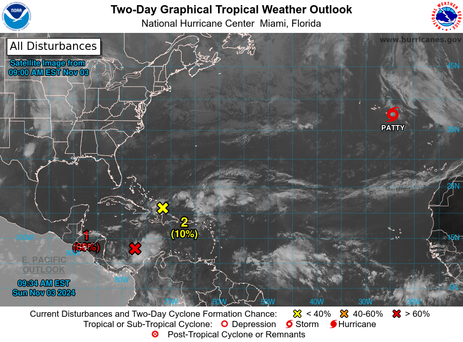
https://www.nhc.noaa.gov/graphics_at2.shtml?start#contents
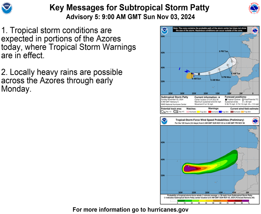
More on this type of storm, shortly.
Mike said:
“Interesting that the top 3(of the 6) were BEFORE 1900 and WELL BEFORE CO2 increased and we had a 1 deg. C warming of the planet!”
———————
Thanks Mike,
1. Agreed that this metric shows no trend correlating with GW. Good observation.
2. We may have still another soon after Invest 97L that some models like GFS and Icon have been hinting at:
Tropical Weather Outlook
NWS National Hurricane Center Miami FL
100 PM EST Sun Nov 3 2024
Southwestern Atlantic:
An area of disturbed weather is expected to develop near the
northern Leeward Islands around the middle of the week. Some slow
development of this system is possible after that time as it moves
generally westward over the southwestern Atlantic.
* Formation chance through 48 hours...low...near 0 percent.
* Formation chance through 7 days...low...20 percent.
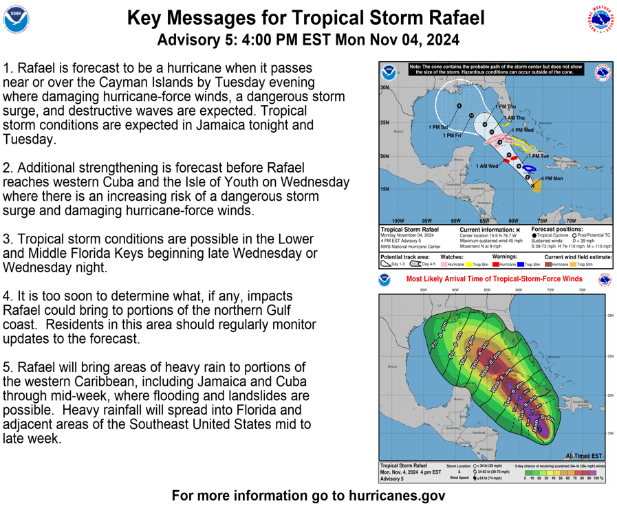
Hello Tropical Storm Raphael!
Looks like a cat. 1 or 2 hurricane that hits Western Cuba, then weakens:
https://www.nhc.noaa.gov/refresh/graphics_at3+shtml/210050.shtml?3-daynl
Related to subtropical storm, Patty:
https://en.wikipedia.org/wiki/Subtropical_cyclone
A subtropical cyclone is a weather system that has some characteristics of both tropical and extratropical cyclones.[1]
++++++++++++
Previous discussion related to this:
Re: Re: Re: Re: Invest 92L SW Gulf: threat to W FL mid-week!
By metmike - Oct. 10, 2024, 12:15 p.m.
now a weakening TS in the southern GOM.
continuing to weaken before hitting southern Mexico in the middle of next week.
see links above….traveling to Detroit to be with my 99 year old dad today.