Midwest- Tracking the Winter Storm 1-4-25+
7 responses | 0 likes
Started by metmike - Jan. 4, 2025, 9:21 p.m.

Previous thread:

                Winter weather ahead 12-30-24            

                                       Started by metmike - Dec. 30, 2024, 10:04 p.m.       

     https://www.marketforum.com/forum/topic/109248/

+++++++++++

Get all the constantly updated weather here:

https://www.marketforum.com/forum/topic/83844/

+++++++++++

Go to the link below, hit hazards box in the top right hand corner(it will also define all the color codes), if its not already in the hazards mode when you load the link.

 Then you can hit any spot on the map, including where you live and it will go to that NWS with all the comprehensive local weather information for that/your county. 

https://www.weather.gov/                                                                                                                 


New radar product below          

 https://radar.weather.gov/?settings=v1_eyJhZ2VuZGEiOnsiaWQiOm51bGwsImNlbnRlciI6Wy05NC45OCwzNy4wMl0sImxvY2F0aW9uIjpudWxsLCJ6b29tIjo0fSwiYW5pbWF0aW5nIjpmYWxzZSwiYmFzZSI6InN0YW5kYXJkIiwiYXJ0Y2MiOmZhbHNlLCJjb3VudHkiOmZhbHNlLCJjd2EiOmZhbHNlLCJyZmMiOmZhbHNlLCJzdGF0ZSI6ZmFsc2UsIm1lbnUiOnRydWUsInNob3J0RnVzZWRPbmx5IjpmYWxzZSwib3BhY2l0eSI6eyJhbGVydHMiOjAuOCwibG9jYWwiOjAuNiwibG9jYWxTdGF0aW9ucyI6MC44LCJuYXRpb25hbCI6MC42fX0%3D

Go to: "Select View" then "Local Radar"

Hit the purple circle to see that local radar site

+++++++++++++++++++++++

                          This link below provides some great data. After going to the link, hit "Mesoanalysis" then,  the center of any box for the area that you want, then go to observation on the far left, then surface observations to get constantly updated surface observations or hit another of the dozens of choices.
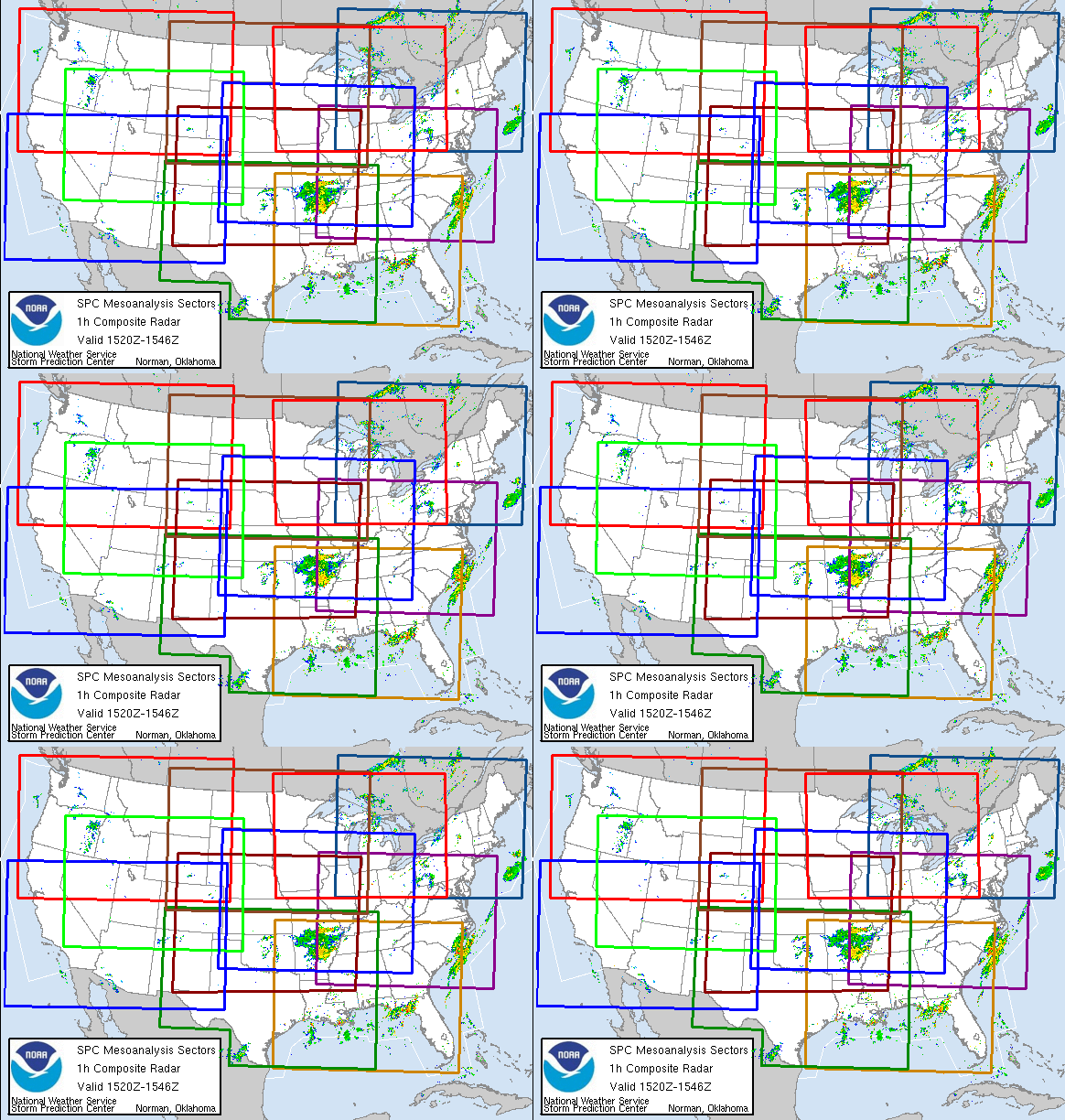
https://www.spc.noaa.gov/


 Northwest Southwest Central Plains Northern Plains
      https://www.eldoradoweather.com/radar/national-doppler-radar-full-resolution.htmlConus Radar Very High Resolution


https://www.wunderground.com/maps/radar/current
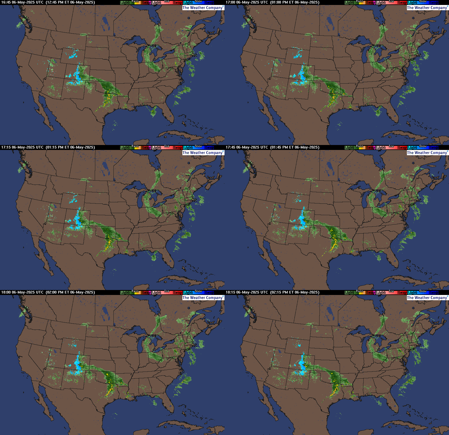
Static map

Comments
By metmike - Jan. 4, 2025, 9:28 p.m.
Like Reply
By metmike - Jan. 4, 2025, 9:38 p.m.
Like Reply

KS/NE/MO:

NWS Forecast Office Dodge City, KS (southwest)

      https://www.weather.gov/ddc/


                Local Radar Image

+++++++++++++

Witchita, KS(southeast)

Click a location below for detailed forecast.

    https://www.weather.gov/ict/


                Local Radar Image

+++++++++++++++++++++++++++

NWS Forecast Office Hastings, NE

        https://www.weather.gov/gid/


                Local Radar Image                                                             

              +++++++++++++++

NWS Forecast Office Kansas City, MO                                                                                      

https://www.weather.gov/eax/


                Local Radar Image


By metmike - Jan. 4, 2025, 10:20 p.m.
Like Reply

MO/IL:

NWS Forecast Office St. Louis, MO

        https://www.weather.gov/lsx/    


                Local Radar Image


Central Illinois

NWS Forecast Office Lincoln, IL  

        https://www.weather.gov/ilx/     


                                Local Radar Image


NWS Forecast Office Springfield, MO

       https://www.weather.gov/sgf/ 


                Weather MapWeather Map            


                Local Radar ImageLoca


By metmike - Jan. 4, 2025, 10:24 p.m.
Like Reply

MO/IL/IN/KY:

NWS Forecast Office Paducah, KY 

     https://www.weather.gov/pah/

   Click a location below for detailed forecast.  


                Local Radar Image                                               

                ++++++

NWS Forecast Office Indianapolis, IN  
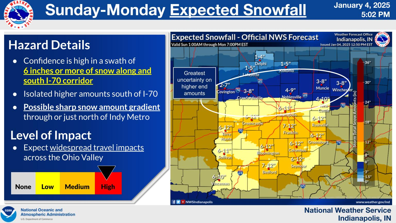
     https://www.weather.gov/ind/


                Local Radar Image


NWS Forecast Office, Northern Indiana
https://www.weather.gov/iwx/


                Local Radar Image


By metmike - Jan. 4, 2025, 10:25 p.m.
Like Reply

KY/IN/OH:

NWS Forecast Office Louisville, KY

https://www.weather.gov/lmk/


                Local Radar Image


NWS Forecast Office Wilmington, OH(Cincinnati)     

    https://www.weather.gov/iln/


Weather Story

Local Radar

By metmike - Jan. 6, 2025, 9:25 p.m.
Like Reply

Doing my best to find total snow reports across the country and will report them as they come in.

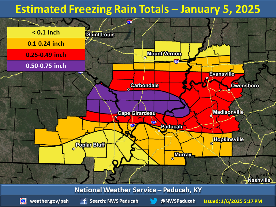
For many people, however it was the freezing rain, just south of the heavy snow that knocked out power and caused the majority of issues:

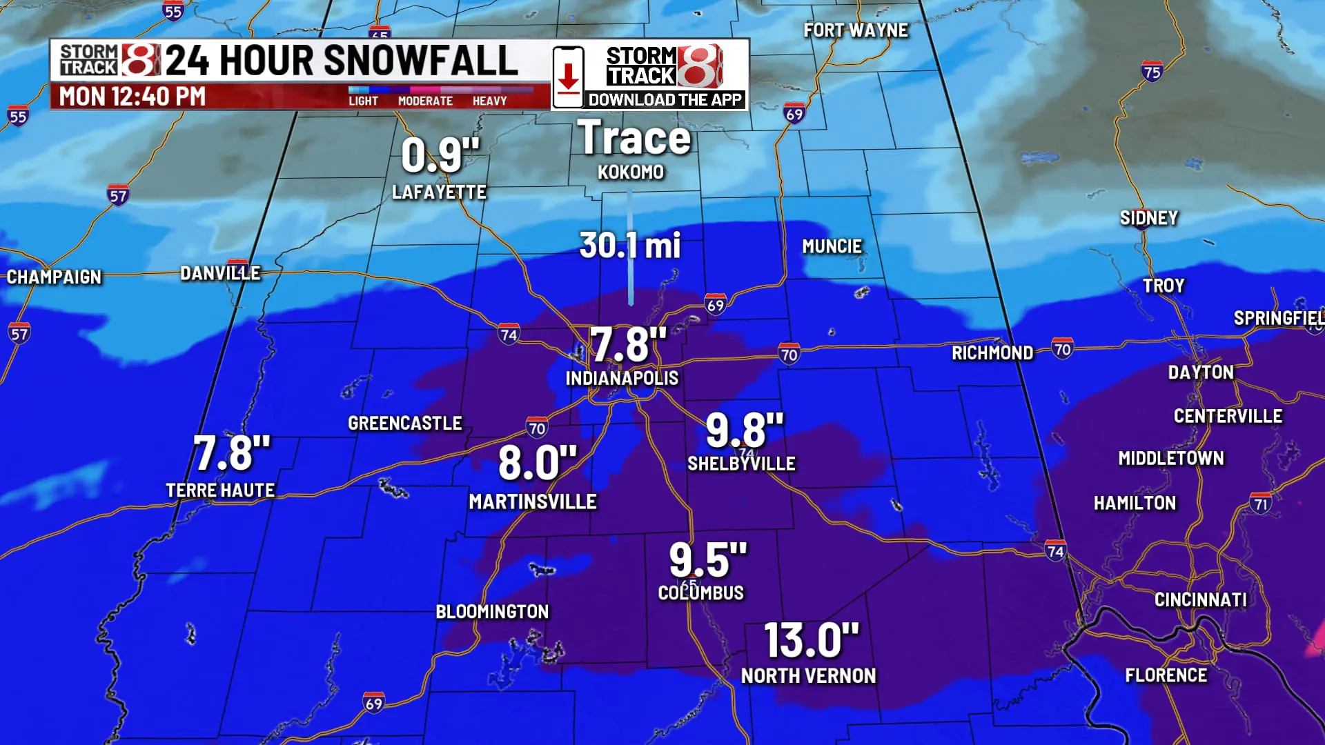
Indianapolis area(mcfarm-land):

https://www.wishtv.com/weather/weather-stories/winter-storm-2025-snowfall-totals/
+++++++++++++++++++++++++

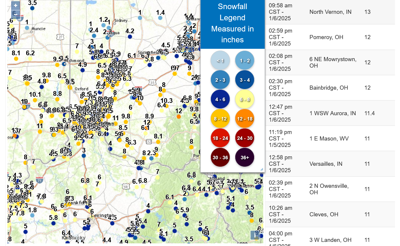
Cincinnati area(cutworm land):

https://www.weather.gov/source/crh/snowmap.html?zoom=8.075902571694881&lat=39.19&lon=-83.85&hr=48
          

                Re: Re: Re: snow in my area                                               

                By cutworm - Jan. 6, 2025, 8:24 p.m.            

            Snow ended about 12:30 

10 mph winds gusting to 15 mph. all afternoon drifting snow 4  foot drifts common lower 20s for temps.

Some reports of 12 inches of snow. Hard to tell here as it is heavily drifted. I would guess 8- 10 inches.

No traffic on the roads so they must be bad.

No ice or rain here 

++++++++++++++++++++++

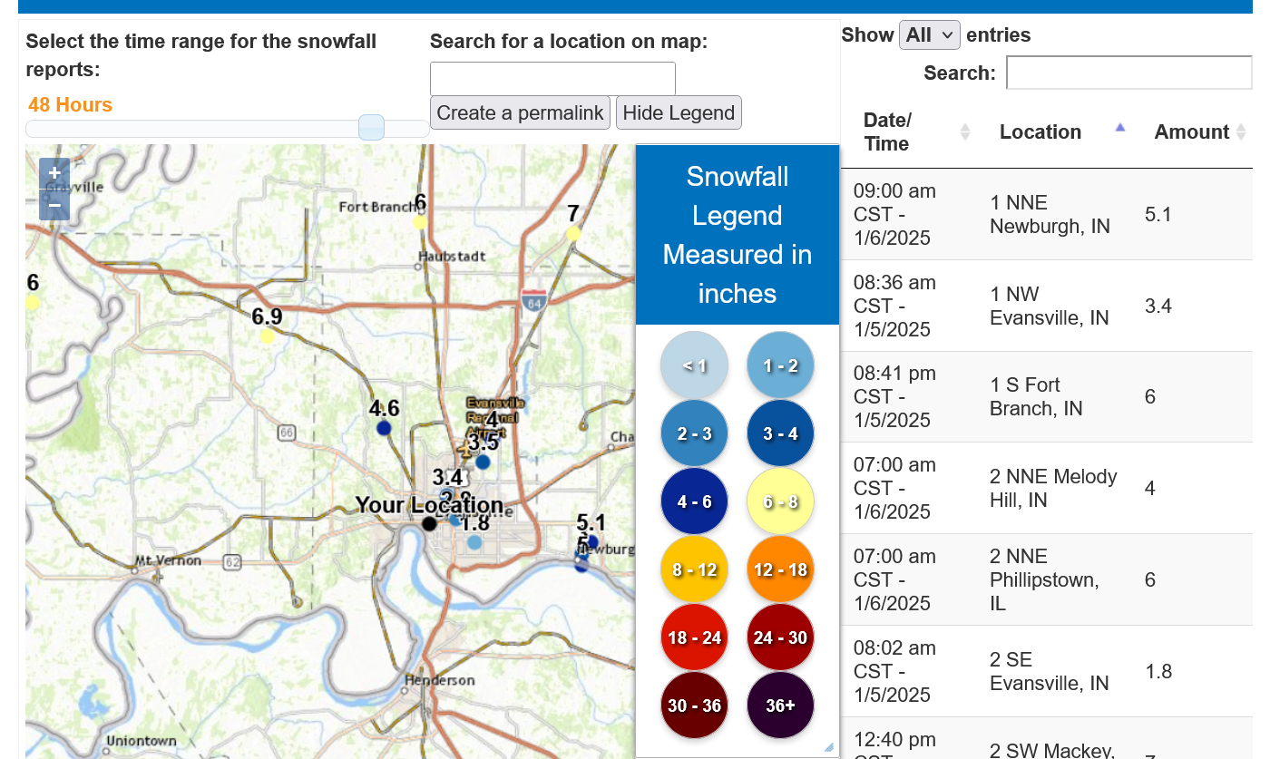
   Evansville, Indiana: I measured 5.9" BEFORE the freezing rain hit. Then we got sleet and mostly freezing rain(ice) + some sleet, something like .9" total. Then another ~1.3" of snow this morning. We live just north or Evansville. 

Most of these reports below did not include our 1-6-25 additional snow on the backside of the Winter storm.
++++++++++++++++++


                                      ++++++++++++++++++++++

Overview of the Major Ice and Winter Storm of January 5, 2025

                          https://www.weather.gov/pah/2025January5WinterStorm
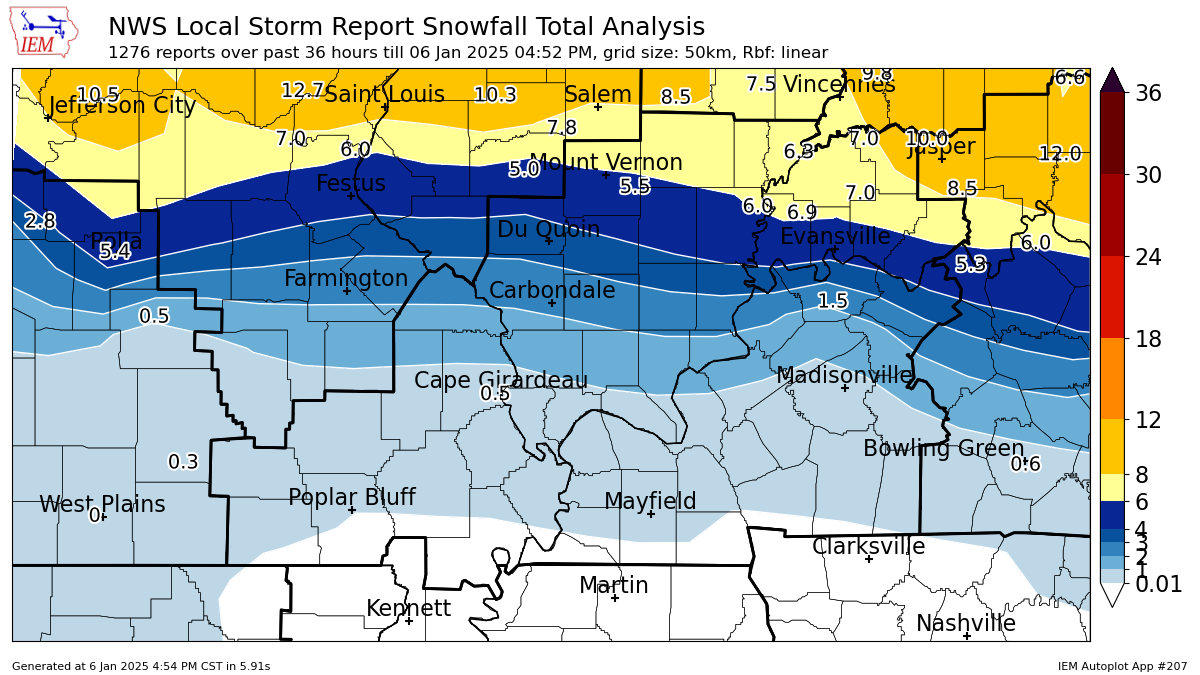


I would extend the purple color above,northeast to Evansville based on my measurements. 

     +++++++++++++++++++++++++++++++++++++              


By metmike - Jan. 6, 2025, 9:44 p.m.
Like Reply

OK, NOW we're cookin!

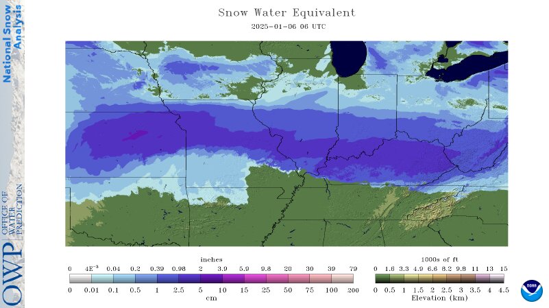
Regional Snow Analyses: Midwest

https://www.nohrsc.noaa.gov/nsa/index.html?year=2025&month=1&day=6&units=e&region=Midwest

Automated Model Discussion:

January 6, 2025

   Area Covered By Snow:58.1%
   Area Covered Last Month:0.5%


Snow Reports(metmike: There were MUCH higher amounts than this!!!

Top Ten:Metric Units...
    
Station IDNameElevation
(feet)
Snowfall
(in)
Duration
(hours)
Report Date / Time(UTC)
TFOK1TOPEKA - NWS8927.9006.0002025-01-05 18:00
LMKLOUISVILLE, KY6366.0006.0002025-01-05 18:10
TFOK1TOPEKA - NWS8925.2006.0002025-01-06 00:00
BASK1BASEHOR 3NE96810.20014.0002025-01-06 03:00
JKLJACKSON, KY13624.0006.0002025-01-05 18:00
LSXST LOUIS, MO6043.8006.0002025-01-06 06:00
PLHM7PLEASANT HILL WFO10143.6006.0002025-01-06 00:00
TFOK1TOPEKA - NWS89214.00024.0002025-01-06 06:00
LEXBLUE GRASS ARPT9323.5006.0002025-01-05 17:59
ILXCENTRAL ILLINOIS, IL5843.3006.0002025-01-05 23:59


The band in the center measured 9.8+ inches on the ground this morning 1-6-25. A bit more than that likely fell from the storm in those locations. 
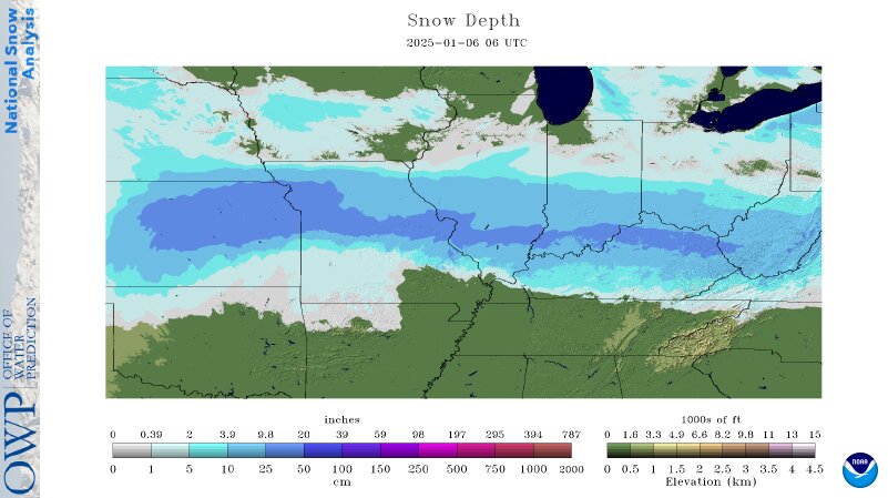

The band in the center is .39+ inches. There's a small pocket in KS of 2+ inches.