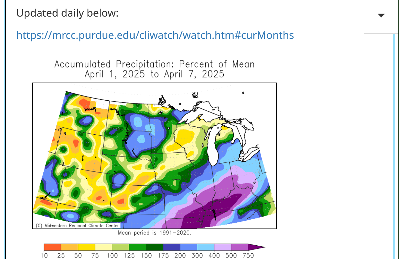

This stalled weather system has another couple of days impacting us!
Previous thread:
3-30-25 TORNADO outbreak on 4-2-25
Started by metmike - March 30, 2025, 3:08 p.m.
https://www.marketforum.com/forum/topic/110789/
+++++++
All the weather here:
With the cold front, stalling and moving back north as a warm front, we're back in the warm, humid and unstable air again. Along with it is an ENHANCED potential of severe weather later Friday.
The highest threat for tornadoes, some violent will be SOUTHWEST of Evansville in the hatched area on this map.
Tornado threat for Evansville tonight = 5%
Tornado threat this evening and tonight. Just 5% in Evansville and we're NOT in the hatched area where its much higher. 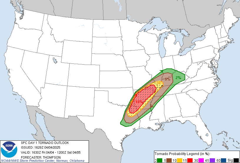
| |
Go to this link and hit your county:
++++++++++
Rain amounts MUCH less than earlier in the week(some/much of it has fallen)
https://www.marketforum.com/forum/topic/83844/#83848
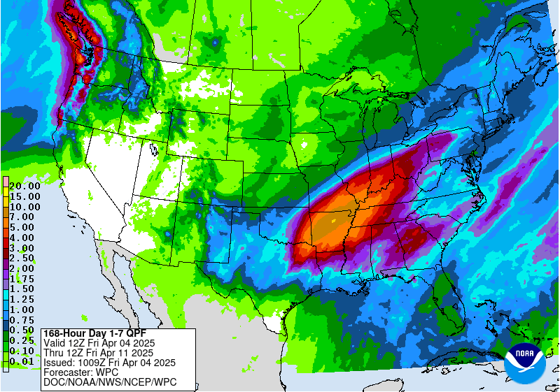
Excessive rain threat.
https://www.wpc.ncep.noaa.gov/qpf/excess_rain.shtml
Day 1 Threat Area in Text Format
Current Day 2 Forecast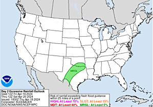 |
Recall the jet stream forecast maps we showed you early this week that made this extremely long lasting weather thread (severe and flooding) inevitable:
++++++++++++++++++++
3-30-25 TORNADO outbreak on 4-2-25
By metmike - April 1, 2025, 11:07 p.m.
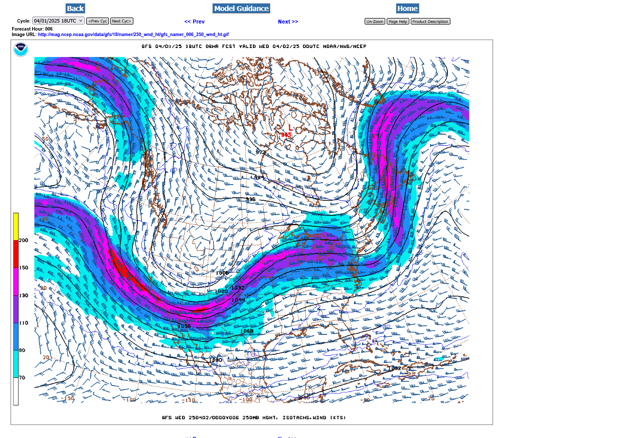
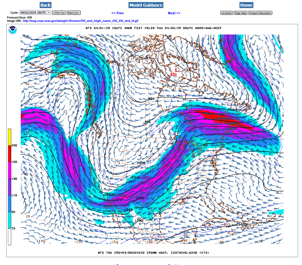
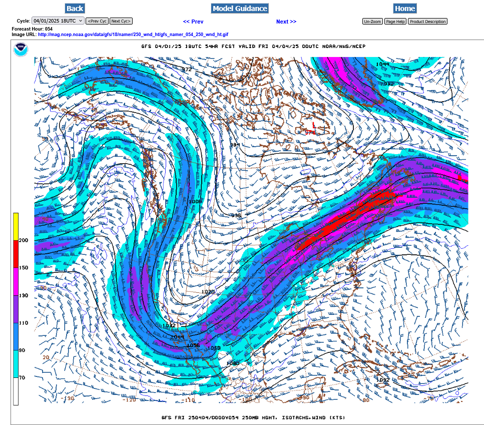
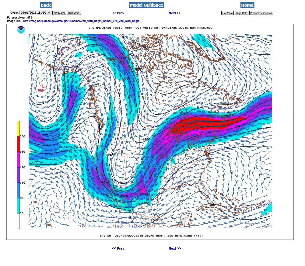
Look at this amazing 250 mb jet stream for the next 6 days:
Tuesday pm-200 mph jet streak in the base of the trough
 ++++++++++
Wednesday pm-Jet stream causing severe storm and tornado outbreak in the middle of the country-new energy feeding into the backside of the trough, redeveloping it and deepening it farther south and to our west, instead of allowing it to progress forward.
+++++++++++++
Thursday pm-very deep trough stalled to our west with strong southerly component to our upper level winds. Deep layered moisture gushing north and overunning some cooler at at the surface with perturbations in the strong flow triggering waves of very heavy t-showers.
+++++++++++++++++++++++++
Friday pm-upper trough still to our west with s/sw winds here. Severe weather moves back north. Fresh batch of strong winds from northwest Canada NOT feeding the trough but instead, positioned to kick it out finally over the weekend.
 ++++++++++++++++++++++++++
Saturday pm- the last of the strong sw jet stream over us.
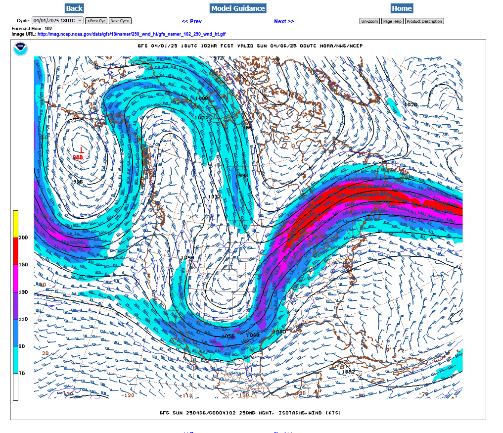
++++++++++++++++++++++
Sunday pm-the jet stream that caused the severe weather and flooding in finally to our east. A new, potent Northern stream is taking aim at us with some very chilly weather for the 2nd week of April.
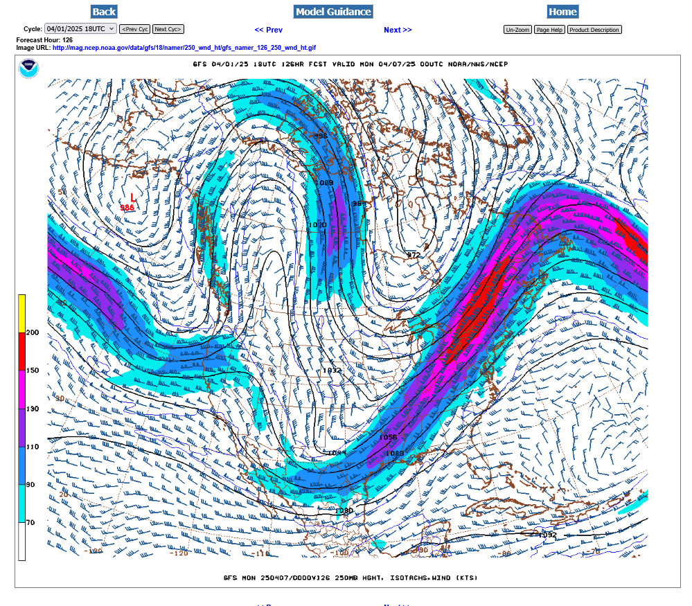
++++++++++++++
Monday pm-Very chilly air pushing in for early/mid NEXT week:
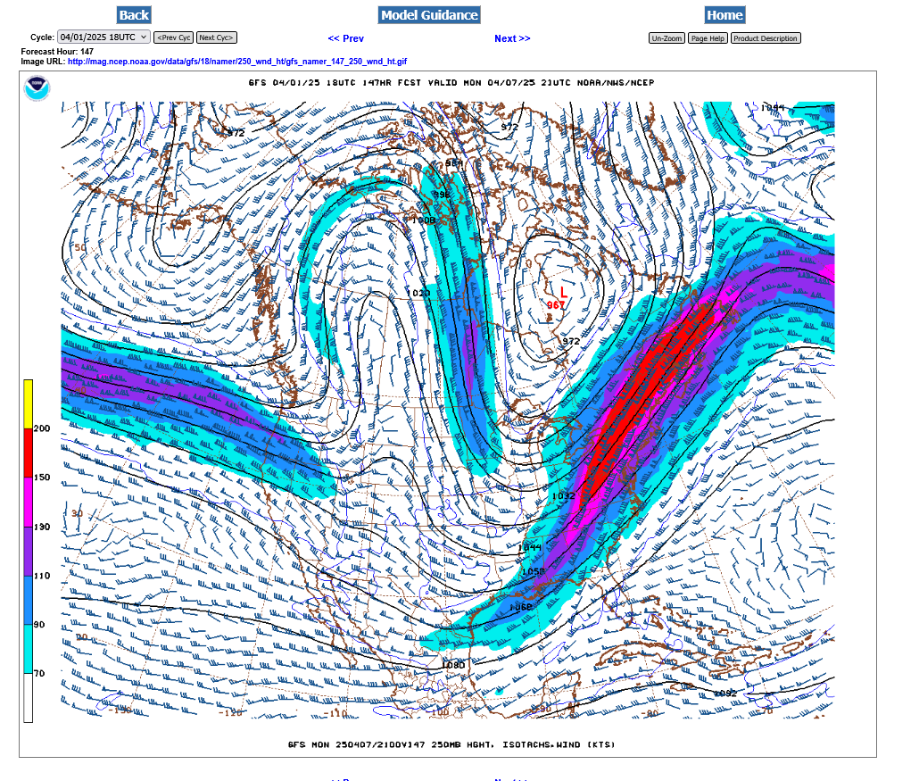
This was the radar loop around Noon, showing the warmer air and rains pushing north with the warm front aloft.
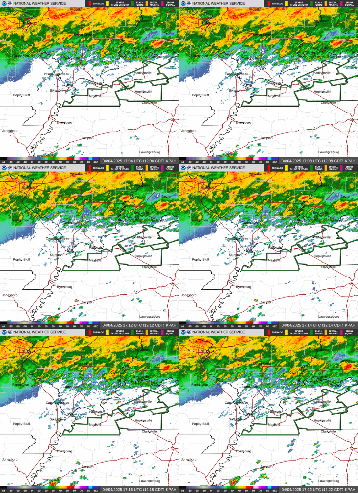
If I had a guess on the additional rain for Evansville between now and Sunday, it would be another 4 inches. As much as 8 inches farther to our southwest.
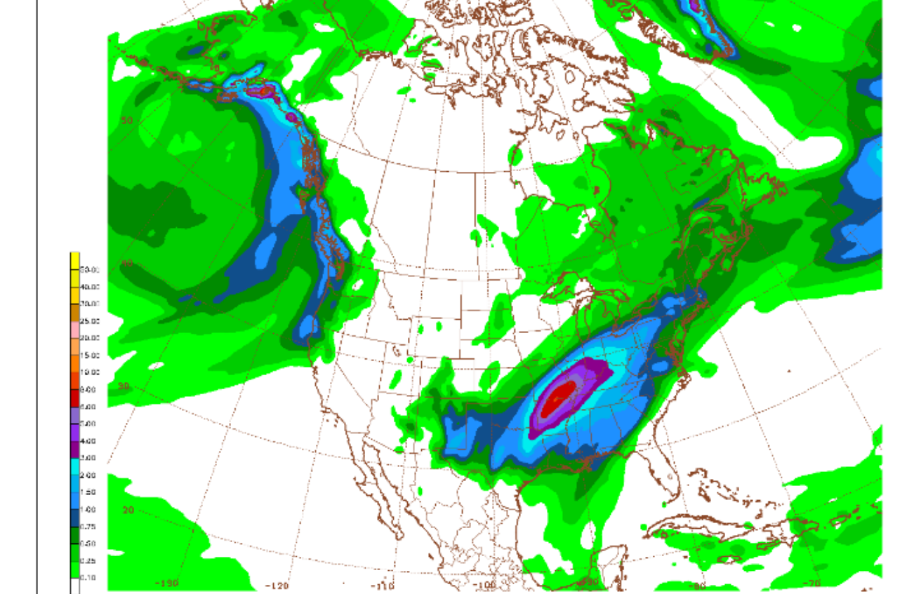
This was the last total rain forecast from the just out 12z GEFS model:
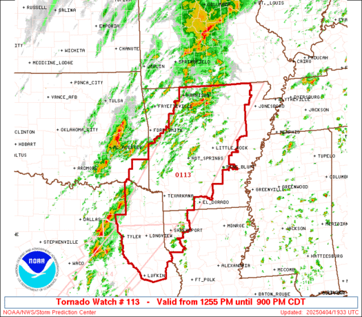
Tornado watch until 9pm. Potential for strong, EF3 tornadoes.
https://www.spc.noaa.gov/products/watch/ww0113.html
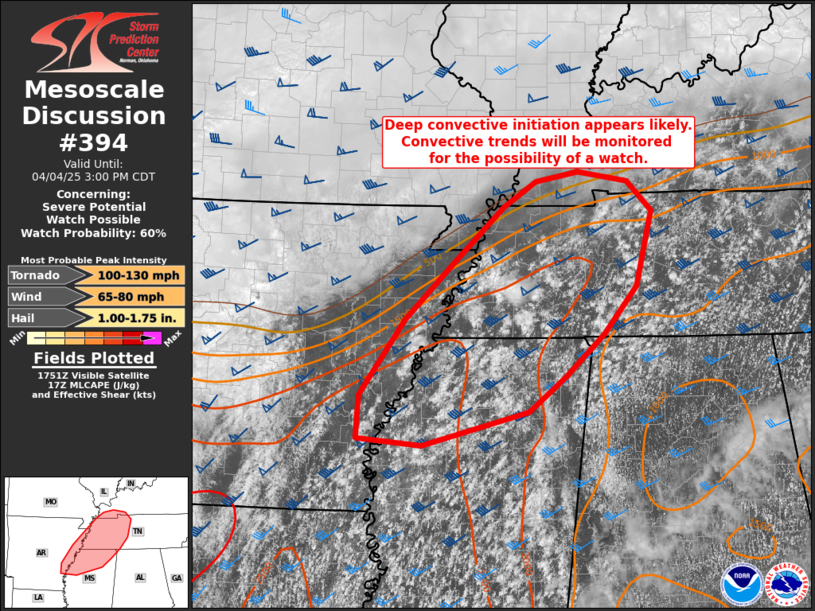
These were their thoughts from earlier this afternoon, closer to us but the storms haven't developed(so far):
https://www.spc.noaa.gov/products/md/md0394.html
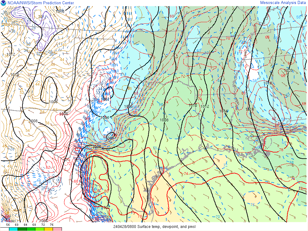
WOW temperature contrast!
Nashville is 88, St.Louis is 45 at mid afternoon.

LOWER MIDWEST
https://www.spc.noaa.gov/exper/mesoanalysis/new/viewsector.php?sector=20

https://www.spc.noaa.gov/exper/mesoanalysis/new/viewsector.php?sector=20#

https://www.spc.noaa.gov/exper/mesoanalysis/new/viewsector.php?sector=20# 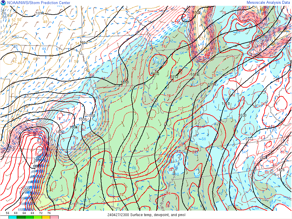
SOUTHCENTRAL
https://www.spc.noaa.gov/exper/mesoanalysis/new/viewsector.php?sector=15#

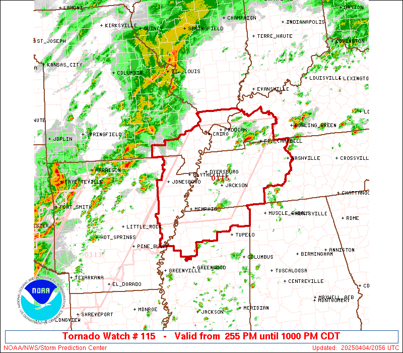
Tornado watch until 10 pm in that area they've been watching for several hours:
https://www.spc.noaa.gov/products/watch/ww0115.html
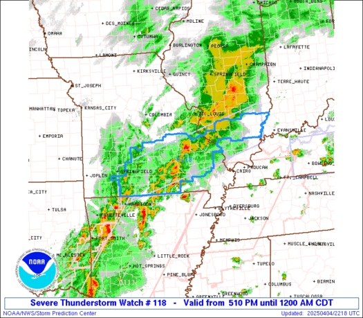
Here's the latest watch just issued close to our area until Midnight. Note that its a severe thunderstorm watch box. This is because the chance of severe thunderstorms is the main risk. A tornado is still possible but NOT the main risk. Any tornadoes tonight in our area are more likely to be the weaker type but that's not a guarantee, just a recognition of what the atmosphere is most likely to do or not do.
Wind gusts to 60 mph are possible vs the Wednesday Evening risk of higher winds and violent tornadoes.
https://www.spc.noaa.gov/products/watch/ww0118.html
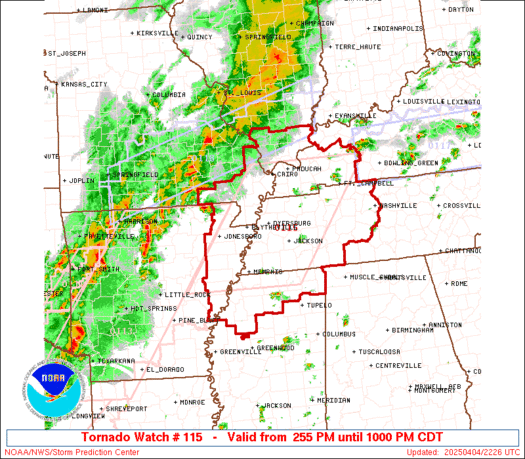
The Storm Prediction Center also expanded the tornado watch to our south. This is the area more likely to have tornadoes, including strong tornadoes.
This one is in effect until 10pm.
Evansville will likely be in some sort of a watch box later this evening.
https://www.spc.noaa.gov/products/watch/ww0115_radar_big.gif
We should note that almost all the warnings being issued with these impressive looking thunderstorms approaching are for FLASH FLOODING(in red).
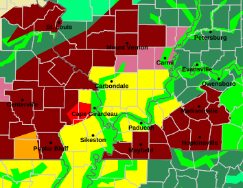
On this radar loop, the flash flood warnings are in green.
Just to repeat, the chance of a tornado tonight is only 5% and that 5% means a tornado within 25 miles of any particular locations. So you could also say a 95% of no tornadoes within 25 miles of you and any tornadoes that do develop in Indiana are mostly likely to be the weaker types farther away from the most powerful jet stream dynamics.
That doesn't at all mean to not be prepared for that outside chance and act like its a wonderful day in the neighborhood.
Be INSIDE A STURDY BUILDING, away from windows when these storms hit AT THE VERY LEAST.
If there's a tornado warning, go to your safe place ESPECIALLY if its for a confirmed, long track strong tornado on the ground.
That's the thing about strong, long track tornadoes. Other than the spot where they touch down, everybody else in the path usually gets a decent lead time in their warnings about what it is so they KNOW to go to the basement or safe spot.
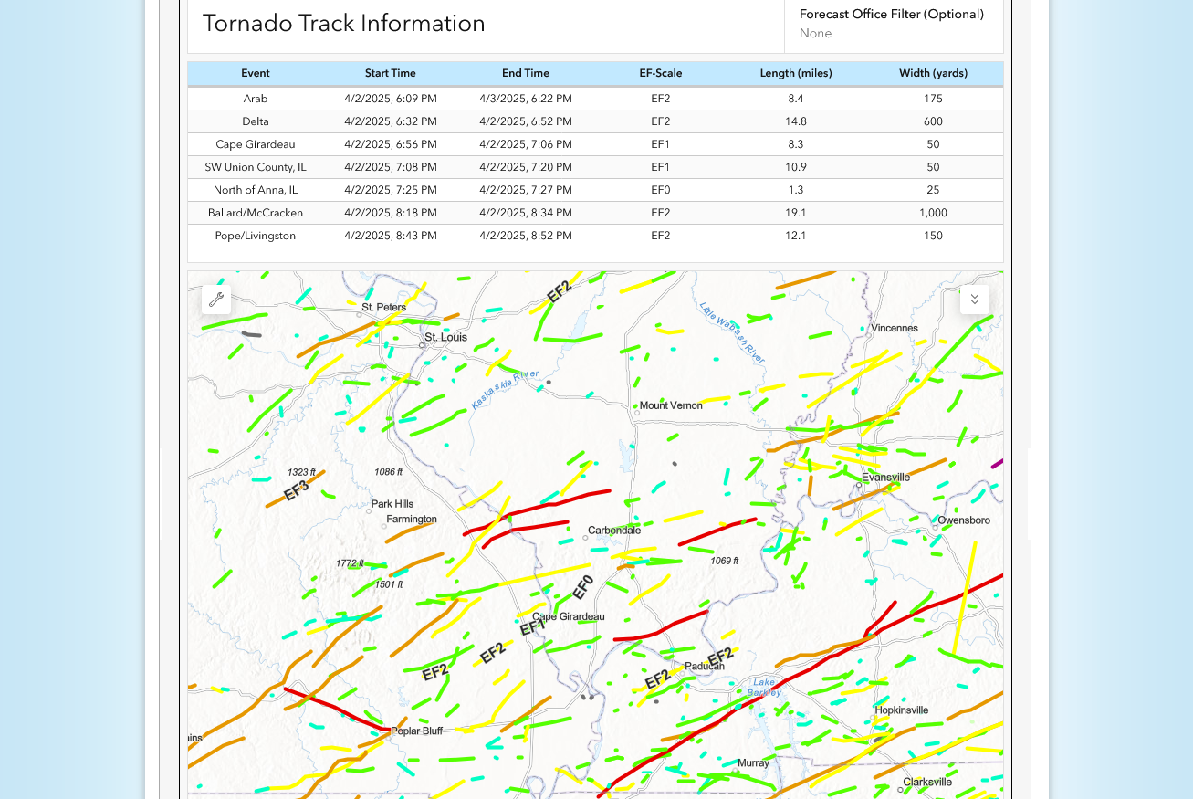
You will note that we had some pretty bad storms on Wednesday but no long track tornadoes EF2 or stronger long track tornadoes here.
This is the preliminary list and tracks of the 7 tornadoes(in red?) in the Paducah area of responsibility 2 days ago. And EF2+ is a major tornado.
https://www.weather.gov/pah/2025April2Severe
https://en.wikipedia.org/wiki/Enhanced_Fujita_scale
| EFU | Unknown | No surveyable damage |
|---|---|---|
| EF0 | 65–85 mph | Light damage |
| EF1 | 86–110 mph | Moderate damage |
| EF2 | 111–135 mph | Considerable damage |
| EF3 | 136–165 mph | Severe damage |
| EF4 | 166–200 mph | Devastating damage |
| EF5 | >200 mph | Incredible damage |
We're seeing a bow echo signature on the storms which coincides with their increase in speed and intensity.
Severe thunderstorm warnings are in effect ahead of the bow echo. The 1 tornado warning is sw of Paducah.
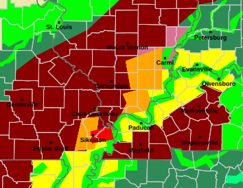
On this radar loop, the flash flood warnings are in green.
Storms will hit Evansville before 11pm. possible warning before 10:30pm.
Warning now is in posey county.
No warning with the storms almost in vanderburgh county so they must think wind gusts will be below severe levels.
We’re good now. The risk for severe weather is over tonight.
we‘ll probably have a flash flood warning like most of the area the next day+
I'm a member of the local fire department in my area. Just a little while ago came back from a run where someone drove into flooding waters over a low water crossing. PLEASE do not drive into flooding water. This is very dangerous. Fortunately, everyone survived. But the reminder in our minds was the rum we had March 2020 in which we had to recover the bodies of 3 adults and 3 young children. One of the hardest days of being on the department.
Excellent message cutworm!
Thanks for connecting it to a reality and tragic personal experience.
Thanks for your volunteer service!
The rains so far have been persistent and adding up to around 5 inches over the course of 2.5 days but not the intensity of classic flash flooding rains in Southern IN.
Weve had local events of 5 inches in a stalled thunderstorm that occurred in a few hours before. That is usually over just a handful of counties. And those are extremely rare events.
But this is much more widespread over many dozens of counties.
The flash flood warning for Vanderburgh County just expired. Flash flood warnings are in red below.
We have around 1.5 inches of rain to go the next 36 hours here in Evansville. The risk of severe storms is over from this weather system.
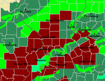
Go to this link and hit your county:
Excessive rain threat.
https://www.wpc.ncep.noaa.gov/qpf/excess_rain.shtml
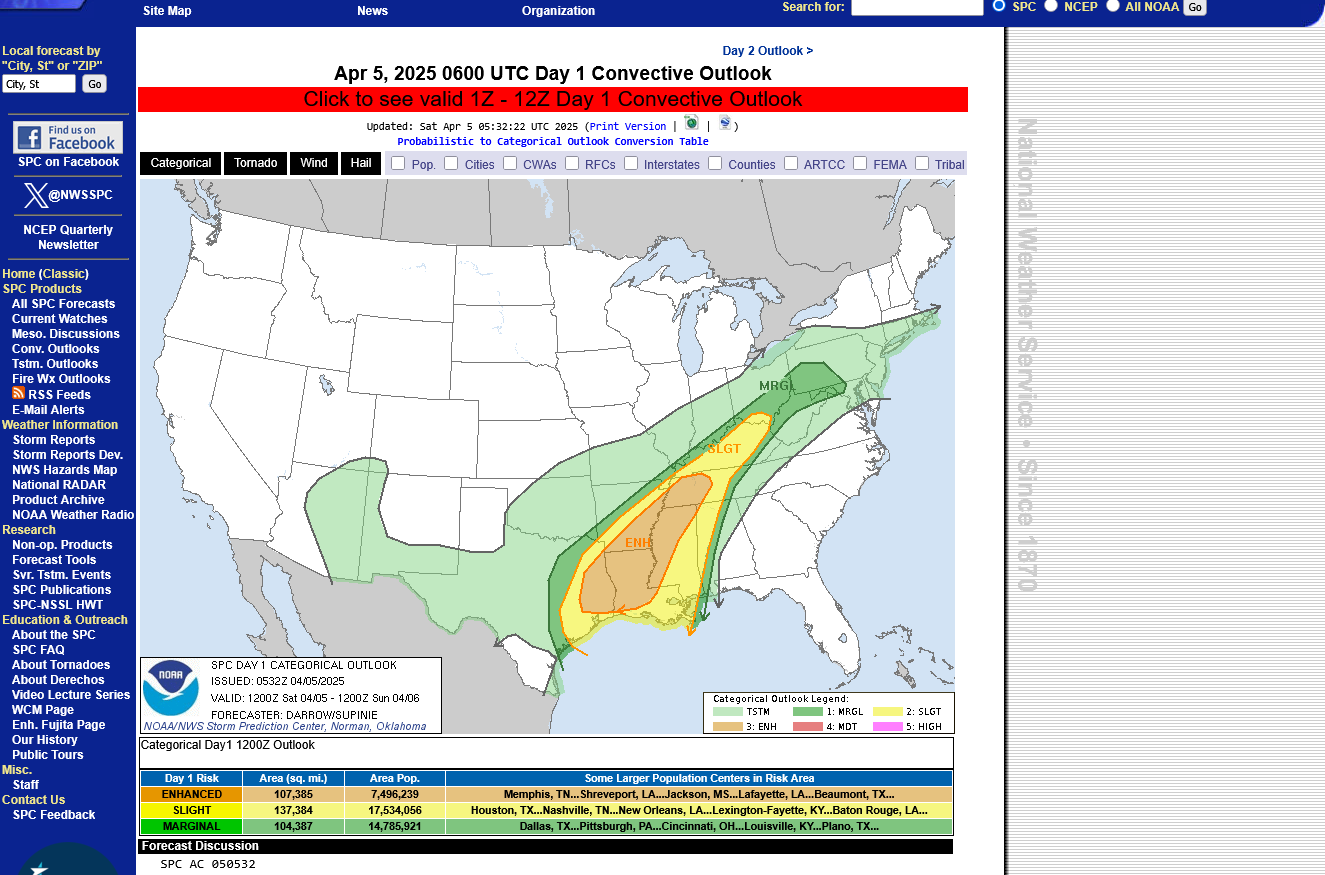
Current Day 1 Forecast
The much colder, stable air at the surface has shifted south today:

So all the severe weather is farther south today(barely):
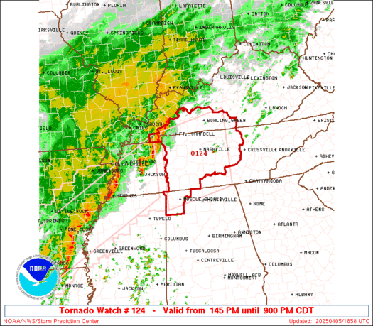
Tornado watch just issued until 9pm:
https://www.spc.noaa.gov/products/watch/ww0124.html
I'll say that we still have another 1.5+ inches of rain to go.
The initial rain numbers that I got from the NWS were bogus. Sorry about that!
The cumulative total rain that Evansville got from this 4 day rain was 6.75"
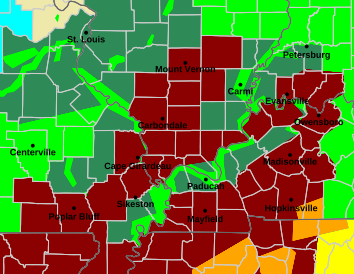
There are no warnings in Vanderburgh County right now. The rate of rainfall is not heavy enough for flash flooding.
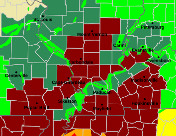
The NWS just issued a new flash flood warning for Vanderburgh County until 8:45 pm.
Please don't try to cross rapidly flowing water across a road that has unknown depth. Rapidly flowing water is extremely powerful.
River forecasts:
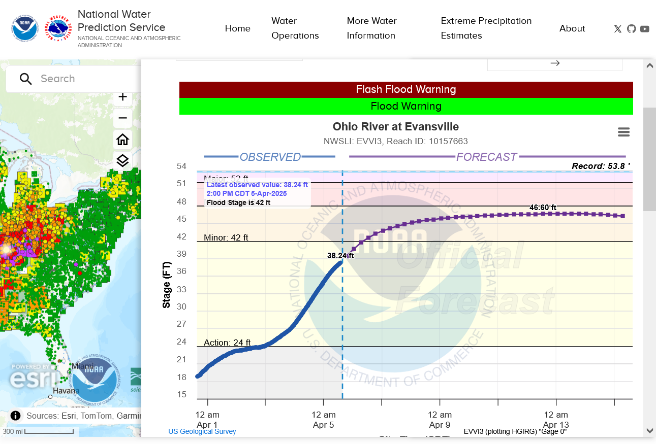
There is other information at that link/site, including every river forecast.
The severe weather AND the excessive rains are over in Evansville but this storm is still clobbering areas to our south.
One of cutworm's favorite's too:
https://www.yahoo.com/news/heres-much-rain-fell-evansville-153558735.html?fr=yhssrp_catchall
Evansville - 6.78 inches
++++++++++++++
I was misinformed with bad data about the rainfall total I used on Saturday and apologize for that!
Apparently, this was the 10th highest 4 day rainfall total in Evansville history, so it was NOT unprecedented.
Much heavier rains fell in KY where over 10 inches fell in many locations. In Muhlenberg county, around 50 miles to the southeast, over a foot of rain fell(12.39 inches).
+++++++++++++++++++++++++
John Tufts, Indianapolis Star
https://www.yahoo.com/news/much-rained-kentucky-know-latest-141400725.html?fr=yhssrp_catchall
Kentucky Floods that were WORSE than this in history
By The NumbersEvansville LivingThe Bend
Regional waterway defines life in The Bend
By John Martin
River’s record level in Evansville — nearly 19 feet above flood stage — during the 1937 flood
+++++++++++++++++++++++++++++++++
River forecasts:
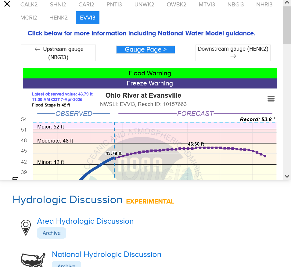
The Ohio River flood of 1937 took place in late January and February 1937. With damage stretching from Pittsburgh, Pennsylvania, to Cairo, Illinois, 385 people died, one million people were left homeless and property losses reached $500 million ($10.2 billion when adjusted for inflation as of September 2022). Federal and state resources were strained to aid recovery as the disaster occurred during the depths of the Great Depression and a few years after the beginning of the Dust Bowl.[1]
https://www.marketforum.com/forum/topic/83844/#83853
Updated daily below:
https://mrcc.purdue.edu/cliwatch/watch.htm#curMonths
Freeze frame of the first week in April below:
