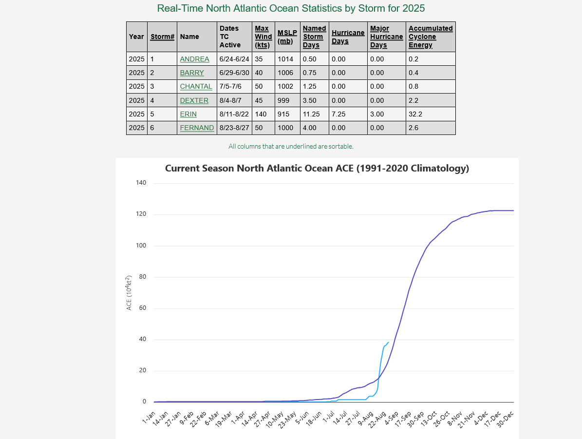
The jury is obviously far from a decision for the 2025 NATL tropical season. Yes, YTD NATL ACE has been very low (1.5 vs 1951-2024 avg of ~9) through this morning with it at 64th highest out of the last 75 seasons. And being that low this far into the season does increase the chance for a quiet rest of season somewhat, which I’d love to see for a change. And yes, there are two new areas in the EPAC that may develop this week. However:
1. The EPAC is currently still at only 28 ACE vs a normal of 47 meaning it’s now ranked at only 39 of the last 55 seasons.
2. We have weak La Ninalike conditions, which are typically conducive for an active rest of season.
3. The following other relatively quiet through now NATL seasons (under 5 ACE vs normal of 9) were active the rest of the season:
Season: Total season’s NATL ACE
1969: 148 and that was El Niño (don’t have EPAC pre-1971); only 1 storm as of now (not an H) with 17 others still to come and not til Aug 10th+
2017: 225 and EPAC was then way up at 74 (12/54); no H yet with 10 H/6 MH still to come Aug 7th+
2019: 132 and EPAC ACE was then up at 45; only 2 storms as of now with 16 more to come and not til Aug 20th+
1980: 148
1999: 176; only 1 storm through now (not an H) with 11 others to come and not til Aug 18th+ including 5 MH
2004: 227 and that was El Niño; only 2 storms through now with 13 more to come Aug 9th+ including 9H/6 MH
1998: 181 and EPAC was then up at 55 (14/54); only one storm as of now (not an H) with 13 more to come, including 10 H and not til Aug 19+
1955: 158 (don’t have EPAC pre-1971); only 2 storms through now (no H yet) with 9H/4 MH still to come
1967: 125 (don’t have EPAC pre-1971); only 1 storm as of now with 12 more to come and not til Aug 28+
From this list: 1969, 2017, 2019, 2004, and 1998 should especially get one’s attention.
4. The Euro Weeklies, which overall did well last year with its several week out predictions, have been forecasting an active August for the last 5 days.
5. The various ensemble runs have been active both in the MDR as well as off of NC. The current TWO is already highlighting two areas.
6. The MJO is headed for phases 1 and 2, two often active phases during August.
Excellent stuff, Larry!!!
From our MarketForum tropical weather specialist!
I'll have to keep an eye on the European model weeklies. The last run was pretty quiet thru mid September.
Thanks, Mike.
Mike said:
“I'll have to keep an eye on the European model weeklies. The last run was pretty quiet thru mid September.”
————-
Hey Mike,
Actually I’m seeing the opposite in August, above the 2005-24 average ACE for Aug as a whole on the last 6 days of EW runs.
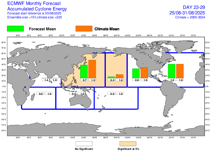
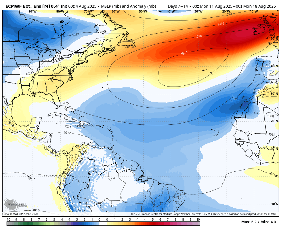
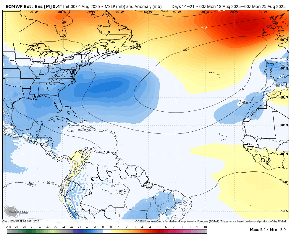
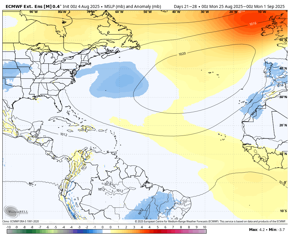
Here was the latest run (8/3/25): focus on the size of NATL green boxes relative to brown as well as relative to green boxes in other basins
8/4-8/10: 190%
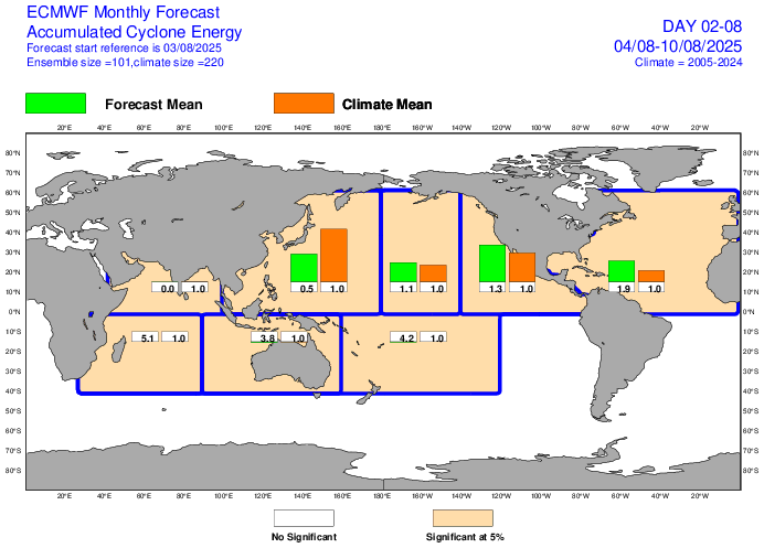
8/11-17: 220% and largest green box of any basin
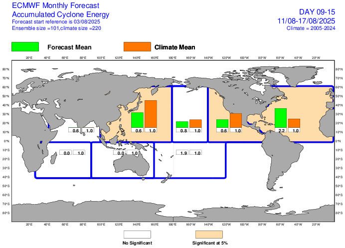
8/18-24: 150% and largest green box of any basin
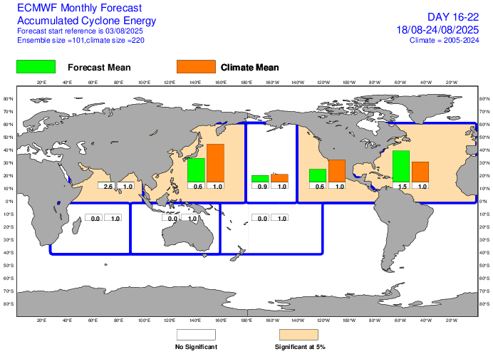
8/25-31: 100% and largest green box of any basin
Wow, Larry I didn't know about this, thanks!
You mentioned that this product has decent skill?
What's your take on this!
I'm puzzled why surface features of the weeklies from now thru mid September have no tropical activity in the Atlantic Basic. Where are they getting this from?
Mike said:
What's your take on this!
I'm puzzled why surface features of the weeklies from now thru mid September have no tropical activity in the Atlantic Basic. Where are they getting this from?
———————
Hey Mike,
Where are you seeing no tropical activity on EW thru mid Sept? Do you have a link to the surface features of the weeklies?
Mike said:
“What's your take on this!
I'm puzzled why surface features of the weeklies from now thru mid September have no tropical activity in the Atlantic Basic. Where are they getting this from?”
———————
Hey Mike,
Where are you seeing no tropical activity on EW thru mid Sept? Do you have a link to the surface features of the weeklies?
The brand new Euro Weeklies have even more ACE forecasted vs yesterday’s run for 8/11-17 and 8/18-24.
Larry,
I assume that you still use WeatherBell.
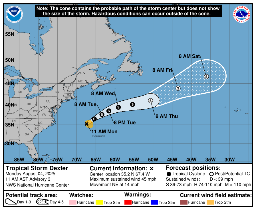
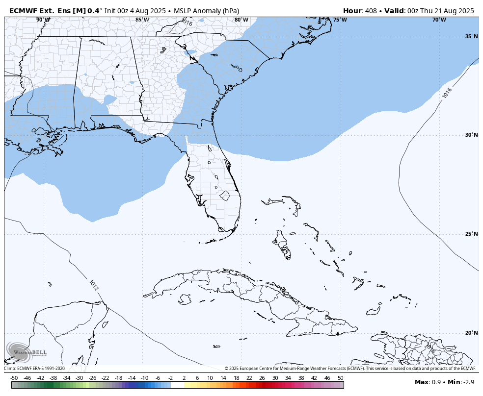
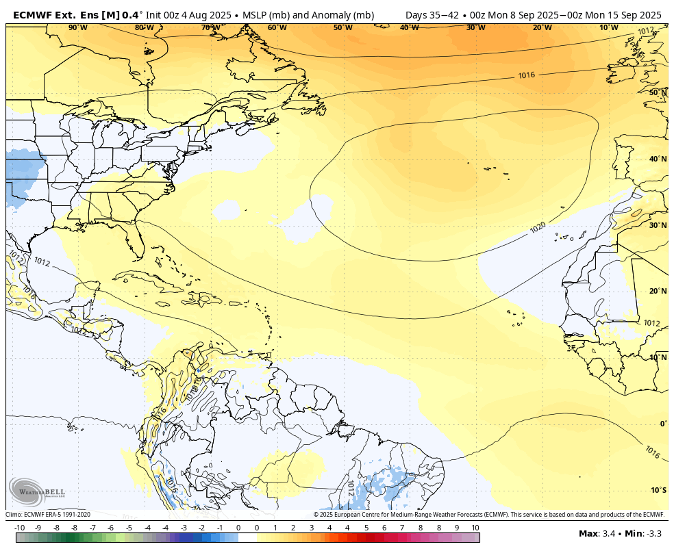
Go to the MLSP anomaly for days 0-46 for the Atlantic Basin. No indication of a tropical system(other than Dexter which is there now).
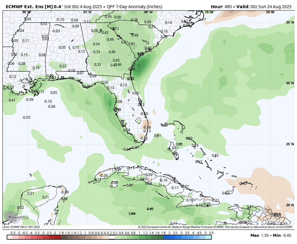
The precipitation profile of the same forecast is also not identifying a tropical storm signature.
I'm not questioning the usefulness of this product because I've never used it to monitor it. Where are you getting is from, please?
The GEFS also shows no indication of a tropic system(other than Dexter)
Hey Mike,
What about these maps from today’s EW run?
Low SLP anomaly: for a 100 member ens this far out, this evidently is a significant signal of low pressure: remember that members with a TC will be pretty scattered and thus there’s no strong anomaly:
Wet Rainfall anomaly is also based on scattered TCs and also this is 7 days (not entire 7 days would be wet typically):
Link to free Euro Weeklies ACE with green and brown bars:
OK, I see your point, Larry, thanks very much. I will need to watch this to see what happens.
1. It looks like the actual 7 day low pressure anomaly peak in the Atlantic Basin is in week 2 in the far east-mid August
2. Then west in week 3.-mid/last August
3. Week 4, fading/small negative anomaly-late August
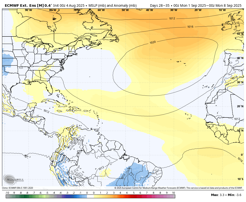
4. Week 5: average to positive anomalies-Early September-as we approach the climatological peak
5. Week 6: positive SLP anomalies-mid September-during the climatological peak
This seems pretty odd to me based on this:
The EE weekly tropical signal from lower average SLP is for a peak in August, with the positive SLP anomolies increasing in September being a negative tropical system indicator........when we usually have the opposite happening.
Each individual year is different and its possible to have more storms in August than September and this might be one of those years based on the MJO or something else that the EE weeklies is picking up on.
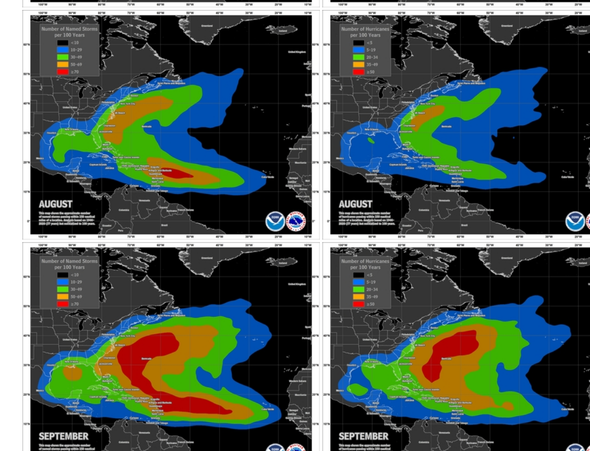
https://www.nhc.noaa.gov/climo/
https://www.nhc.noaa.gov/climo/
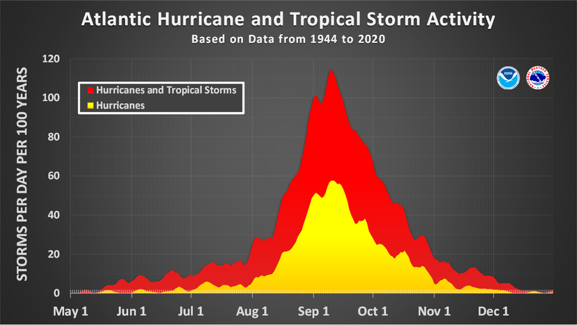
More on the frequency stats between August and September.
The top graphs are from August. The bottom graphs are from September.
The graphs on the left are TSs on the right are Hurricane numbers.
The EE is telling us that in 2025 it will be the exact opposite, right?
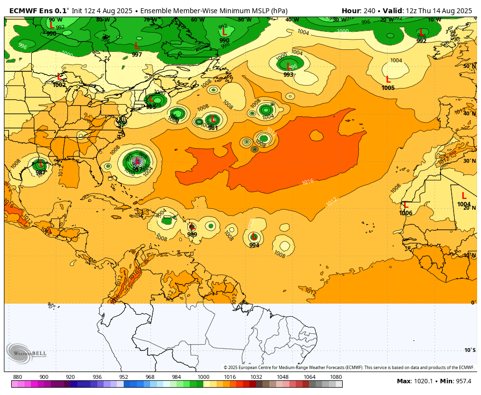
These were the individual SLP solutions at the start of week 3 for all the ensembles of the last 360 hour 12z EE.
Its lining up with the weeklies which have the biggest negative SLP anomaly in this general area.
I've not studied this exact product in the past but these all look like spurious/phantom storms.
Probably the model is latching on to favorable conditions with almost no skill to pinpoint exact locations at this time frame.
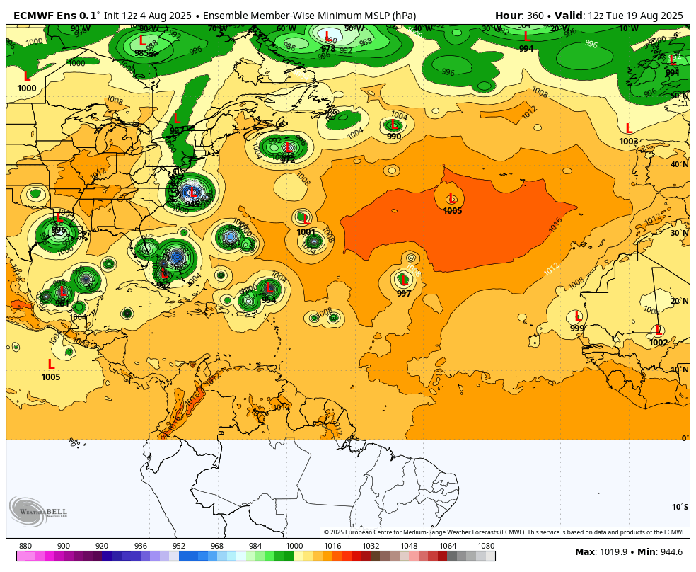
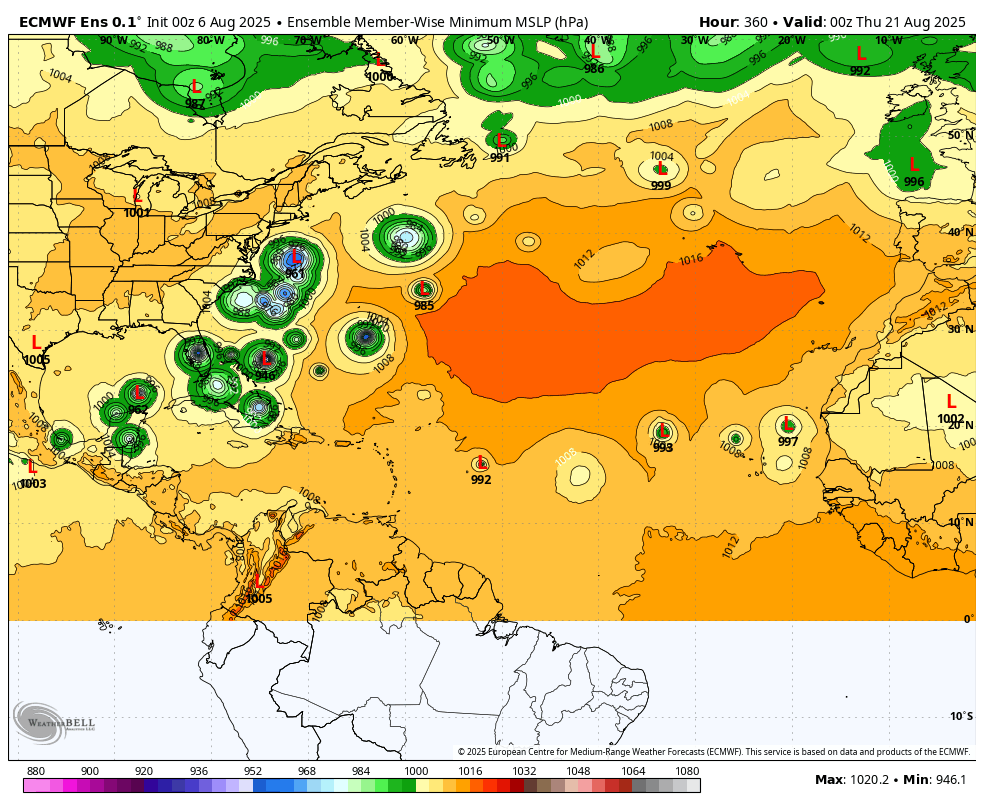
However, from this same 12z EE on day 10, August 14th, when the biggest negative anomaly on the weekly is clearly in the Eastern Atlantic/off the Coast of Africa........we have similar, spurious/phantom storms, just not as many.
Maybe a potential track in the South Atlantic aimed at Puerto Rico and the Dominican Republic/Haiti?
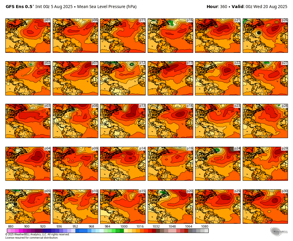
The SLP forecast from last 0z GEFS ensembles don't have anything like this at 360 hours, while the 0z EE continued bullish for spurious tropical systems in the hurricane belt of the western Atlantic basin:
The 0z European Ensembles continue to be emphatic about tropical systems at the end of 2 weeks. It just has no idea where, with individual members all over the place. This was from the last 0z solution for August 21st/360 hours.
Conditions for tropical systems appear to be VERY favorable at that time(being picked up by the model) so, at the very least the EE is identifying an elevated chance for the tropics to become much more active in the locations indicated below.
I appreciate Larry very much for bringing this to our attention.
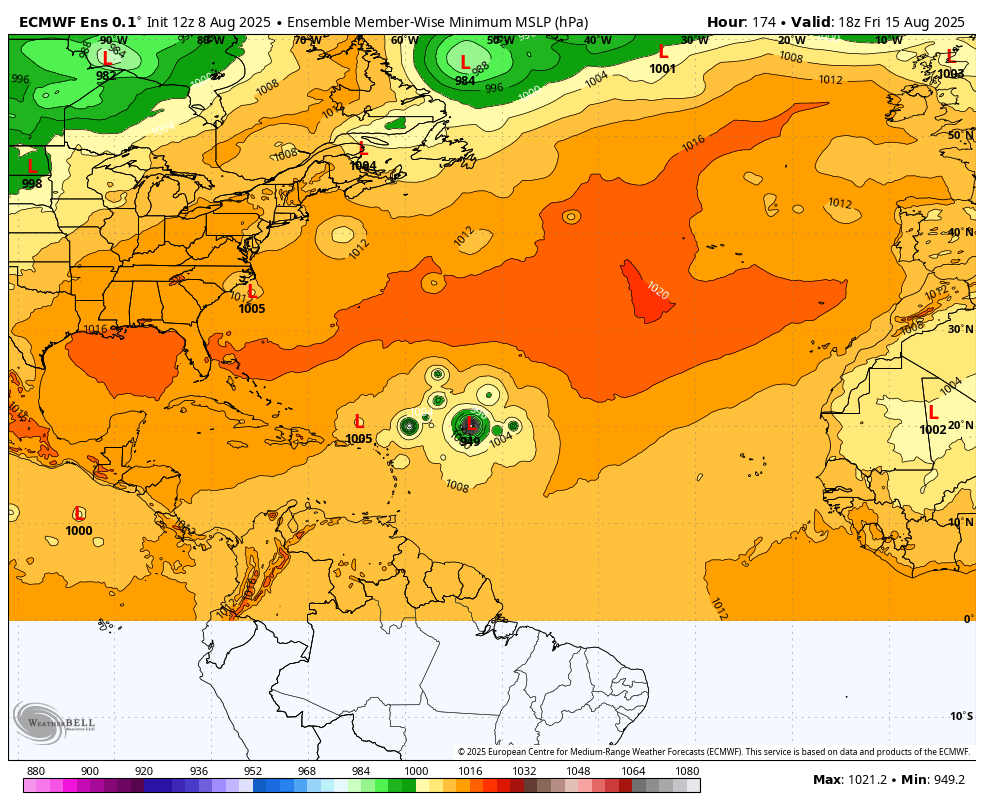
Many have been watching closely a tropical wave over W Africa about ready to hit the ocean. Numerous model runs of the major models have had this as a hurricane in the western Atlantic. As early as ~Aug 15th, this conceivably could pose a threat to the NE Caribbean and to areas further W and N thereafter. IF this were to threaten the CONUS, that shouldn’t be til ~Aug 18th at the very earliest.
Thanks, Larry! These were the latest ensemble forecasts, spaced 2 days apart. It's about time!! From the Europeand model.
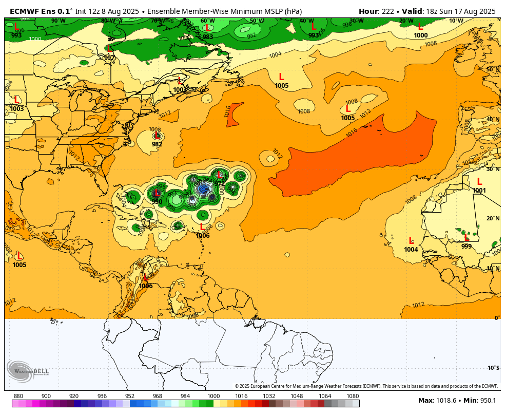
1. August 15th-day 7-tightly clustered solutions-tracking west
2. August 17th-day 9-spread greatly increasing-tracking west
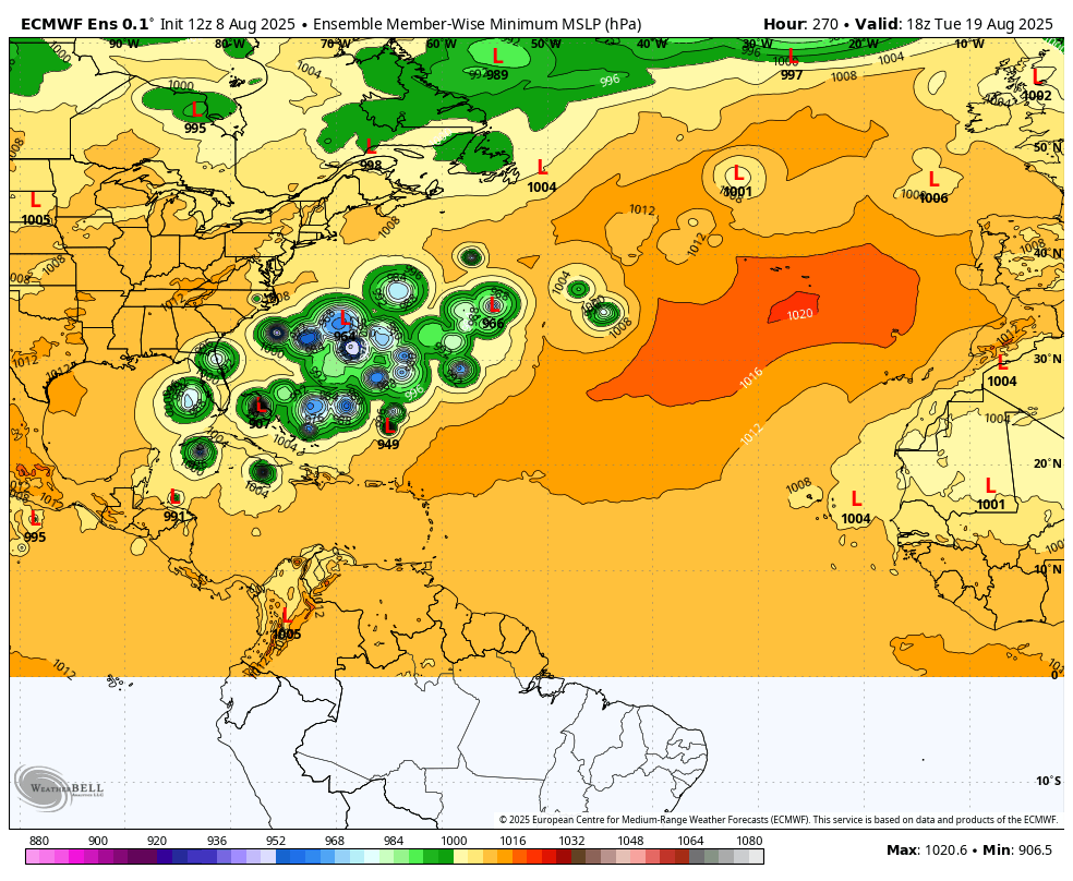
3. August 19th-day 11-wider spread but the mean is in the Western Atlantic
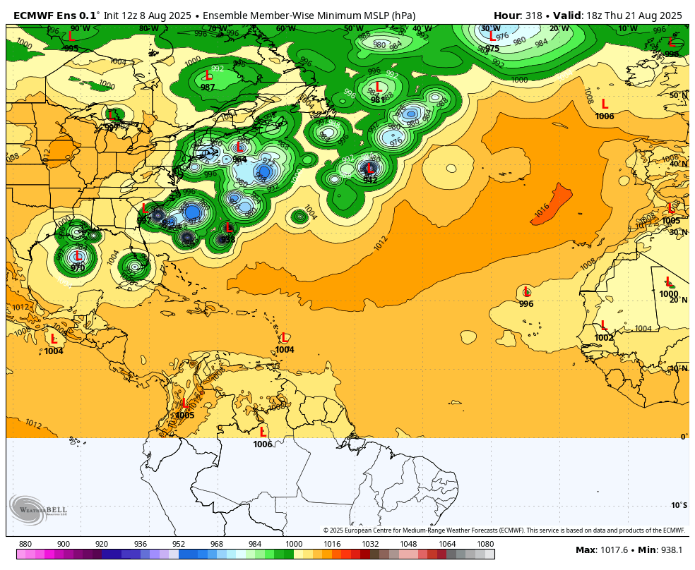
4. August 21st-day 13-consensus has a turn north but several threaten the GOM and East Coast-this is pretty far out
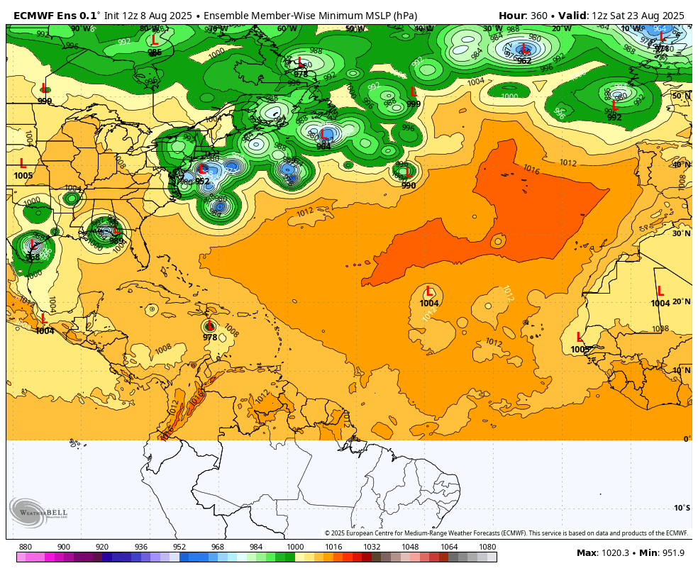
5. August 23rd-day 15-too far out but another weak wave coming from a favored storm birthing place
https://www.nhc.noaa.gov/gtwo.php?basin=atlc&basin=atlc&fdays=7
50% of a cyclone developing next week from the wave off the coast of Africa.
 |
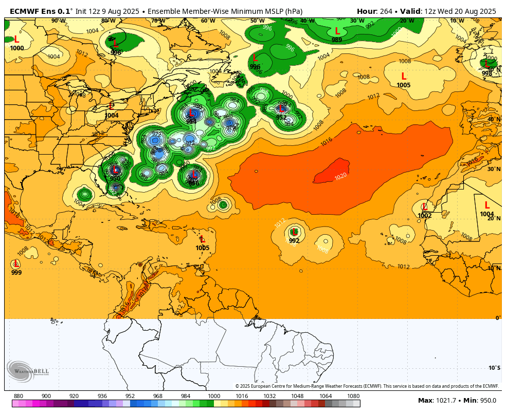
This is August 20, surface low pressure (SLP) for all the individual members from the last 12 European Ensemble run, 11 days from now. Likely keying off that potential cyclone above.
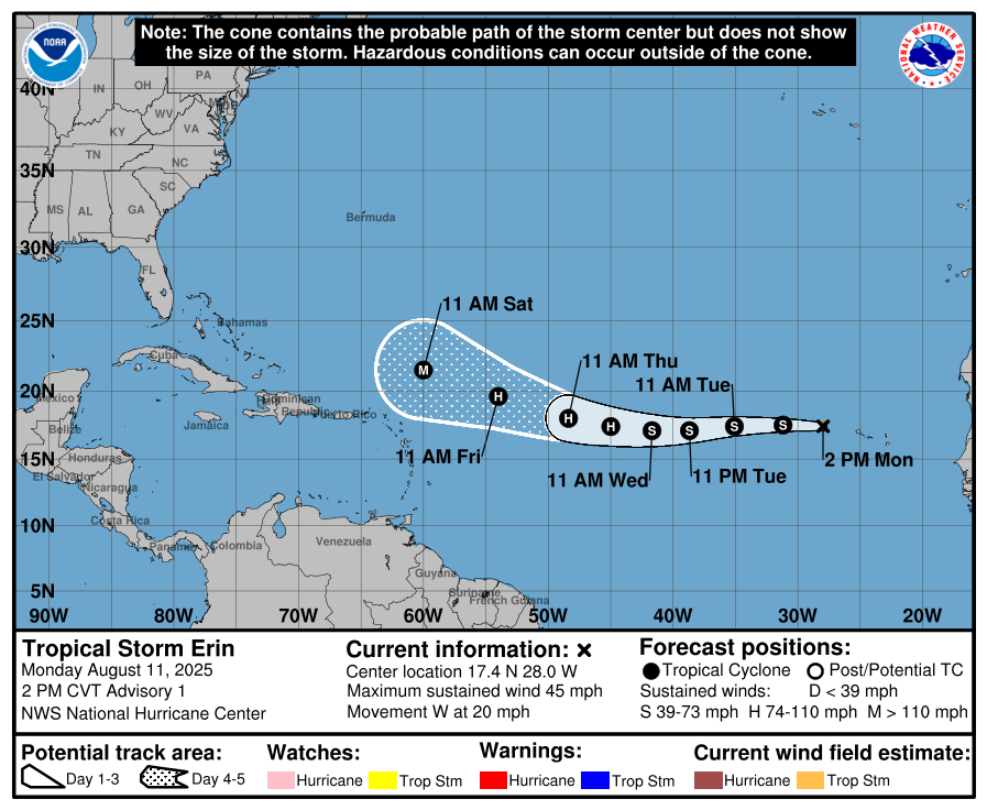
Hello TS Erin-soon to be a major hurricane
Started by metmike - Aug. 11, 2025, 11:11 a.m.
https://www.marketforum.com/forum/topic/113877/
https://www.nhc.noaa.gov/graphics_at5.shtml?start#contents
Larry,
You were right about all the ACE from Erin! Great call!
https://tropical.atmos.colostate.edu/Realtime/index.php?loc=northatlantic