mother nature will show herself and all that she alone controls. We have spoken here about strong evidence of fronts approaching large urban areas and being shifted, shoved, stopped, moved by some strange urban forces
Just yesterday was the classic. A large rain approaching from the usual NW towards Indy. Coming right down either 65 or 74 usually. it begins a large rain just NW of Indy just W of 37. Then mysteriously moves east toward Castlenton {NE corner} no sooner had it reached there and a little east that sucker turned directly S straight down hiway 9 to Shelbyville. Rained 3 inches there. As it made that area it turned swiftly back to the SW and headed right back to hiway 37 at Columbus and Bloomington. Yes a complete circle right around Indy as if a circle had been drawn on a map. Not a sprinkle in Indy. And the circle was complete to the southern 1/2 and drifted away.
if anyone has the history of the radar its amazing to watch....unless you desperately needed the rain closer to town.
PS another day another storm from the NW this am. It reaches the NW corner and falls flat. Now this front did not have near the intensity of the first but if you check the radar its kind of odd where it fell flat
Thanks, mcfarm great post!
Nobody tracks storms/rains headed towards them than a producer in the growing season!
I posted earlier about the dynamics of the excessive rains in the Upper Midwest, let's add to that here.
Re: Re: Re: Re: August 12, 2025 USDA
By metmike - Aug. 17, 2025, 12:54 p.m.
Thanks, mcfarm.
Not surprising in August, when you have an active pattern around the periphery/over the top of a heat ridge. Storms often have a tremendous amount of water vapor coming up from the south to feed on. In this case, we had 70 deg. F dew points all the way to southern MN.
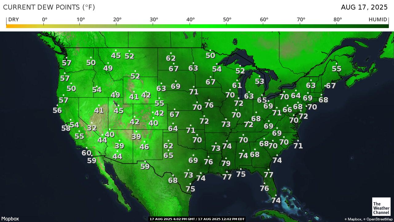
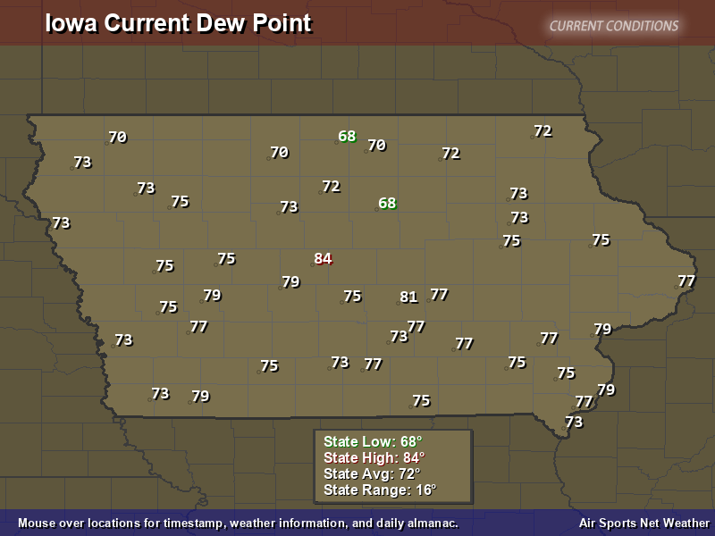
I counted 8 stations with instruments near heavy transpiring cornfields in IA that had 79+ degree dew points last hour with an incredible 84 deg. F dew point in central IA!
https://www.usairnet.com/weather/maps/current/iowa/dew-points/
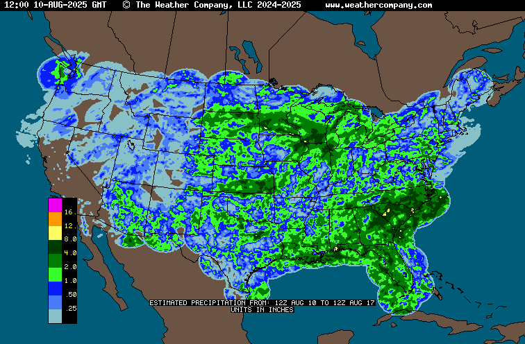
Rains the past 7 days thru yesterday/Saturday morning. The tiny yellow specks were 8 inches of rain.
++++++++++++++++++++++++++++++++
Added 2:30 pm 8-17-25:
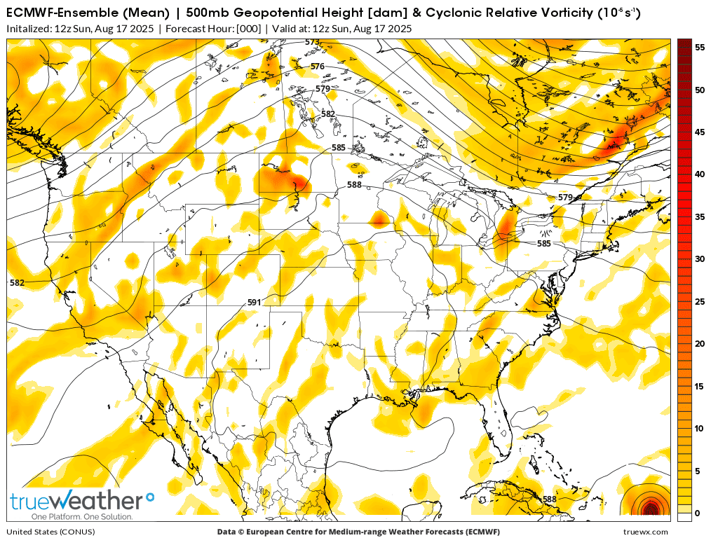
This 500 mb map is the halfway point in the atmosphere around 18,000 feet. A key level to monitor in weather forecasting.
The 591 DM contour in the center represents our current heat ridge/dome. The yellow blobs are areas of vorticity/spin that often rotate around the periphery of heat ridges and fire up storms.
When there is ample moisture the west side and top side of the heat ridge will produce the heaviest rains because of the most favorable dynamics. In this case, the moisture convergence was greatest around southern MN and they really got dumped on.
The east side of an upper ridge is tricky. Very often its completely dry. However, in this case we have the vorticity blobs rotating around the right side of the heat ridge, triggering storms that take on unusual characteristics. One of them is that they can dive straight south and even track southwestward towards higher moisture.
But this often takes them inside the perimeter of the heat ridge, where the warmer air aloft can kill them.....or not in some cases. The models and meteorologists cannot forecast them very well.
As what frequently happens with threads like this, is that I am the one that learns the most in doing the research/investigation/response.
I've been looking for some time for a good site that shows radar images of the past and just found it thanks to you, mcfarm.
This is a keeper link forever for me!
https://www.ncei.noaa.gov/maps/radar/
You can set the images to whatever location you want to view and any 5 minute time frame. I set it to the region of IL/IN/OH and copied the radar images FROM THE LAST 24 hours, 1 hour apart, starting from 3pm CDT on Saturday. OTC time is 5 hours ahead of CDT and 4 hours ahead of EDT. Yesireee, very unusual pattern!
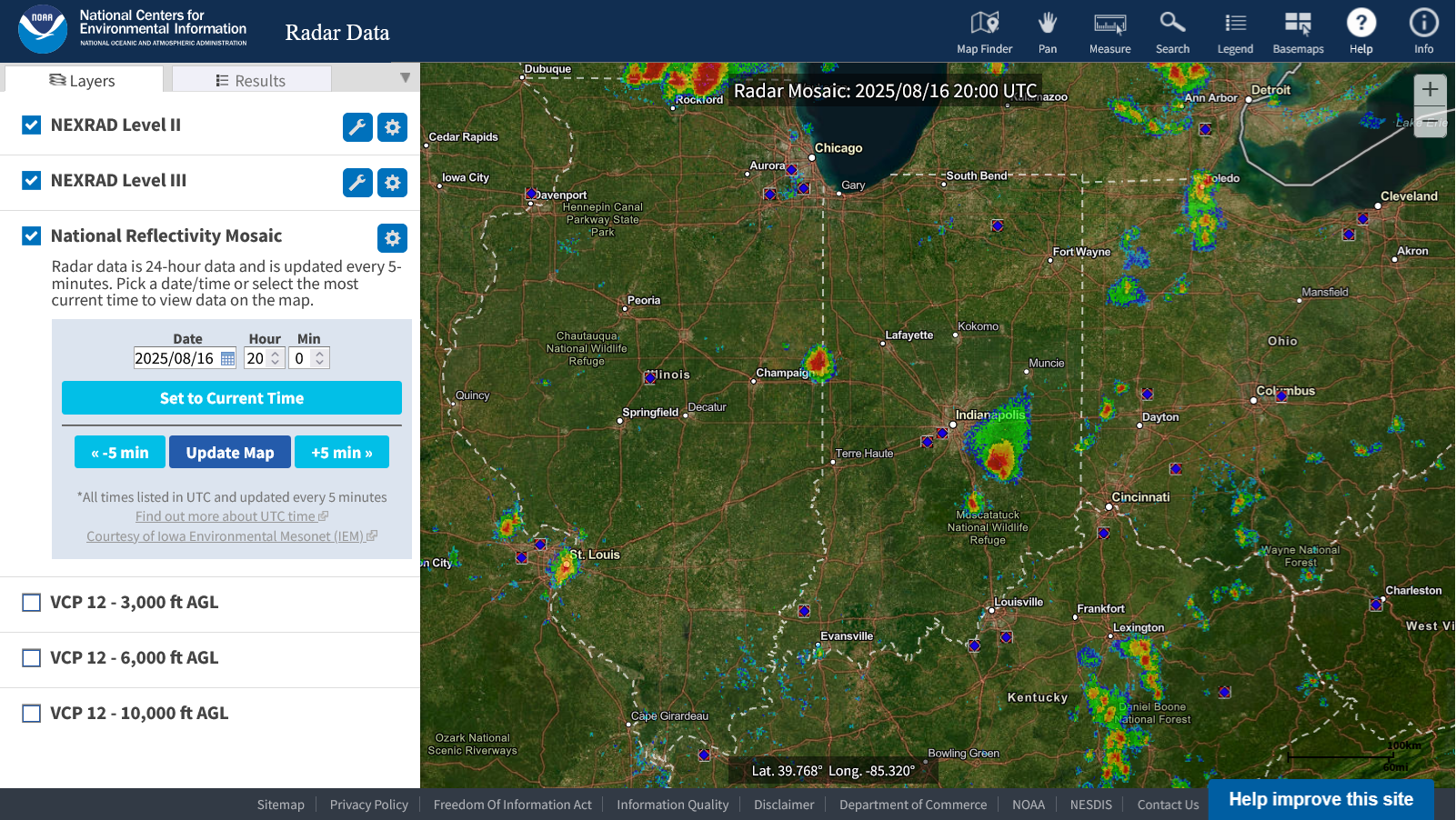
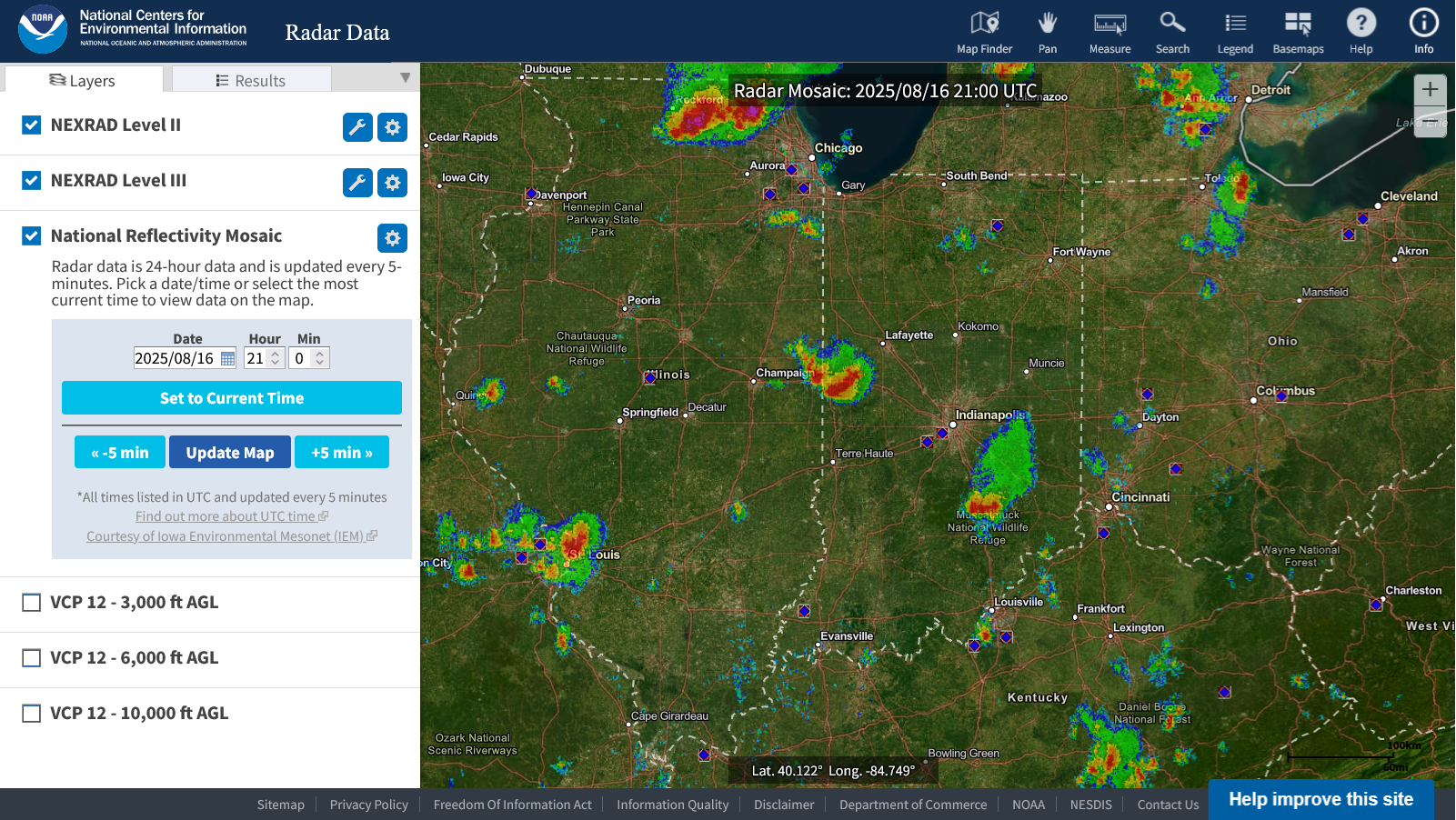
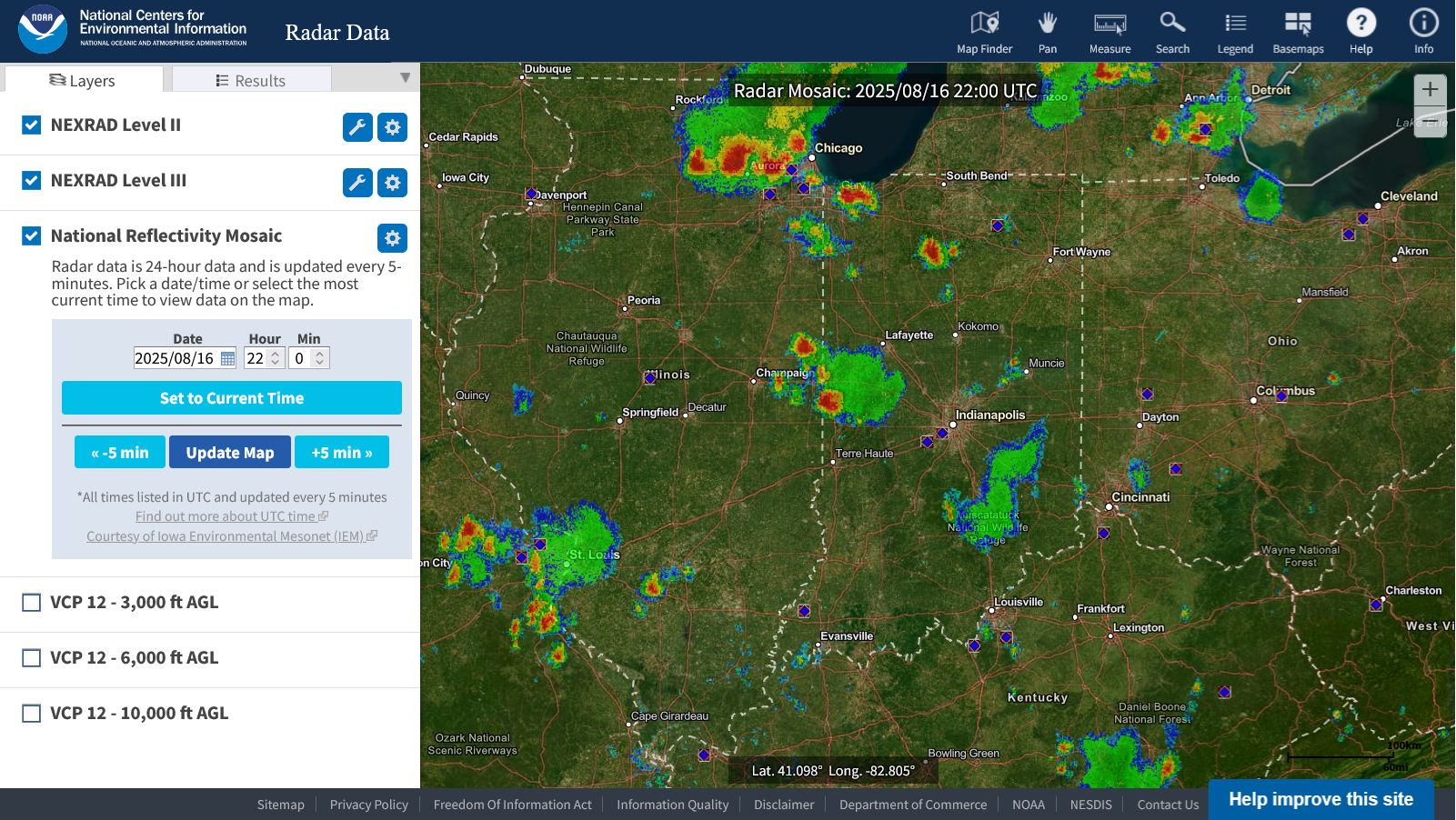
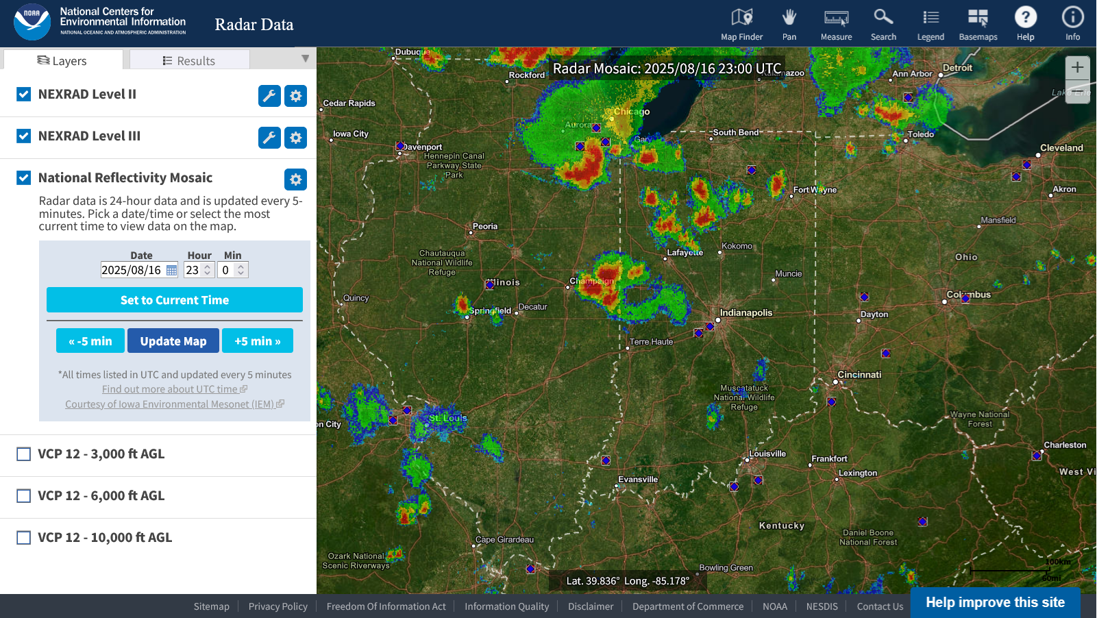
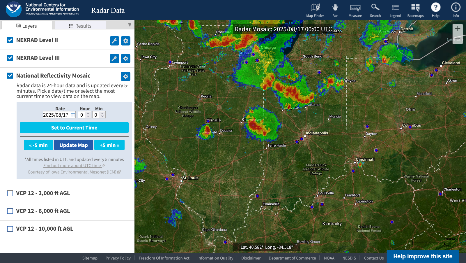
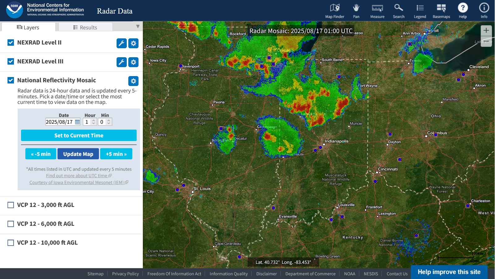
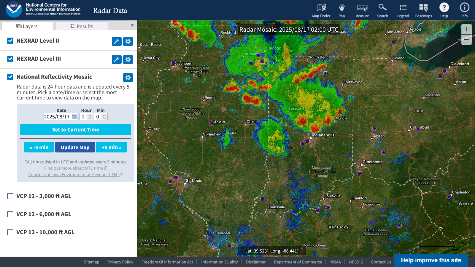
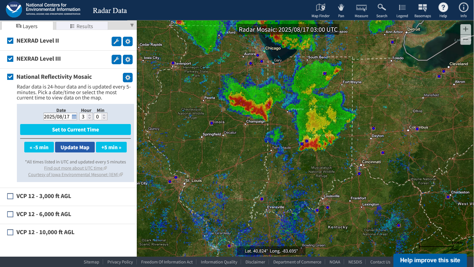
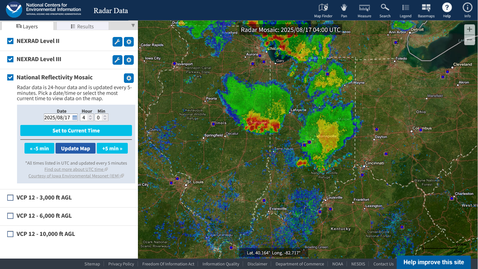
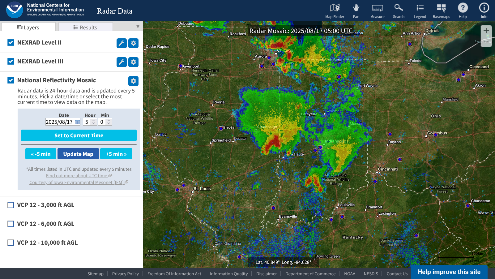
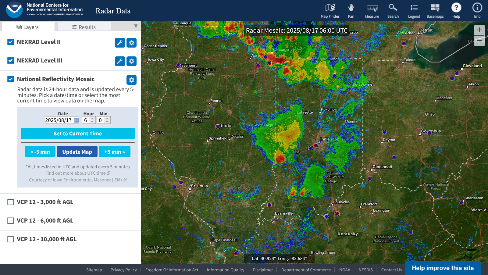
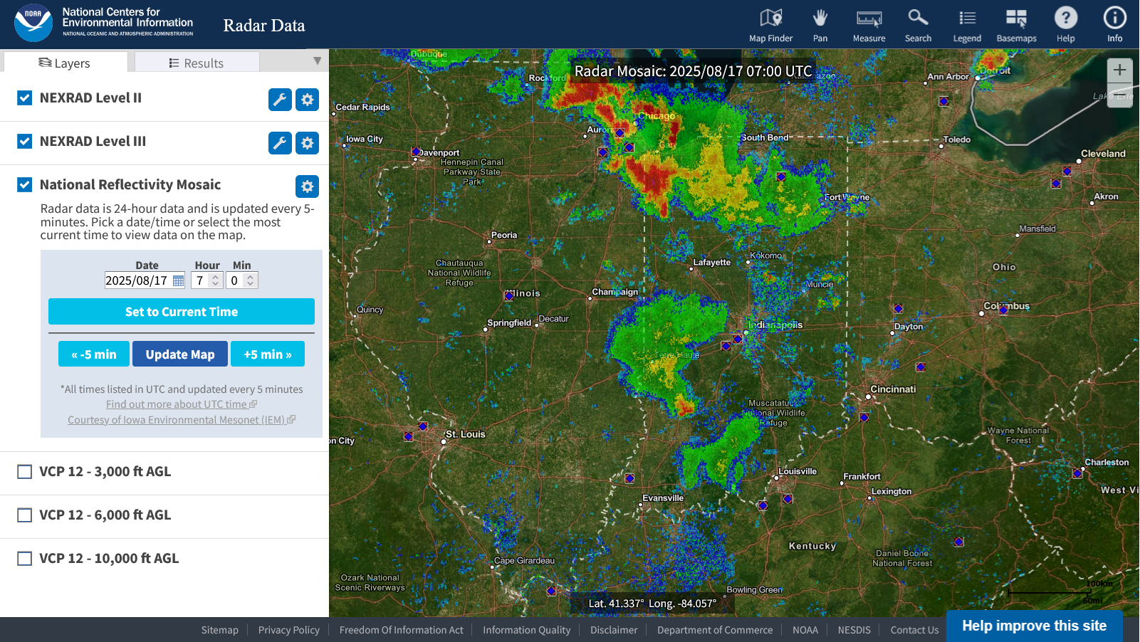
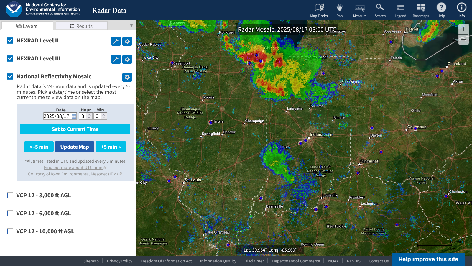
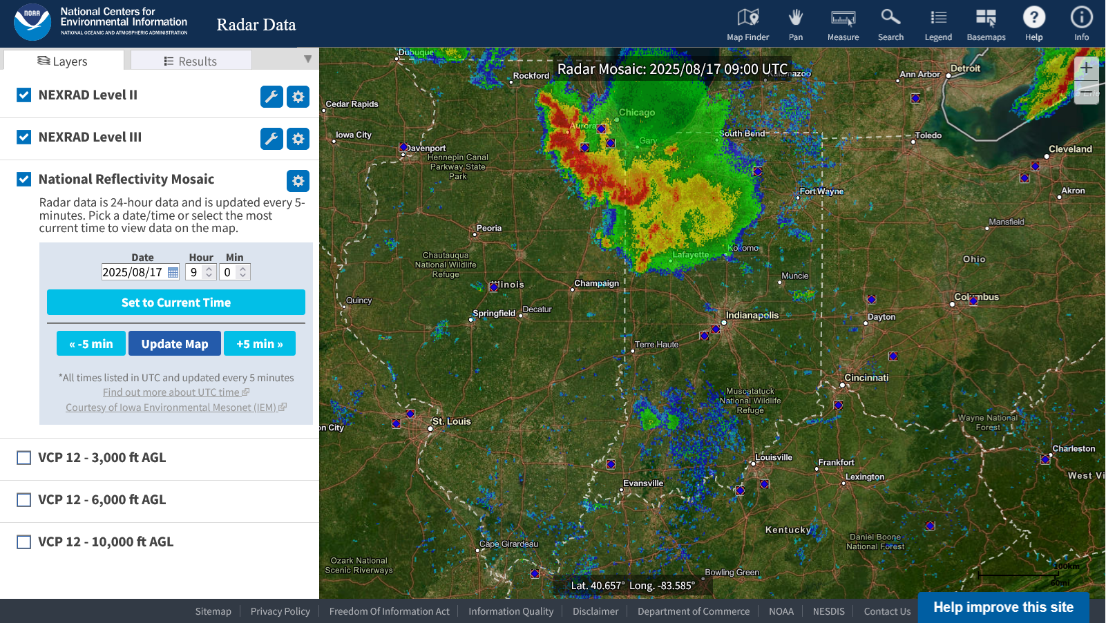
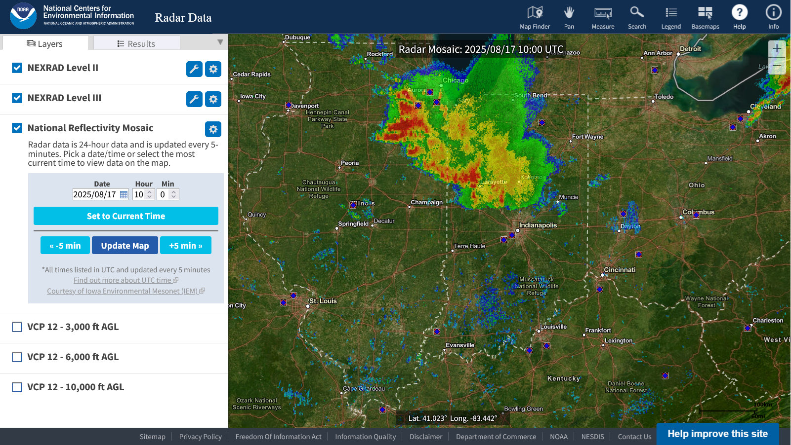
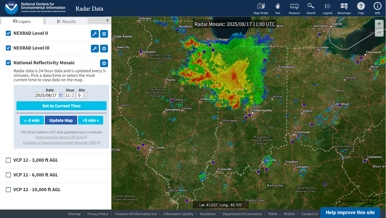
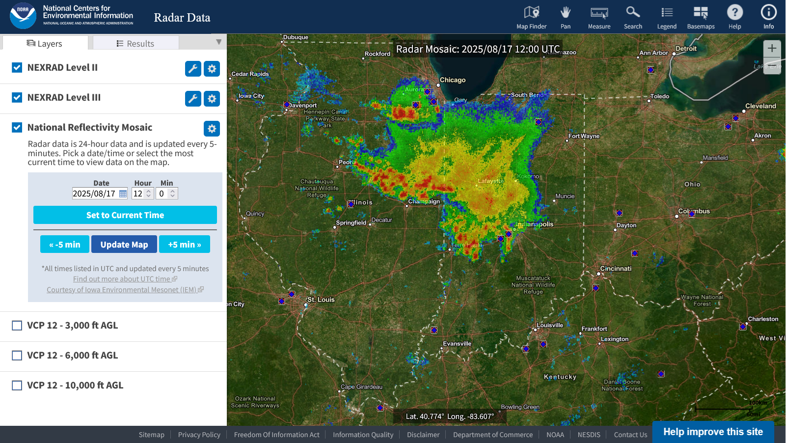
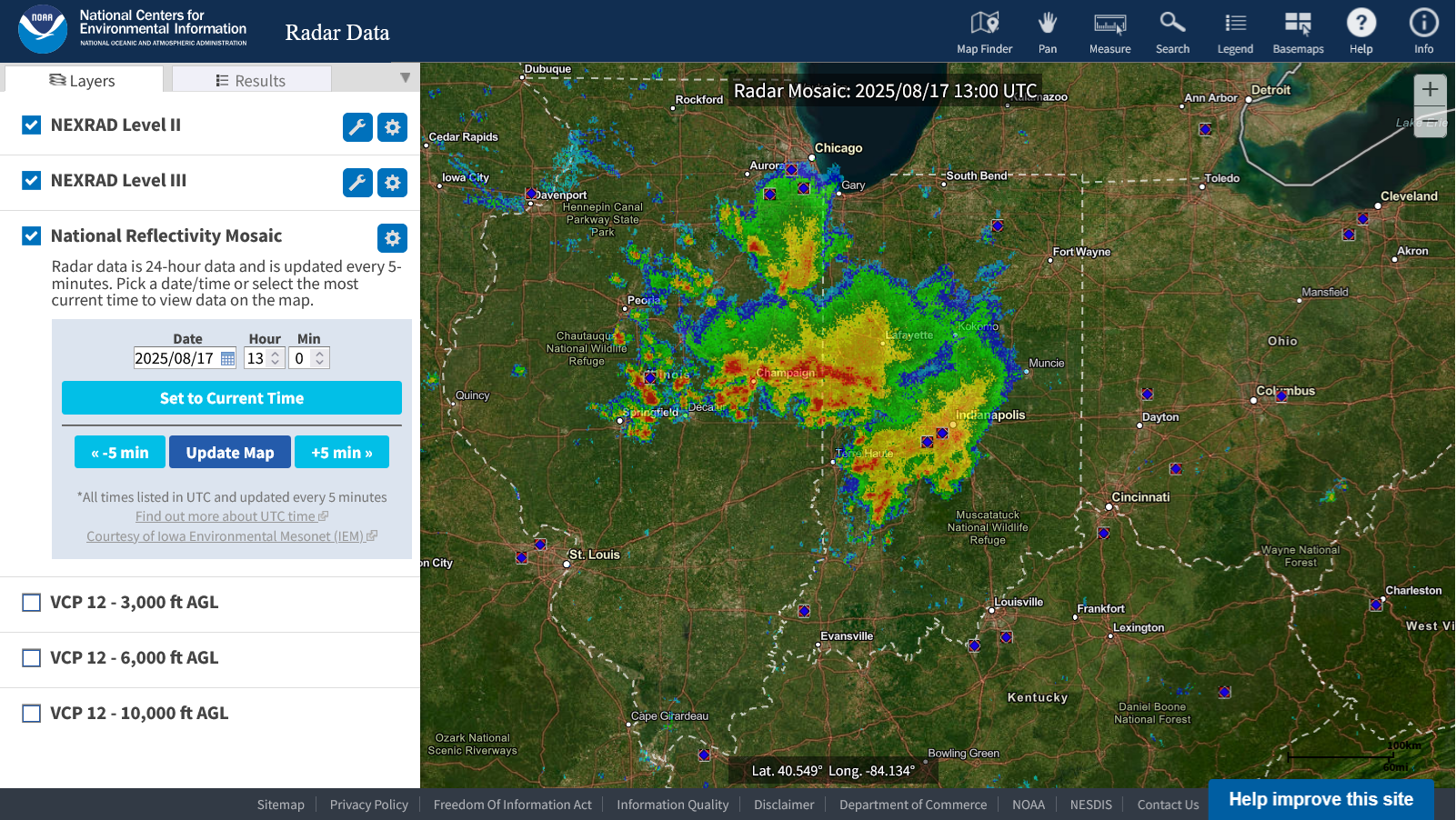
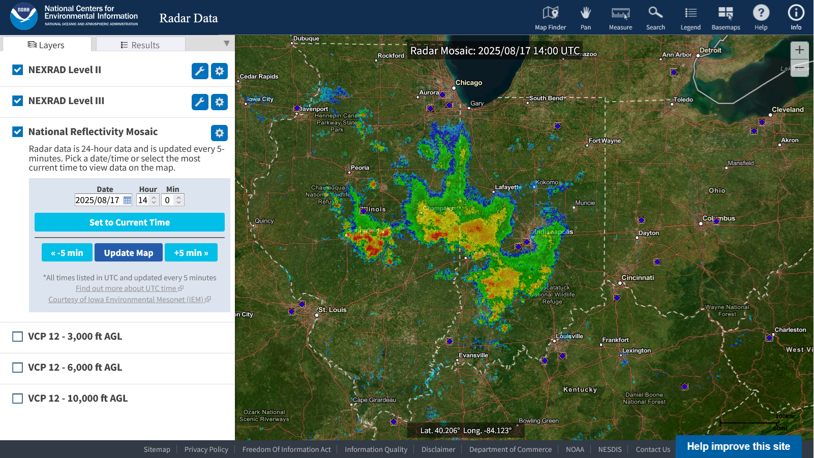
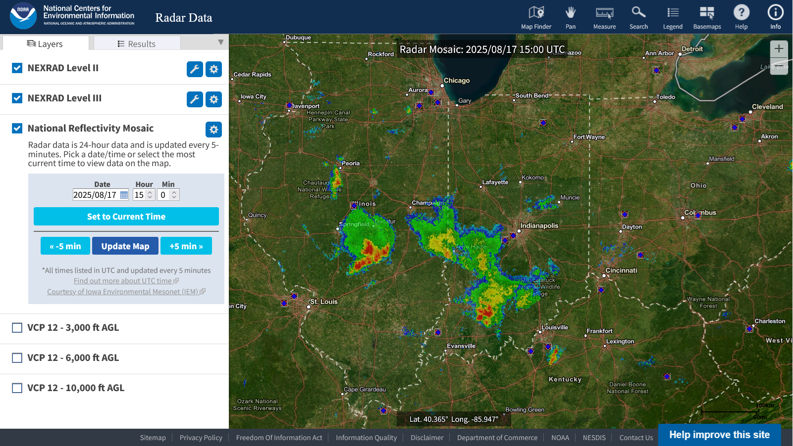
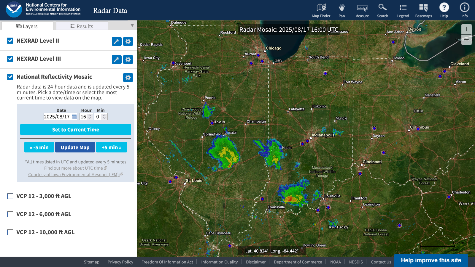
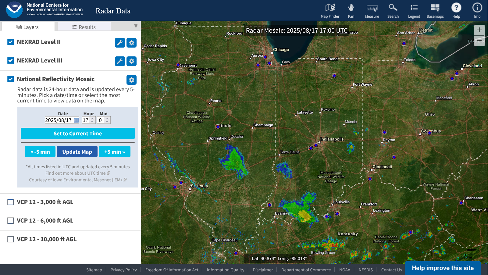
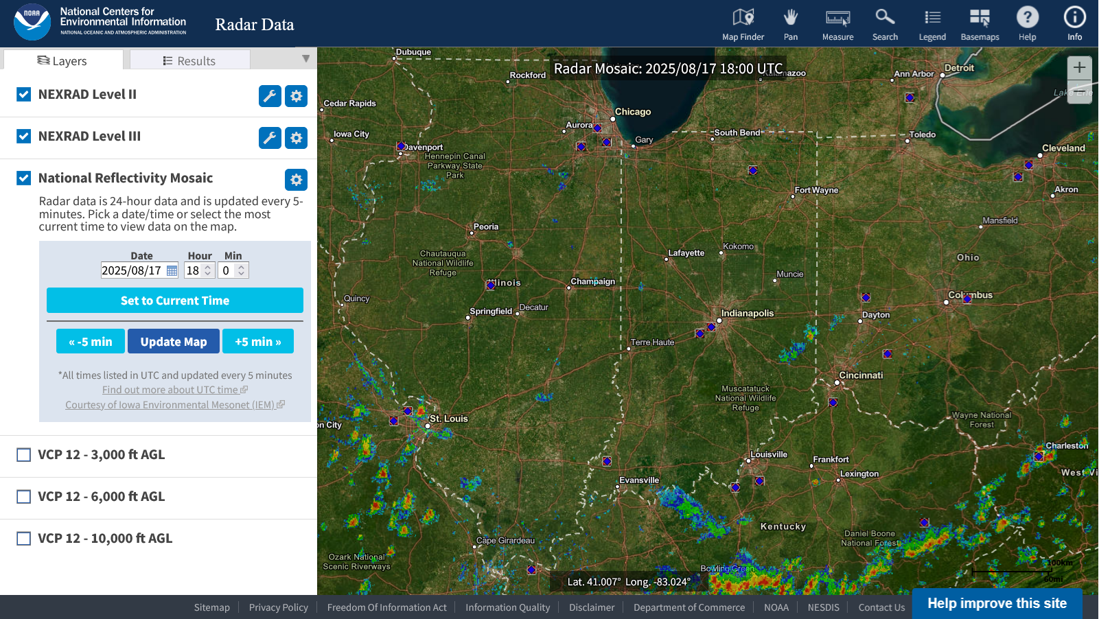
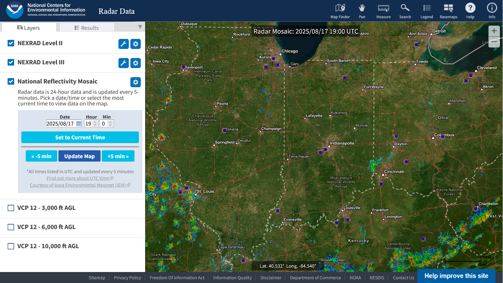
Early this morning, when the dying cluster of storms was still pretty large in central IN back to central IL and diving south, I was hopeful that they might survive long enough to bring some rain to us in southwest IN. Nope