By WxFollower - Dec. 8, 2025, 11:32 a.m.
The natural gas market, which is down sharply (6%), currently feels the prospects for a warmer pattern Dec 16th and beyond have increased as Mike so well explained and showed clearly on the 0Z EE HDD chart. But we’ll have to see whether or not this will finally verify well as the EE has been too warm for the last 3 weeks as it has continually been correcting colder as the periods get closer.
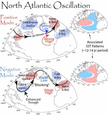
Big reasons the models have been much too warm for week 2 in the E US on many of the last 3 weeks of runs are the horrible NAO/AO progs with this one from just 11 days ago having it go + just 1 week later:
11/28 GEFS AO prog for today: ~+1
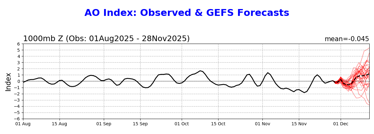
But, today’s AO verified way down at ~-2 (strong -AO) meaning a +3 miss:
—————
There was a similar big miss for the NAO:
11/28 GEFS NAO prog for today slightly positive (~+0.2):
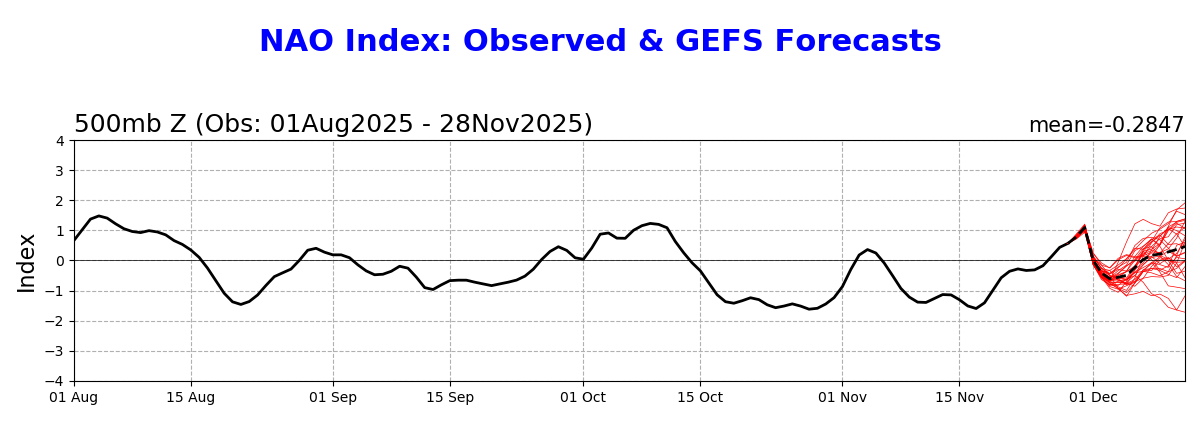
But today’s NAO verified way down at -1.2 (strong -NAO), meaning a +1.4 miss:
+++++++++++++++++++++++++++++==
By metmike - Dec. 8, 2025, 11:48 a.m.
Larry,
You are RIGHT ON THE MONEY with this analysis!!
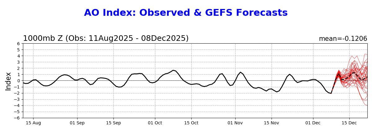
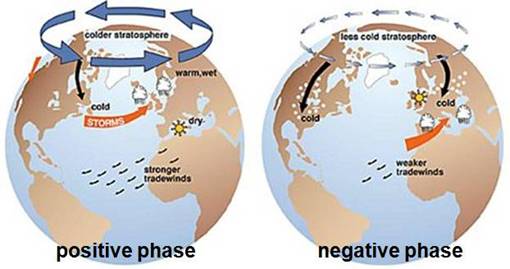
One of the features that I (and others like you) look at every morning is the updated AO and NAO to help us decide on how much cold is coming up with the pattern.
Every morning over the past month, I've looked at the forecast for these indices and thought "this isn't very cold!!!" After a couple of weeks of NOT verifying from being too positive, like you showed, I thought, "this forecast indicator is busted!"
http://appinsys.com/globalwarming/ao_nao.htm
AO BELOW
++++++++++++++
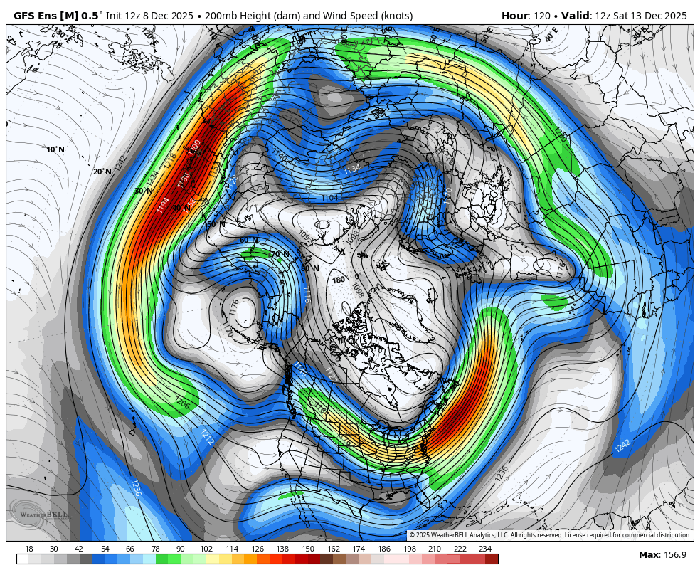
The models have really busted badly on the northern stream and higher latitudes which have missed the magnitude of the powerful high in Western North America, trough in Central/Eastern north America couplet
1. This is what it will look like in 5 days, from the last 6z GEFS, with its LAST GASP. This is the jet stream at 35,000+ feet above the ground. Note that this high/down stream low/trough couplet features a strong north to south component in the steering currents, transporting Frigid air from high latitudes south to the middle latitudes. This has been the dominant UNDER forecast flow the past month.
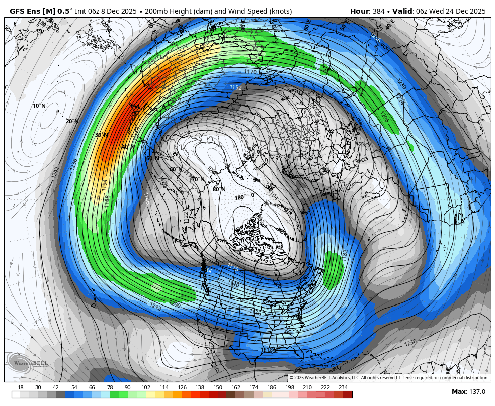
2. This is the same forecast going out to day 16 at the end of the period. A profound change in the flow!! The NEW pattern will feature mild, oceanic origin air masses blowing Pacific air from west to east across the country. The northern stream and cold air connection from the couplet on the first map is completely gone. It's a huge pattern chance! I'm believing it this time because its so definitive on all the models despite all the models UNDER forecasting the northern stream for a month.