Previous threads:
1-23-26+ Tracking the historic Winter Storm
22 responses |
Started by metmike - Jan. 24, 2026, 12:17 a.m.
https://www.marketforum.com/forum/topic/117428/
Historic snow/ice, late week of 1/18/26
26 responses |
Started by metmike - Jan. 18, 2026, 4:49 p.m.
https://www.marketforum.com/forum/topic/117294/
++++++++++++++
Frigid Blast
Started by metmike - Jan. 17, 2026, 10:44 p.m.
https://www.marketforum.com/forum/topic/117282/
++++++++++++++
Get all the comprehensive weather here:
https://www.marketforum.com/forum/topic/83844/
+++++++++++++++++++++++++
A huge pattern change to much milder is coming, especially in the week 2 part of the forecast!
This below has been the weather pattern the past 2 weeks:
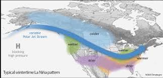
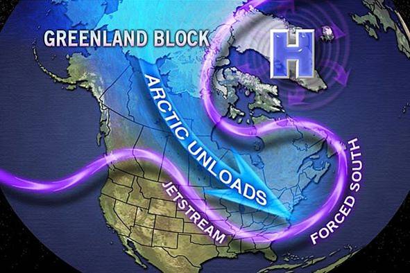
La Nina Winters have more amplified, merional type flow........from north to south and a Greenland Block is more likely during a La Nina, like we have currently.
The pattern we had recently was an AMPLIFIED version of the La Nina signal depicted below.
https://www.hometownforecastservice.com/2020-2021-winter-outlook/
++++++++++++++
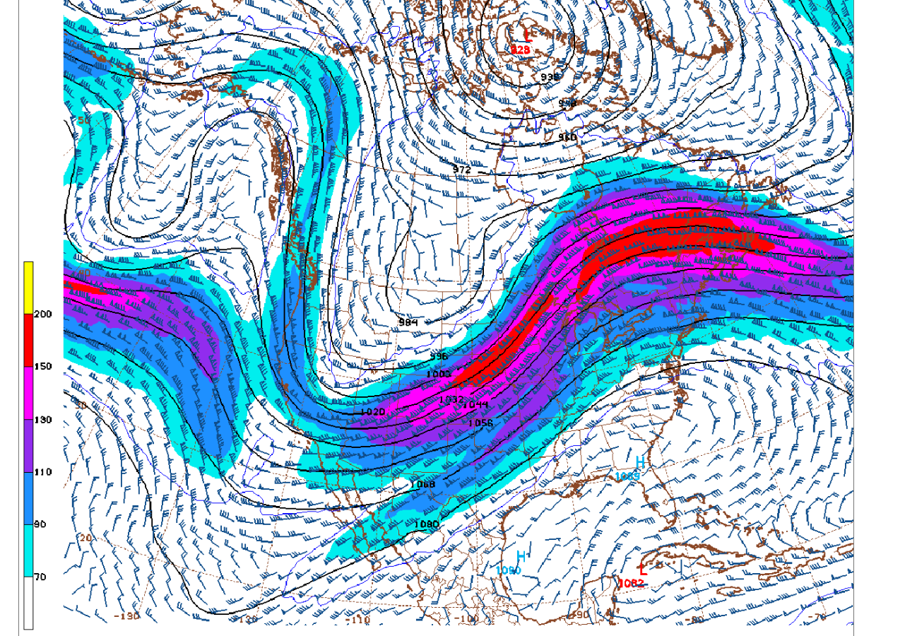
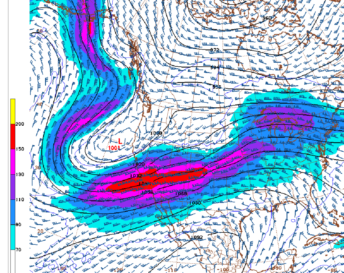
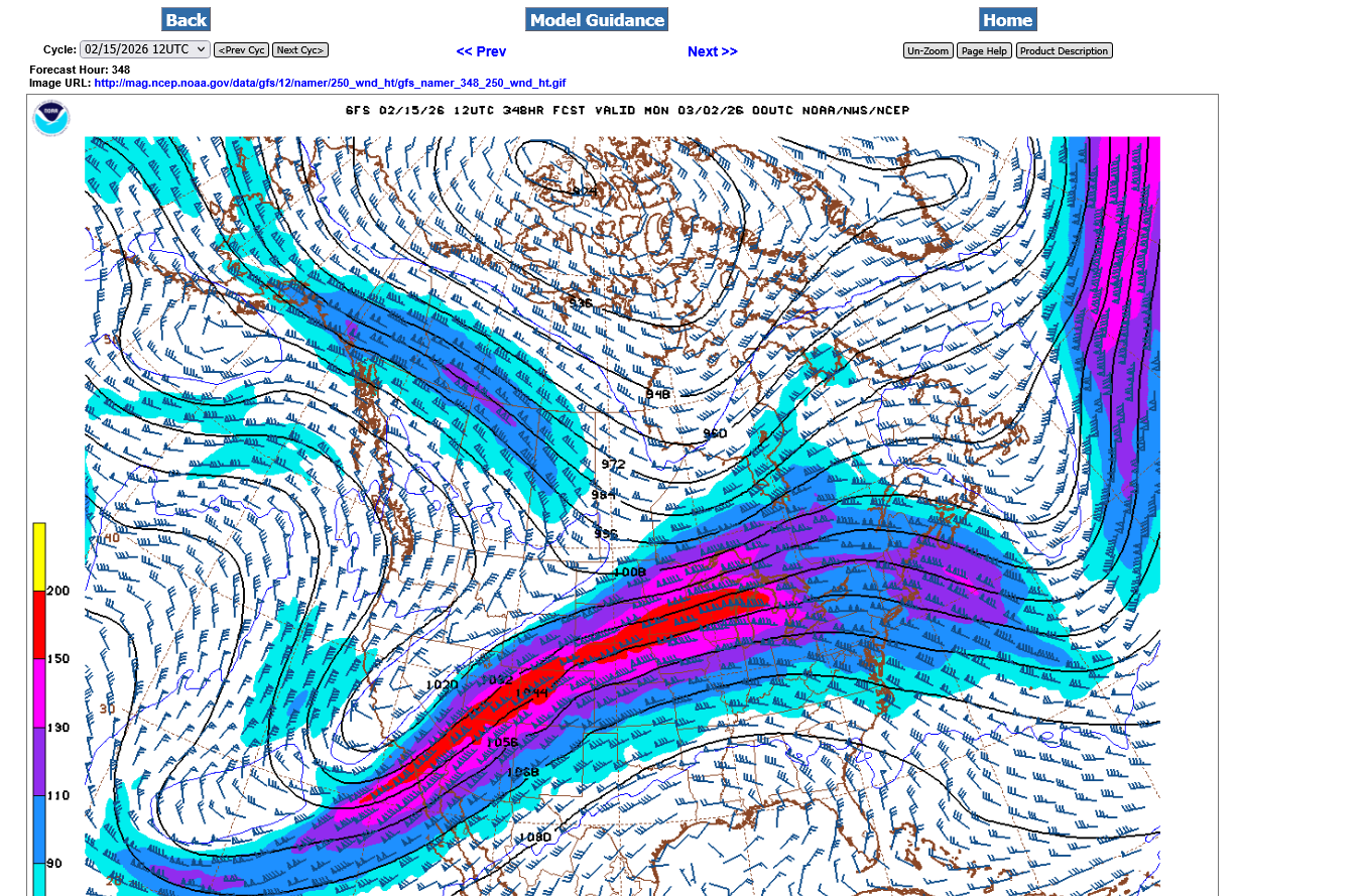
Below is going to be the NEW pattern in 2 weeks. This is the jet stream at 250 mb which is 34,000+ above the ground, up where the commercial jets fly! Note the big upper level ridge building in the East.
The upper level trough in the East RECENTLY will be replaced with this upper level RIDGE. The steering currents there will be from the south, replacing the flow that had been coming from Siberia, with cross polar flow, thru Canada, then plunging deeply into the United States, all the way to the Gulf of Mexico as depicted on the map above.
https://mag.ncep.noaa.gov/Image.php
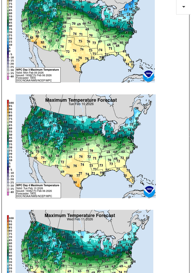
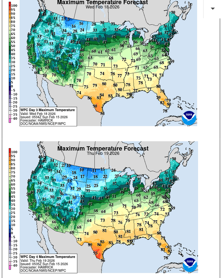
Temperatures are really going to start warming up NEXT week.
Next Tuesday, February 10th we have a shot at 50 deg. F. Wednesday and Thursday are likely to be in the 50's, with a shot at 60 all the way to Evansville IN.
https://www.marketforum.com/forum/topic/83844/#83852
We’re moving up the warming by a day with the huge weather pattern change.
Looks like next Monday we have a crack at 50. The only thing keeping it lower will be the deep snowpack, some of which will still be on the ground.
50s should really kick in on Tuesday and continue Wednesday. By then, probably just the big snow piles today will be left as dirty small snow piles.
Some possible modest cooling back into the 40s later in the week for a couple of days before we get back into the 50s for at least a sew days the week after that. This milder pattern should stick around for awhile even though it’s impossible to predict which days will be milder than other ones beyond 10 days out.
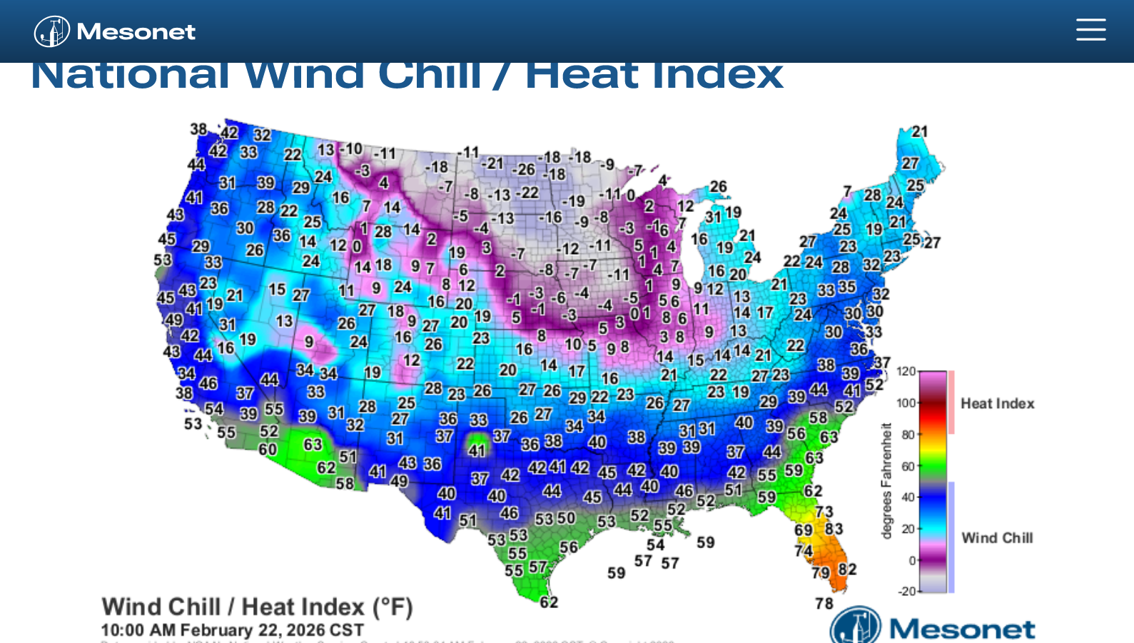
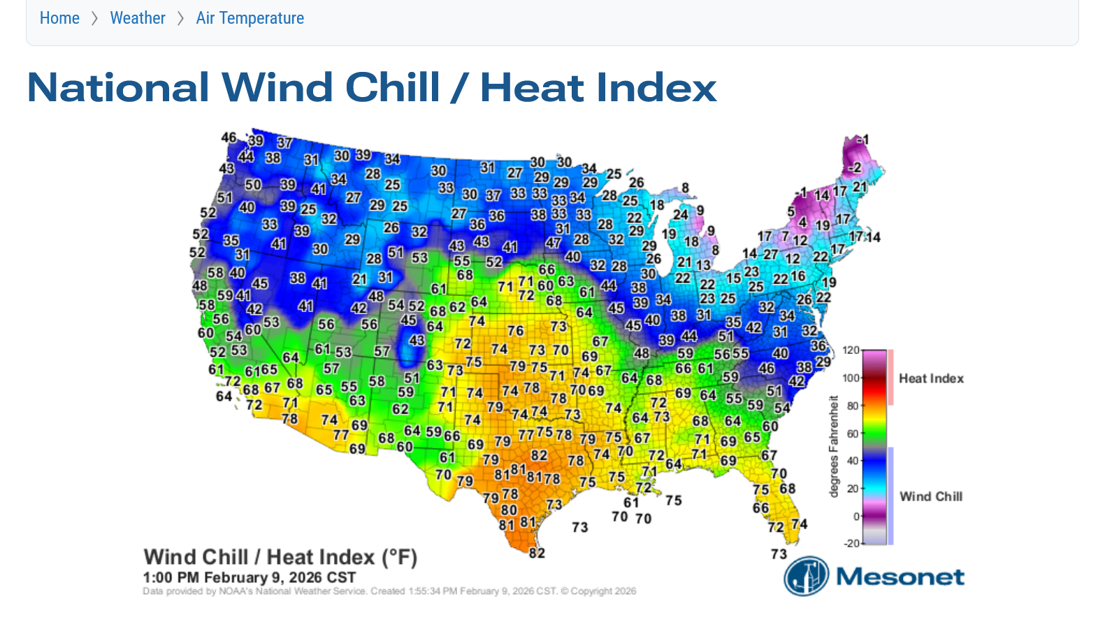
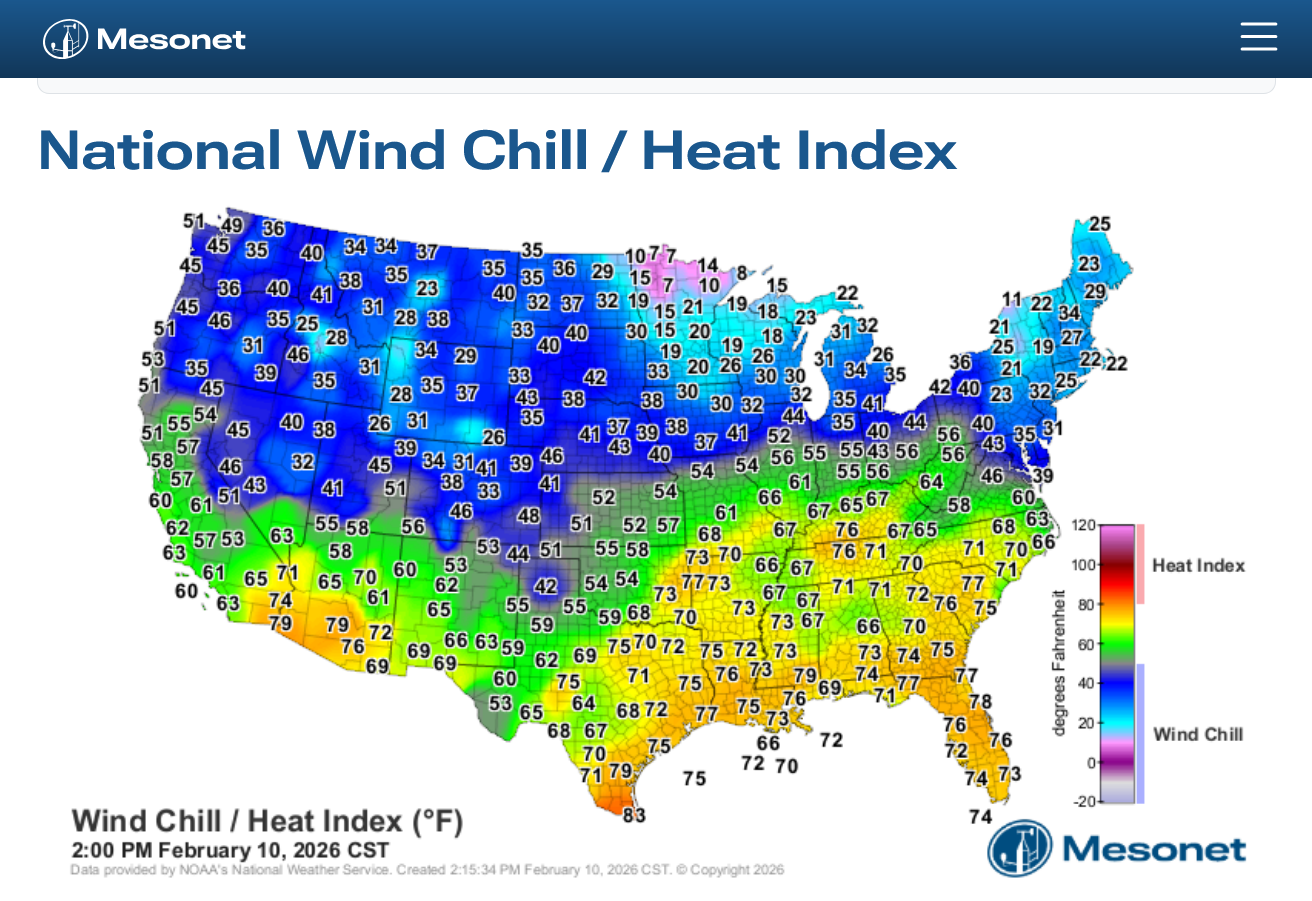
Look at the current temperature contrast across the country.
Warmth is spreading in behind it(near 80 in TX!), with just a small sample of it this week in parts of the Midwest with the Arctic air receding.
The last of the frigid weather exiting, stage northeast.
https://www.mesonet.org/weather/air-temperature/national-wind-chill-heat-index
+++++++++++++++++++++
Current Hazards at the link below.
For your NWS and county, go to the link below.
Then you can hit any spot on the map, including where you live and it will go to that NWS with all the comprehensive local weather information for that/your county.
Freeze frame below. Northeast getting hit.
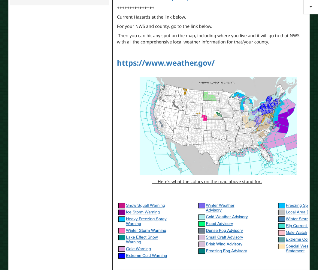
1. Weather map Friday evening. One last blast of modified, less surging Arctic air.
2. Weather map Saturday evening. Warmer air poised to surge east next week!
https://www.marketforum.com/forum/topic/83844/#83848
The 3 warmest days next week will be Mon-Tue-Wed!
Temperatures cool back into the 40's after that??
The snow will melt FAST next week with these mild temperatures.
Residents of Evansville will remember the 2004 snow with 24 inches. The snow to water ratio was was close to 10 to 1.
This last cold/dry snow had a ratio of more like 25 to 1.
So, doing the math means that every inch of frozen water in the snow from the heavy wet snow in 2004, had 2.5 times the amount of frozen water that the same amount of this 2026 snow did.
In addition, we had 2 times the snow fall in 2004.
So that means 2 X 2.5 = 5 times more frozen water(and heat required) that had to be melted in 2004 compared to how much frozen water that needs to be melted (and heat required) in 2026.
What that means is that this snow already compacted and partially melted should melt away quickly next week!
With temperatures staying ABOVE freezing at night, that will keep the snow/ice from refreezing too........so we will go from rapid melting during the day to slower melting at night. And the snow will be gone FAST!
Last of the extreme cold in the Northeast. Here comes the warmth with winds kicking in with a southerly component!
https://www.spc.noaa.gov/exper/mesoanalysis/new/viewsector.php?sector=19
https://www.mesonet.org/weather/air-temperature/national-wind-chill-heat-index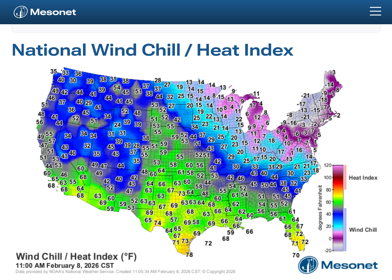
Get all the comprehensive weather here:
The big thaw is about to commence!
50's Tuesday will be the warmest day of the week and warmest since we had the 12 inches of snow over 2 weeks ago.
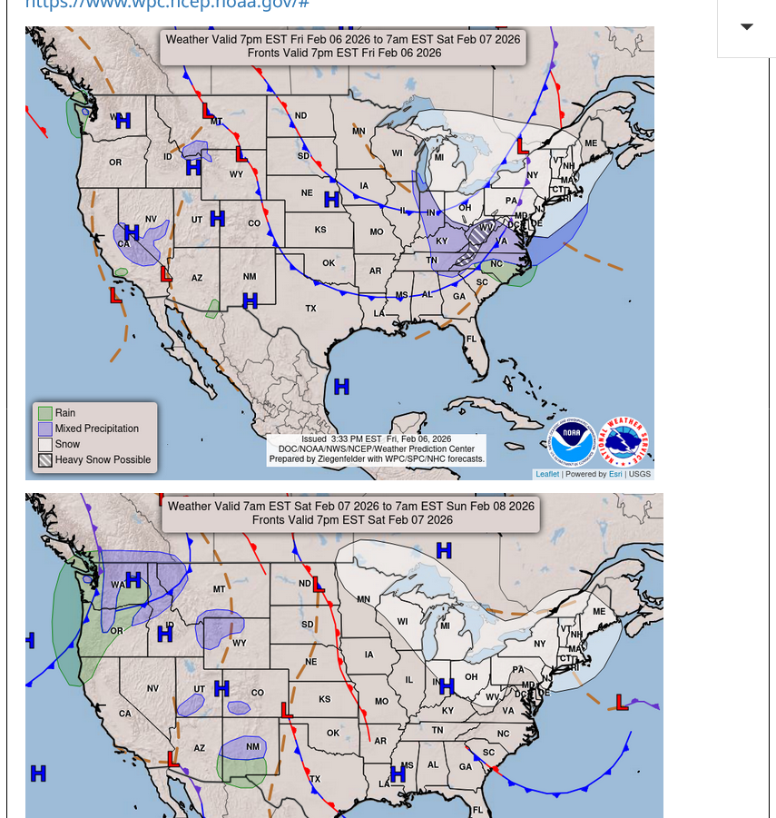
https://www.wpc.ncep.noaa.gov/#

Back home:
https://www.weather.gov/media/pah/DGT/DGT_PAH_02062026.pdf
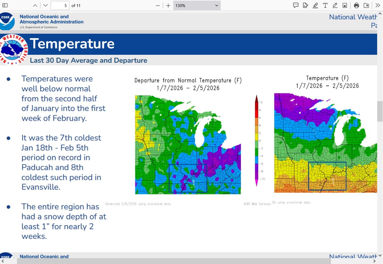
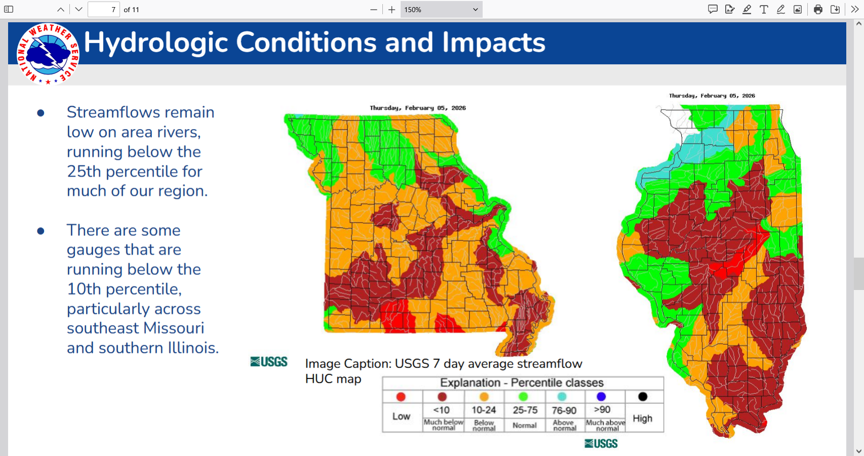
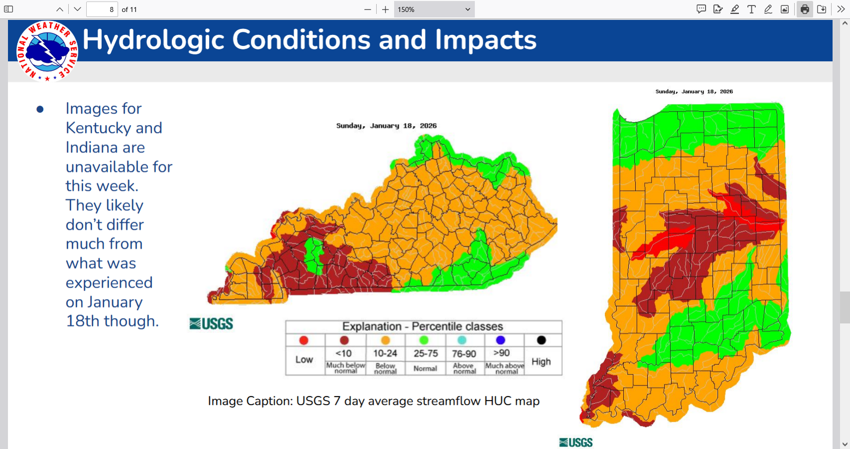
Hydrologic Impacts
● 14 day streamflows, according to USGS data, are below the 10th percentile in portions of our region
and below the 25th percentile in most other areas.
Soilmoisture anomaly:
These maps sometimes take a day to catch up to incorporate the latest data(the bottom map is only updated once a week).
https://www.cpc.ncep.noaa.gov/products/Soilmst_Monitoring/US/Soilmst/Soilmst.shtml#
![]()

++++++++++++++++++++++++++++
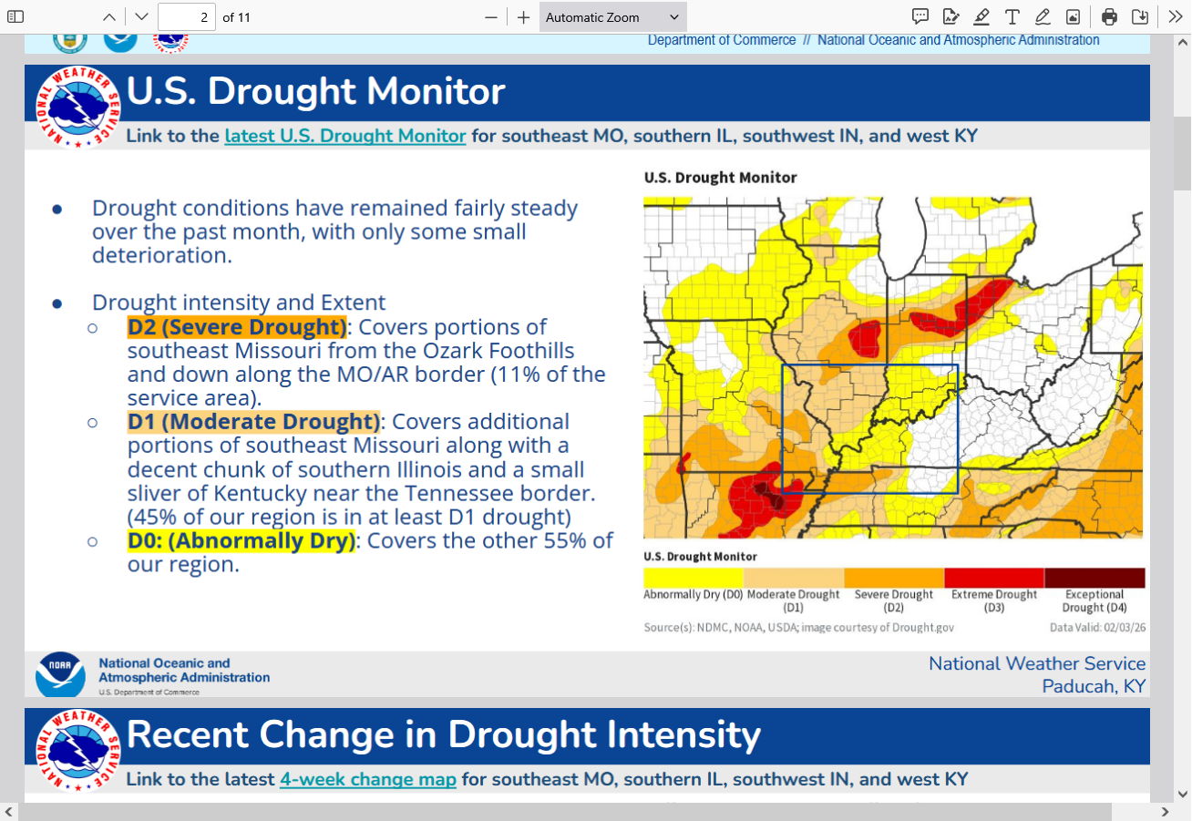
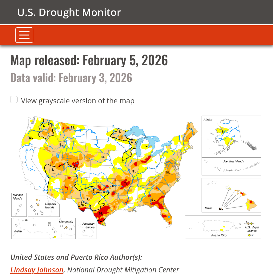
https://www.drought.gov/current-conditions
Thru February 3, 2026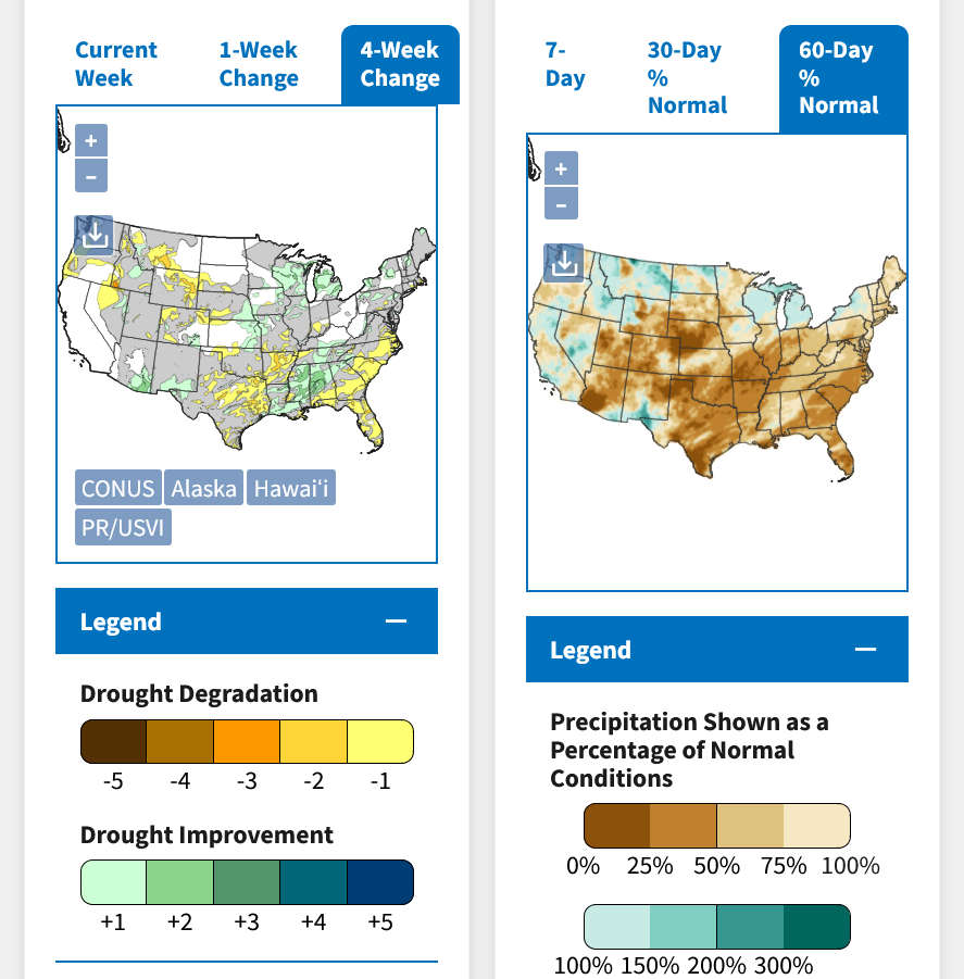
DROUGHT MONITOR
https://droughtmonitor.unl.edu/
Drought expanding this Winter from Southern Plains, northeastward.
This much milder pattern coming up will also increase rains!
7 Day Total precipitation below:
http://www.wpc.ncep.noaa.govcdx /qpf/p168i.gif?1530796126

Extended weather.
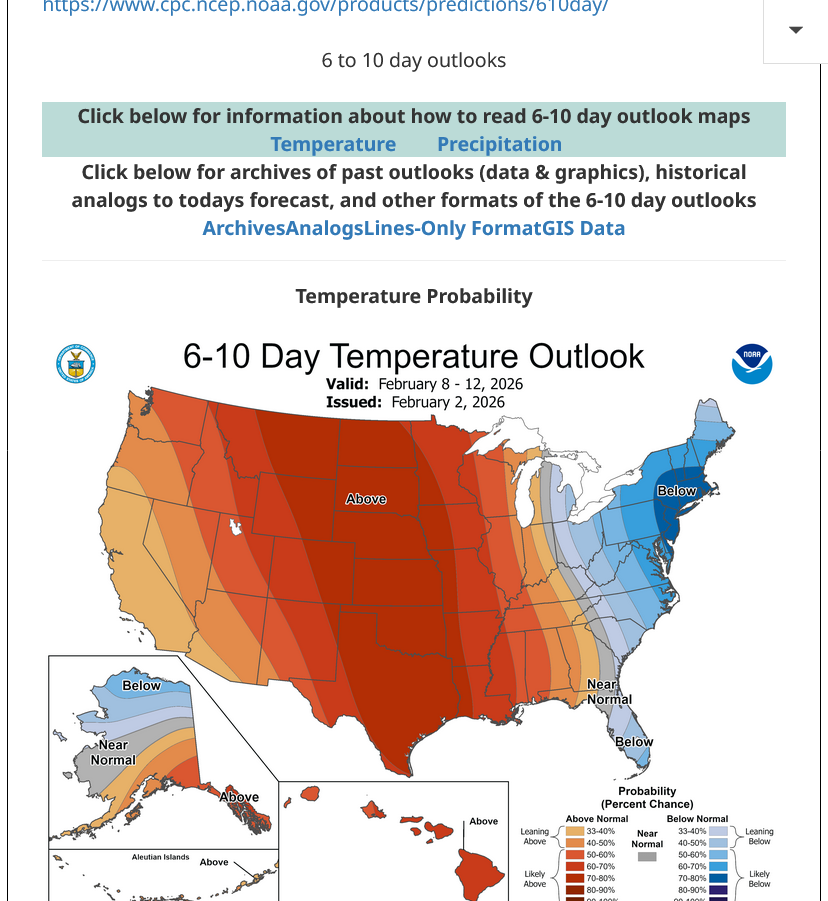
https://www.cpc.ncep.noaa.gov/products/predictions/610day/ | ||||||||
| 6 to 10 day outlooks | ||||||||
| Click below for information about how to read 6-10 day outlook maps Temperature Precipitation | ||||||||
| Click below for archives of past outlooks (data & graphics), historical analogs to todays forecast, and other formats of the 6-10 day outlooks ArchivesAnalogsLines-Only FormatGIS Data | ||||||||
Temperature Probability | ||||||||
Precipitation Probability | ||||||||
When really warm air over runs a deep snow pack, much of the heat energy at the surface is gobbled up in melting the snow so instead of warming the air temperature, it melts snow.
I've noted the NWS reducing their forecast highs for today and tomorrow in the last several forecasts because of this.
Fact is, an air mass this incredibly warm in the Plains blowing in on Tuesday with strong southwest winds would ordinarily give us a good shot at getting ABOVE 70 degrees, especially with recent dryness/dry soils.
With so much snow still on the ground, we might have a hard time getting to 60.
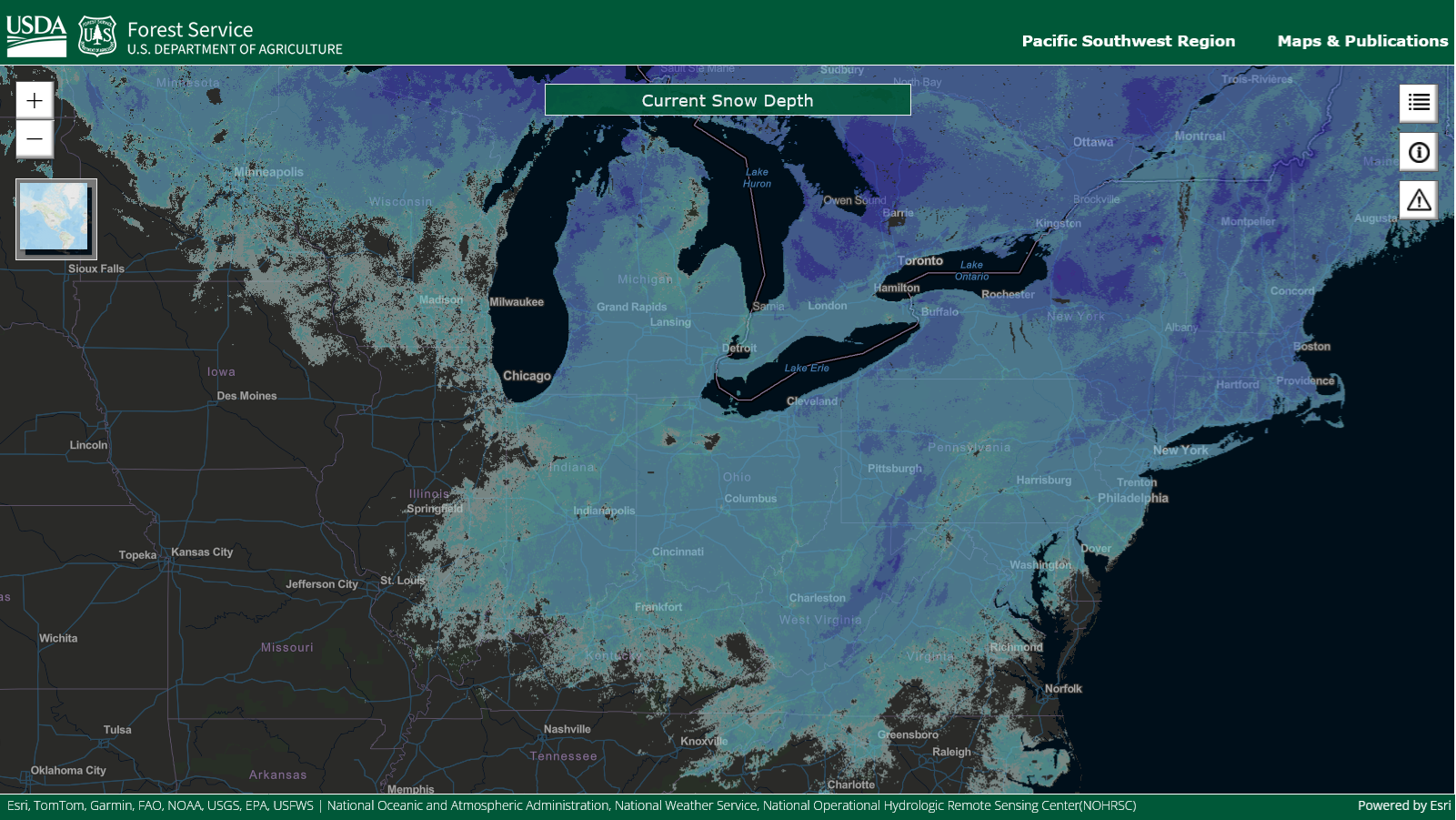
1. Current snow cover.
2. Current temperatures. The cooler temperatures over the deep snow pack are mainly the result of the leftovers of the last extremely cold Arctic air mass that coincidentally are over the snow pack. However, today, it's been incredibly difficult to dislodge that much colder air because it's so much heavier than the warmer, lighter air and also the snow pack is gobbling up heat to melt it around the edges where temperatures are ABOVE freezing. Note U-70's all the way to NE right now. That same air mass transported into IN on Tuesday will drop to the 50's because of the snow pack.
https://www.fs.usda.gov/sites/nfs/files/r05/publication/R5_SnowDepth_Map.html
https://www.mesonet.org/weather/air-temperature/national-wind-chill-heat-index
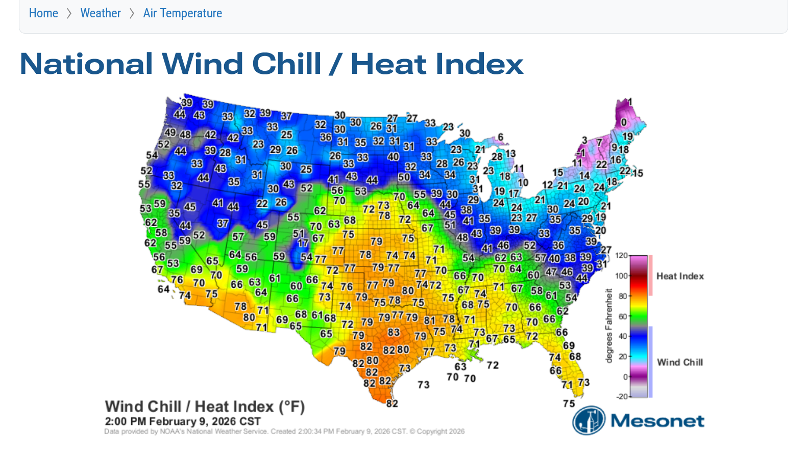
11am: The warm air is gushing in now!
With the edge of the previously deep snow pack eroded, it's having less impact on cooling down the air mass too so we should easily get above 60 in Evansville IN on Tuesday.
https://www.mesonet.org/weather/air-temperature/national-wind-chill-heat-index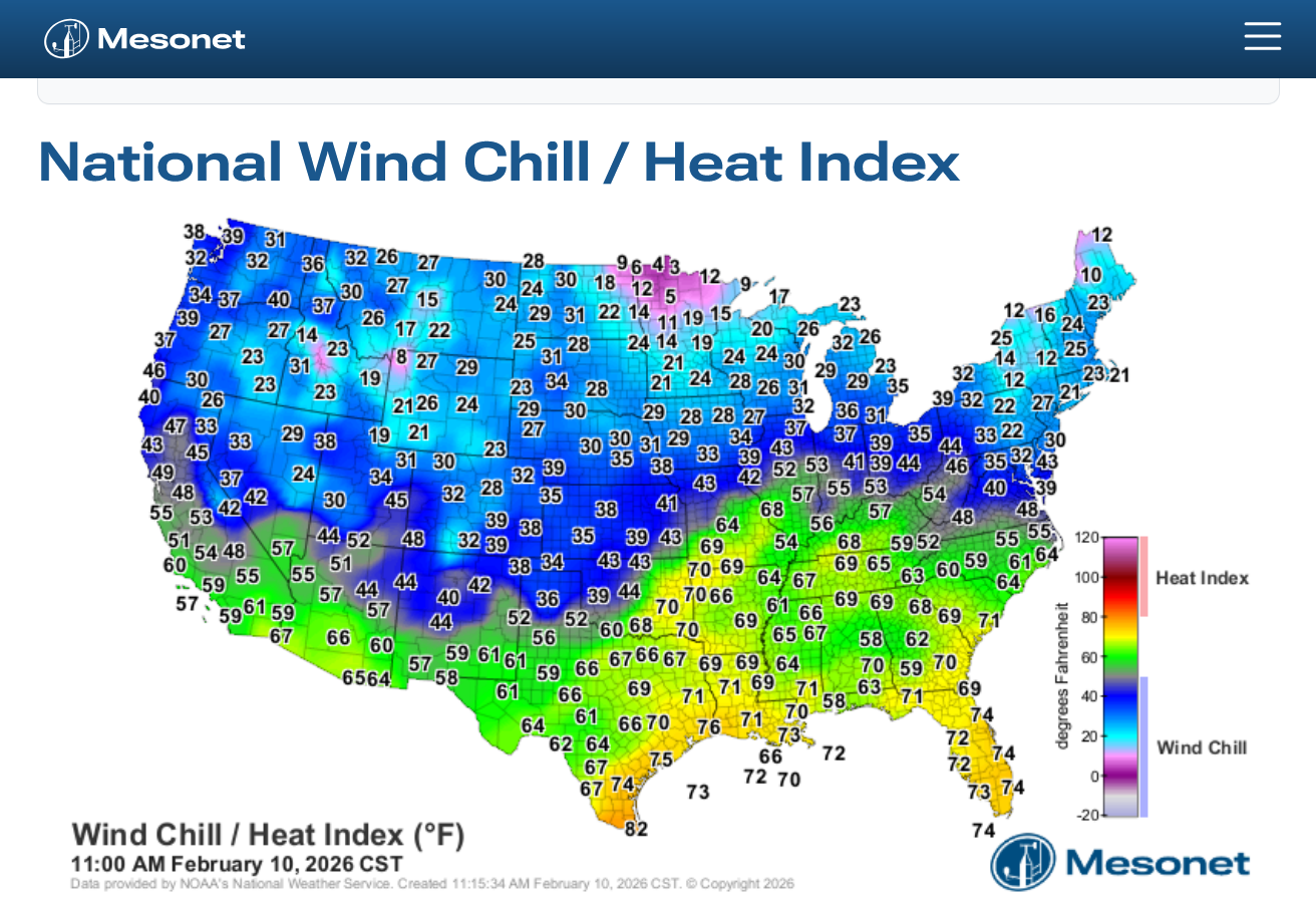
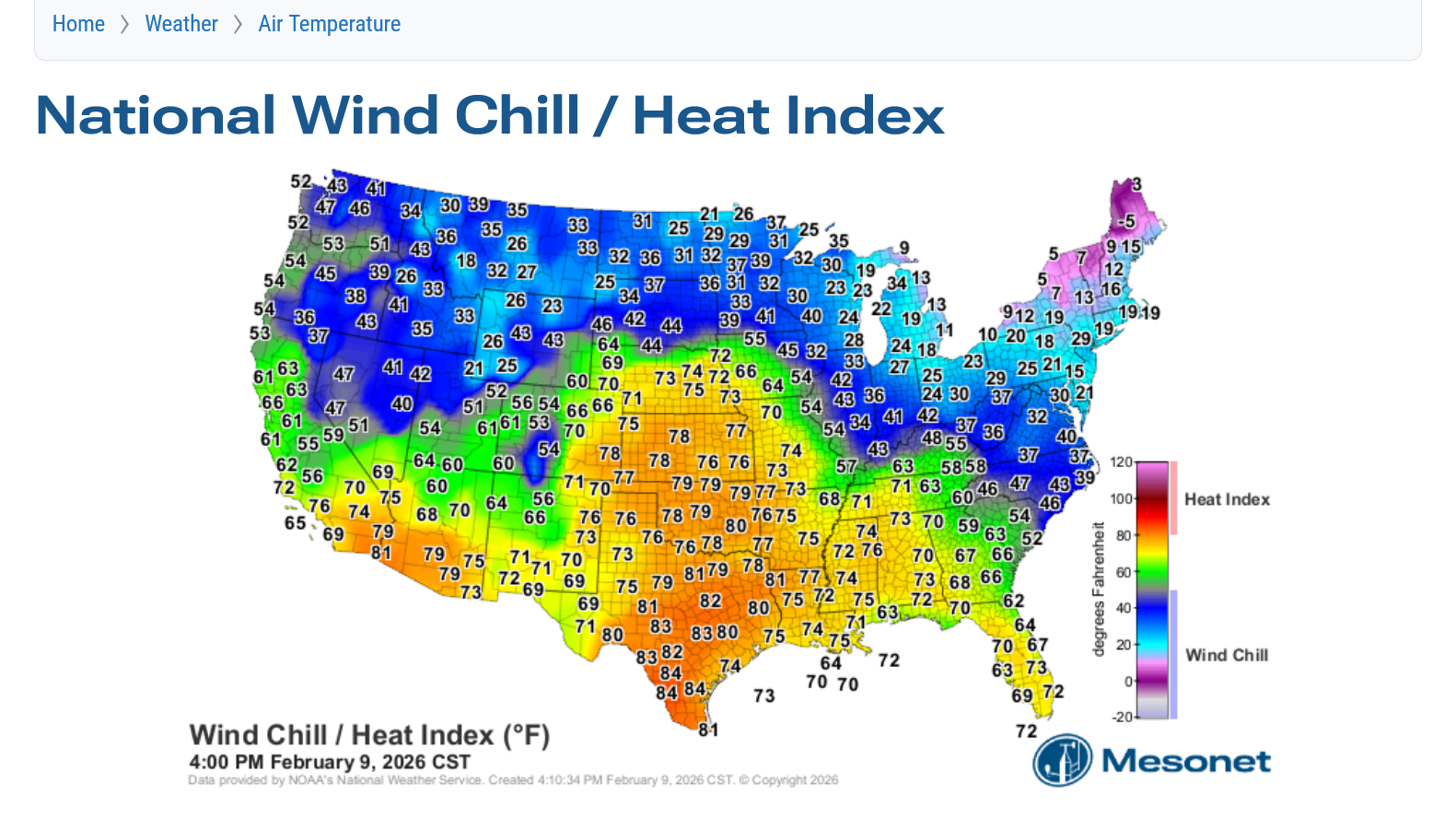
2pm: We're having a heat wave! Could hit 70 degrees today with most of the snow melted off!
https://www.mesonet.org/weather/air-temperature/national-wind-chill-heat-index
After a brief cool down back to average, starting Friday temperatures will climb above average, getting MUCH above average next week. In the 60s! Even the big snow piles should melt away completely.
Along with that pattern change, rains will increase too which will help to restore soil moisture in some places in drought. Plenty of time before the growing season when that matters!
This long lived pattern below changed last week!
This is what the jet stream will look like next week. No chance for cold air to get close. In fact, the southerly component in the steering currents (southwest) assures WONDERFUL WARMTH that looks to last beyond 10 days!
No sign of this pattern ending.
60s for sure on several days next week!
Next Wed/Thur could be our first 2 days on 2026 to crack 70 deg. F!!
https://www.marketforum.com/forum/topic/83844/#83851
However, it now looks like a short lived cold snap is on the way to end this next week and to start the last week in February.
Instead of the zonal to southwest jet stream/steering currents, a kink/buckling in the jet stream that leaves us in northwest flow which will send some of the cold air in Canada pouring south in the US.
5pm: This will be PROGRESSIVE flow so its back into the main pattern again with steering currents having a distinct southerly component.
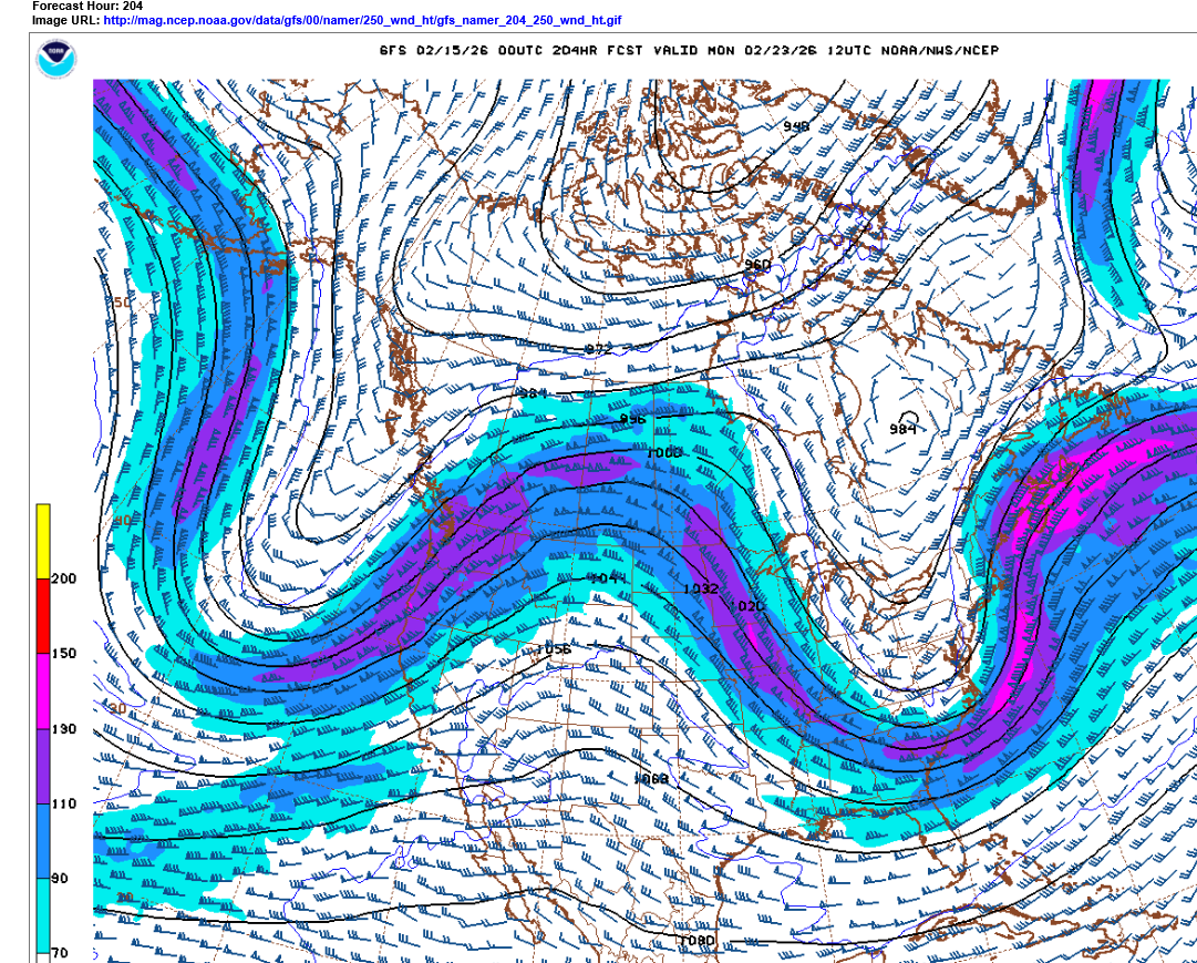
The Jet stream as we start March could look like this below. Forecast skill that far out is not great and the northern stream farther west will be dumping very cold air into the Western and possibly the Upper Midwest.
The strength and direction of the jet stream is FAVORABLE for a major severe weather event but that's very speculative this far out.
Look at this temperature contrast at 5pm on Thursday!!!
70's on the front/warm side of this system.
Frigid weather on the back/cold side.
https://www.mesonet.org/weather/air-temperature/national-wind-chill-heat-index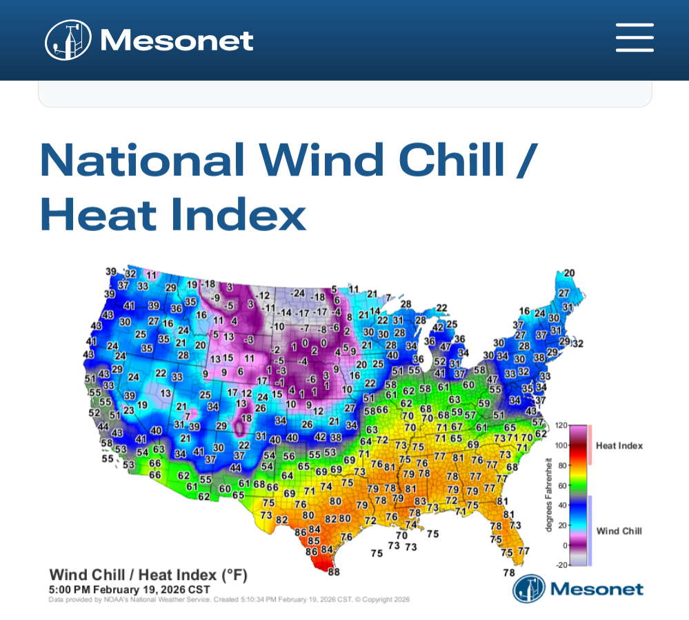
https://thermastor.com/dew-point-and-weather-maps/
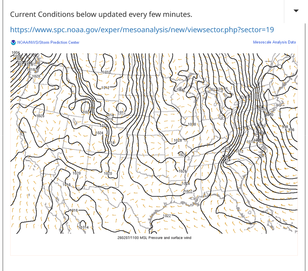
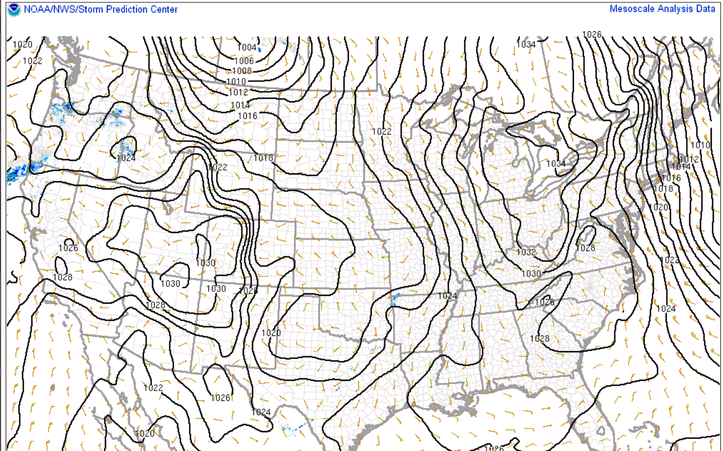
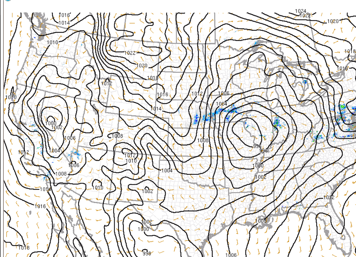
Surface low just northwest of St. Louis. Not extremely wound but plenty of lines of equal pressure surrounding it. The pressure gradient is actually tighter/steeper on the back side between the low and an approaching Arctic high.
https://www.spc.noaa.gov/exper/mesoanalysis/new/viewsector.php?sector=19
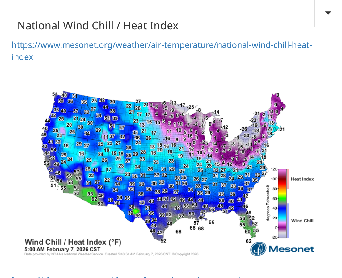
Saying bye to the 60's leaving southeast, MO while the northwest part of the same state has a wind chill in the single digits at 10pm!
https://www.mesonet.org/weather/air-temperature/national-wind-chill-heat-index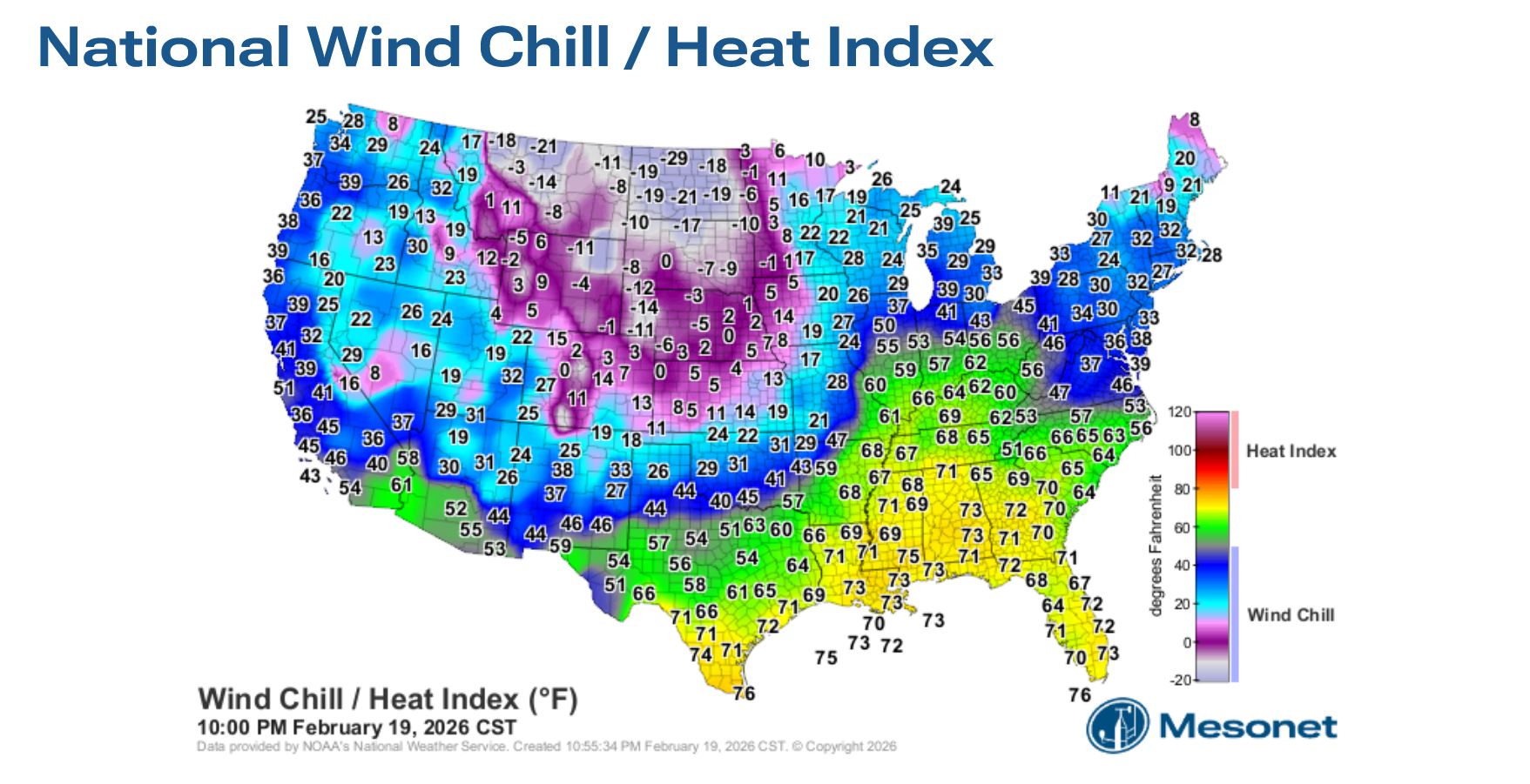
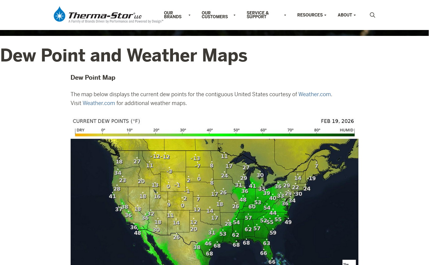
The air coming in is DRY too.
https://thermastor.com/dew-point-and-weather-maps/
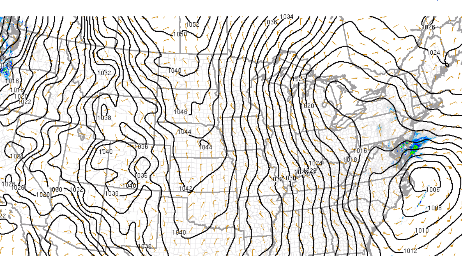
Surface low headed towards northern IL.
https://www.spc.noaa.gov/exper/mesoanalysis/new/viewsector.php?sector=19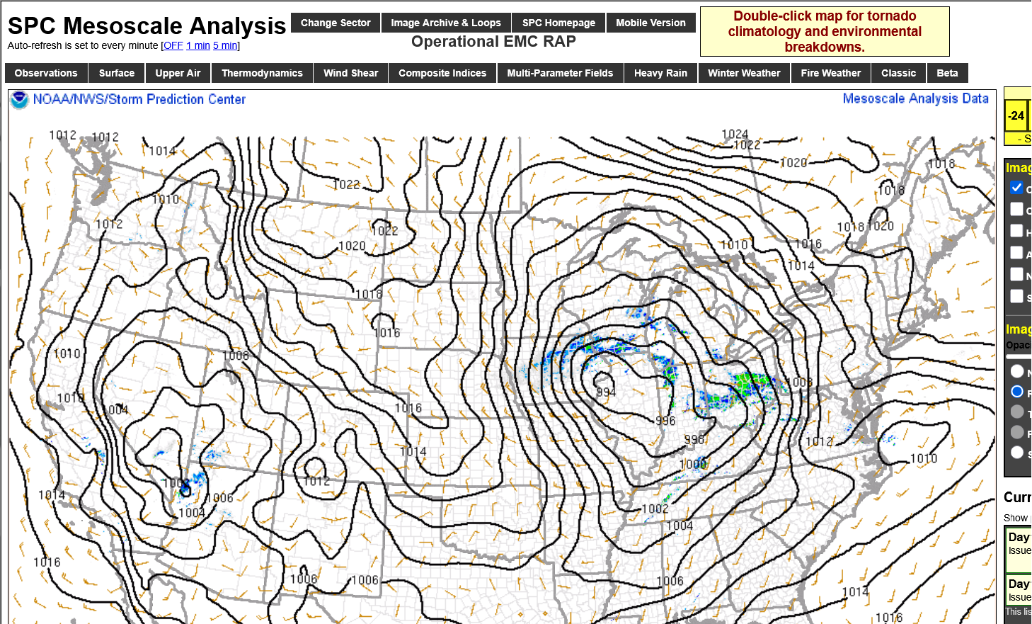
Additional thread covering this last week's weather:
2-16-26 active weather week!
| Started by metmike - Feb. 16, 2026, 7:04 p.m.
https://www.marketforum.com/forum/topic/117950/
++++++++
After the brief cold shot the next several days, the mild weather resumes later this month and lasts well into March.
We could use the rain to recharge soil moisture!!!
The rapidly advancing El Nino(warming of the surface water temperatures in the east-central tropical Pacific) portends better chances of rain as we head into the 2026 growing season.
https://www.cpc.ncep.noaa.gov/products/predictions/WK34/


2-17-26 El Nino, here we come-FAST!
Started by metmike - Feb. 17, 2026, 11:54 a.m.
Brief, Arctic blast/high, modifying over bare ground! Snow storm in the Northeast! Steep pressure gradient causing gusty northwest winds.
https://www.spc.noaa.gov/exper/mesoanalysis/new/viewsector.php?sector=19
https://www.mesonet.org/weather/air-temperature/national-wind-chill-heat-index