This is way outside of tornado alley!!!
Get all the comprehensive weather here:
https://www.marketforum.com/forum/topic/83844/
+++++++++++++
Previous thread that was getting pretty long:
Higher risk severe weather threat 3-15/16-2026
36 responses |
Started by metmike - March 13, 2026, 8:02 p.m.
https://www.marketforum.com/forum/topic/118638/
+++++++++++++++++==
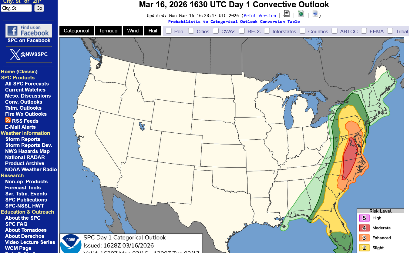
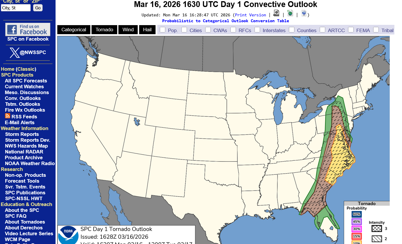
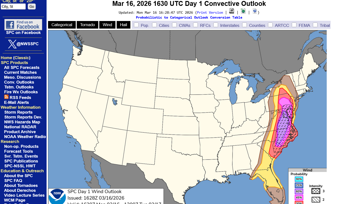
1. Categorical risk up to level 4 of 5
2. Risk for tornadoes
3. Risk for severe wind
https://www.spc.noaa.gov/products/outlook/day1otlk.html
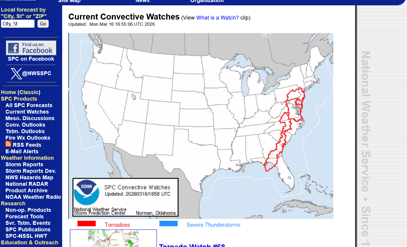
These are all tornado watches at 1pm Monday:
https://www.spc.noaa.gov/products/watch/
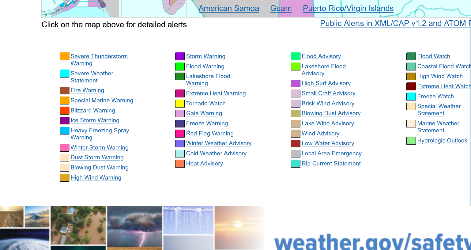
Current Hazards at the link below. These maps will be updated constantly for you.
For your NWS and county, go to the link below.
Then you can hit any spot on the map, including where you live and it will go to that NWS with all the comprehensive local weather information for that spot.

Severe weather so far today. It's early and this map should update all day.
1. 77 severe storm winds
2. 0 tornadoes
3. 1 hail report
https://www.spc.noaa.gov/climo/reports/260316_rpts.html

This is what the same system did the previous 24 hours 7am Sunday to 7am Monday:
1. 573 severe storm winds
2. Just 3 (weak?) tornadoes
3. 44 hail reports
https://www.spc.noaa.gov/climo/reports/260315_rpts.html

Thanks for starting this thread, Mike!
Fortunately, though my worry was up there last night, very little of this high threat has materialized so far, especially for the Carolinas. A forecast bust like this would be a great thing! although the threat is not over.
Side story: it’s snowing in Birmingham, AL, with some accumulating!
Severe weather on the warm side.
Snow on the backside.
++++++++++++
https://www.wunderground.com/maps/radar/current


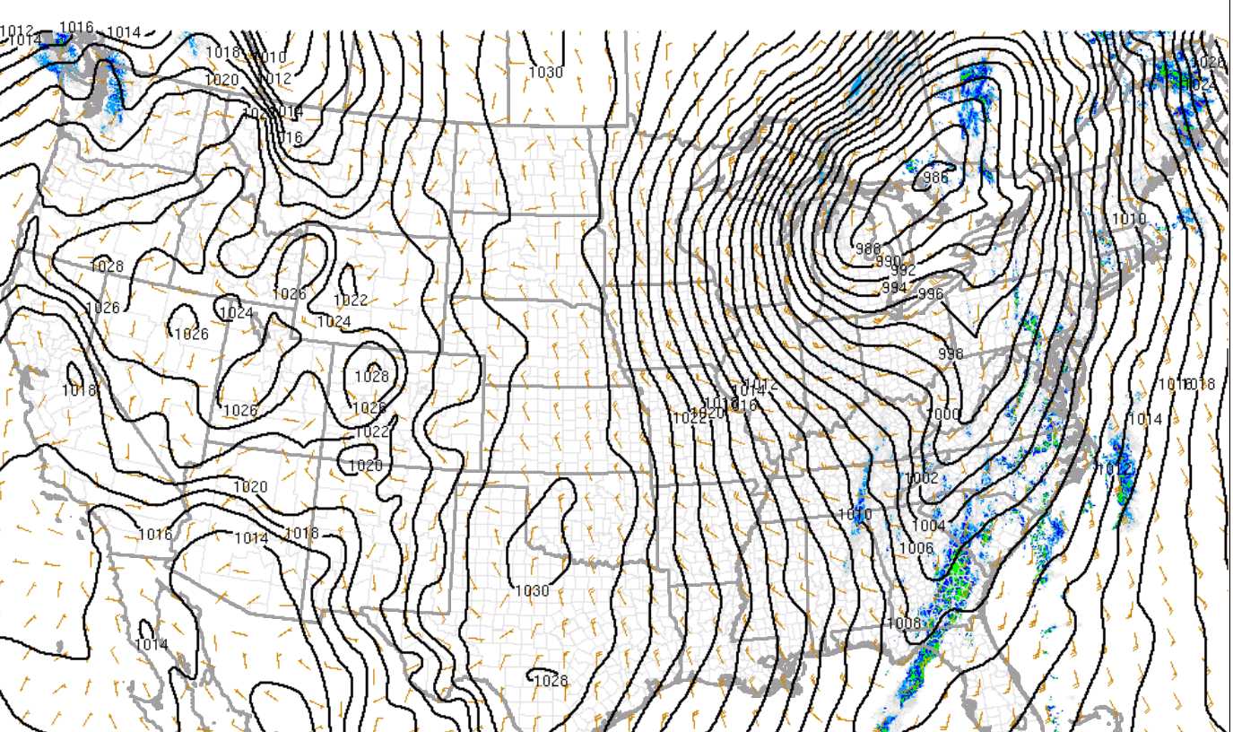
Deep lower pressure, with a center now just northeast of Lake Huron and moving into southeast Canada. Tight pressure gradient on both sides. Southerly winds pulling up warm/moist air ahead of it, nw/n winds behind it with very cold Arctic air.
It feels 80+ deg. F colder in the Upper Midwest right now compared to the Mid-Atlantic!!!
https://www.spc.noaa.gov/exper/mesoanalysis/new/viewsector.php?sector=19
https://www.mesonet.org/weather/air-temperature/national-wind-chill-heat-index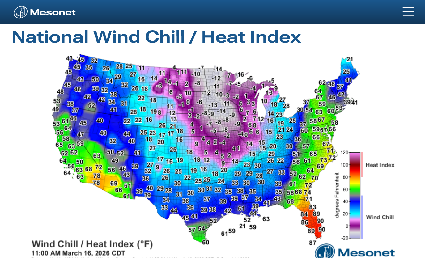
You're very welcome, Larry!
Appreciate your assistance too.
If I could stay up 24 hours or was getting paid, I might have been able to extend the coverage better in the Deep South, including your home state of GA that was hit overnight. Sorry for neglecting that.
I agree strongly that this system is underperforming (so far) today.
Yesterday's hundreds of severe thunderstorm winds would seem to authenticate expectations, however there were almost no tornadoes that were expected and we even thought there may be at least several strong tornadoes yesterday. That never happened.