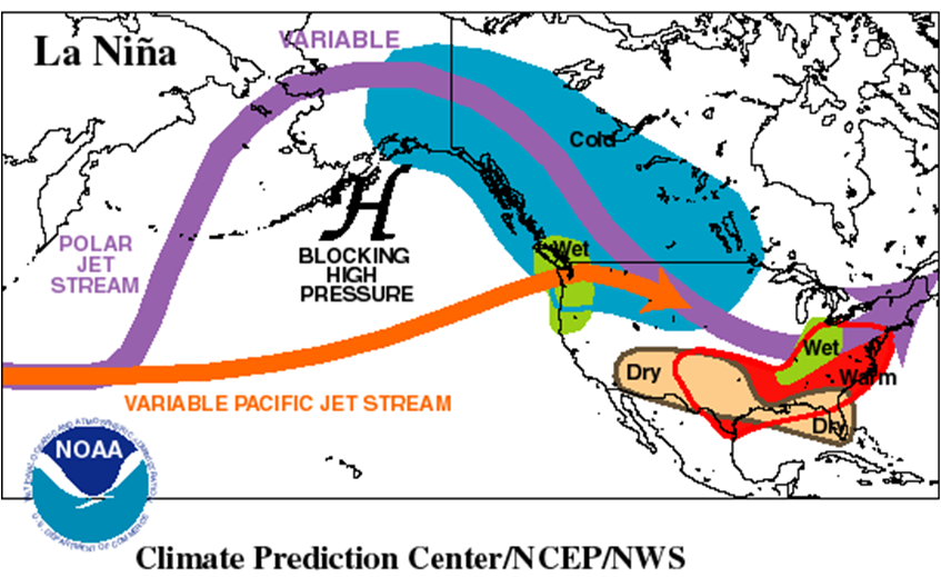
The NWS updated its Winter forecast yesterday, giving great weight to La Nina conditions expected to last for at least the next several months.
Warm southern 2/3rds and East. Cold Northwest.
Wet/snowy northern 1/3 to Ohio Valley. Dry southern 1/2.
 | |||||||||
| OFFICIAL Forecasts | |||||||||
| Dec-Jan-Feb 2020-21 | |||||||||
| Click here for information about the three-month outlook | |||||||||
| [UPDATED MONTHLY FORECASTS SERVICE CHANGE NOTICE] [EXPERIMENTAL TWO-CLASS SEASONAL FORECASTS] | |||||||||
| |||||||||
This was a great article from the Northern Indiana NWS that they sent out a decade ago with analog/composites from previous La Nina Winters, as well as explanations for numerous Winter Weather indicators.
https://www.weather.gov/iwx/la_nina

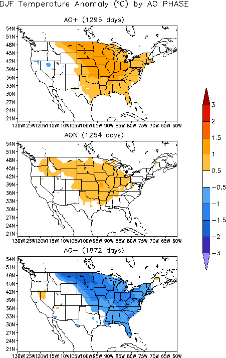
metmike: Note below that there were many more days with a -AO during La Nina years and the very cold temps that occur because of it, from the N.Plains(coldest anamolies) across the entire Midwest, down to the Southeast and including all points eastward.
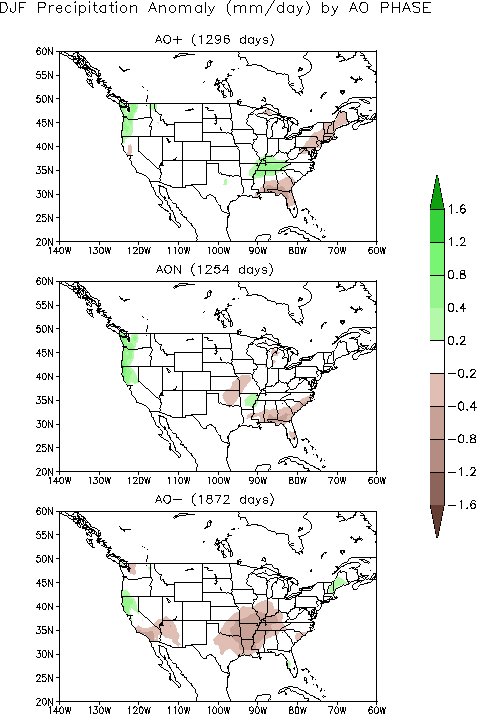
Precip tends to be low/dry(but a higher % is snow) because the air being flushed down from high to mid latitudes with a -AO is usually very dry.

