
I'll be updating this thread thru next Monday, January 17th. Scroll down for the latest. Feel free to pass this link on to others that are interested!
1:30 am Thursday:
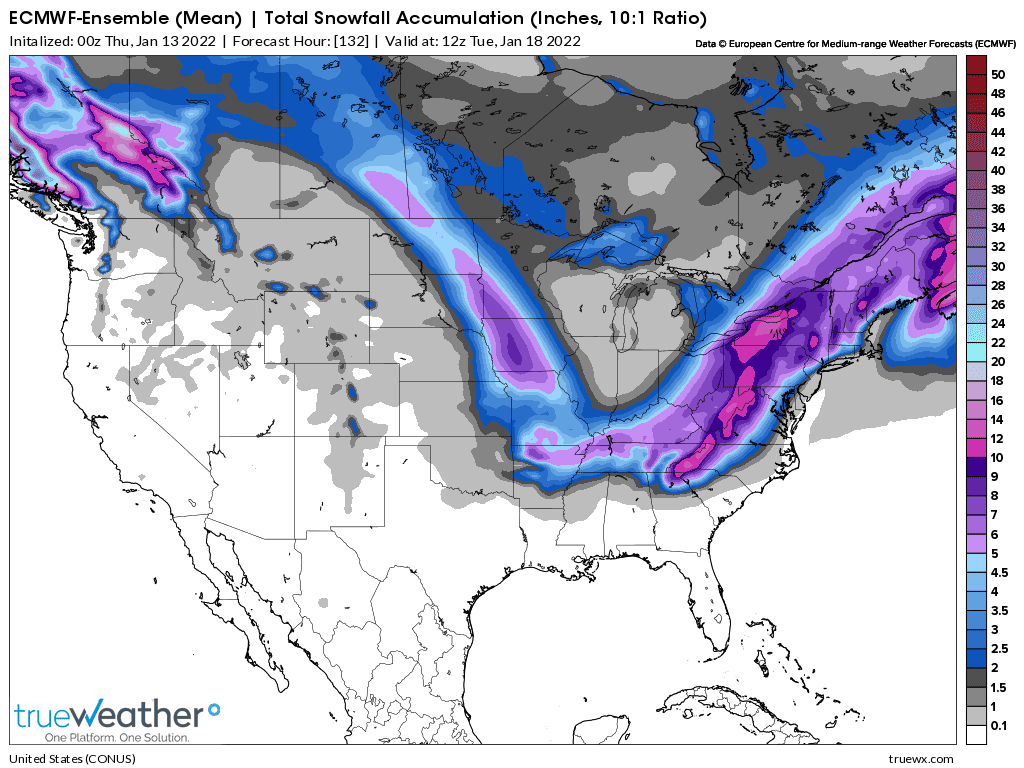
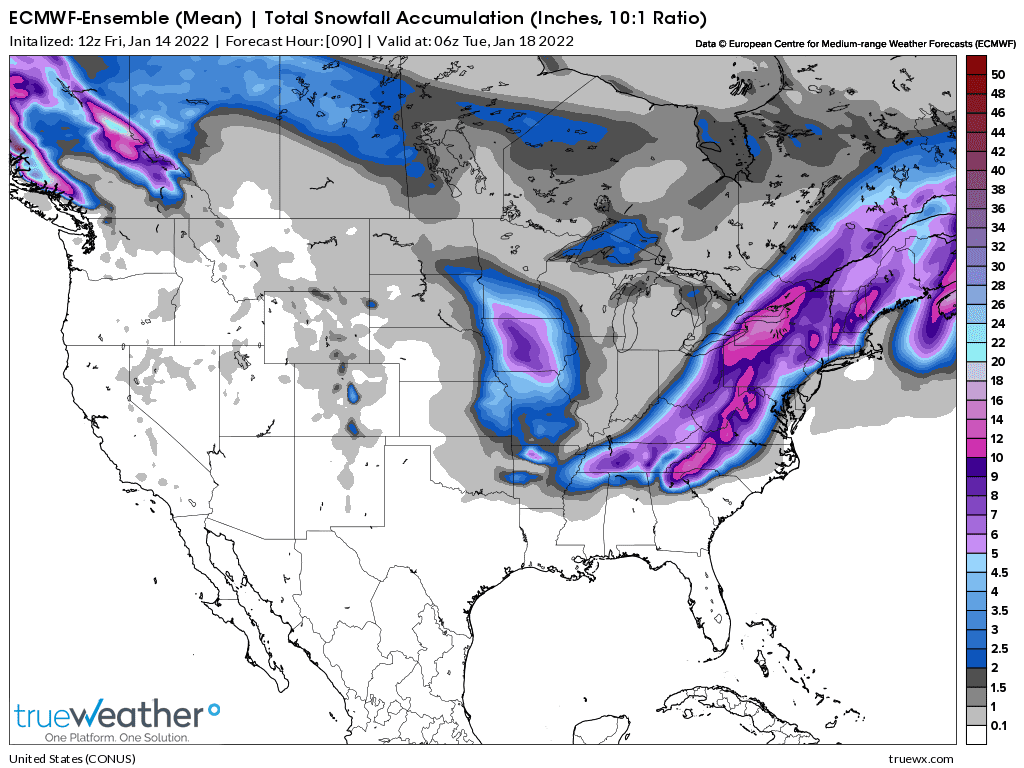
Here are some model forecasts for the upcoming snow thru next Tuesday morning:
0Z Thursday early European Ensemble model:
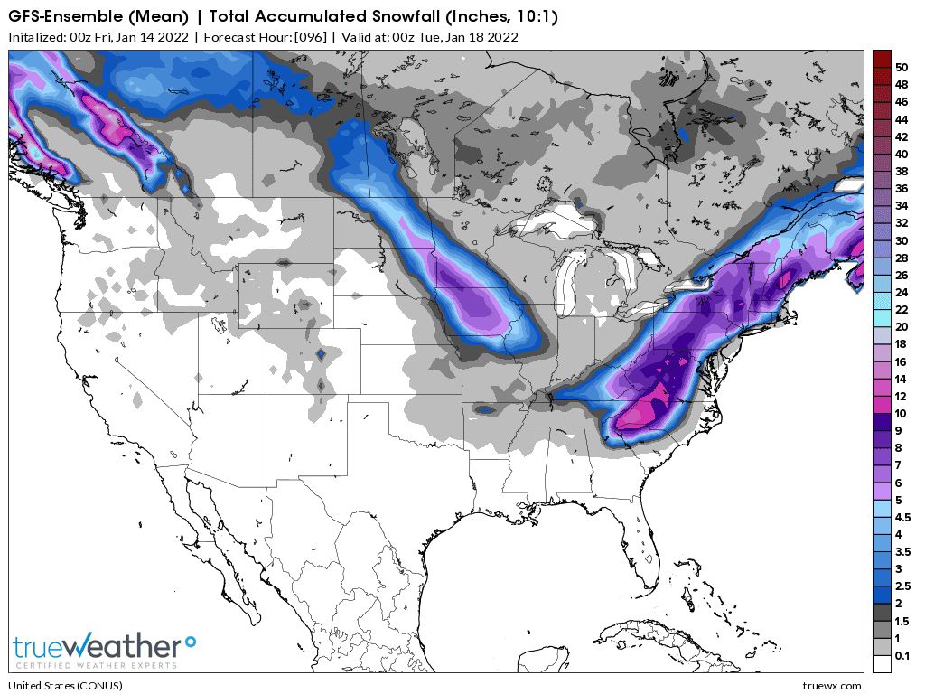
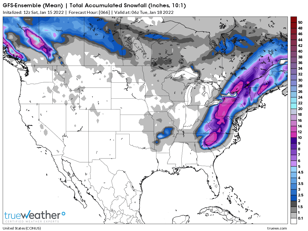
GFS ensemble:
CMC model:
https://weatherstreet.com/weather-forecast/Snow-Depth-US.htm
National Snow Analyses
https://www.nohrsc.noaa.gov/nsa/
Current Snow Depth
https://www.wunderground.com/maps/snow/snow-cover

1 week ago below

1:30 pm Thursday:
12z model updates. Less snow than previous runs if you live in Evansville IN.
Here are some good links to follow this event live:
Local NWS for Evansville Indiana:
Our weather thread:
https://www.marketforum.com/
+++++++++++++++++++++++++++++++++++++++++++++++
https://www.wunderground.com/maps/radar/current
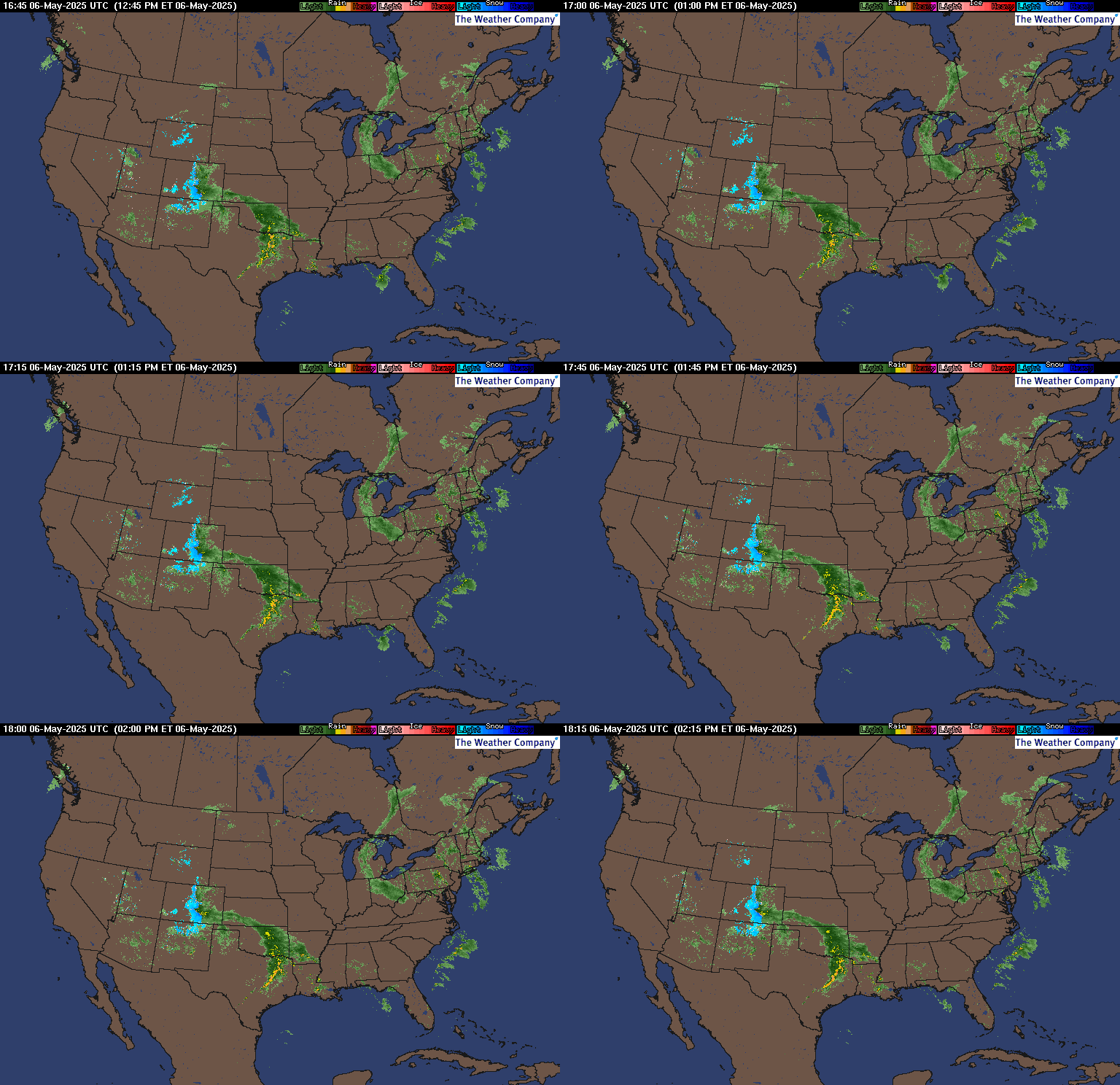
This link below provides some great data. Hit the center of the box below for the area that you want, then go to observation on the far left, then surface observations to get constantly updated surface observations.
 |
Previous Evansville area weather threads:
Snow to water equivalent
19 responses |
Started by metmike - Jan. 5, 2022, 11:51 p.m.
https://www.marketforum.com/forum/topic/79941/
Severe weather late Friday/early Saturday
46 responses |
Started by metmike - Dec. 9, 2021, 7:18 p.m.
It's just after midnight on Thursday night/Friday Am.
Models continue to lower chances for anything much more than an inch of snow for southwest Indiana. Snow totals for the next 4 days/96 hours below. Heavy snows in the Upper Midwest on Friday...........dry up as they cross into IL early Saturday.
Then, they redevelop in KY on Sunday and increase rapidly as the system heads east, then tracks up the East Coast to New England on Monday.
This is what the storm looks like, Saturday afternoon, then Sunday afternoon, then Monday Afternoon:
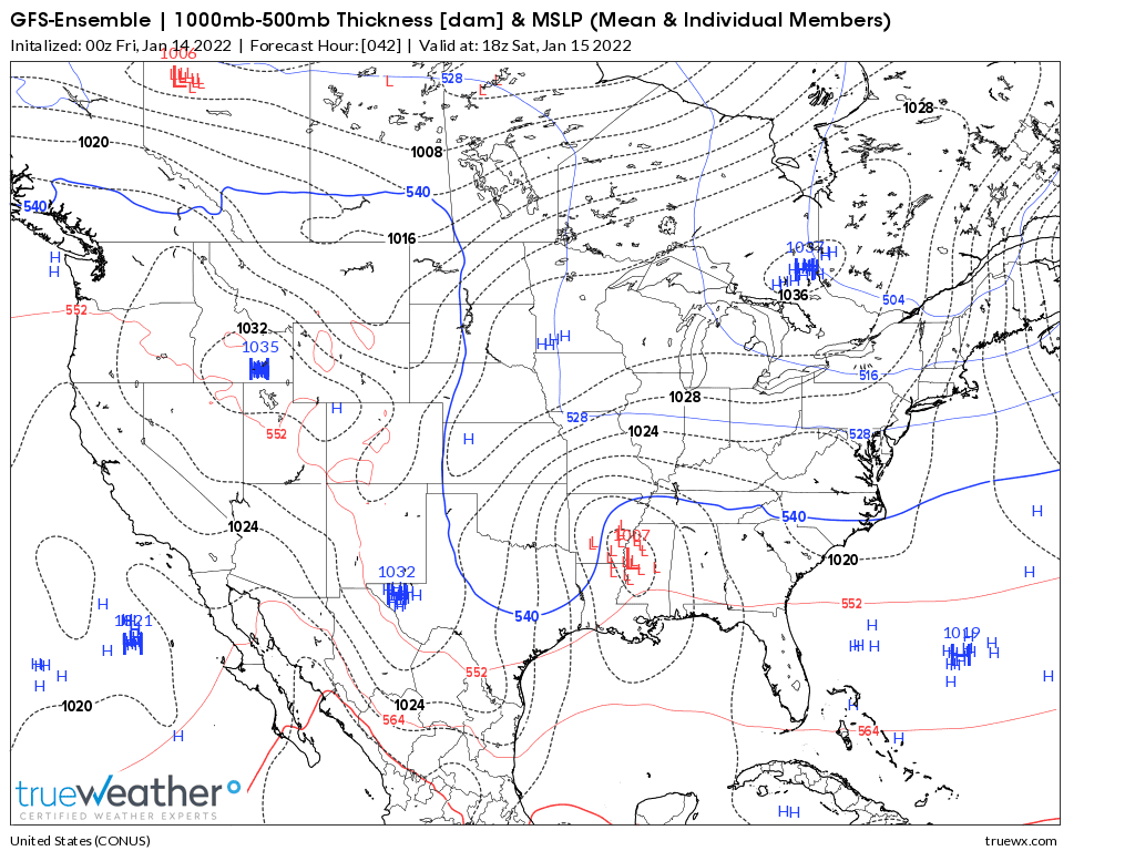
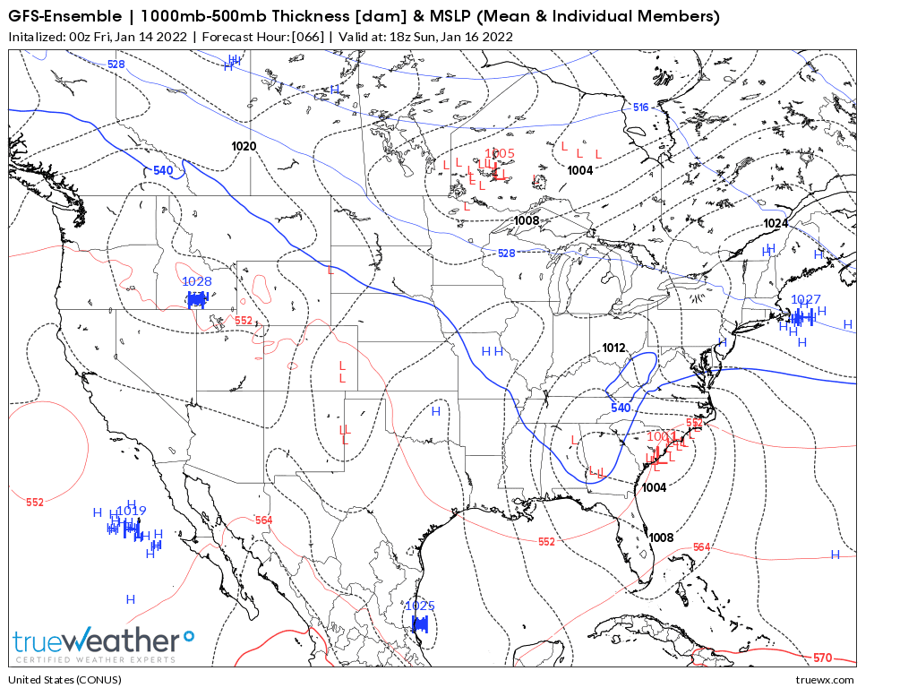

We're close enough to the events to have high confidence in the outcome now. This is from the just updated 12z GFS Ensemble mean solution.
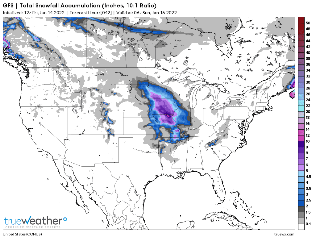
This is the snow from storm #1 below, thru Saturday.
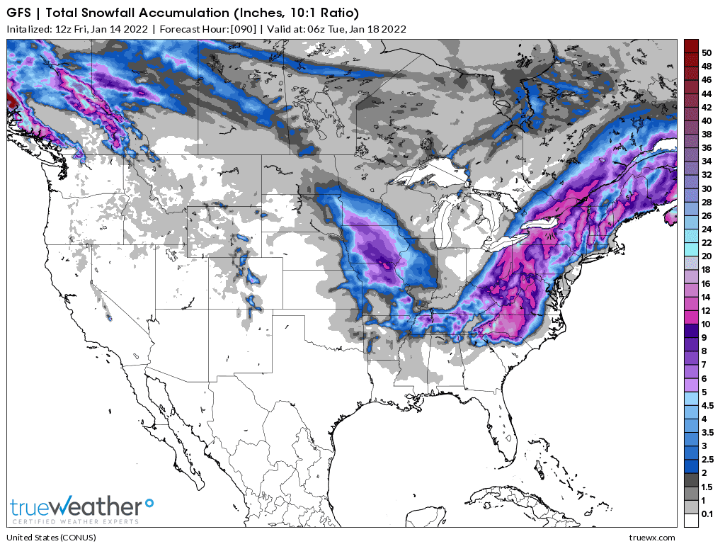
The 2nd map is the snow from both storms thru Monday.
Hardly any in Evansville.........less than 1 inch.
Just storm thru Saturday #1 below
Storm #1 and Storm #2 thru Monday below
Latest European ensemble model just out, just before 2pm on Friday. Puts the nails in the significant accumulating snow chance coffin!
For sw Indiana that is.
this has to be a wee bit concerning for orange growers. Last few days the juice wicked volatile, sweeping stops both top and bottom something fierce. Witnessed live drop of 7 cents in a couple seconds, only to run right back up. And today, Friday, morning surges up wicked in the March, unchanged in the May, only to reverse AND CLOSE DOWN HARD TO FINISH THE WEEK.
This will have absolutely no impact on the OJ market that you're trying to talk higher hayman.
Snowfall the last 48 hours. Snow from the first system dried up as it headed southeast.
https://weatherstreet.com/weather-forecast/Snow-Depth-US.htm
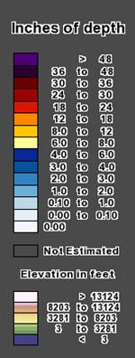
Total Snow/Depth for all of the United States below
https://www.nohrsc.noaa.gov/nsa/

Latest snowfall forecast thru Monday, here on Saturday at 4pm.
The 2nd model, European model has more snow much farther west, in TN, MO and AR!
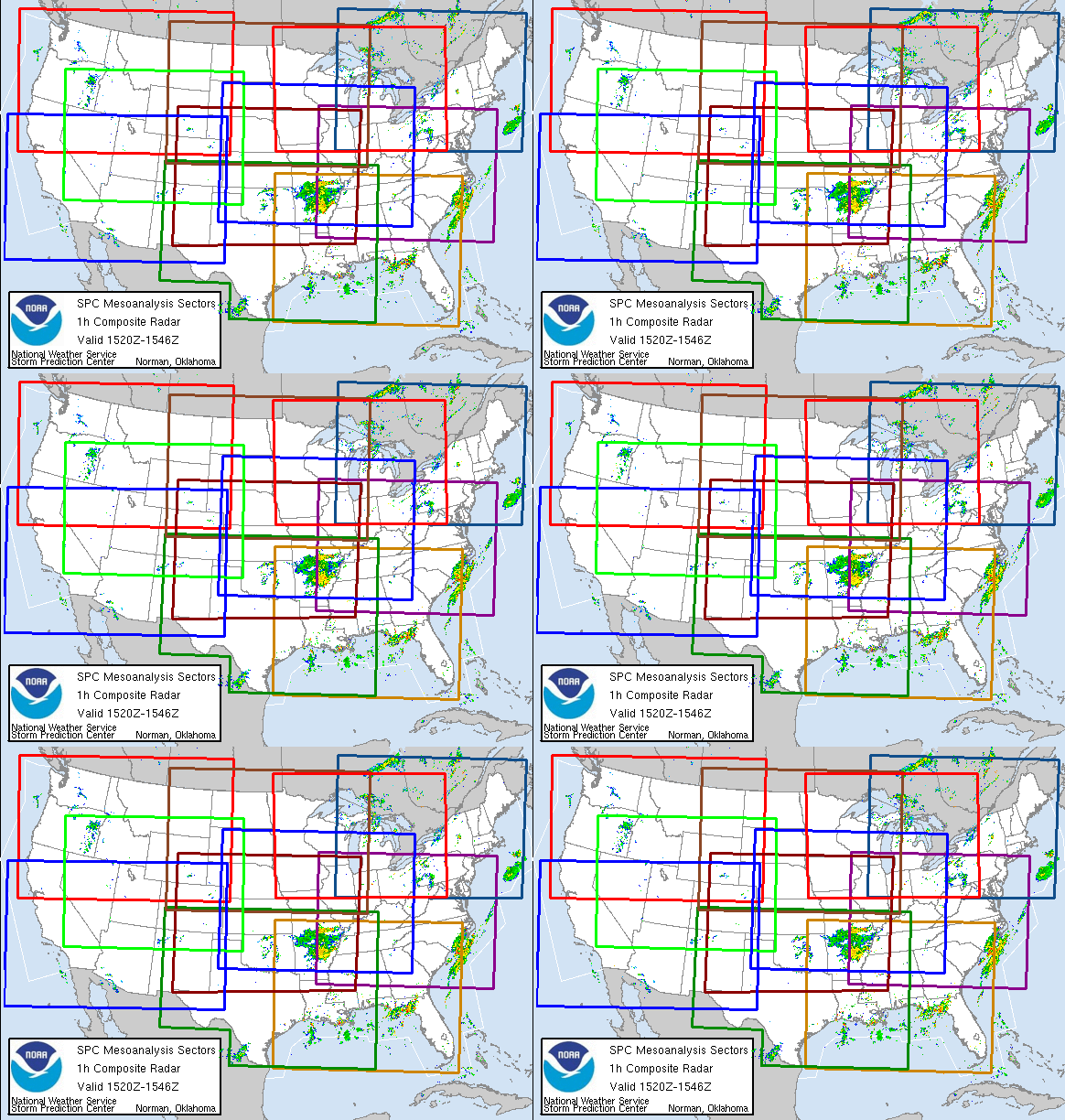
You can track the storm using these maps/links below. They get updated constantly!
https://www.spc.noaa.gov/exper/mesoanalysis/new/viewsector.php?sector=17

https://www.spc.noaa.gov/exper/mesoanalysis/new/viewsector.php?sector=17#

https://www.spc.noaa.gov/exper/mesoanalysis/new/viewsector.php?sector=17#

https://www.wunderground.com/maps/radar/current

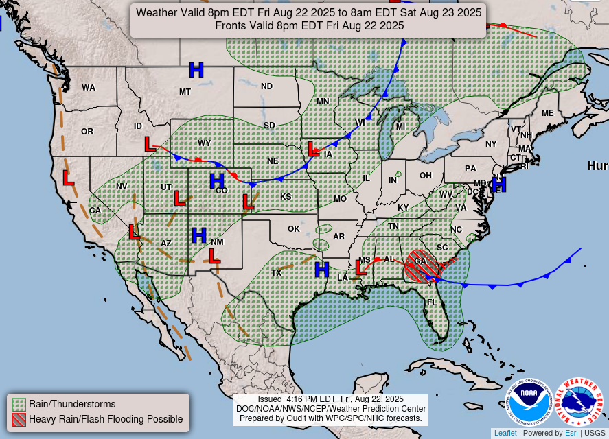
Weather forecast maps from NOAA's Weather Prediction Center
https://www.wpc.ncep.noaa.gov/#page=ovw
Days 1, 2, 3 below. Save the links that I provide at Marketforum to use in the future!
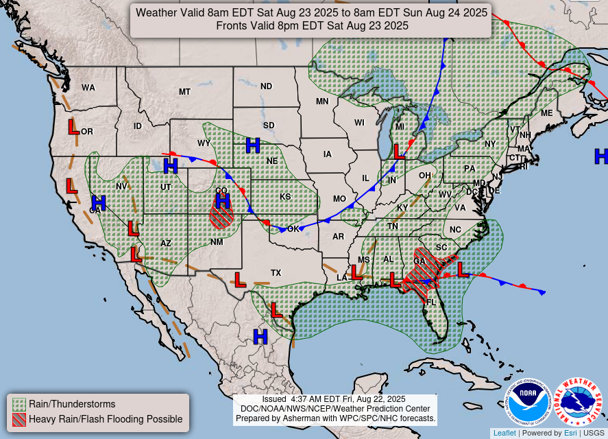
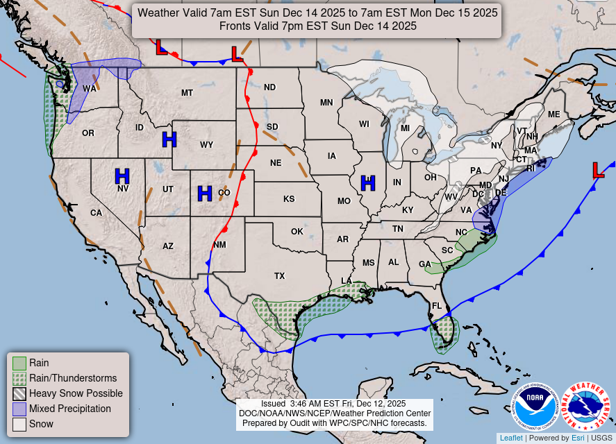
Snowfall the last 48 hours. Snow from the first system dried up as it headed southeast.
https://weatherstreet.com/weather-forecast/Snow-Depth-US.htm

TOTAL SNOW IN THE COUNTRY BELOW
| |||
| |