Unlike the last 2 weeks, that were no brainer substantial deterioration in the C and S predictions, well before the release on Monday at 3pm, this one will be mixed.
Let's look at the maps defining the factors/elements that effected the crops.
The areas below that got no rain last week, also got no rain for the last month. Conditions WILL drop in all those locations. That includes the southwest cornbelt back to TX.
However, there was a 400 mile wide swath of glorious rains from MT, across ND/SD/NE, then southeast across the core of the Corn and Bean belt, including IA, IL, IN and OH.....key producers.
Not everybody got rain in that swath(c.In and mcfarm missed) but by July standards this was an unusually wet week with some places getting several inches+ of rain.
My guess is that alot of the crop in those spots will bounce up 1 or even 2 categories with 2+ inches. Those that got .5 inches may stay the same. No rain and they drop a category.
The crop was/is pollinating in many of those places, so it was perfectly timed!
https://release.nass.usda.gov/reports/prog2822.txt
We got over 1.3 inches in the southwest corner of IN. I haven't driven around to see the crops but know they must all be looking good, maybe some being excellent.
https://water.weather.gov/precip/
Rains the last 7 days
The last 14 days below

Rains the last month below

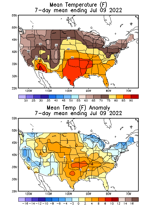
There was widespread heat in much of the belt.
Where it rained 1"+, this didn't matter that much.
However, if it rained LESS than .5, the rains were not enough to offset the heat.
Areas that received no rains in the southwest belt to TX were severely punished with very adverse hot/dry and WILL have drops, some big drops in OK, AR and eastern TX/southern MO.

USDA crop ratings: