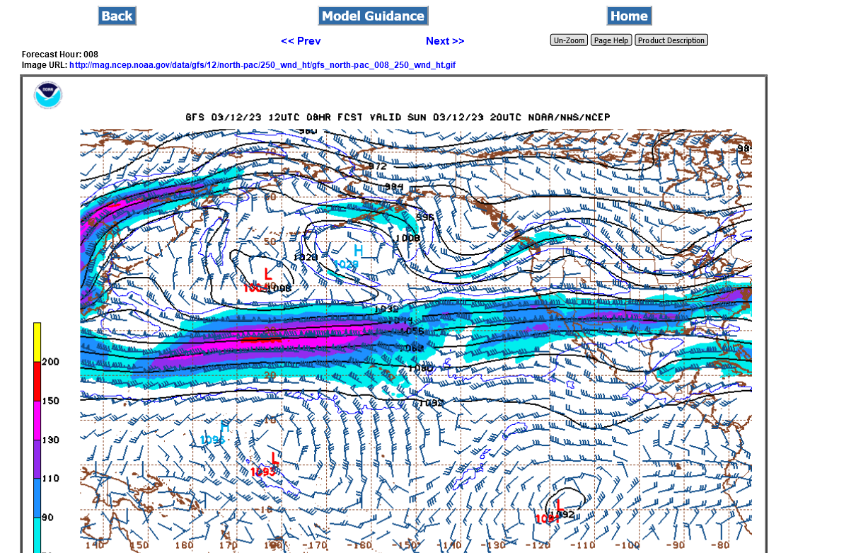
250 mb heights below from the operational 12z GFS-3-12-23 which is around 34,000 feet (around 6.5 miles) up in the atmosphere and also the peak jet steam velocity right now.
The current 150 knot jet max isotach(shades of equal wind) in red below, is the equivalent of 180+ mph. It's part of an atmospheric river aimed at the West Coast. This is very typical during an El Nino Winter but can happen without El Nino.
The stronger the jet stream, the greater the lift that it provides to air below. Rising air is what leads to falling surface pressure(and increasing pressure gradients that cause wind), condensation aloft into clouds/precip.
https://mag.ncep.noaa.gov/Image.php

This jet stream is a classical El Nino Jet stream:
https://www.weather.gov/jetstream/enso_impacts

https://www.wbbjtv.com/2022/02/15/how-does-the-jet-stream-correlate-with-severe-weather-season/

This guy is THE BEST!
| The 300 / 200 MB CHART |
METEOROLOGIST JEFF HABY
https://www.weather.gov/source/zhu/ZHU_Training_Page/winds/JetStream_Stuff/300_200_chart.htm
Get all of Jeff's hundreds of awesome meteorology enlightening discussions here:
HABY'S WEATHER FORECASTING HINTS
Get all the constantly updated, comprehensive weather maps here:
https://www.youtube.com/watch?v=dqFyN_nCs-s