
Here comes STS Don very soon way out in the middle of the Atlantic! That will make 5 storms already! No hurricanes yet, however.
Tropical Weather Outlook
NWS National Hurricane Center Miami FL
200 AM EDT Fri Jul 14 2023
For the North Atlantic...Caribbean Sea and the Gulf of Mexico:
1. Central Atlantic (AL94):
Satellite data indicate that the area of low pressure located about
1000 miles west-southwest of the Azores is producing a large area of
gale-force winds on its east side. In addition, the thunderstorm
activity has remained organized near the center during the past
several hours. If current trends continue, advisories could be
initiated on a subtropical storm later this morning while it
meanders over the central Atlantic. By the weekend, the low should
turn northward, bringing the system over cooler waters and into a
drier airmass potentially limiting further development. Additional
information on this system, including storm warnings, can be found
in High Seas Forecasts, issued by the National Weather Service.
* Formation chance through 48 hours...high...90 percent.
* Formation chance through 7 days...high...90 percent.
Just a reminder of where everybody stands in your hurricane forecasting contest:
Mktfrm 2023 Atlantic Hurricane Season Forecast Contest: deadline *6/4/23* 30 responses |
Started by WxFollower - May 31, 2023, 4:07 p.m.
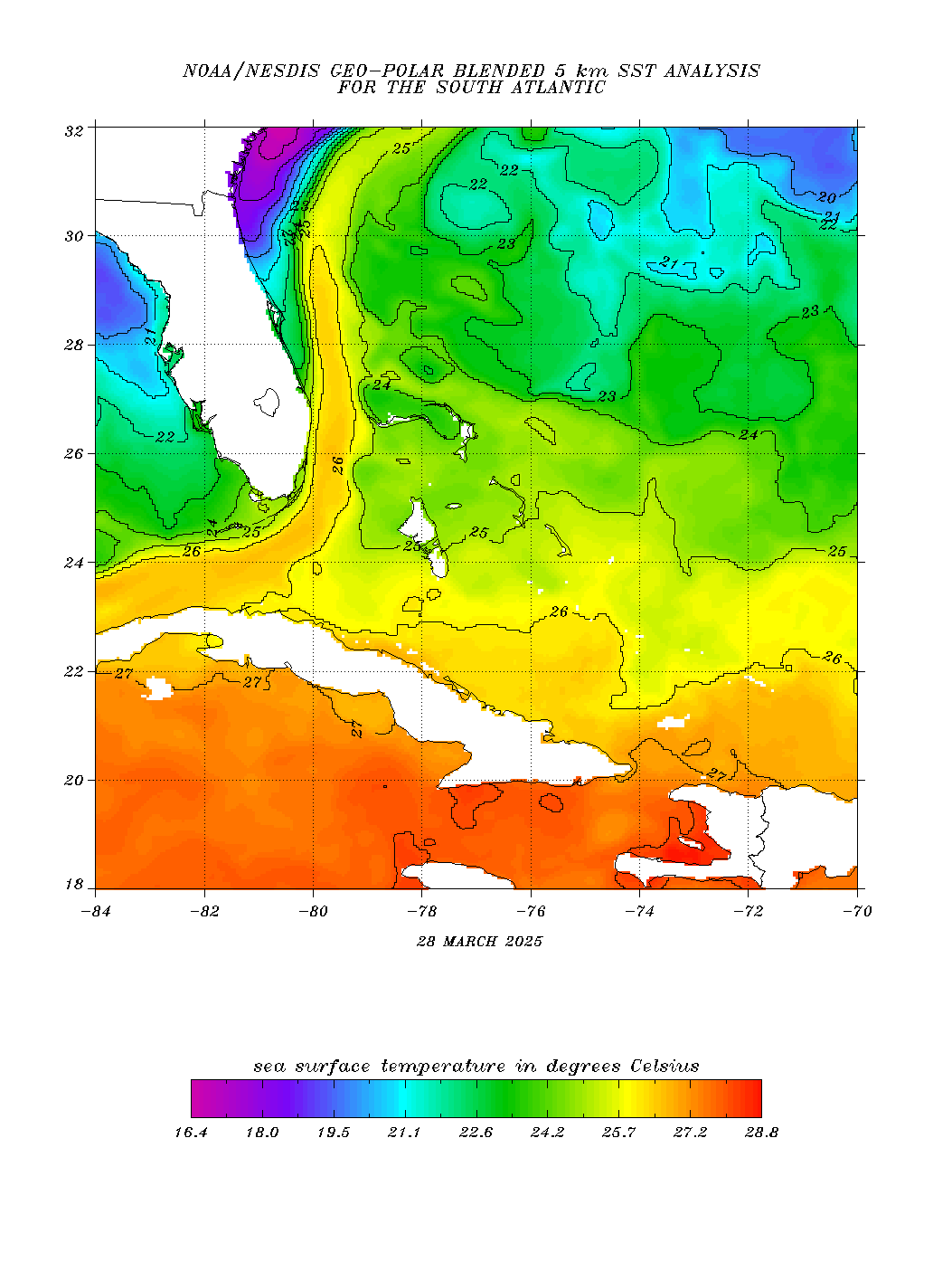
Lot's of attention going to these record warm temps in the Atlantic
https://www.ospo.noaa.gov/Products/ocean/sst/contour/
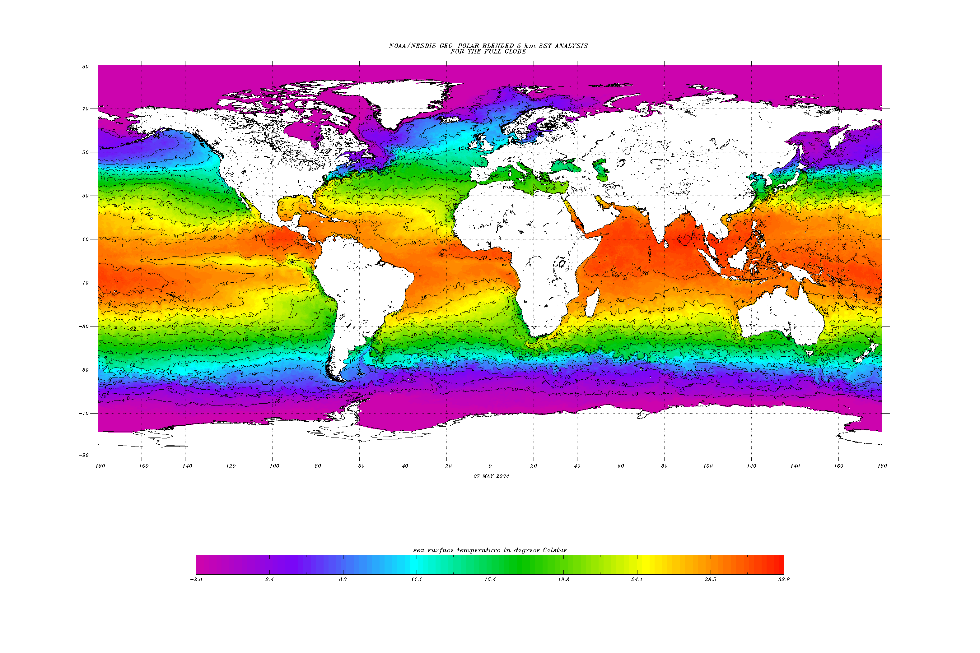
Up around 90 off the Florida Coast! WOW!
https://www.ospo.noaa.gov/data/sst/contour/satlanti.c.gif
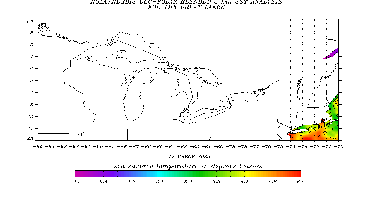
https://www.ospo.noaa.gov/data/sst/contour/gulfmex.c.gif
Subtropical storm Don:
Larry, thanks For bringing this up. Don won’t amount to much but I still wouldn’t know about it if not for your post!
https://www.nhc.noaa.gov/graphics_at5.shtml?start#contents

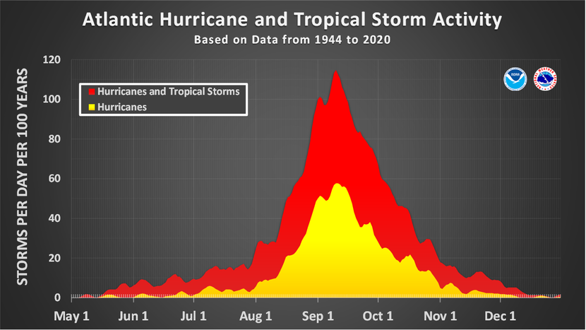
Don is the 5th storm of the season.
The average 5th storm occurs on August 22nd.
https://www.nhc.noaa.gov/climo/
| Number | Named systems | Hurricanes | Major Hurricanes |
|---|---|---|---|
| 1 | Jun 20 | Aug 11 | Sep 1 |
| 2 | Jul 17 | Aug 26 | Sep 19 |
| 3 | Aug 3 | Sep 7 | Oct 28 |
| 4 | Aug 15 | Sep 16 | - |
| 5 | Aug 22 | Sep 28 | - |
| 6 | Aug 29 | Oct 15 | - |
| 7 | Sep 3 | Nov 15 | - |
| 8 | Sep 9 | - | - |
| 9 | Sep 16 | - | - |
| 10 | Sep 22 | - | - |
| 11 | Oct 2 | - | - |
| 12 | Oct 11 | - | - |
| 13 | Oct 25 | - | - |
| 14 | Nov 19 | - | - |
I think that Don is the 4th named storm.
What might be causing these warm Atlantic temps?
Are there El Ninos and such in the Atlantic? I hear reference to the Pacific when La Nina and El Nino are discussed.
John
CUTWORM ~ THERE WAS A VERY LATE ONE, LAST YEAR THAT WAS "OUT OF SEASON", SOOOOOOO... IT'S COUNTED FOR THIS SEASON.
IT'S ON THE ORIGINAL POST LARRY STARTED https://www.marketforum.com/forum/topic/95746/
The subtropical storm that already occurred in January will count in the tropical storm tally. So, please incorporate 1/0/0 in your predictions.
Thanks cutworm,
I forgot to add this:
For Larry's contest, we are counting this as the first storm and Arlene as the 2nd storm.
https://www.marketforum.com/forum/topic/95746/
However, after thinking about your point/post, for this metric that first storm shouldn't matter because the stats below are based on the traditional hurricane season and what happened in January is outside of that.
So this is a wonderful point and I'll adjust the original post.
+++++++++++++++
Don is the 4th storm of the traditional hurricane season.
The average 4th storm occurs on August 15th.
https://www.nhc.noaa.gov/climo/
| Number | Named systems | Hurricanes | Major Hurricanes |
|---|---|---|---|
| 1 | Jun 20 | Aug 11 | Sep 1 |
| 2 | Jul 17 | Aug 26 | Sep 19 |
| 3 | Aug 3 | Sep 7 | Oct 28 |
| 4 | Aug 15 | Sep 16 | - |
| 5 | Aug 22 | Sep 28 | - |
| 6 | Aug 29 | Oct 15 | - |
| 7 | Sep 3 | Nov 15 | - |
| 8 | Sep 9 | - | - |
| 9 | Sep 16 | - | - |
| 10 | Sep 22 | - | - |
| 11 | Oct 2 | - | - |
| 12 | Oct 11 | - | - |
| 13 | Oct 25 | - | - |
| 14 | Nov 19 | - | - |

Mike may want to answer this. But I read that the record warm for June Atlantic tropical sea surface temperatures were due to a combo of record low for June Saharan Air Layer (allows stronger sunlight to reach sea), recent strong AMO (Atlantic hurricane multidecadal oscillation in warm phase now), and overall global warming (highest on record world oceans).
WHY HAVE THE PACIFIC WINDS CHANGED DIRECTION... OR, IS IT MY IMAGINATION?
Well, Don, the underdog subtropical storm somewhat unexpectedly eventually transitioned into a tropical storm. But what was really surprising was that it briefly attained hurricane status late yesterday into early last night, the first of the season. Now it has weakened back into a TS.
So, 5/1/0 for the season to date.
Thanks, Larry!
That was interesting:
https://www.nhc.noaa.gov/refresh/graphics_at5+shtml/144646.shtml?swath#contents
![[Image of cumulative wind history]](https://www.nhc.noaa.gov/storm_graphics/AT05/refresh/AL052023_wind_history+png/144646_wind_history.png)
https://www.nhc.noaa.gov/archive/2023/al05/al052023.discus.035.shtml?
Hurricane Don Discussion Number 35 NWS National Hurricane Center Miami FL AL052023 500 PM AST Sat Jul 22 2023
https://www.foxweather.com/weather-news/hurricane-don-2023
Indeed, Mike, the significantly warmer than normal Gulf Stream (just about everywhere in the Atlantic is warmer than normal) allowed for temps just over 26C (often a key SST) to be crossed way up near 40N, 50W along with light enough wind shear to allow for it to reach hurricane status.