
 Weather Map
NWS Evansville IN area
https://forecast.weather.gov/MapClick.php?x=291&y=89&site=pah&zmx=&zmy=&map_x=291&map_y=89
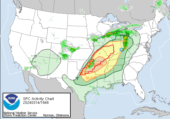
Severe Storm risk is highest around 10pm this evening.
Severe Thunderstorms Possible From Late Afternoon through Late Tonight
Weather.gov > Paducah, KY
Last Map Update: Thu, Mar. 14, 2024 at 2:02:02 pm CDT
Watches, Warnings & Advisories
| Tornado Watch | |||
| Hazardous Weather Outlook | |||

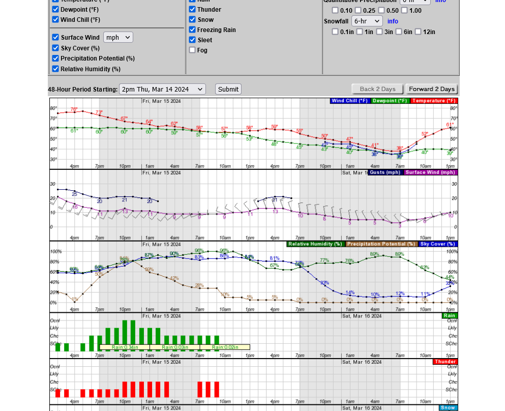
Tracking the rain/storms/advisories:
To see rain amounts, go here: https://www.iweathernet.com/total-rainfall-map-24-hours-to-72-hours
You can scroll down and get almost the entire comprehensive weather picture updated constantly here.
Current Hazards at the link below.
Go to the link below, hit hazards box in the top right hand corner(it will also define all the color codes), if its not already in the hazards mode when you load the link.
Then you can hit any spot on the map, including where you live and it will go to that NWS with all the comprehensive local weather information for that/your county.

New radar product below
Go to: "Select View" then "Local Radar"
Hit the purple circle to see that local radar site
+++++++++++++++++++++++
This link below provides some great data. After going to the link, hit "Mesoanalysis" then, the center of any box for the area that you want, then go to observation on the far left, then surface observations to get constantly updated surface observations or hit another of the dozens of choices.
 Found a great new link/site that shows us how much precip fell(from 1 hr to 72 hours) for different periods to share with you. https://www.iweathernet.com/total-rainfall-map-24-hours-to-72-hours Data Update Cycle: The 1-hr mosaic is updated every 5 min (approx). All other mosaics are now updated hourly, including the 48h and 72h maps. The site does not allow me to copy the actual images/data here, as we do with all the other links above..........so just go to the link! |
Current temperatures:
https://thermastor.com/dew-point-and-weather-maps/

Current Conditions below updated every few minutes.
UPPER MIDWEST
https://www.spc.noaa.gov/exper/mesoanalysis/new/viewsector.php?sector=13#


https://www.spc.noaa.gov/exper/mesoanalysis/new/viewsector.php?sector=13#

LOWER MIDWEST
https://www.spc.noaa.gov/exper/mesoanalysis/new/viewsector.php?sector=20

https://www.spc.noaa.gov/exper/mesoanalysis/new/viewsector.php?sector=20#

https://www.spc.noaa.gov/exper/mesoanalysis/new/viewsector.php?sector=20# 
SOUTHCENTRAL
https://www.spc.noaa.gov/exper/mesoanalysis/new/viewsector.php?sector=15#
SOUTHEAST
https://www.spc.noaa.gov/exper/mesoanalysis/new/viewsector.php?sector=18#

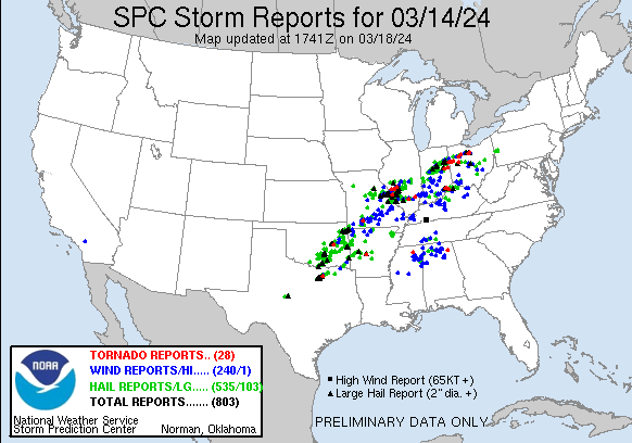
As of 6:15 pm March 14, mostly just high winds and hail.
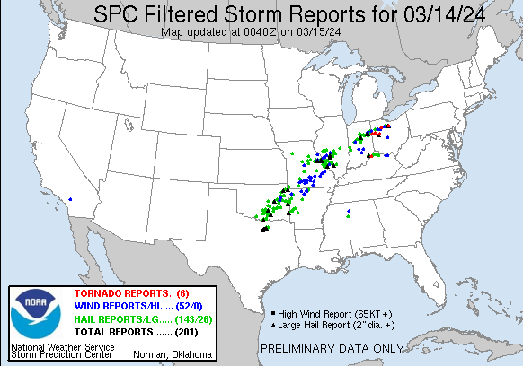
https://www.spc.noaa.gov/climo/reports/today.html
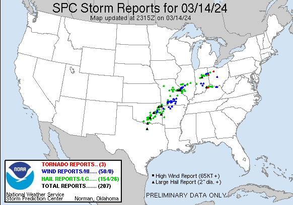
Note all the black triangles! That's hail 2" or greater in diameter. This looks like the greatest threat.
You can go to that link and read about each report.
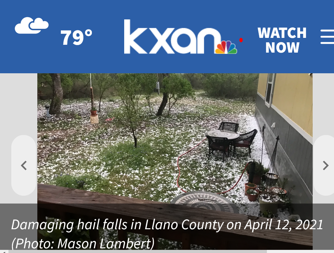
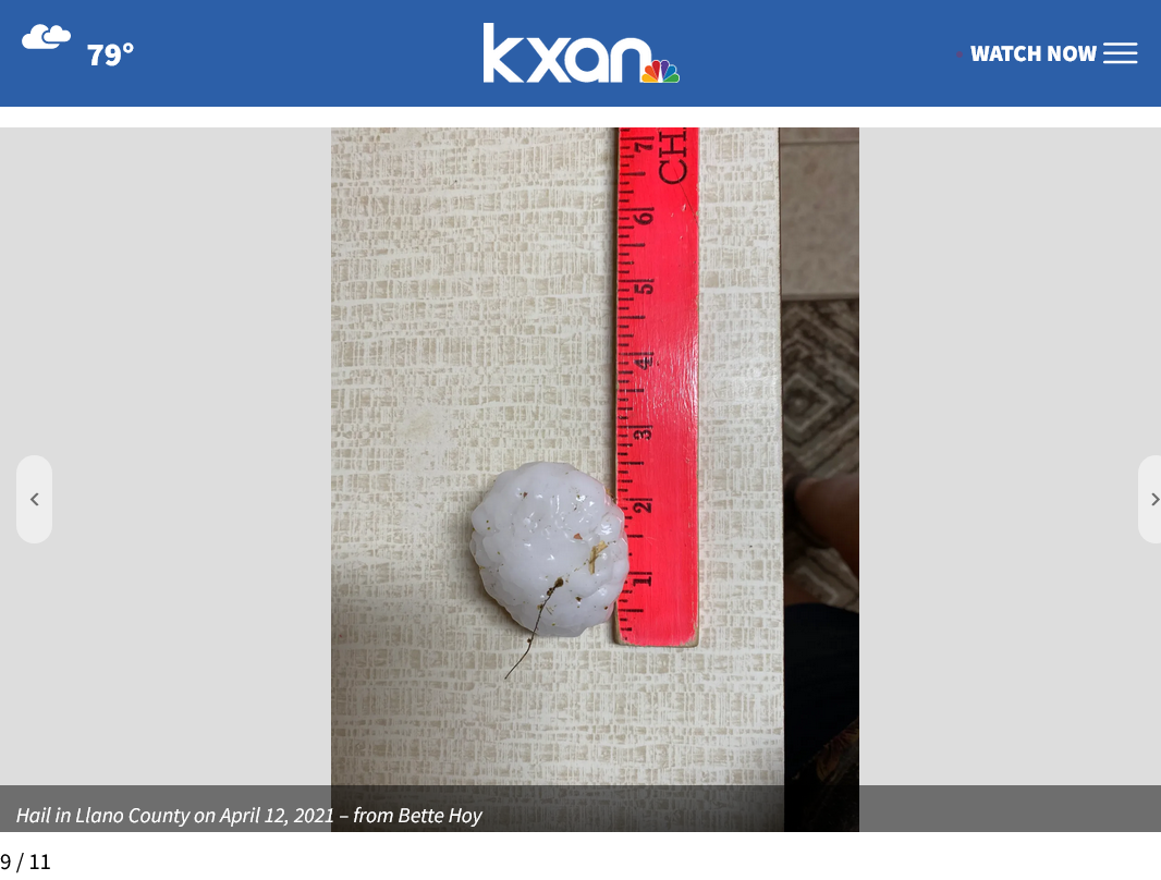
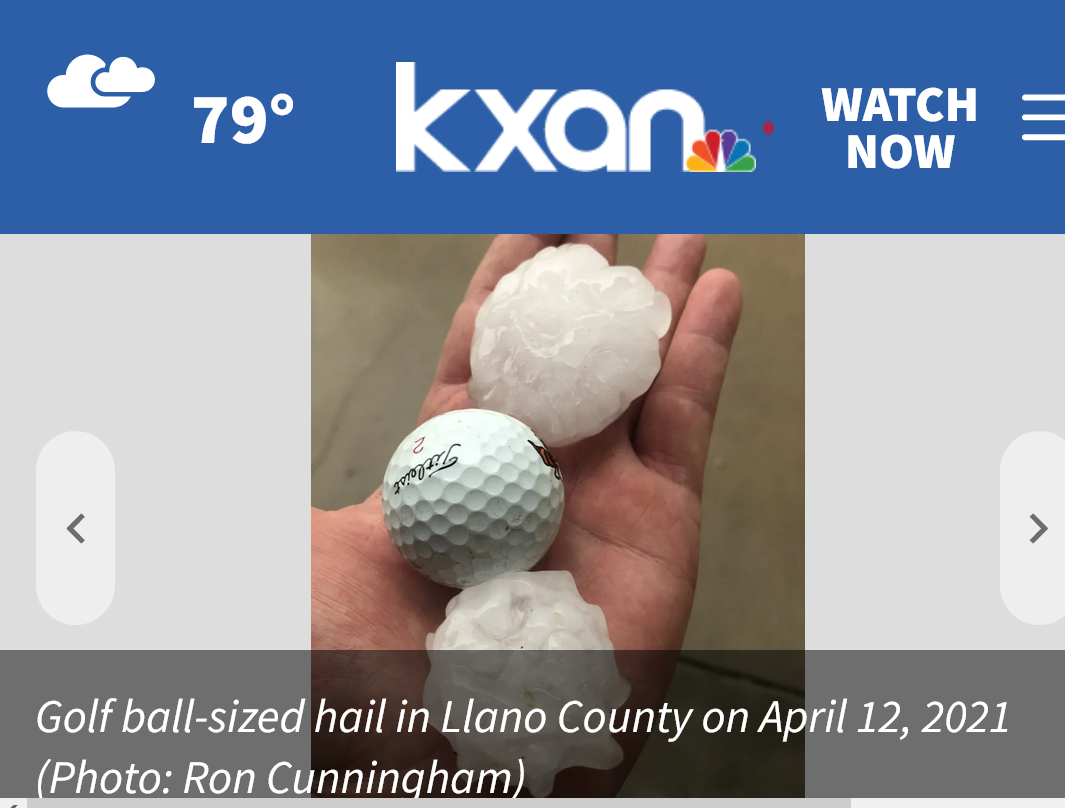
Previous video below, illustrating what 2 inch hail looks like:

Severe weather reports as of 7:40pm Central.
No tornadoes except for the far eastern part of the system. 143 reports of hail/26 of large hail. 52 reports of high winds UNDER 70 mph.
This will NOT be a life threatening event in the Evansville area if you're inside your home, even if not in your safe place. However an isolates WEAK tornado cannot be ruled out here.
Why do I think this:
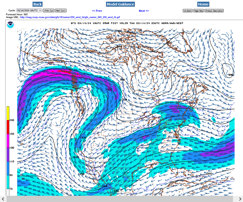
Look at the jet stream. It's just not strong enough to cause widespread violent tornadoes!
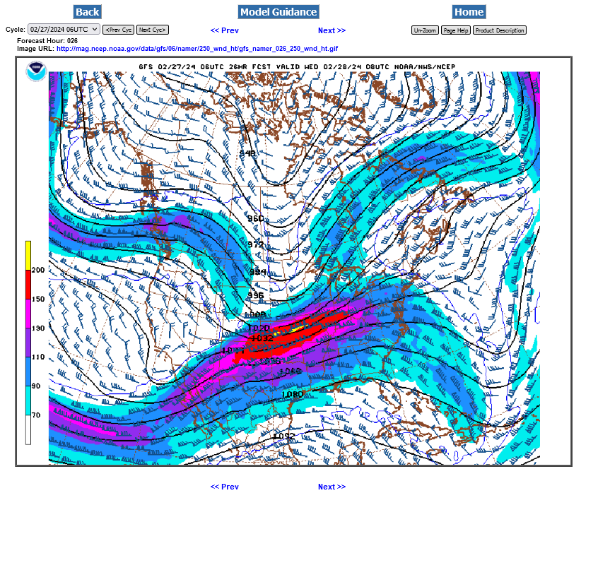
Compare the current jet stream above to the jet stream 2 weeks ago, BELOW when we had an elevated risk and that included an outside chance of a strong tornado.
Fortunately, last time there were some dynamics that didn't come together and that powerful jet stream below was unable to ignite a tornado outbreak or any violent tornadoes.
Colder air aloft on top of more warm humid air is making this one a bigger large hail threat......with the high wind threat but so far, under 70 mph.
Again, that jet stream at the top is limiting strong tornadoes. It's not impossible to get one but that's the LOWEST threat of all of them in this situation.
Radar indicated SEVERE THUNDERSTORM warning, Just after 9pm.
No major widespread reports of anything bad.
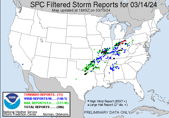
We can see that hail/large hail dominated the storm reports yesterday because of the vertical temperature profile in the atmosphere =227/45
A dozen WEAK tornadoes =11
I NEED TO ADD THAT A COUPLE OF THOSE TORNADOES IN OHIO WERE NEAR EF3 STRENGTH AND CAUSED 3 fatalities in a mobile home park.
As shown above/yesterday, during the event, the jet stream was just too weak for a strong tornado outbreak .
There was only 1 wind report greater than 70 mph.
Total storm reports added up to 386 on this FILTERED report. Unfiltered is always much higher.
https://www.spc.noaa.gov/climo/reports/yesterday.html
+++++++++
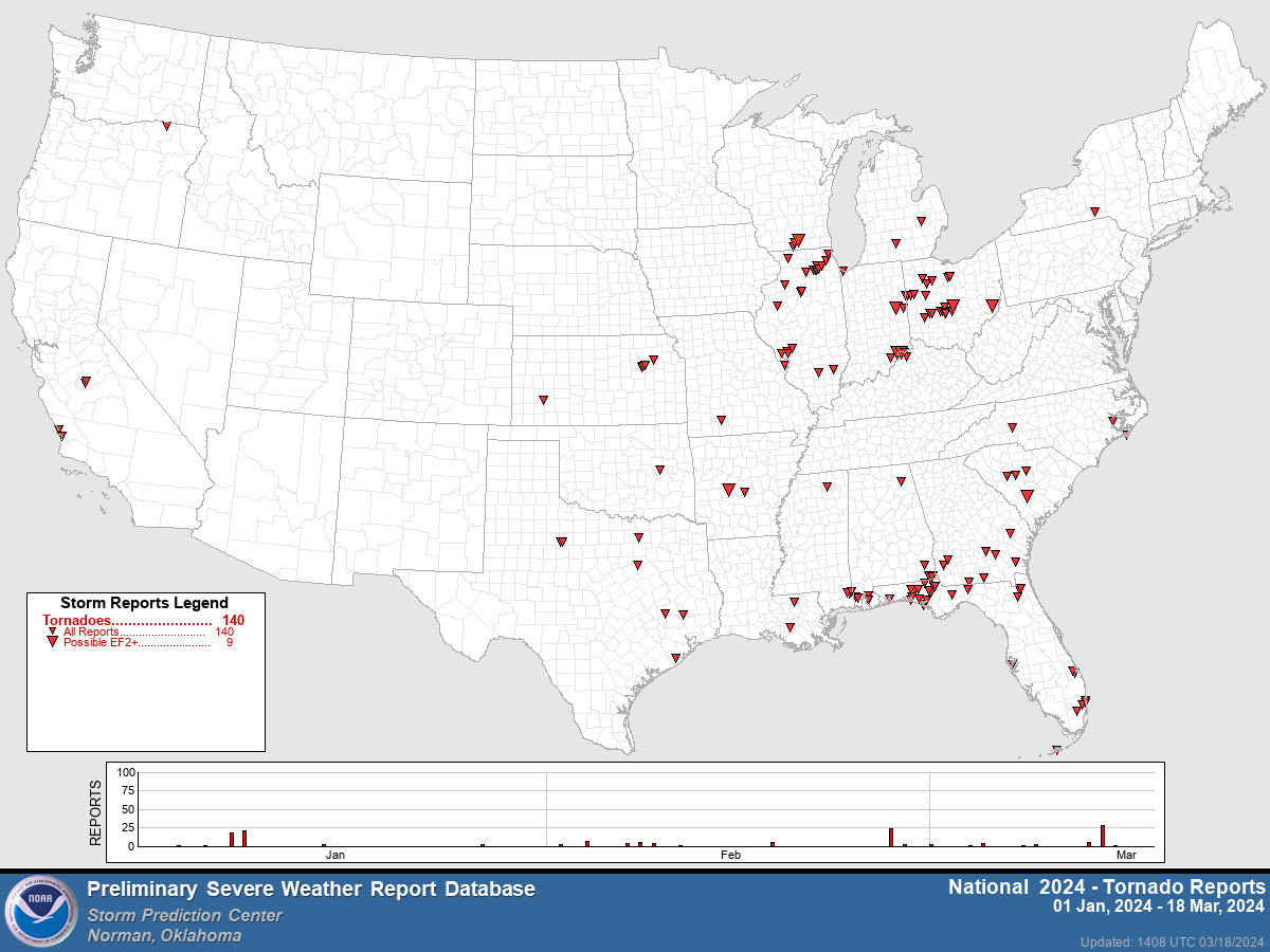
Here are the UNFILTERED reports from the event as on March 18th........MORE THAN DOUBLE!
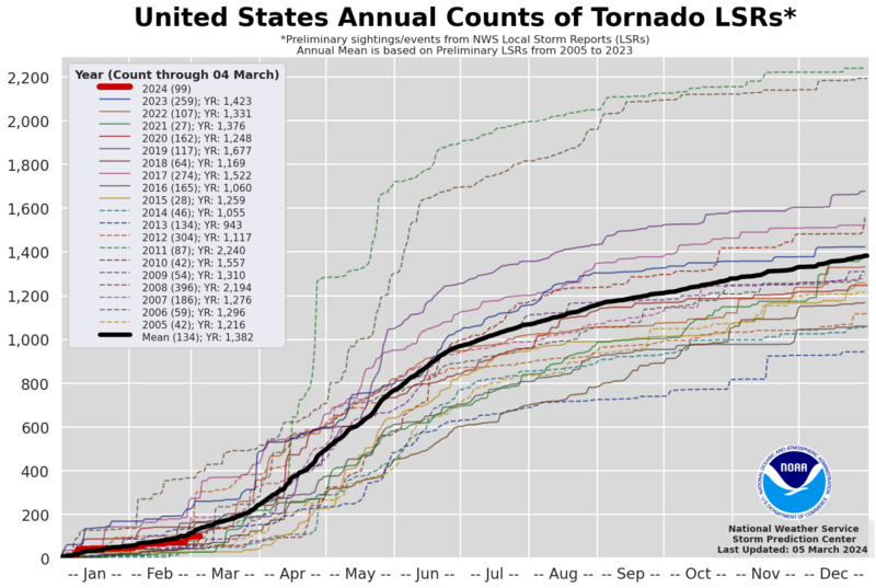
How are we doing so far in 2024 compared to average?
Tornadoes a bit less than the 2005 to 2023 average for early March.
https://en.wikipedia.org/wiki/File:2024_United_States_tornado_LSR_count.png
https://www.spc.noaa.gov/climo/summary/
++++++++++++++++++
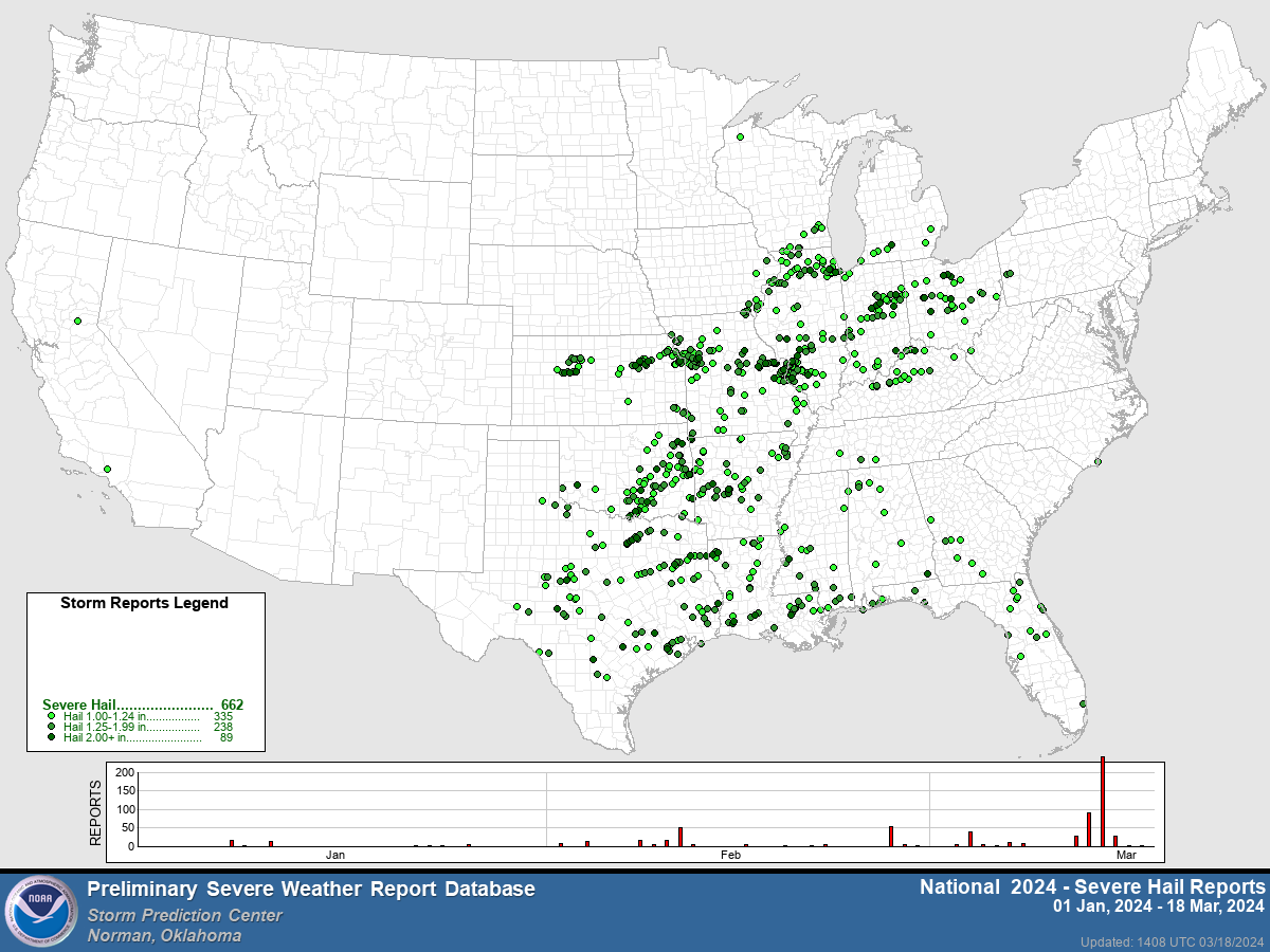
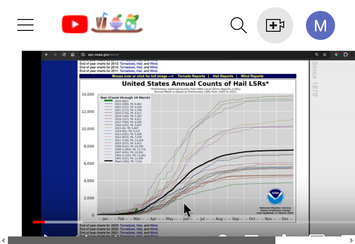
HAIL: Last week was most of it!
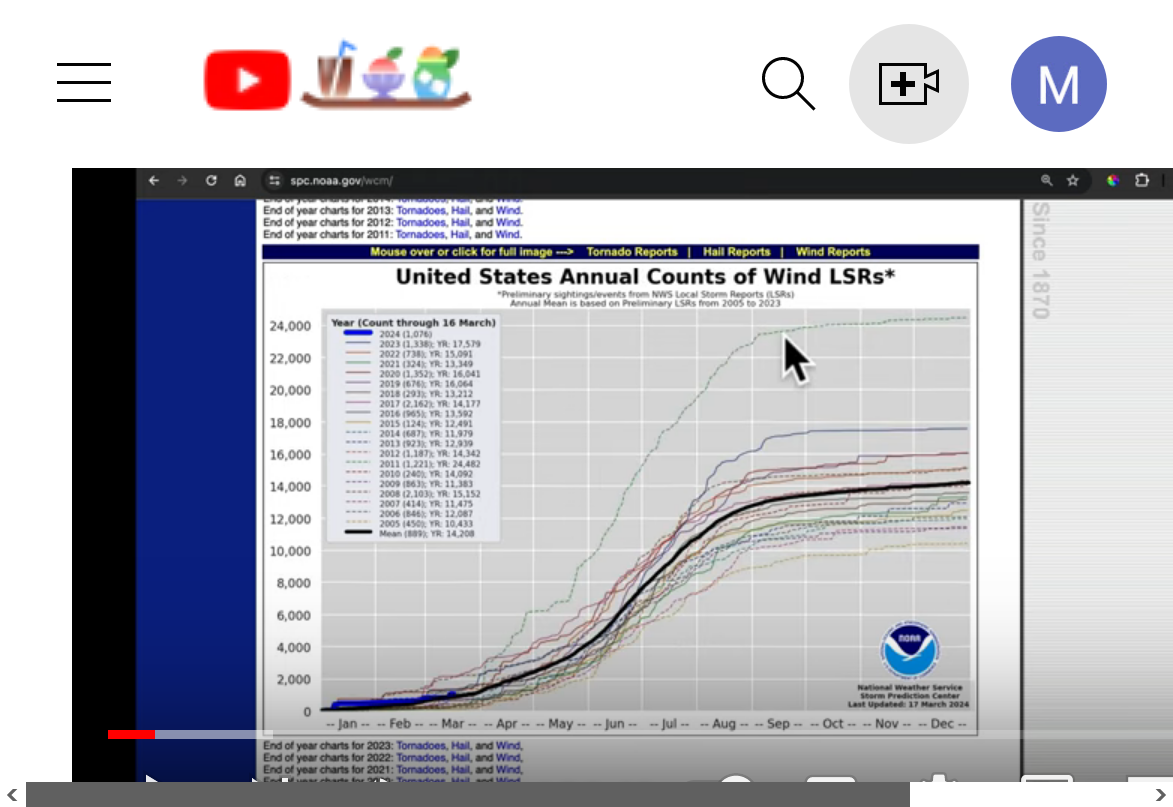
Wind: January event was the biggest contributor:
https://www.spc.noaa.gov/climo/summary/
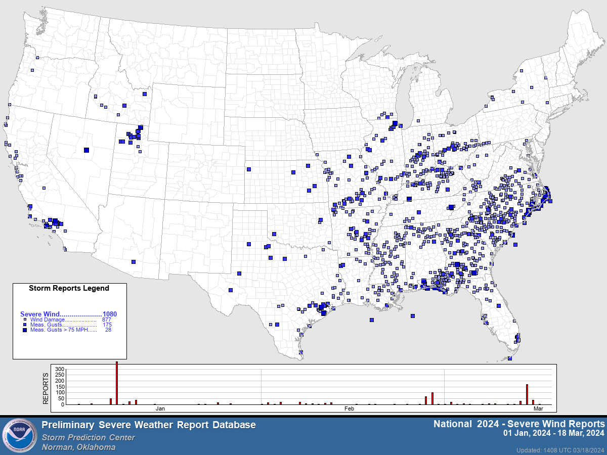
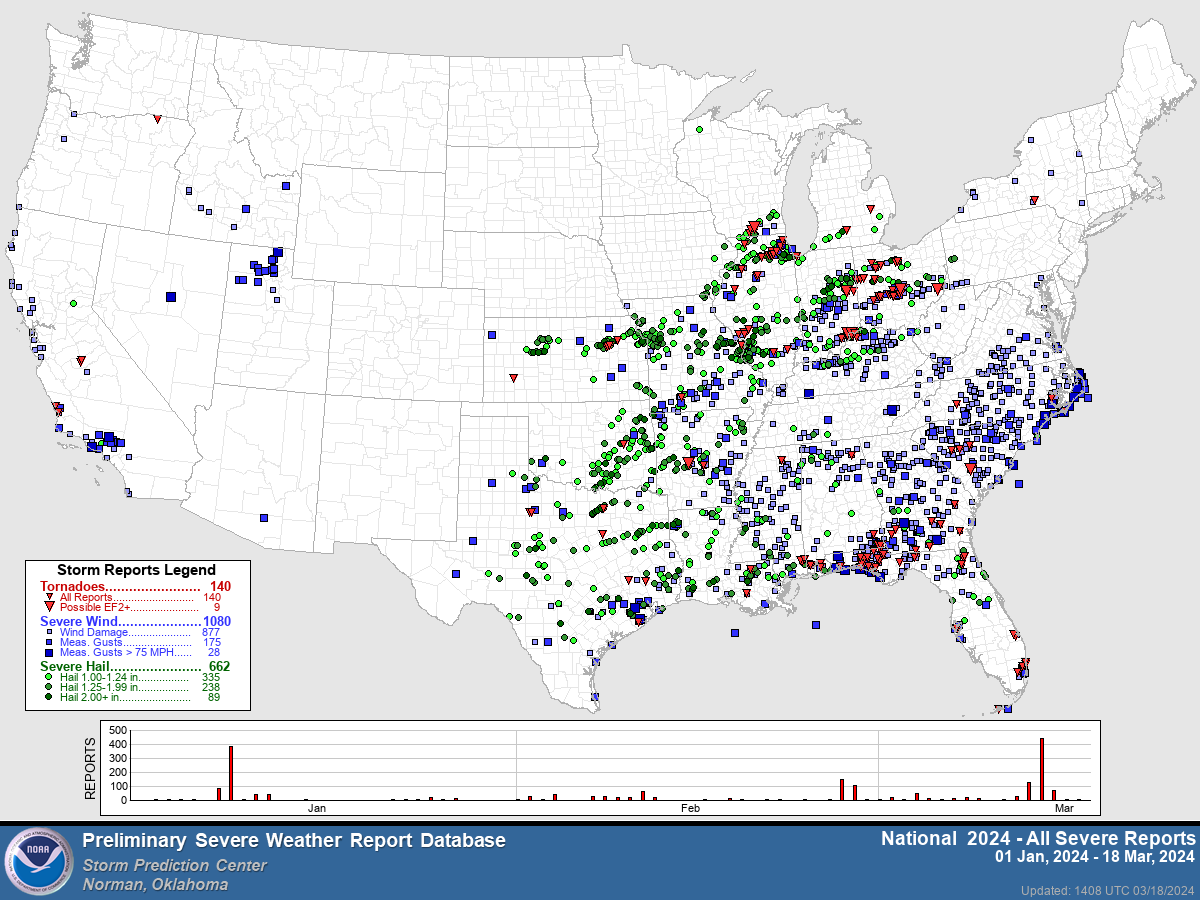
Total severe weather reports for 2024 so far: