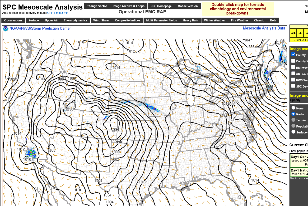
Quite a pressure gradient with this low pressure system which is finally exited into Northeast Canada.
https://www.spc.noaa.gov/exper/mesoanalysis/new/viewsector.php?sector=19&parm=pmsl
That storm lifted into Southeast Canada, followed by an new windbag storm along the Northeast Coast and another one developing in the Plains:
https://www.spc.noaa.gov/exper/mesoanalysis/new/viewsector.php?sector=19&parm=pmsl
Been busy with our huge scholastic chess tournament the past 10 days and not posting as much(as well as our 6 teams competing in the Scholastic Chess of Indiana tournament-4 made it to the state championships on Mar. 22!).
Looks like we'll top 150 students again this year!
Chess Tournament March 8, 2025
Started by metmike - Feb. 23, 2025, 10:18 p.m.
You can get all the comprehensive weather here with most of these maps constantly updated.
https://www.marketforum.com/forum/topic/83844/
More very welcome rains and snows coming to California but look for the MSM to downplay the benefits and sensationalize any flooding. Amounts don't look that heavy:
https://www.marketforum.com/forum/topic/83844/#83848
7 Day Total precipitation below:
http://www.wpc.ncep.noaa.govcdx /qpf/p168i.gif?1530796126

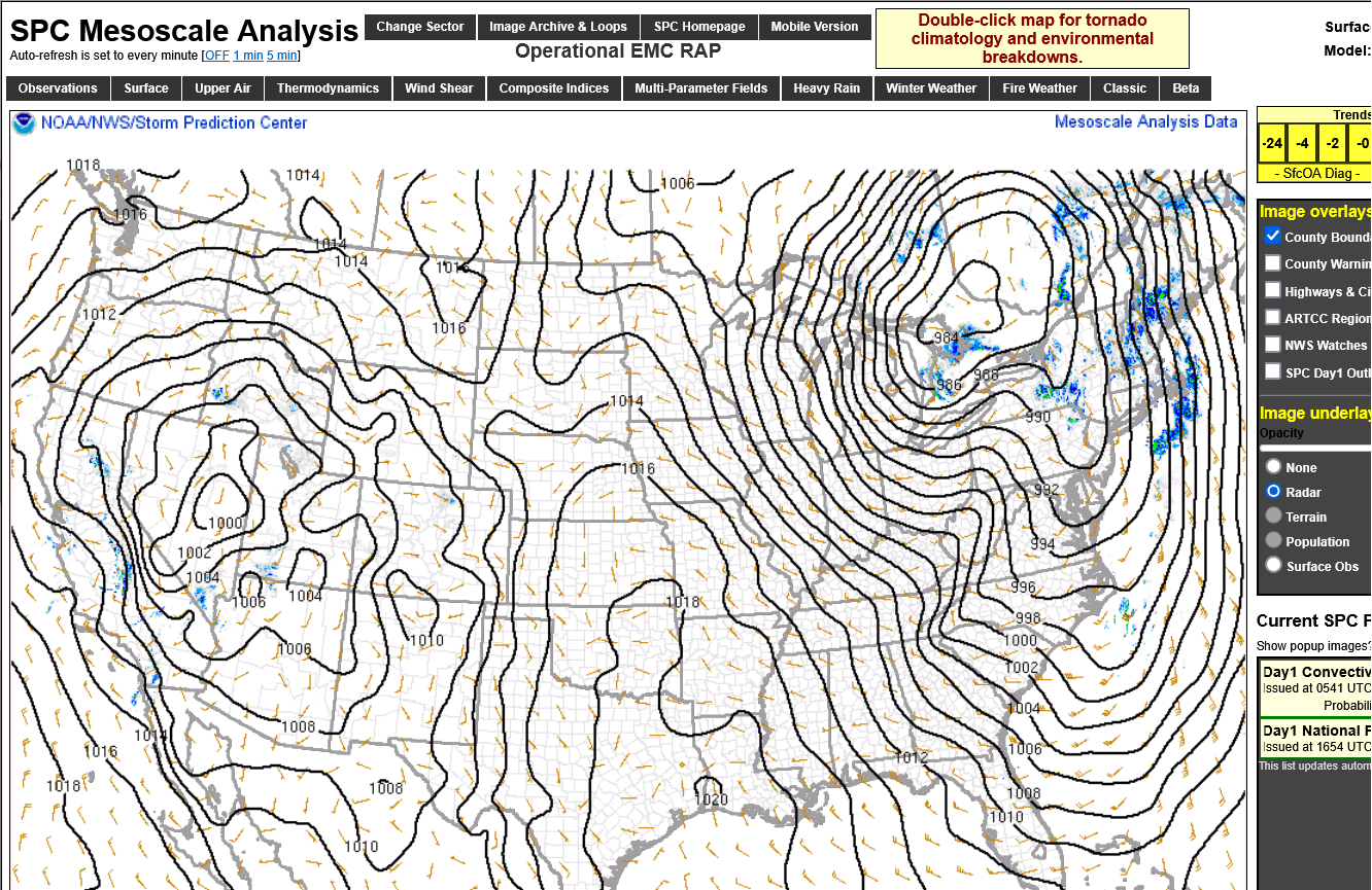
WOW! Look at the pressure/barometer reading in the very far Northeast on Friday morning!
https://www.spc.noaa.gov/exper/mesoanalysis/new/viewsector.php?sector=19&parm=pmsl
Latest, constantly updated map below.
https://www.spc.noaa.gov/exper/mesoanalysis/new/viewsector.php?sector=19&parm=pmsl
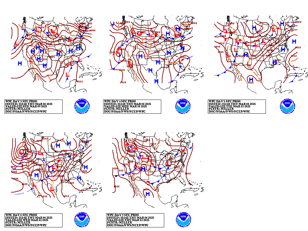
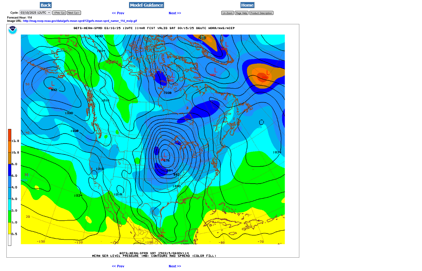
We have a very intense windbag storm coming up this week!
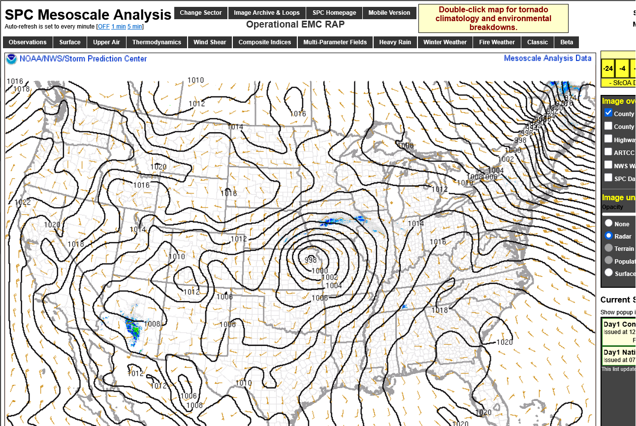
This is the surface map for Friday night from the just updated 114 hour GEFS.
Here's the last 3-7 day forecast from the NWS below:
https://www.marketforum.com/forum/topic/83844/#83848
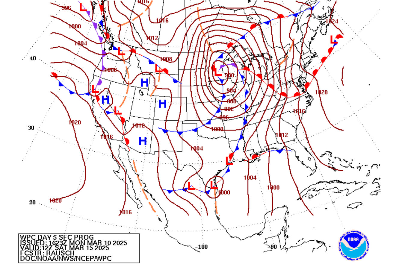
Very early Saturday morning below:
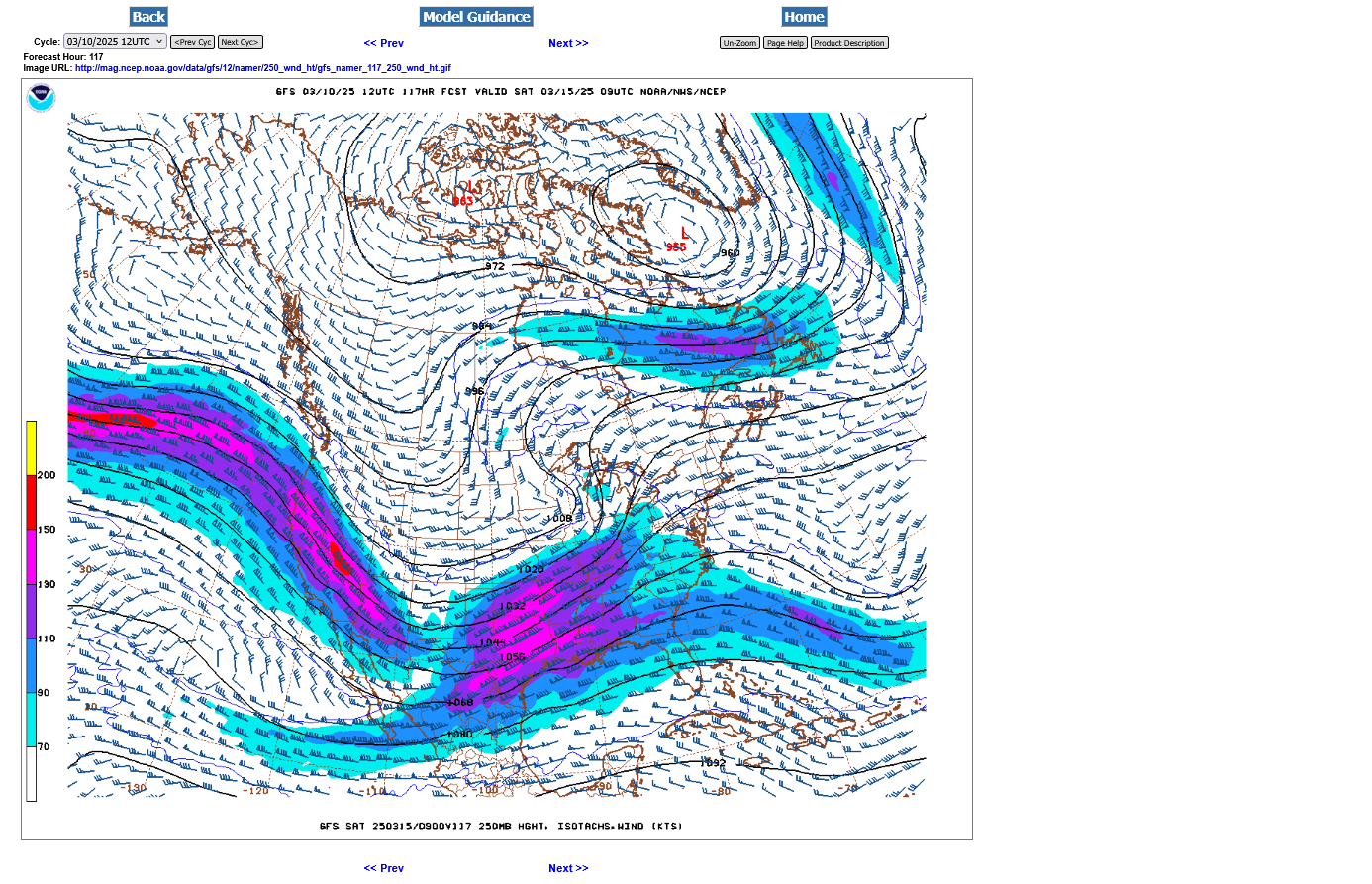
Jet stream at 250 mb below. This is over 32,000 feet up, where the jets fly.
| Level | Standard Height | |
| 1000 MB | 364 ft | 111 m |
| 925 MB | 2498 ft | 762 m |
| 850 MB | 4781 ft | 1458 m |
| 700 MB | 9882 ft | 3013 m |
| 500 MB | 18289 ft | 5576 m |
| 400 MB | 23574 ft | 7187 m |
| 300 MB | 30065 ft | 9166 m |
| 250 MB | 33999 ft | 10366 m |
| 200 MB | 38662 ft | 11787 m |
| [Boqueteweather.com] | ||
This means there WILL BE a regional severe weather outbreak, including tornadoes.
This is the day 5 forecast for Friday morning to early Saturday morning. This will be INCREASED as the time frame to the event shrinks. I am thinking that the Storm Prediction Center will ramp up to at least a moderate risk, which is the 2nd highest level.
The risk for severe weather will be elevated in Evansville late Friday/Friday Night.
https://www.spc.noaa.gov/products/exper/day4-8/#
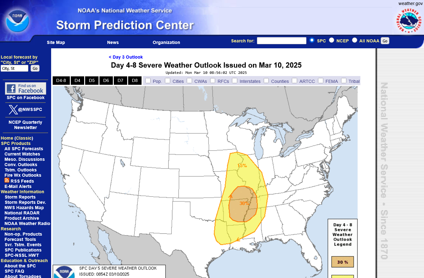
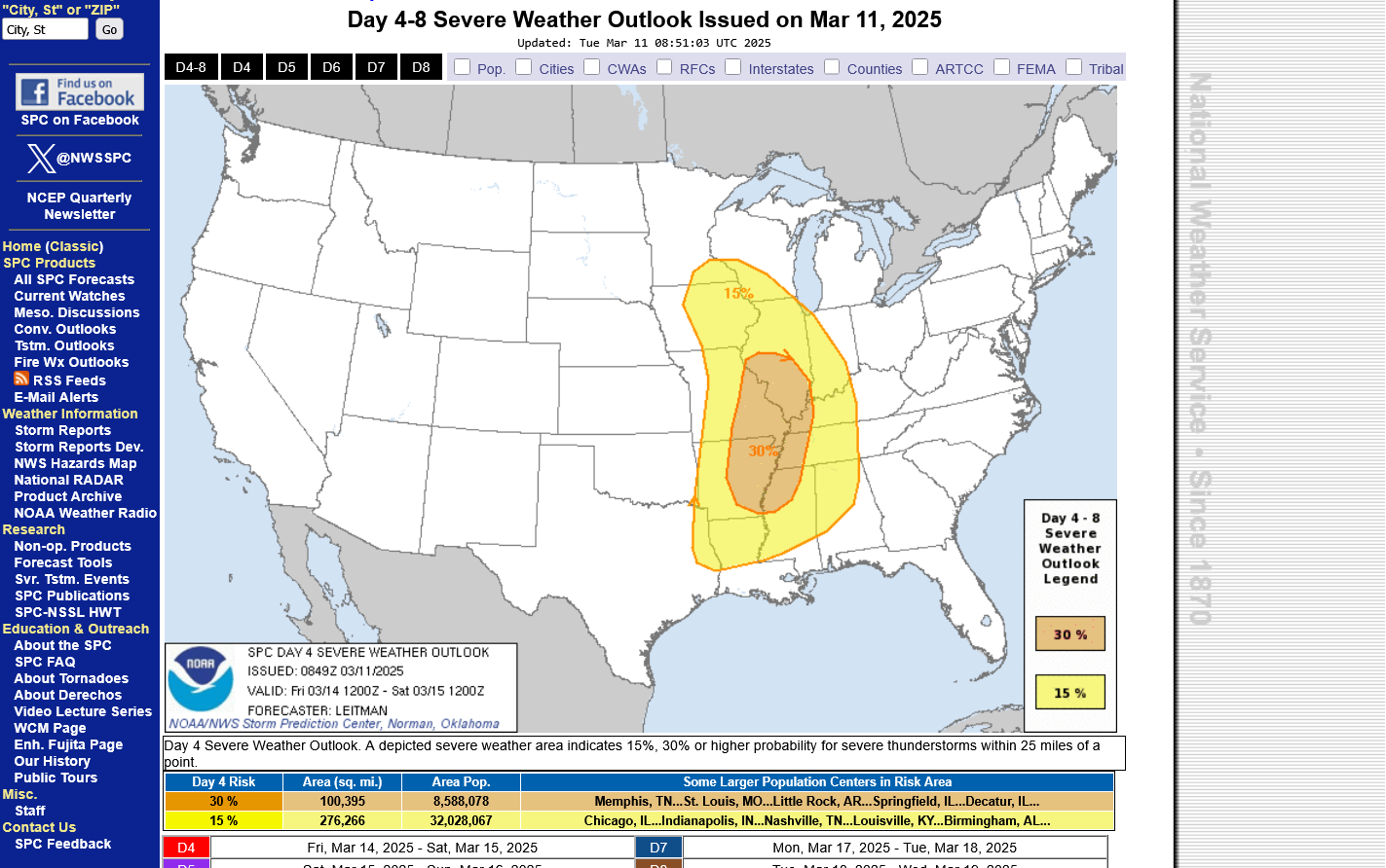
Day 5 yesterday, has become day 4 on Tuesday. As expected, they INCREASED the magnitude of the severe weather threat. 30% is the HIGHEST category that they use at this time frame.
Tomorrow, when the threat moves up to day 3 it will be analyzed on a completely different scale and we will see the severity levels more finely tuned.
https://www.spc.noaa.gov/products/exper/day4-8/#
I'll probably start a new thread on this tonight that starts with this event.