Get all the comprehensive weather here:
https://www.marketforum.com/forum/topic/83844/
At the link below, you should advance to the next day(s).
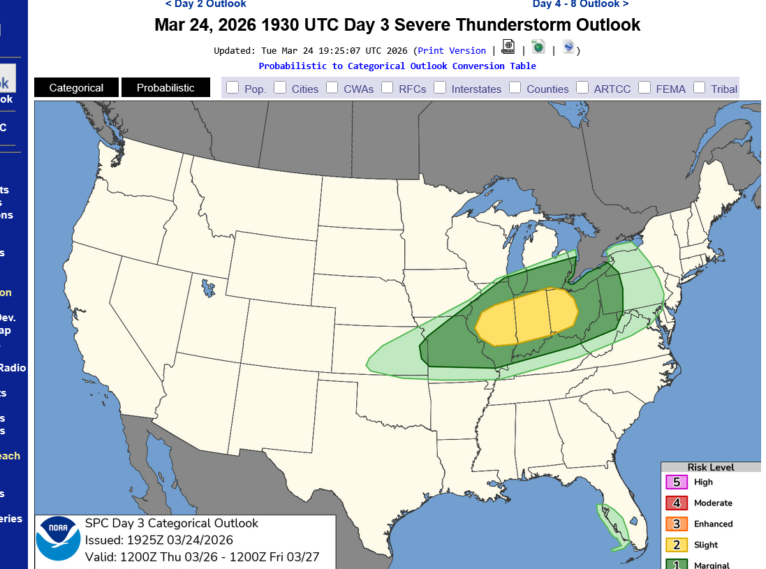
https://www.spc.noaa.gov/products/outlook/day3otlk.html
Previous major severe weather outbreak:
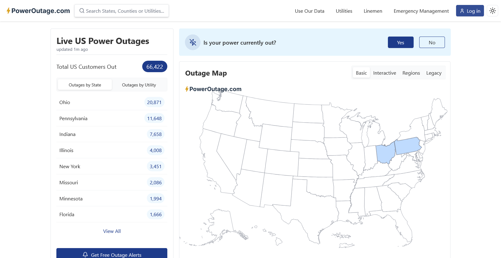
Higher risk severe weather threat 3-15/16-2026
43 responses |
Started by metmike - March 13, 2026, 8:02 p.m.
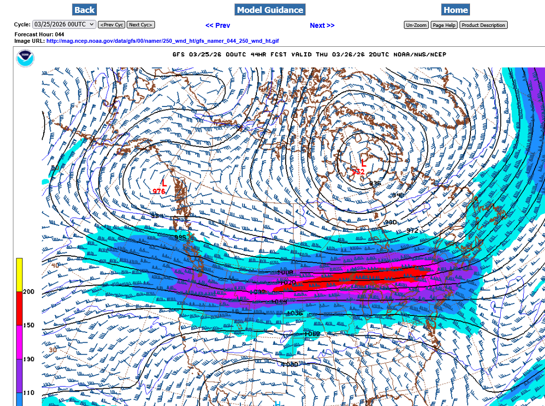
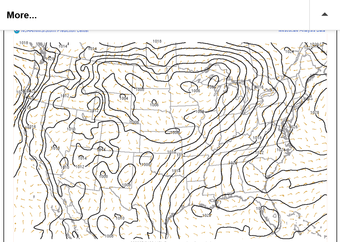
This is a pretty powerful, ZONAL jet stream at 250 mb, 33,000+ feet above the ground late on Thursday. Winds in the jet streak are 160+ knots which is around 185 mph.
The location is too far north to cause a major severe weather out break as far South as the Ohio River.
Some strong storms north of the Ohio River, especially much farther north....YES!
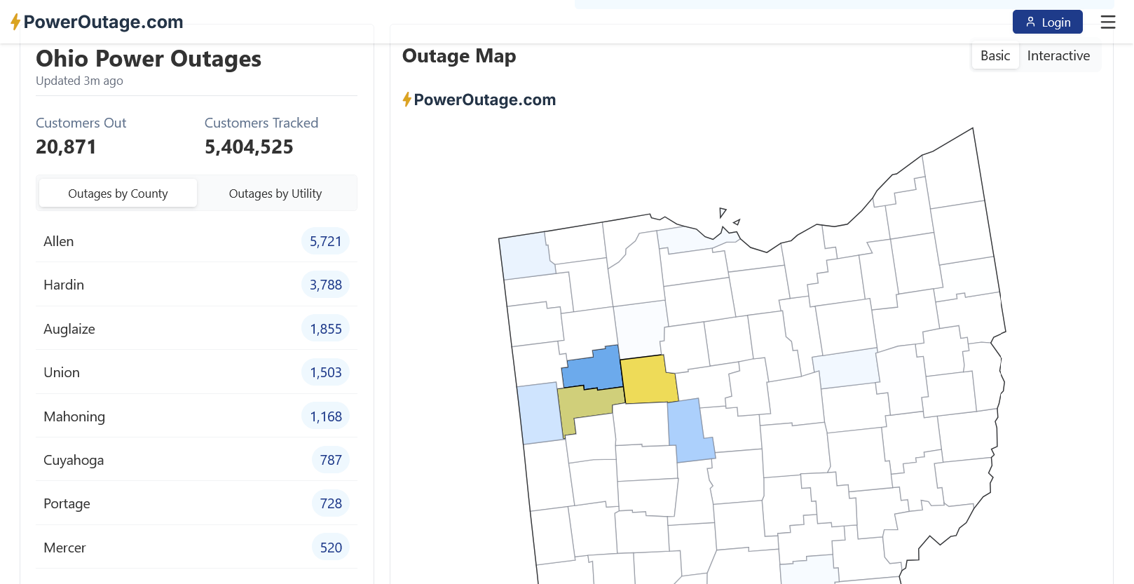
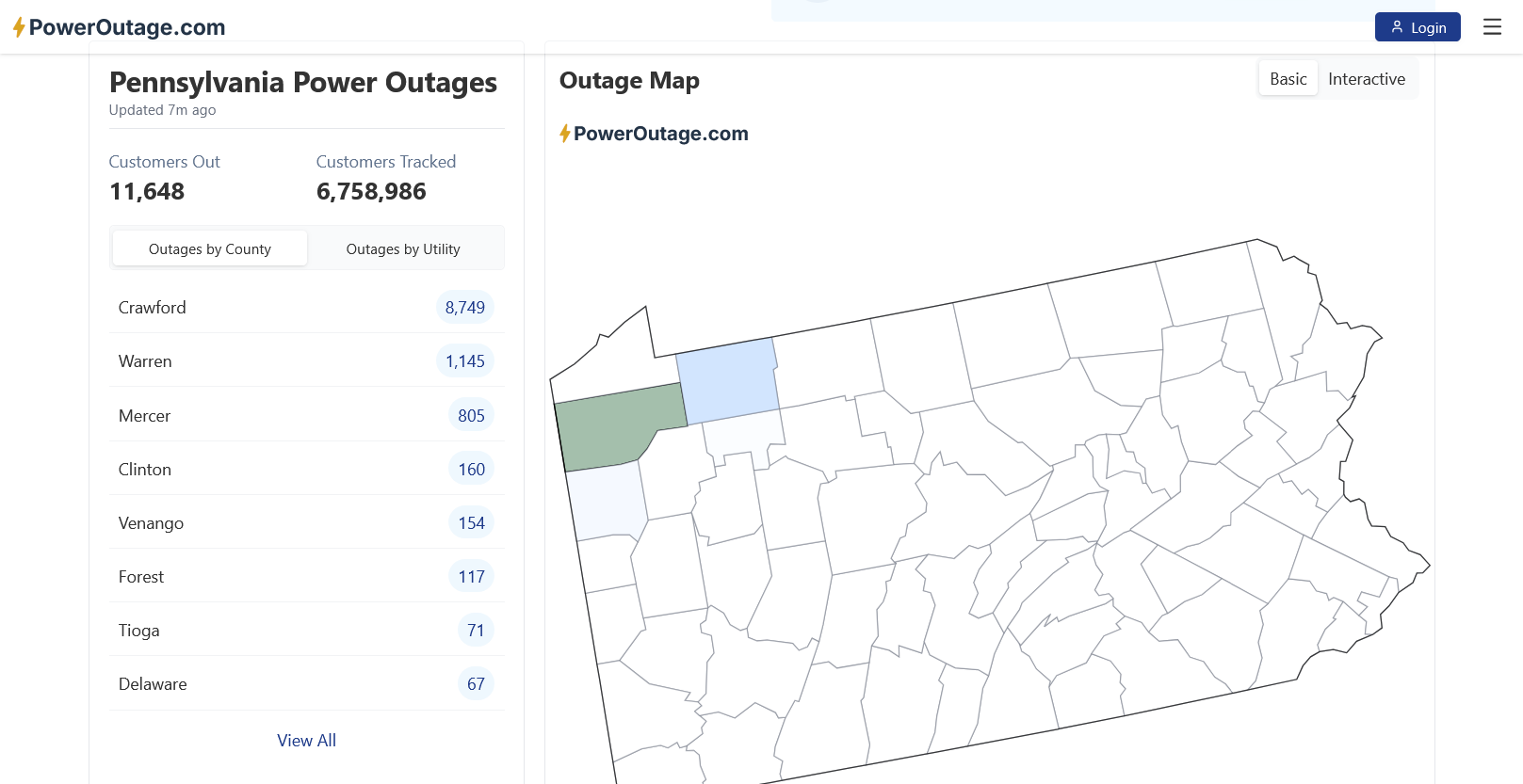
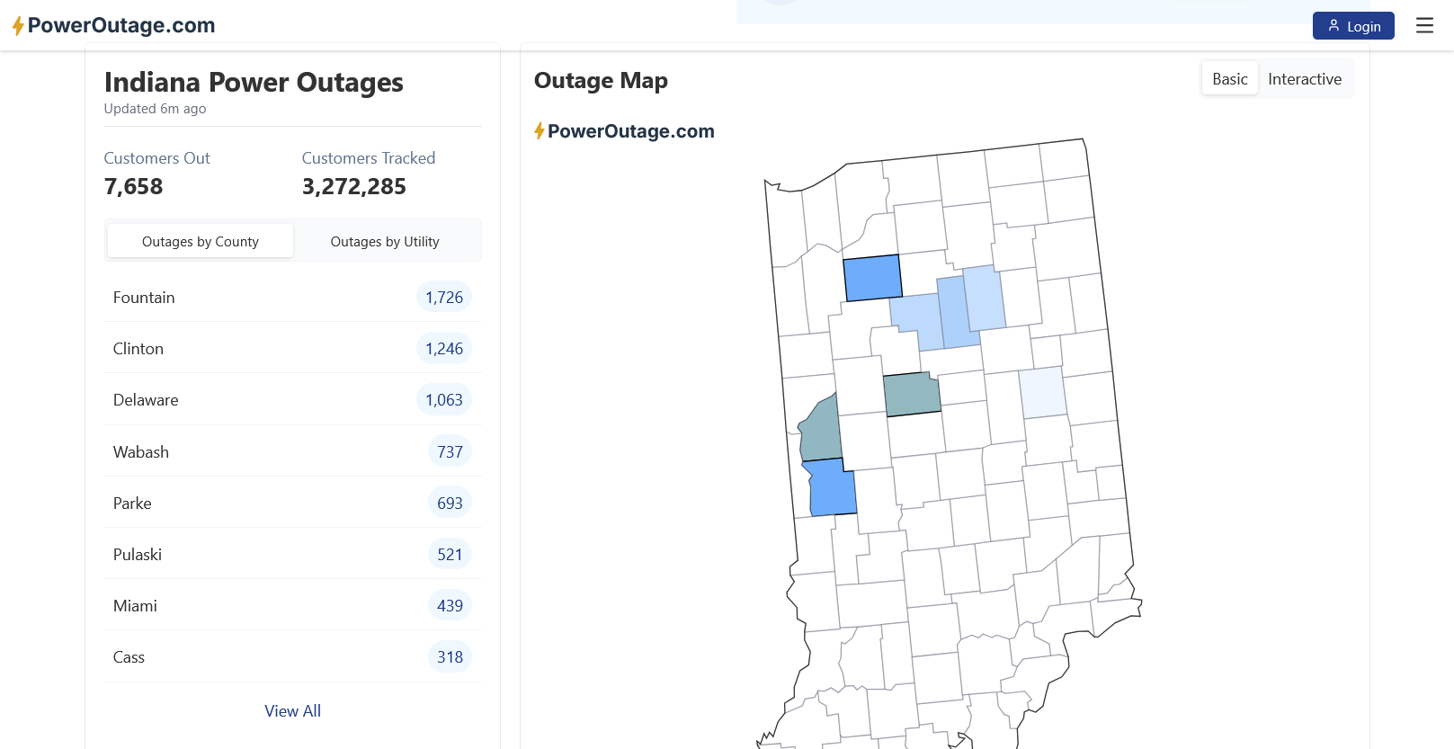
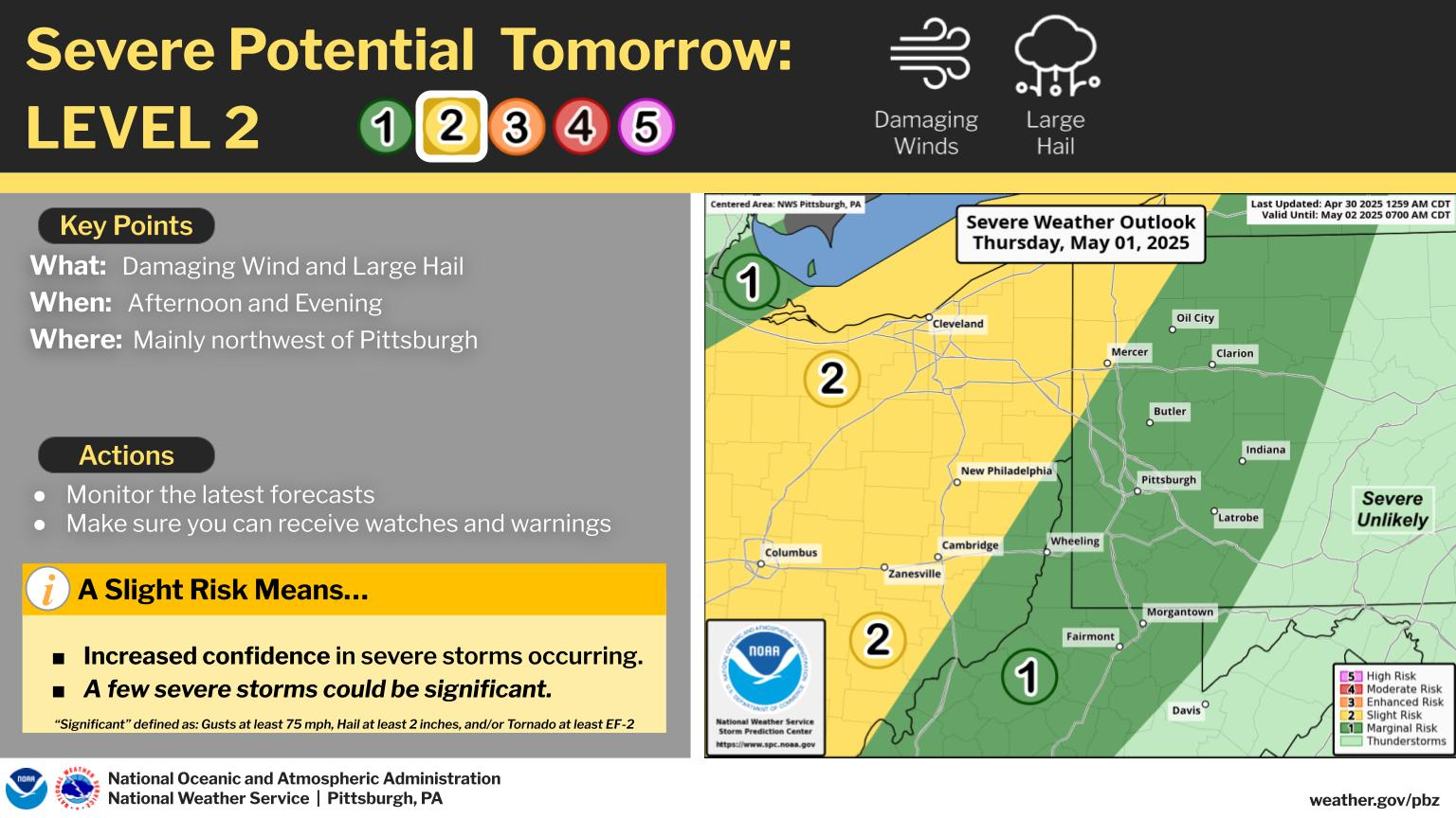
The Storm Prediction Center has just boosted their risk to ELEVATED across northern parts of IL/IN/OH. This is level 3 out of 5, still below moderate. level 4 and high, level 5.
The strength of the jet stream (shown on the previous page) means that strong tornadoes are a possibility. Probably not an outbreak but the type of risk that people under tornado watches tomorrow, especially in the green and brown shades below, should be ready to go to their safest place in case we have tornado warnings.
use this link to go to the right day 1 tomorrow/Thursday.
https://www.spc.noaa.gov/products/outlook/day2otlk.html
1. Categorical risk
2. Risk of a tornado within 25 miles of any 1 point. The brown is 5%+. The hatched area means that the tornadoes could be STRONG.
3. Risk of severe thunderstorm winds within 25 miles of any point. The red shade is 30%. The hatched area means risk that the winds cold be 70+ mph compared to the typical 58+ mph.
4. Risk for hail. The hatched area means it could be LARGE hail. The red shade is 30%.
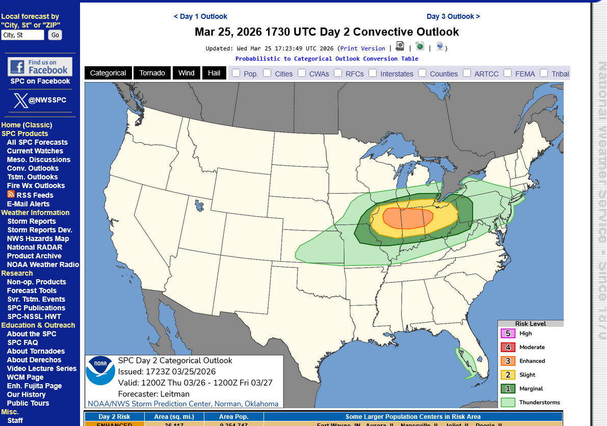

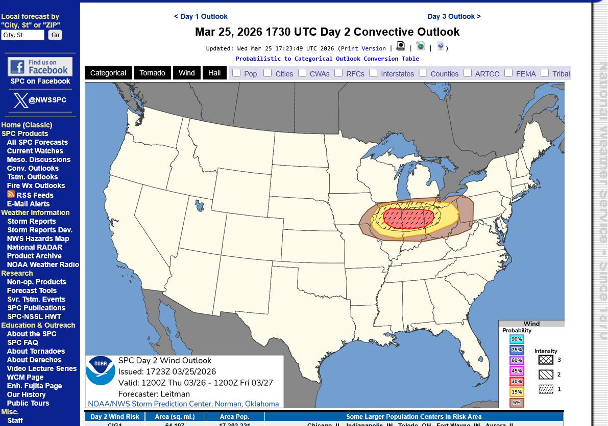
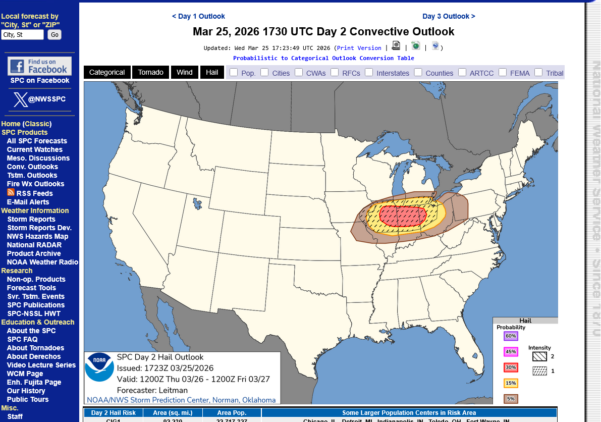
1st map is 4-5pm Wednesday. 2nd map is constantly updated.
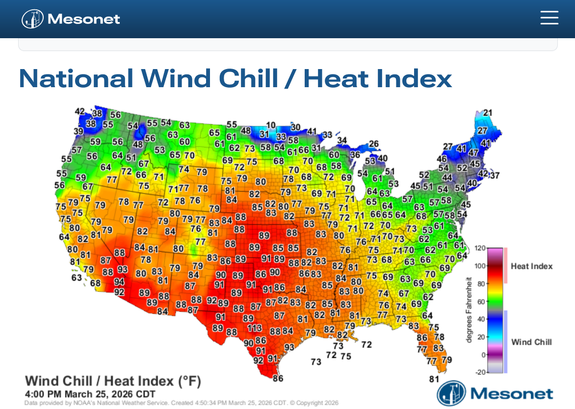
https://www.mesonet.org/weather/air-temperature/national-wind-chill-heat-index
https://thermastor.com/dew-point-and-weather-maps/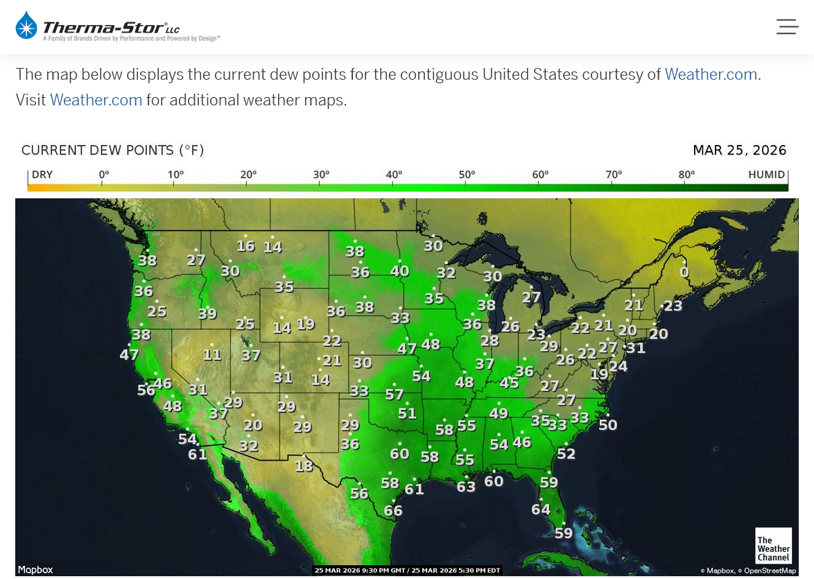

Current Conditions below updated every few minutes.
https://www.spc.noaa.gov/exper/mesoanalysis/new/viewsector.php?sector=19

Not much change. We will track ALL the storms from numerous sites as they develop this afternoon In the risk areas.
This is pretty much the same as shown above from yesterday for each category on this update. Go to this link for today's updates on the Storm Prediction Center's updated forecast philosophy and expectations.
https://www.spc.noaa.gov/products/outlook/day1otlk.html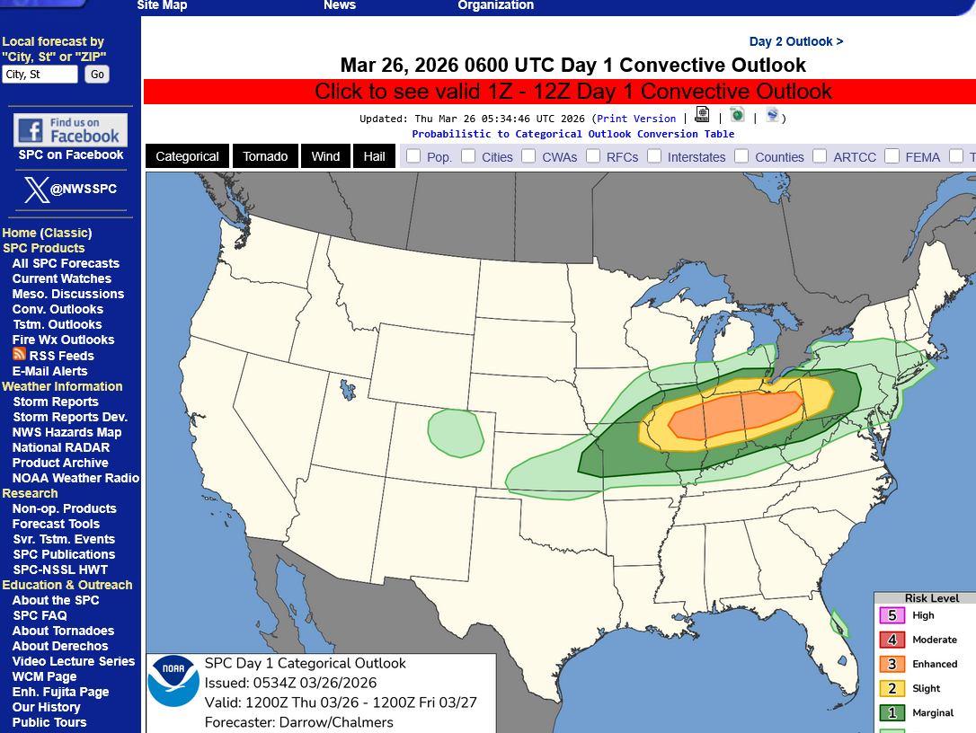
https://www.wunderground.com/maps/radar/current

Current Hazards at the link below.
For your NWS and county, go to the link below.
Then you can hit any spot on the map, including where you live and it will go to that NWS with all the comprehensive local weather information for that/your county.

This link below provides some great data. After going to the link, hit "Mesoanalysis" then, the center of any box for the area that you want, then go to observation on the far left, then surface observations to get constantly updated surface observations or hit another of the dozens of choices.

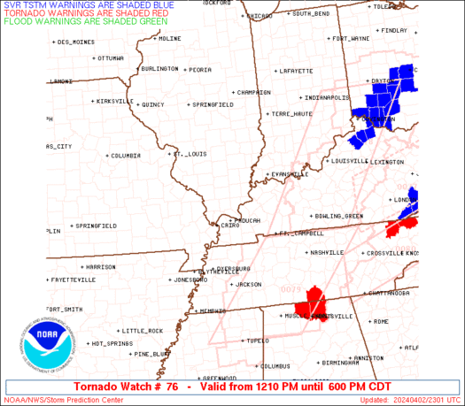
Heads up IL/IN/OH!
The first tornado watch of the day should be issued later this afternoon:
https://www.spc.noaa.gov/products/md/md0291.html
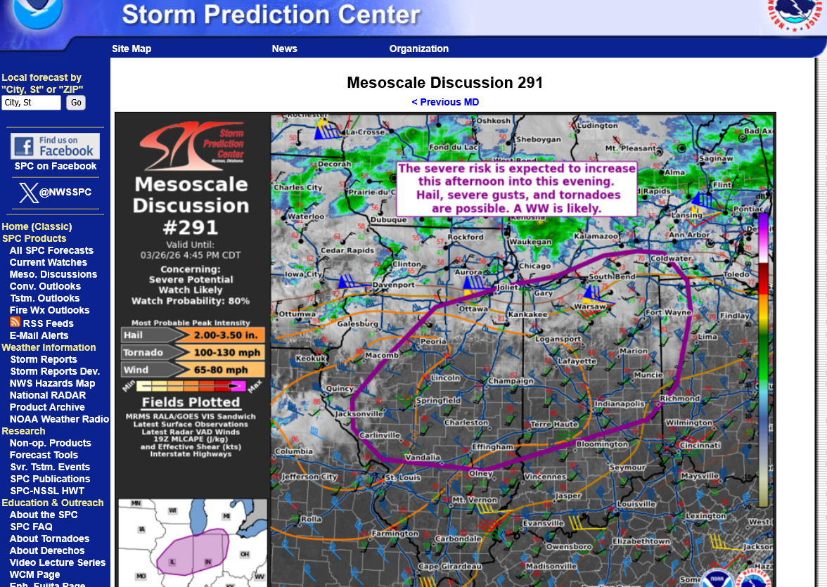
Wind gusts to 80 mph possible.
Tornado strength to 130 mph. So EF2 and you need to go to your safe place with tornado WARNINGs.
We have the tornado watch box but we’ve lost internet 30 minutes ago and I can’t post.
We also have a severe storm watch.

NWS Forecast Office Lincoln, IL


+++++++++++++++++++++++++
Indianapolis


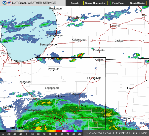
By far, the biggest feature associated with these storms has been the HAIL!
No confirmed tornadoes yet! Tomorrow, these numbers will jump higher as damage reports come in.
https://www.spc.noaa.gov/climo/reports/260326_rpts.html
With any warnings, just stay inside and away from windows!
If the storm has a tornado, then go to your safe place!
What about in a car?
1. Try to avoid driving in an area surrounded by tall trees or objects/power lines that can be blown on to the road during the storm.
2. Lightning: A typical cloud-to-ground, actually cloud-to-vehicle, lightning strike will either strike the antenna of the vehicle or along the roofline. The lightning will then pass through the vehicle's outer metal shell, then through the tires to the ground. It can so tremendous damage to some of the components but YOU ARE SAFE.
Lightning is present in ALL thunderstorms, not just severe thunderstorms.
https://www.weather.gov/safety/lightning-cars
https://www.spc.noaa.gov/climo/reports/260326_rpts.html

There will still be additions to this map but as severe weather goes, it was not a big event and the main feature was hail. No tornadoes right now and if we get any, they will be WEAK tornadoes.
This map includes the OVERNIGHT severe weather reports. It's not based on a calendar day but it includes severe weather until early the next morning.
A 24 hour period from 7am to 7am makes more sense as a metric for this realm, since the same outbreak will very often be winding down but continue past midnight.
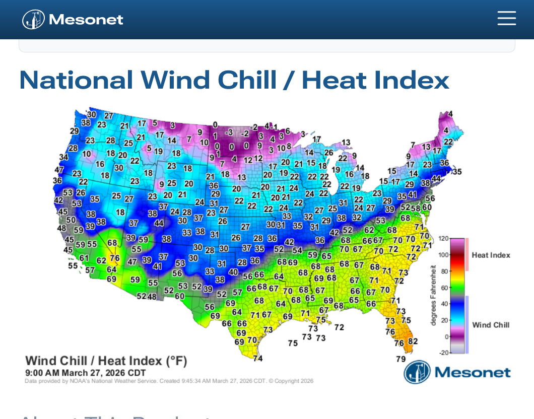
Cold air is dumping in again behind this strong cold front. Freeze warnings in effect for Evansville tonight(purple color on the map below) for temperatures dropping to around or just below freezing.
https://www.mesonet.org/weather/air-temperature/national-wind-chill-heat-index
Current Hazards at the link below.
For your NWS and county, go to the link below.
Then you can hit any spot on the map, including where you live and it will go to that NWS with all the comprehensive local weather information for that/your county.
I copied a freeze frame image below that will not go away after the event to make a point.
Why does the St. Louis area have light blue instead of purple color everywhere else??
The purple color is a freeze warning for temperatures around and just below freezing but NOT a hard freeze warning for the COLDEST temperatures that would be for temperatures well down in to the 20s.
The light blue is a FROST ADVISORY which is for the LEAST cold temperatures(along with clear skies and light winds that form frost.
The St. Louis area is impacted by the HEAT ISLAND EFFECT because its a big city so St. Louis County, an urban county will be several degrees WARMER than the rural counties.
+++++++++++
This is bad in the hot months, of course!
 Weather Map