Get all the comprehensive weather here:
The way to use these maps below is to just scroll thru them to see the changes with time. Weather markets trade on CHANGES compared to the previous weather forecasts. It also helps to forecast by identifying TRENDS!
The last map in the series ALWAYS gets the most weighting. Compare it with previous maps above it for perspective!
Do consider that as the calendar page turns, rains that just fell will come out of the updated forecast as another day is added at the end of the forecast. A huge rain that just fell(that was in the forecast yesterday) can make the latest forecast look much drier than it really is.
This map is updated 2 times a day, automatically:
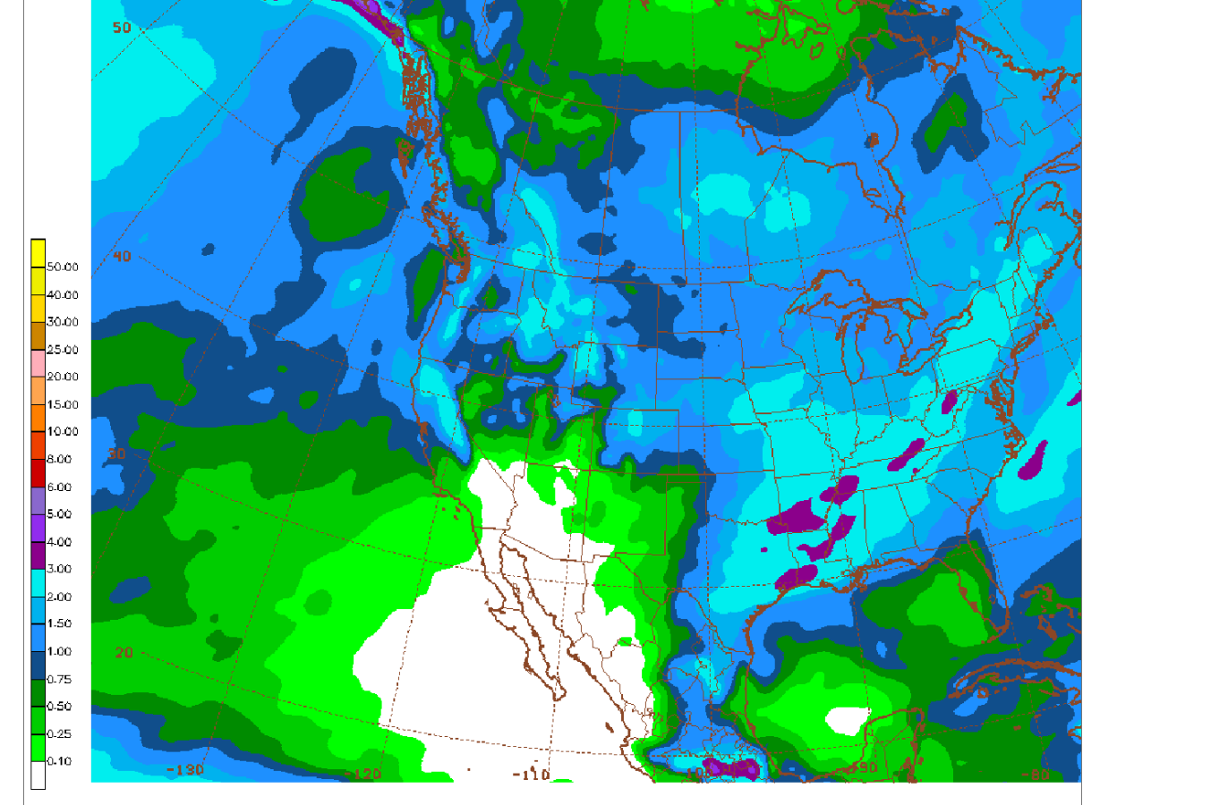
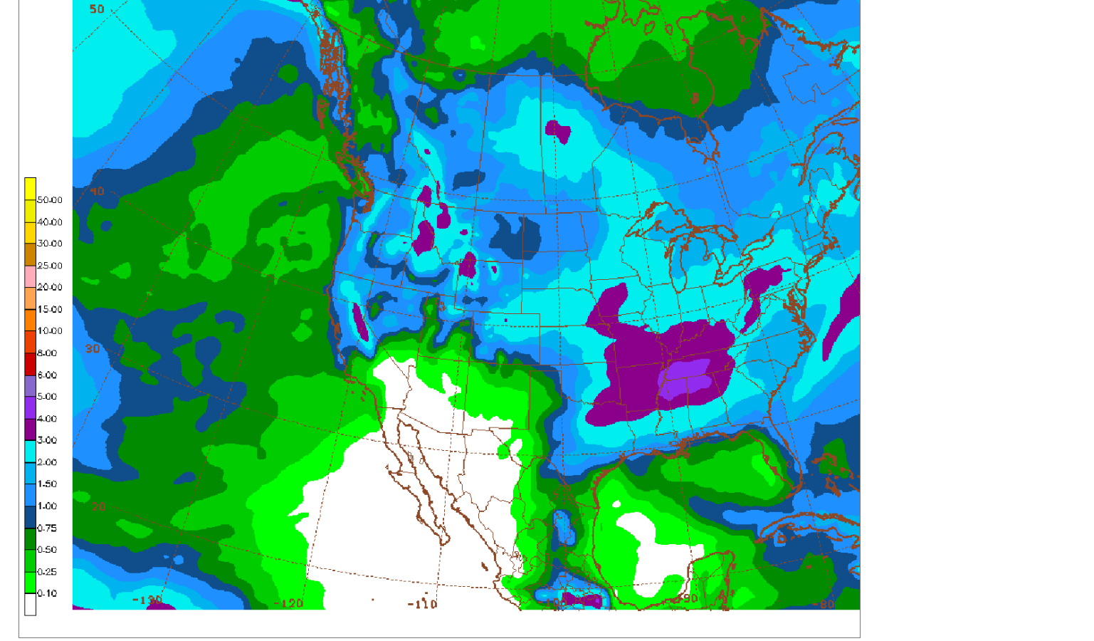
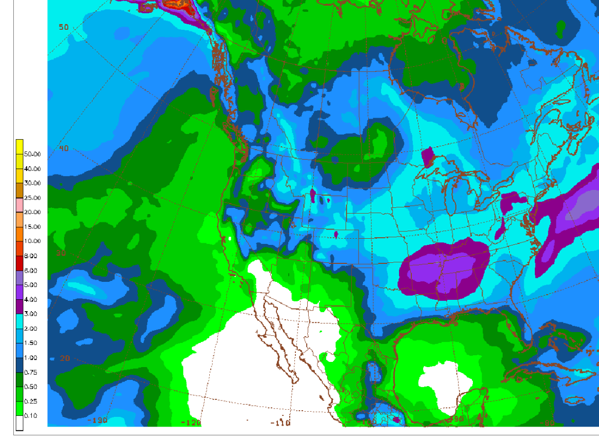
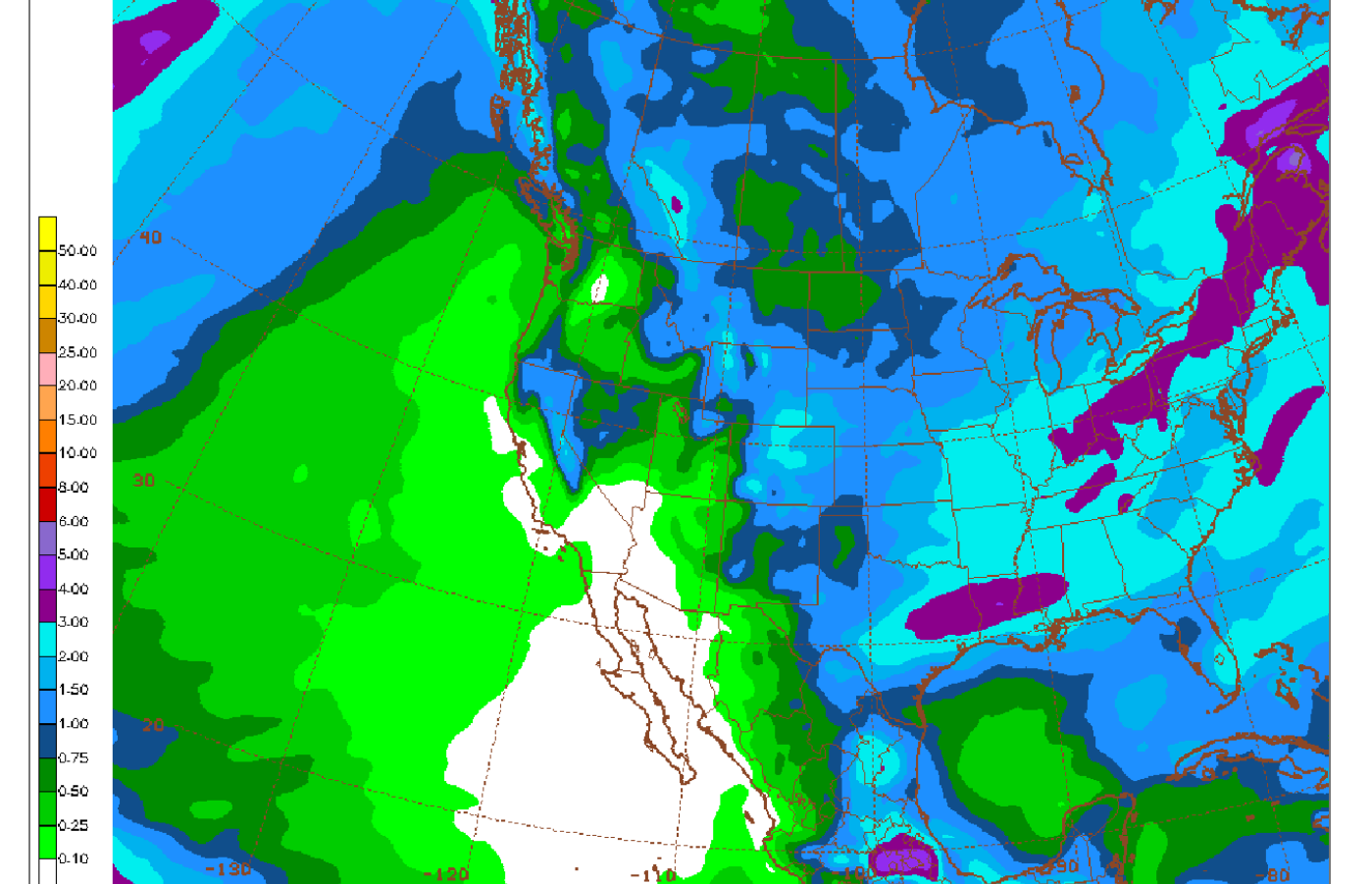
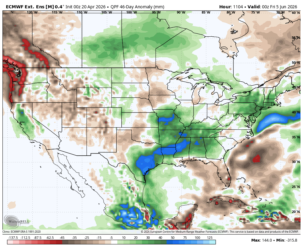
5-4-26: Moderate/Heavy rains Ohio/Tennessee Valley's and south of that. Dry northwest 2\3rds of the Cornbelt which may be the new pattern for May?
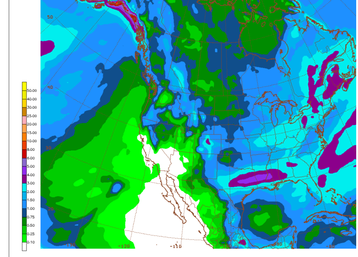
7 Day Total precipitation below:
http://www.wpc.ncep.noaa.govcdx /qpf/p168i.gif?1530796126

+++++++++++++++++++++++++++
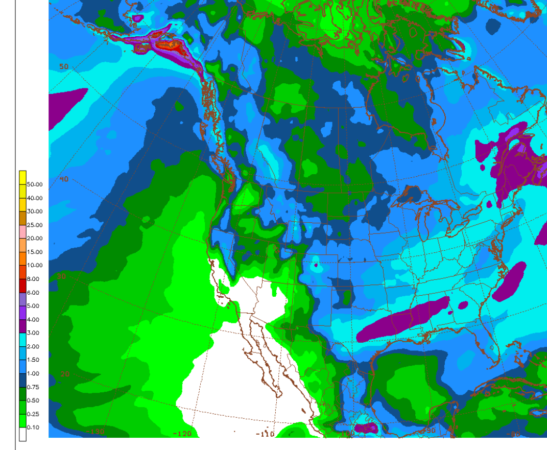
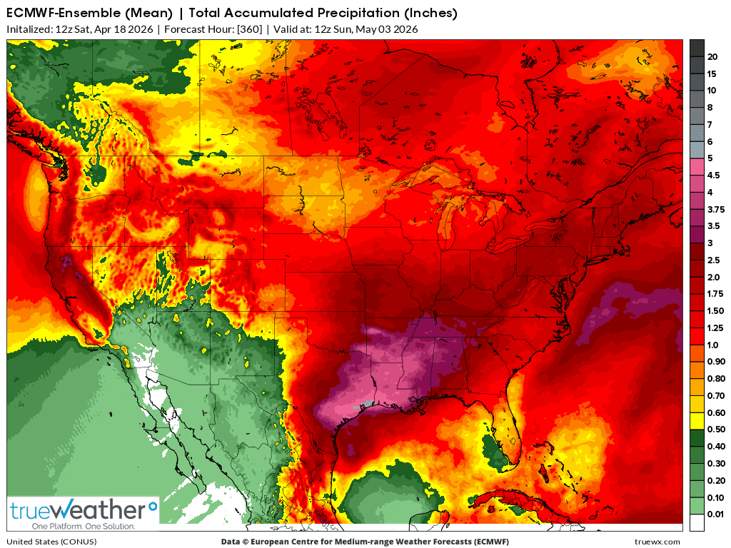
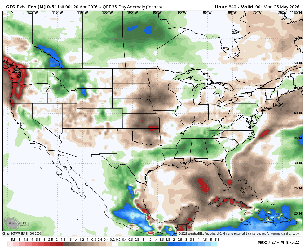
1. 4-18-26 This was the last 12z GEFS for the next 16 days. Heavier rains, 3+ inches focused on areas that need them the most and will take every drop and more! Huge area of 2+ inches(average to just above average).
Note the progression and changes between the top map and the ones below that gradually work their way to the last map.
Last"
4-27-26: 6z Heaviest rains still South. Looking wetter again today!
4-27-26: 18z GEFS. Holding on to those rains in the South!
4-28-26: 12z GEFS. Staying pretty wet in the South.
4-29-26: Week 1 rains have fallen except for the deep south. So this is mostly week 2 for other places. N.Plains/Upper Midwest drying out.
4-30-26: 6z GEFS: Similar to yesterday.
4-30-26: 18z GEFS. Increasingly wet going south/east. Increasingly dry going northwest.
5-1-26: 6z GEFS: Wet South and East dry Northwest belt.
5-1-26: 12z GEFS: Pretty wet for much of the belt, except for Northern Plains!
5-1-26: 18z GEFS: Rains bumped UP!
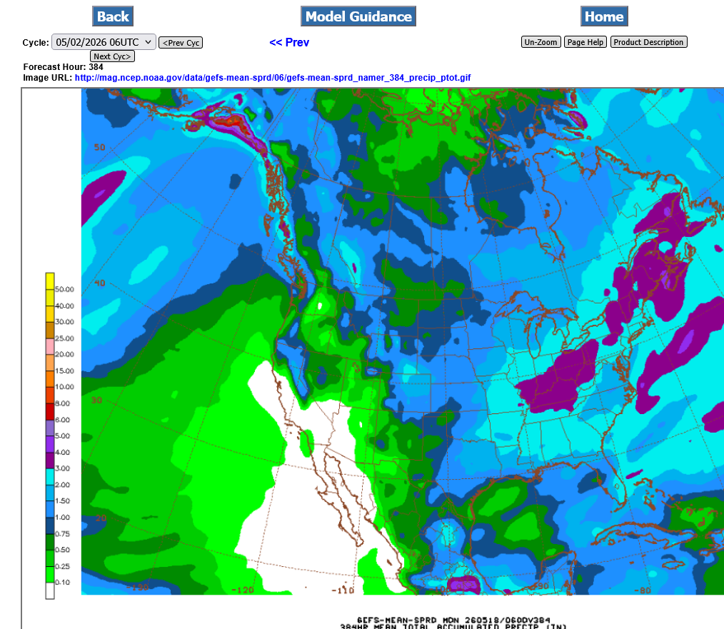
5-2-26: Pretty wet eastern Cornbelt.
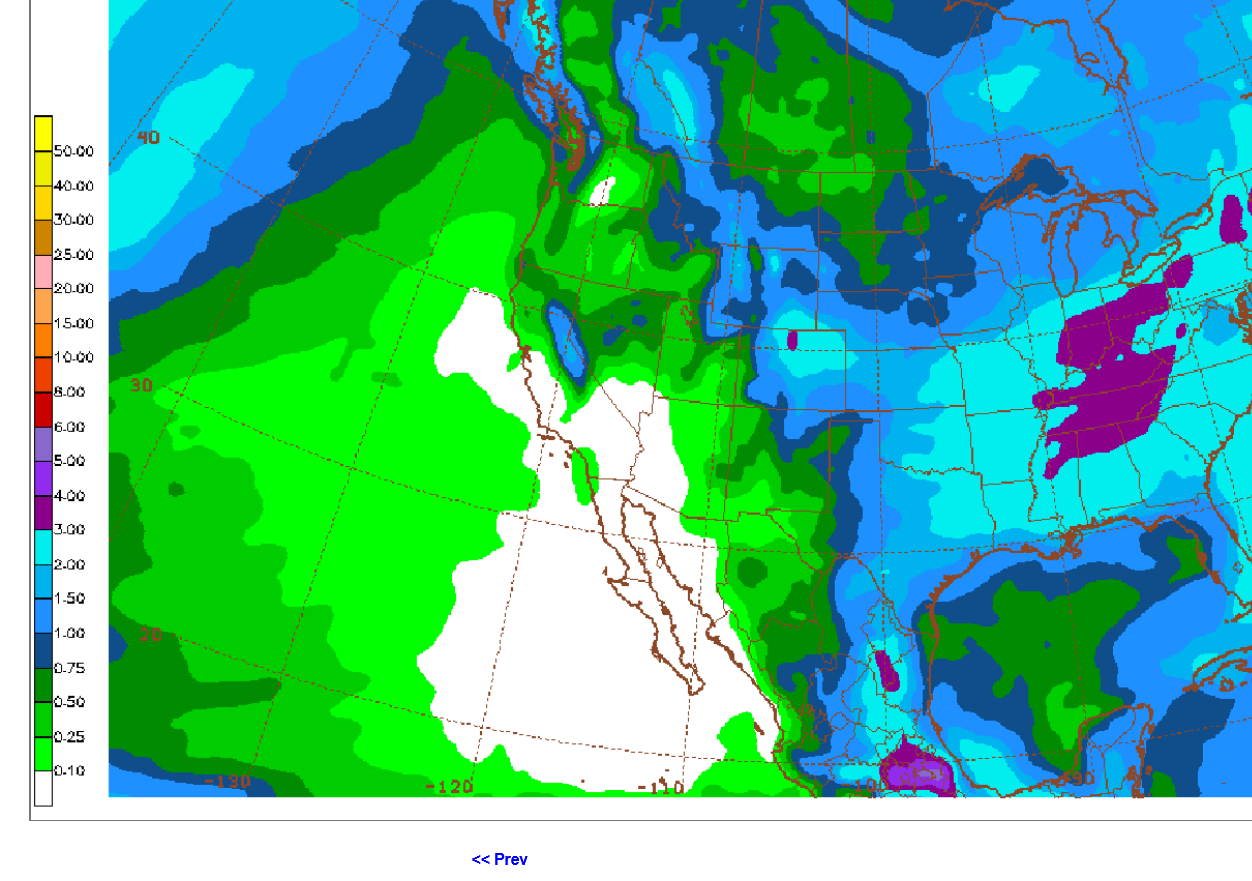
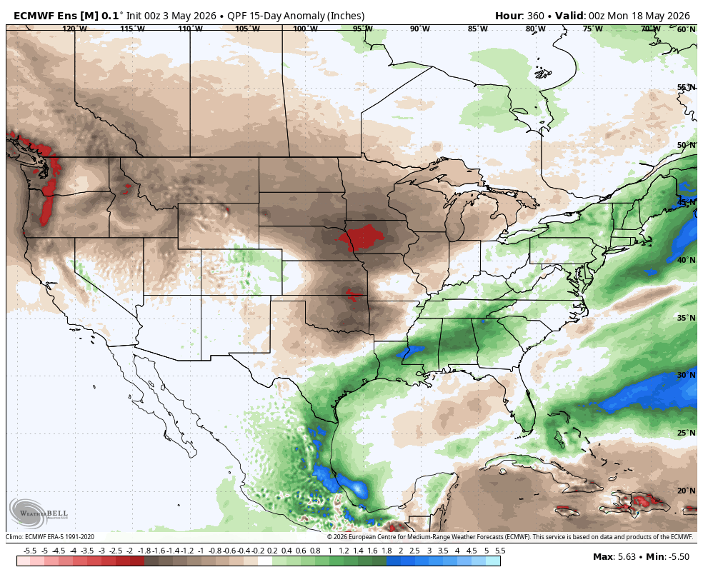
5-3-26: Wettest Ohio/Tennessee Valley's.
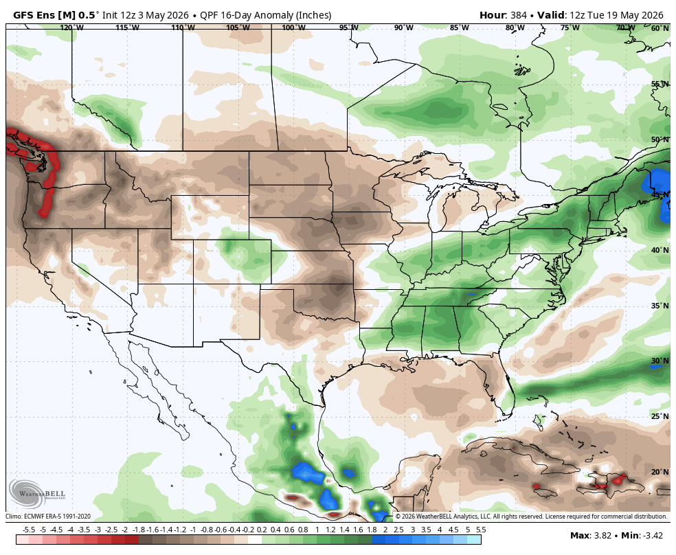
5-3-26: New product with anomalies from a different data provider.
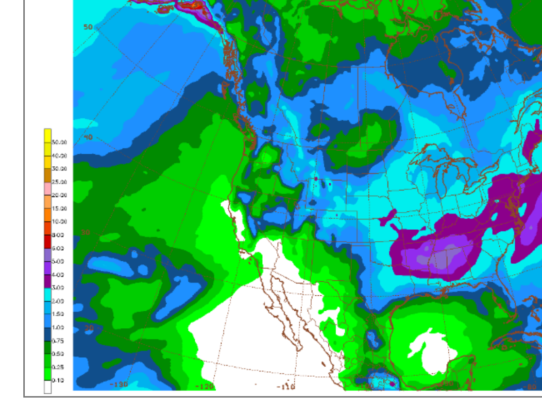
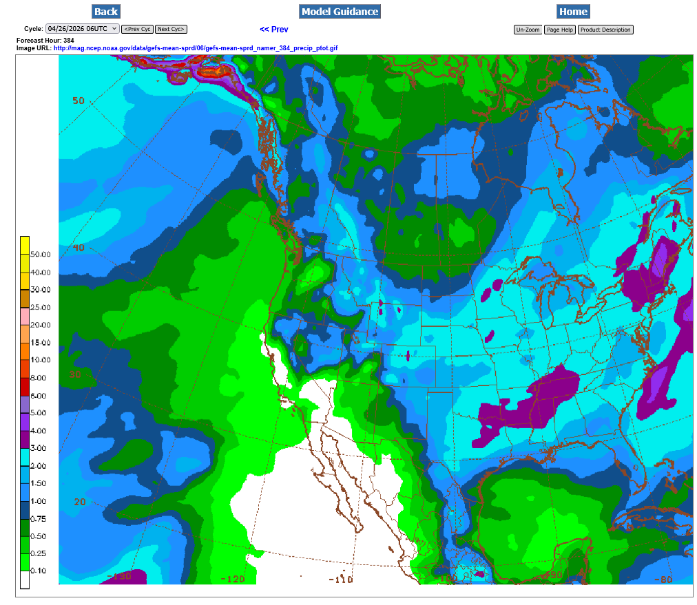
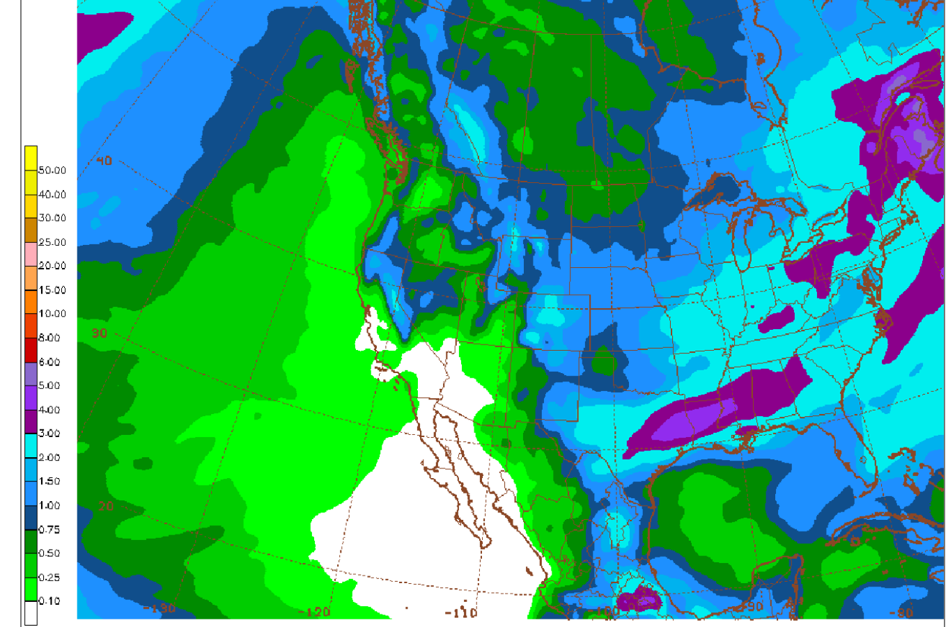
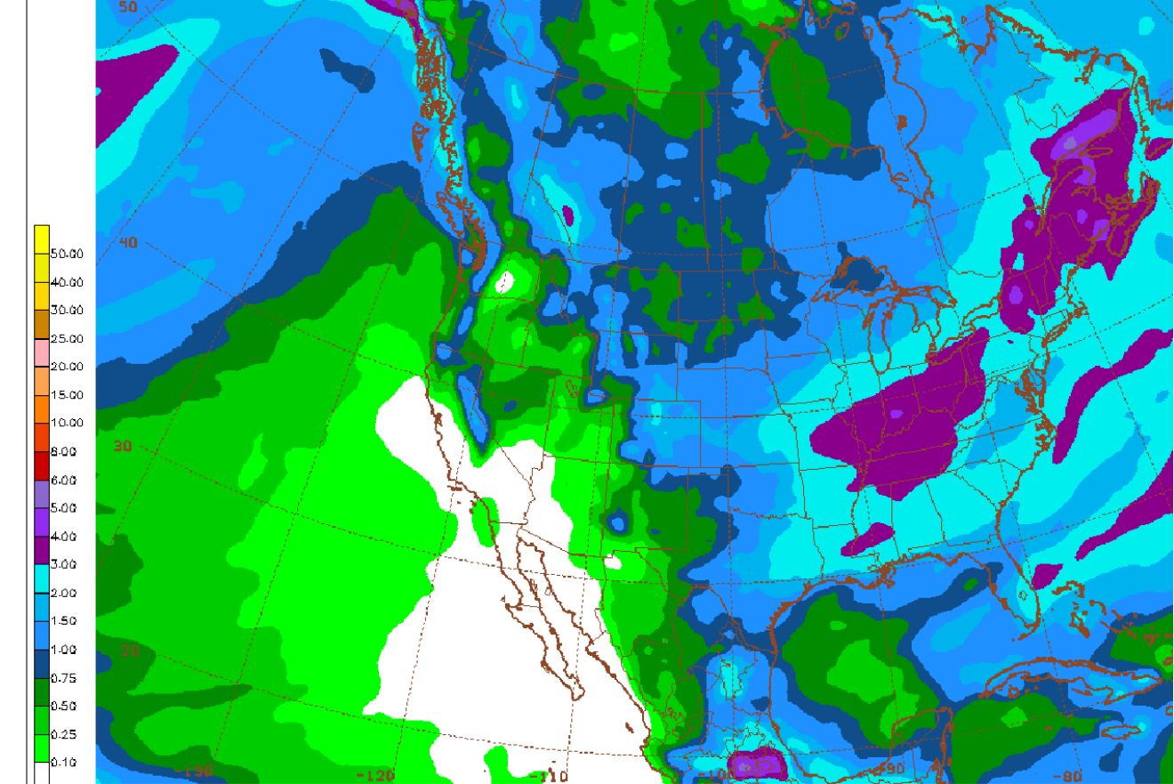
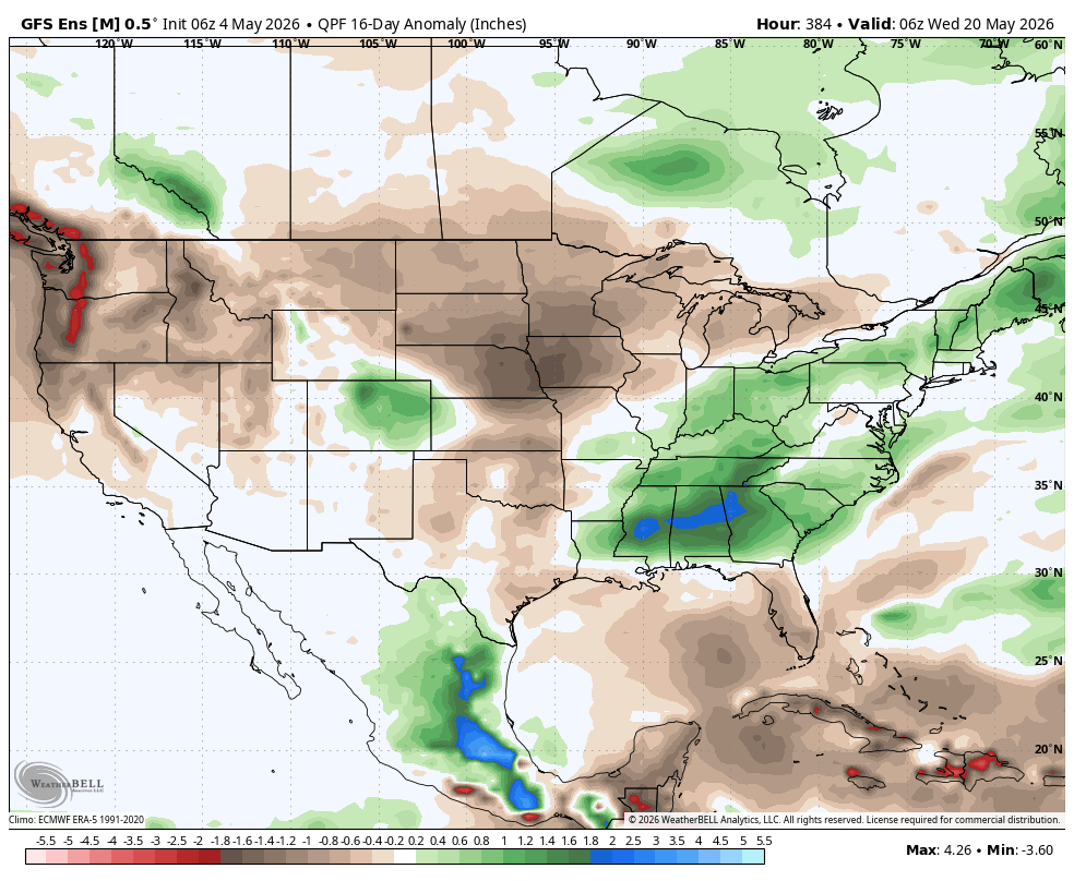
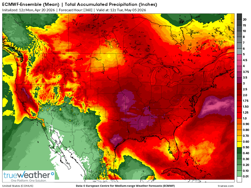
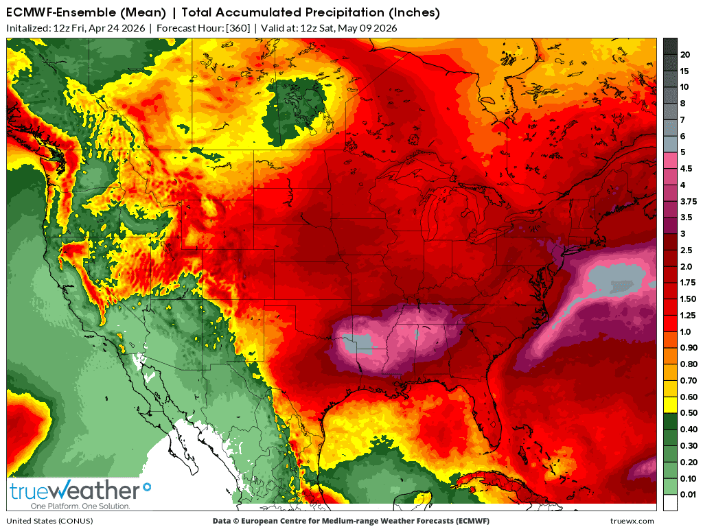
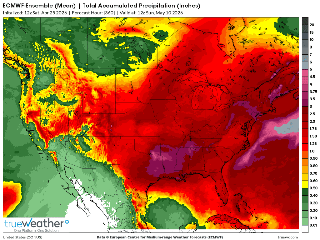
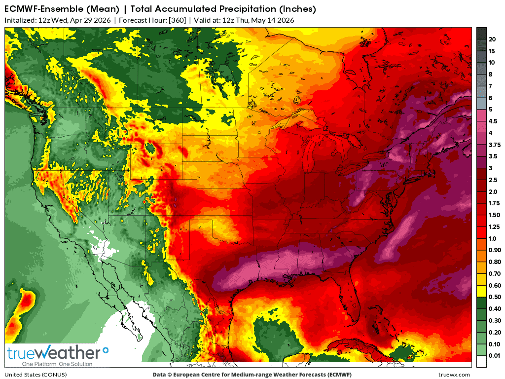
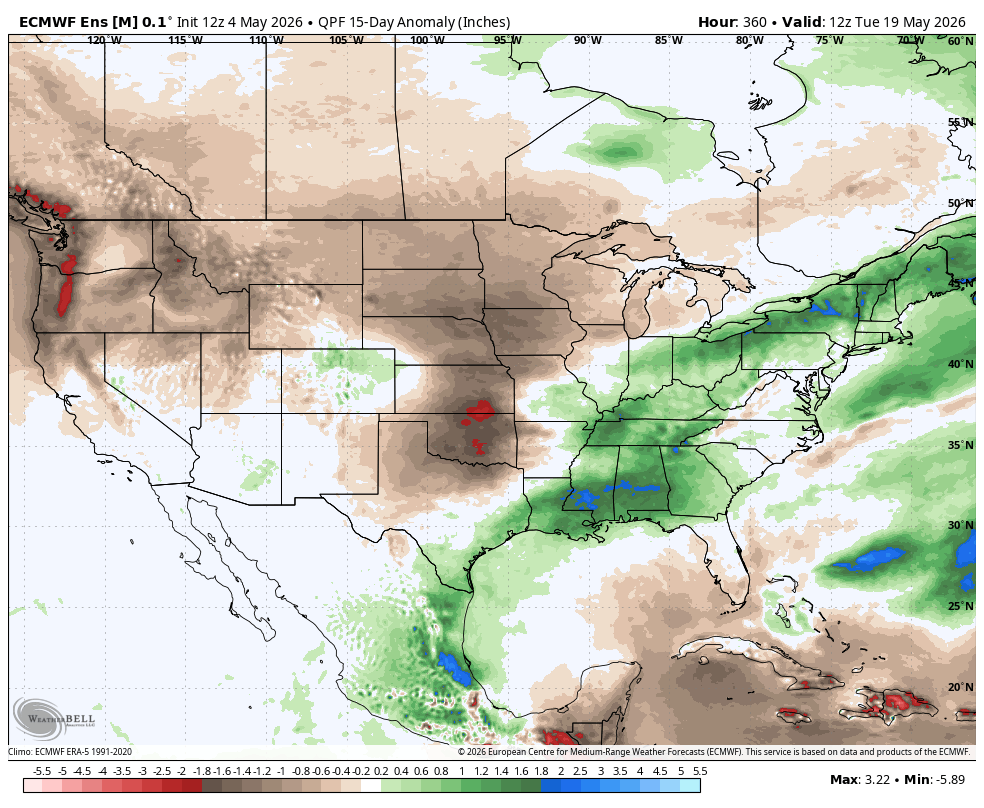
5-4-26: A bit wetter Southeast belt, drier Northwest belt(where its bullish)
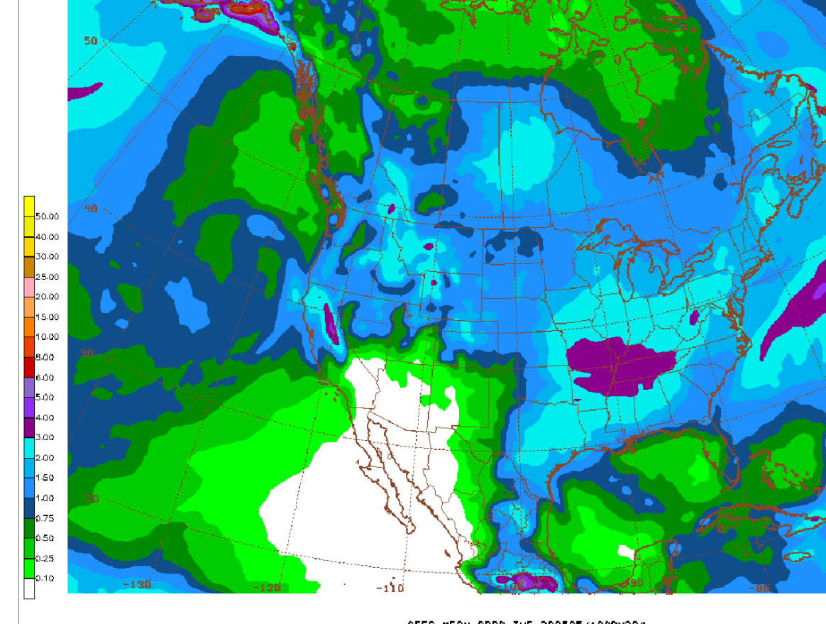

The next 2 maps are from the same 12z GEFS model run on 5-3-26 for the next 15 days but the bottom one, from a different data provider shows the anomalies. I'll be using that one from now on. Same one that I use for the LONG RANGE maps below.
+++++++++++++++++++
1. 4-18-26: The last 12z European model below(15 days), with it's crummy colors for rain has a pretty wet signature for the Southern Mississippi River Valley, westward to TX. This rapidly dries up headed northward.
2. 4-19-26 The last 12z model for 15 days. A bit drier than yesterday.
3. 4-20-26 12z run. Large area of expanding heavy rain signal late in the period.
4. 4-21-26: 12z EE run. Heavy rain potential just west of Mississippi River to the deep South where they NEED IT BAD!
5. 4-22-26: A 5 inch rain band in the epicenter now.
6. 4-23-26: Epicenter of heaviest rains(5"+ over AR) surrounding states also get heavy rains, especially just east.
7. 4-24-26: 12z EE run: Huge rains in AR and surrounding areas, especially just east. They need it!
8. 4-25-26: 12z EE: Huge REDUCTION in the heaviest rains!!! Hopefully not a trend that continues!
9. 4-26-26: 12Z EE. Rains up a bit again!
10. 4-28-26: Heavy rains south. Dry-ish north/central Plains/Upper Midwest
11. 4-29-26: Drying out north/central Plains/Upper Midwest. Wet Deeeep South.
12. 4-30-26: Dry again northwest belt. Wet Gulf Coast.
13. 5-1-26: Wet Ohio Valley-East and Gulf Coast. Dry far northwest belt/N.Plains
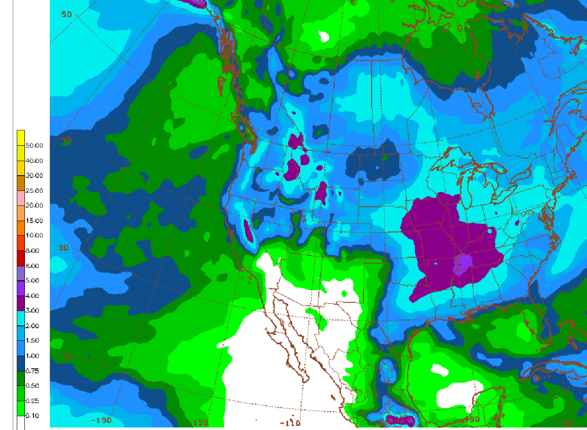
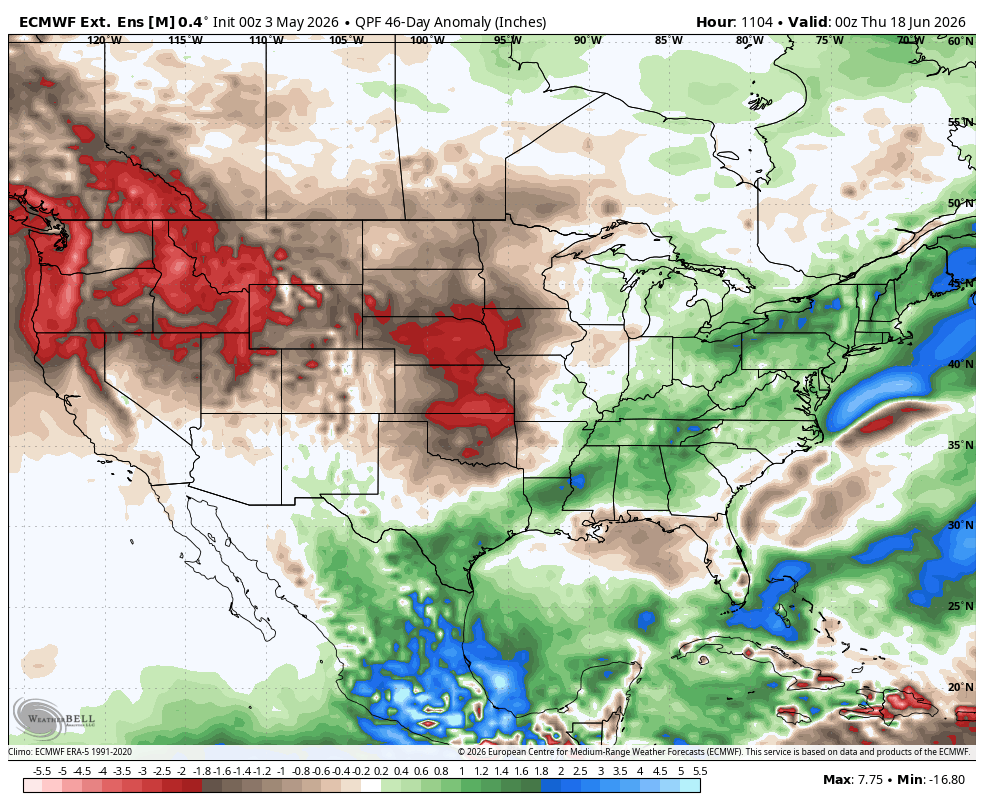
5-3-26: Average/Above rains southeast 1/3 Cornbelt and South. Dry northwest 1/2.
5-3-26: NEW PRODUCT: This is the same EE model but from a different data provider that I use that shows rain anomalies. I'll start using this product!
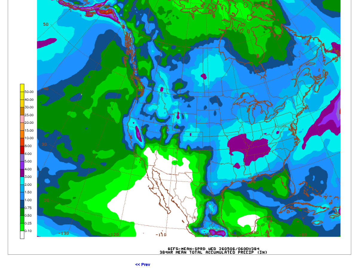
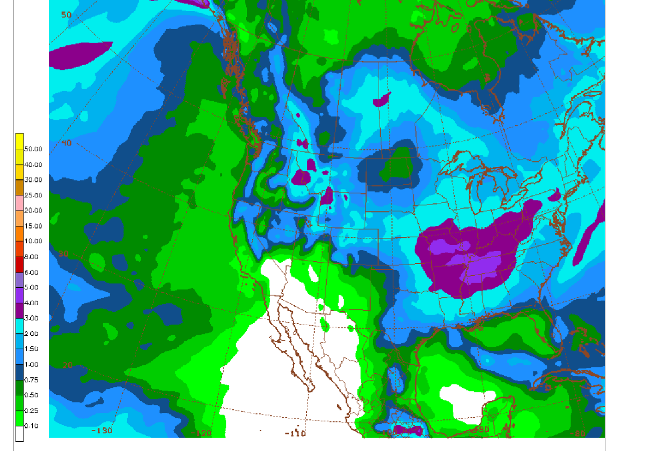
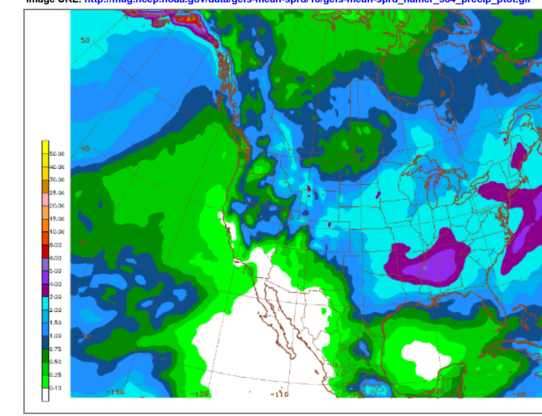
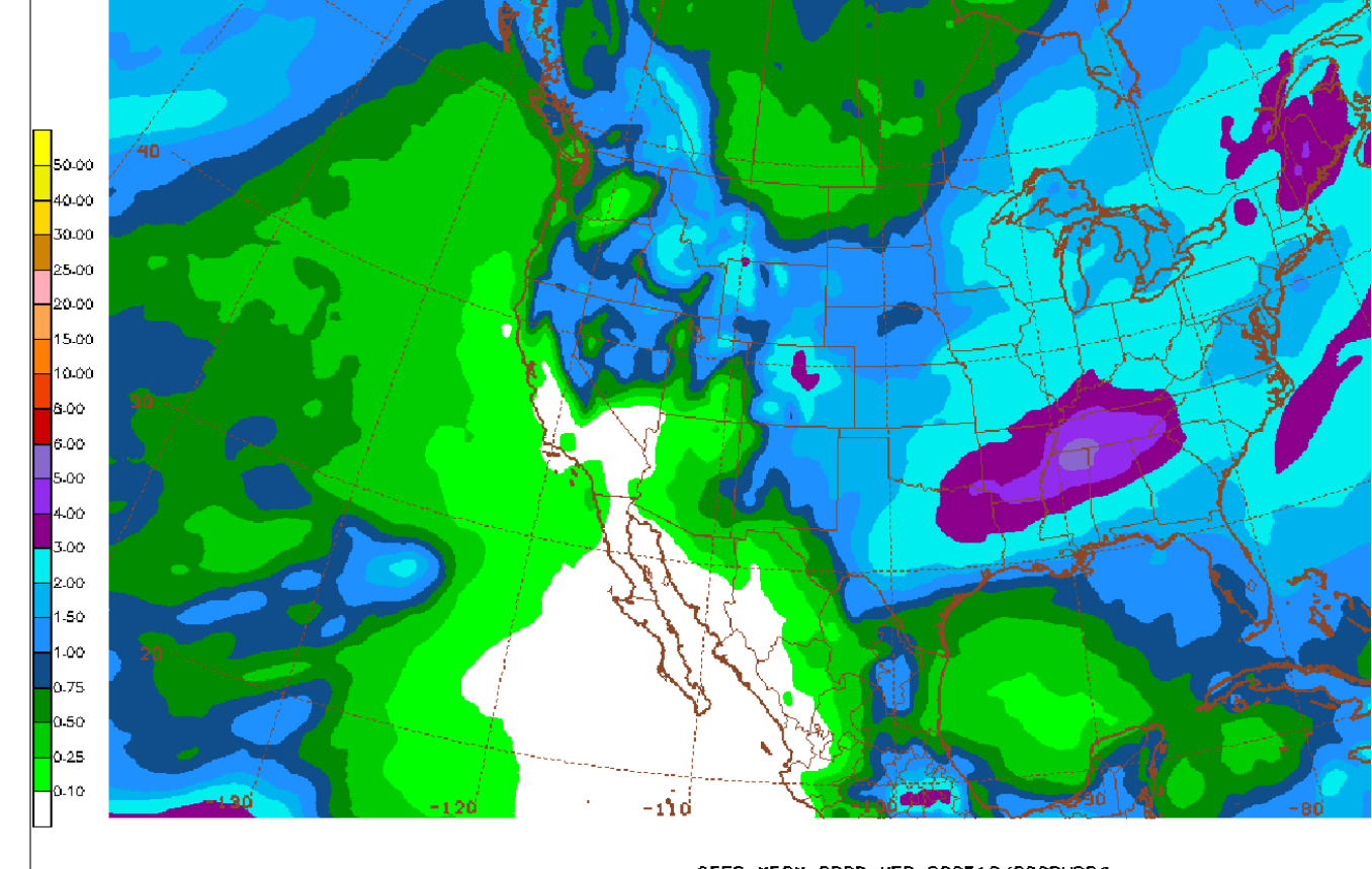
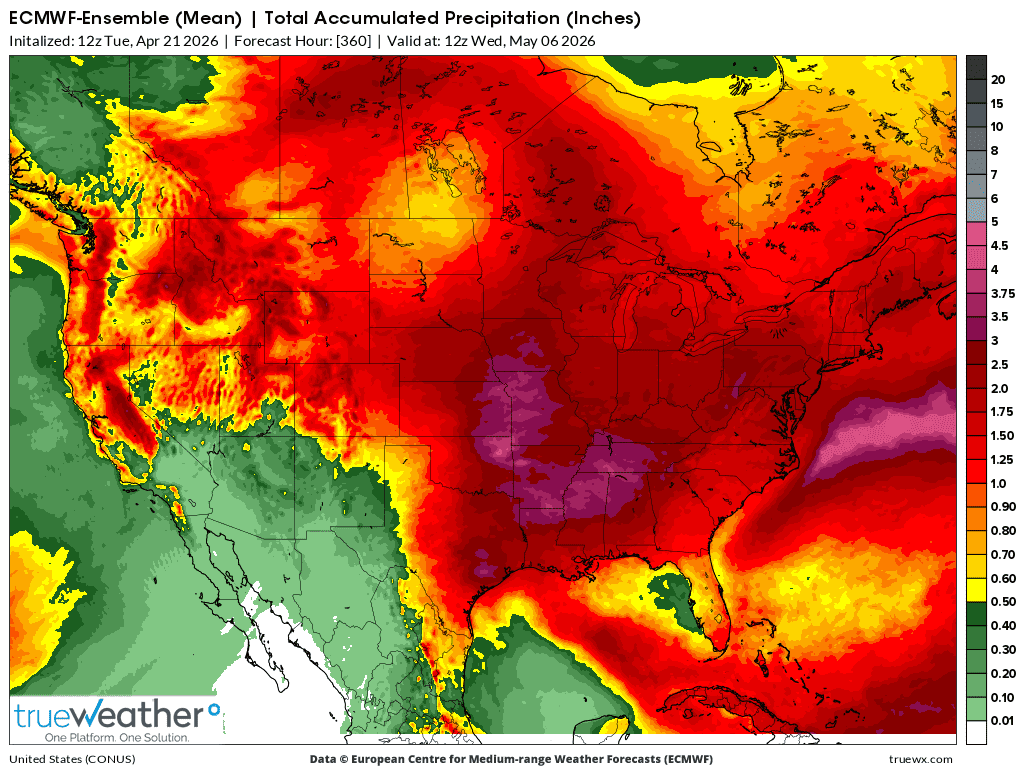
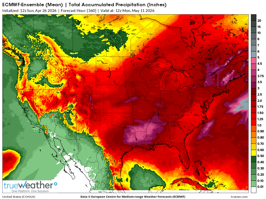
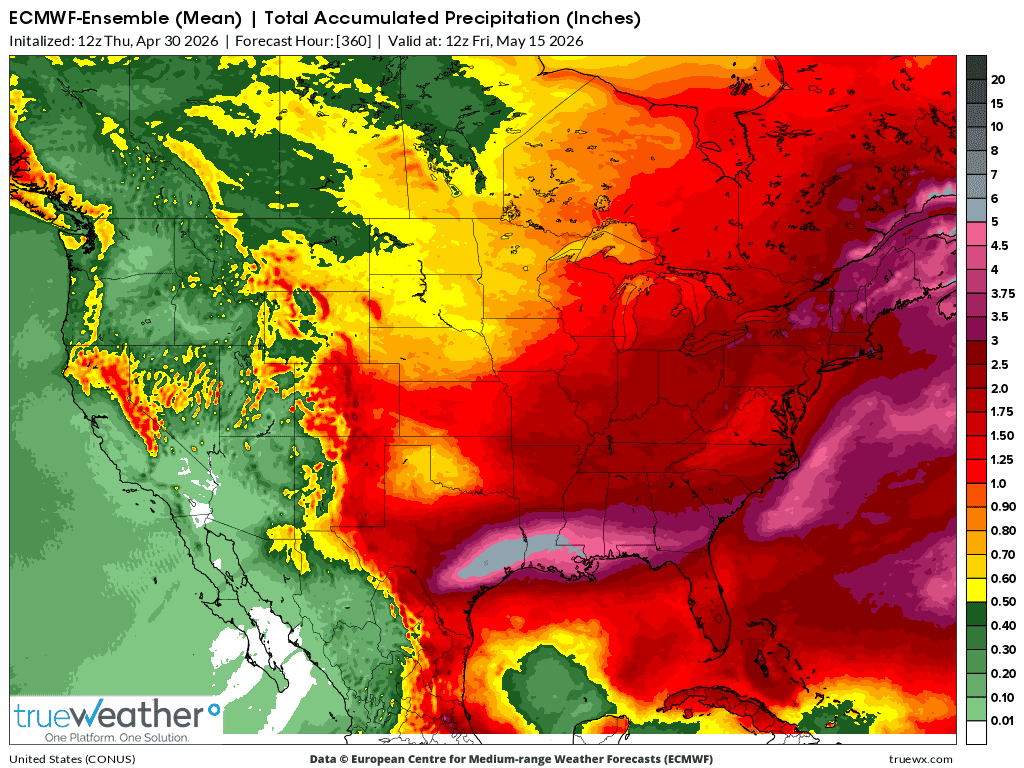
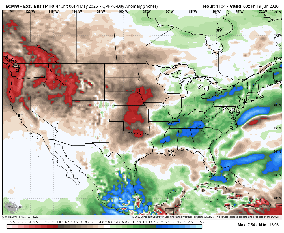
5-4-26: 6z: Slightly more rain most places. Wet southeast. Dry northwest.
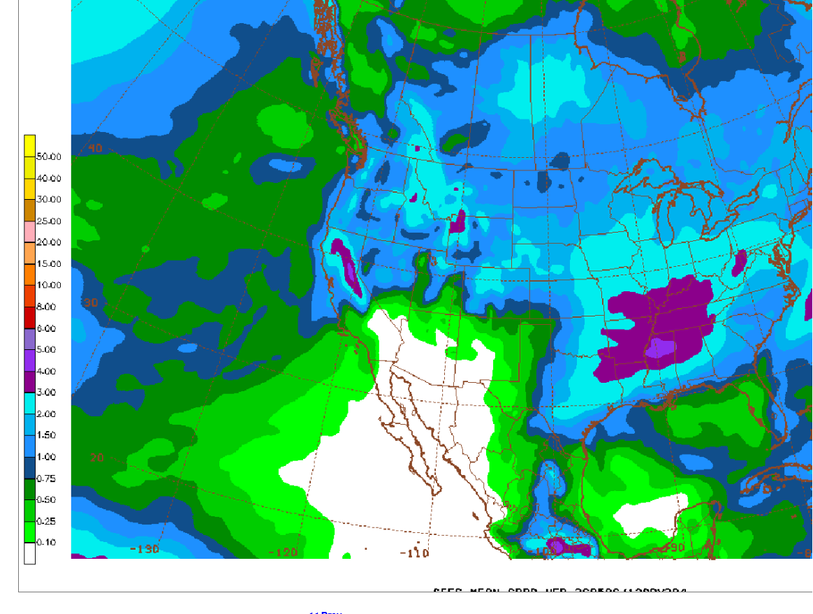
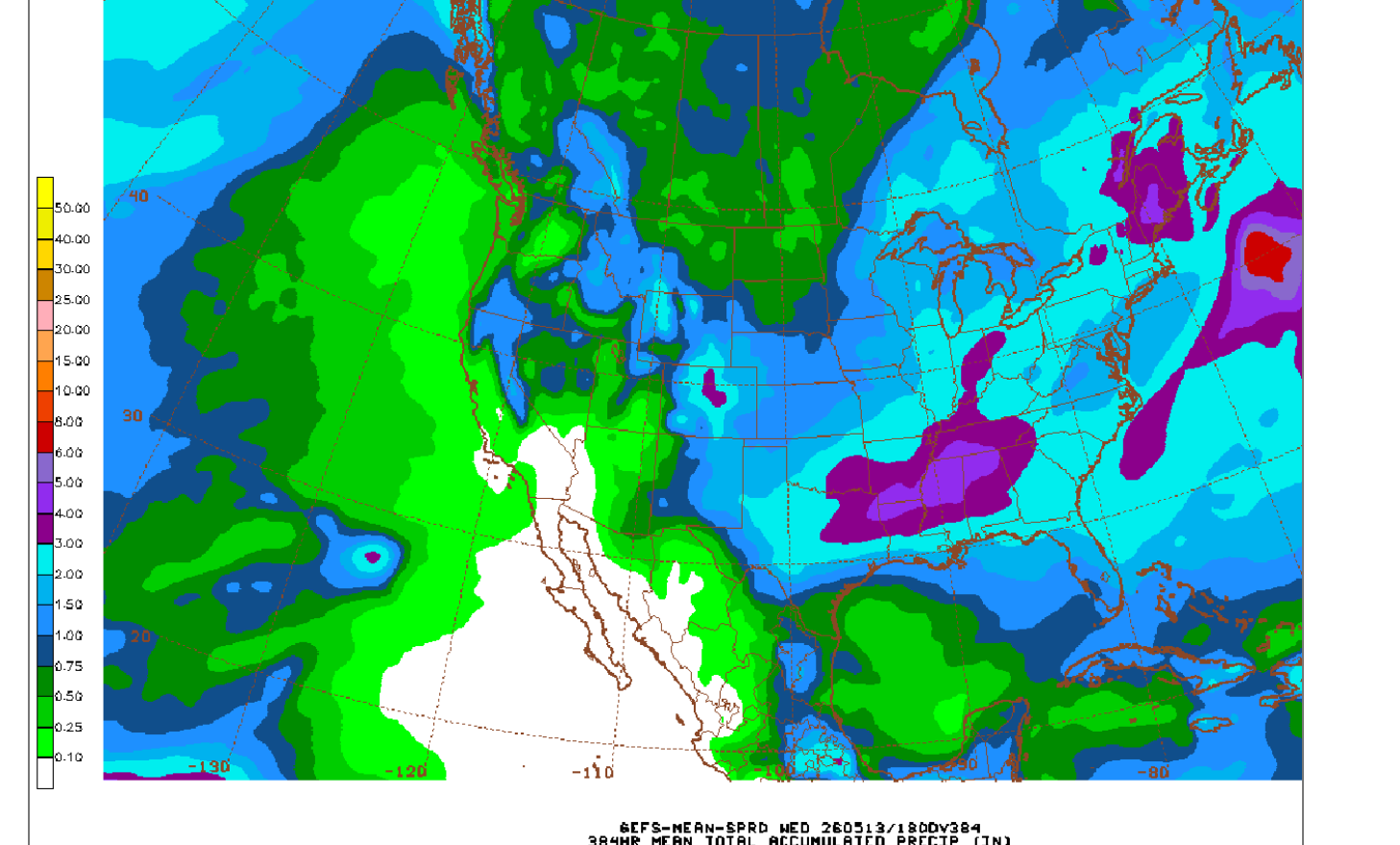
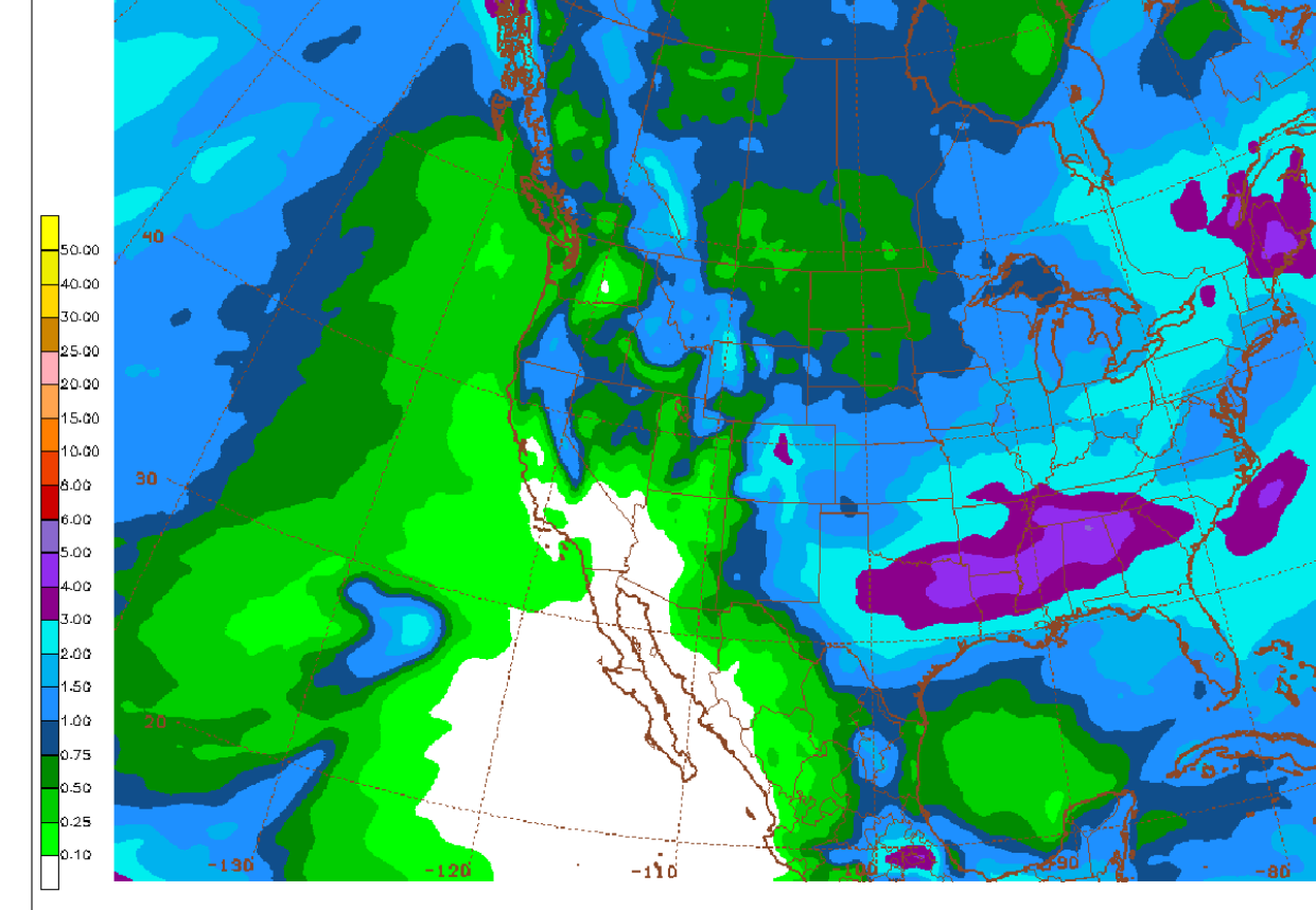
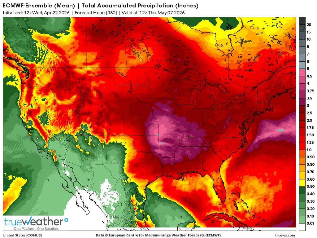
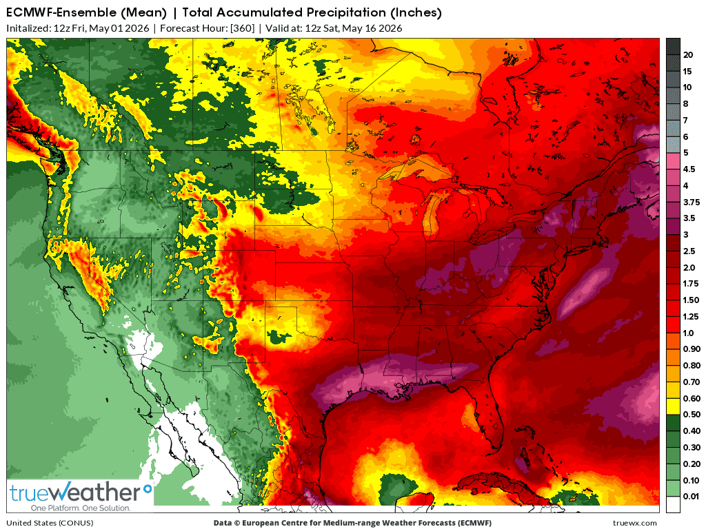
5-5-26: Wet southeast, dry northwest and Plains. Not much change.
The next 2 maps are from the same 12z EE model run on 5-23-26 for the next 15 days but the bottom one, from a different data provider shows the anomalies. I'll be using that one from now on. Same one that I use for the LONG RANGE maps below.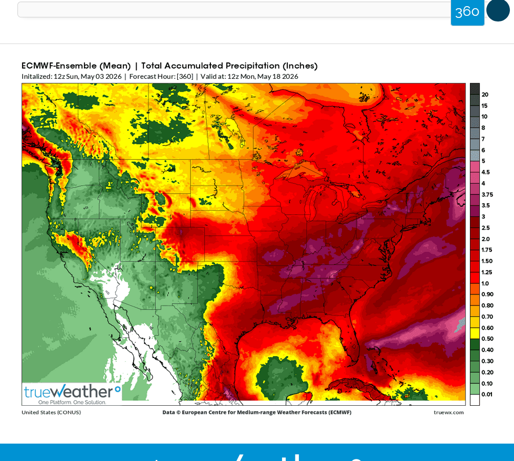
1. The last 46 day European Ensemble model from 4-18-26 is below. It's in decent agreement with map #2 BELOW from the GEFS today. Tomorrow, Sunday PM I'll put the update to the right.
2. 46 day rains 4-19-26. Pretty wet in the driest areas!
3. 4-20-26: Heavy rain signal GROWING!
4. 4-21-26: Just what the drought doctor ordered, WOW!
5. 4-22-26: Potential rain capping, heat ridge in the S.Plains with numerous perturbations around the periphery in a southwest Jet Stream coming off the rapidly developing El Nino, causing a ring of fire active storm pattern with very heavy rains in the most favored area of convergence/east side with the Gulf wide open?
6. 4-23-26: Same analysis as yesterday!
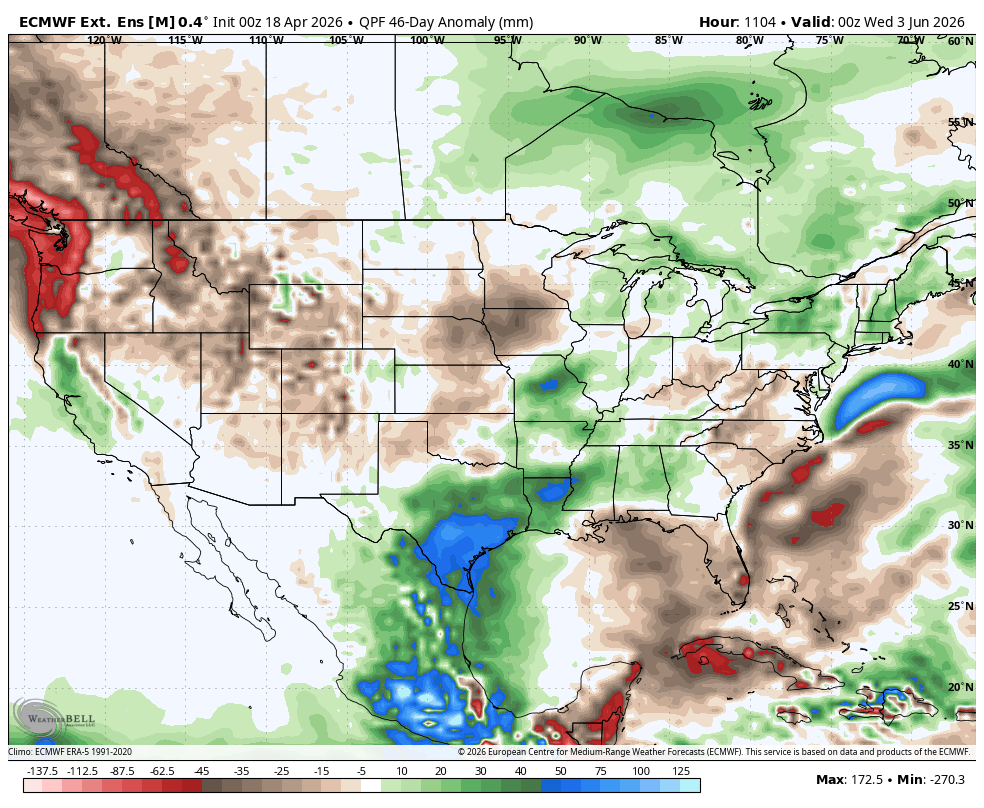
7. 4-25-26: Greatly reduced heavy rain signal. Heat ridge building in early June?
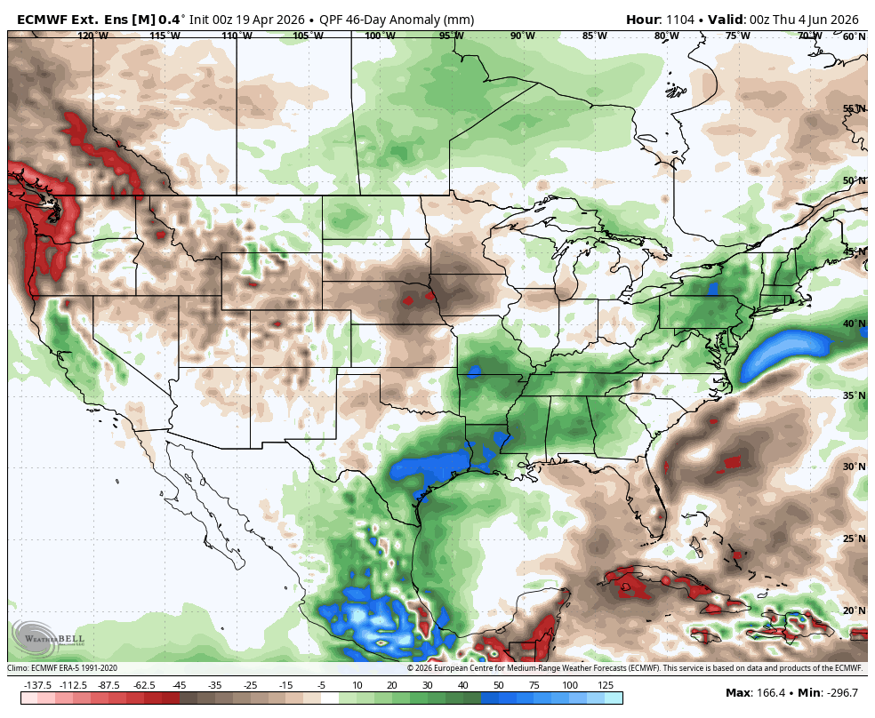
8. 4-27-26: Greatly INCREASED rains.
9.4-28-26: Wet South. DRY North/Central Plains/Upper Midwest/W.Cornbelt.
10. 4-29-26: Plains and Upper Midwest VERY DRY. THIS COULD TURN BULLISH!!!
11. 4-30-26: Dry Plains/Upper Midwest. Very WET deep South.
12. 5-1-26: DRY west of the Mississippi, Wet East. Wet deep South.
13. 5-3-26: Even DRIER west of the Mississippi. Not all guidance agrees but this needs to be watched! Still low confidence right now.
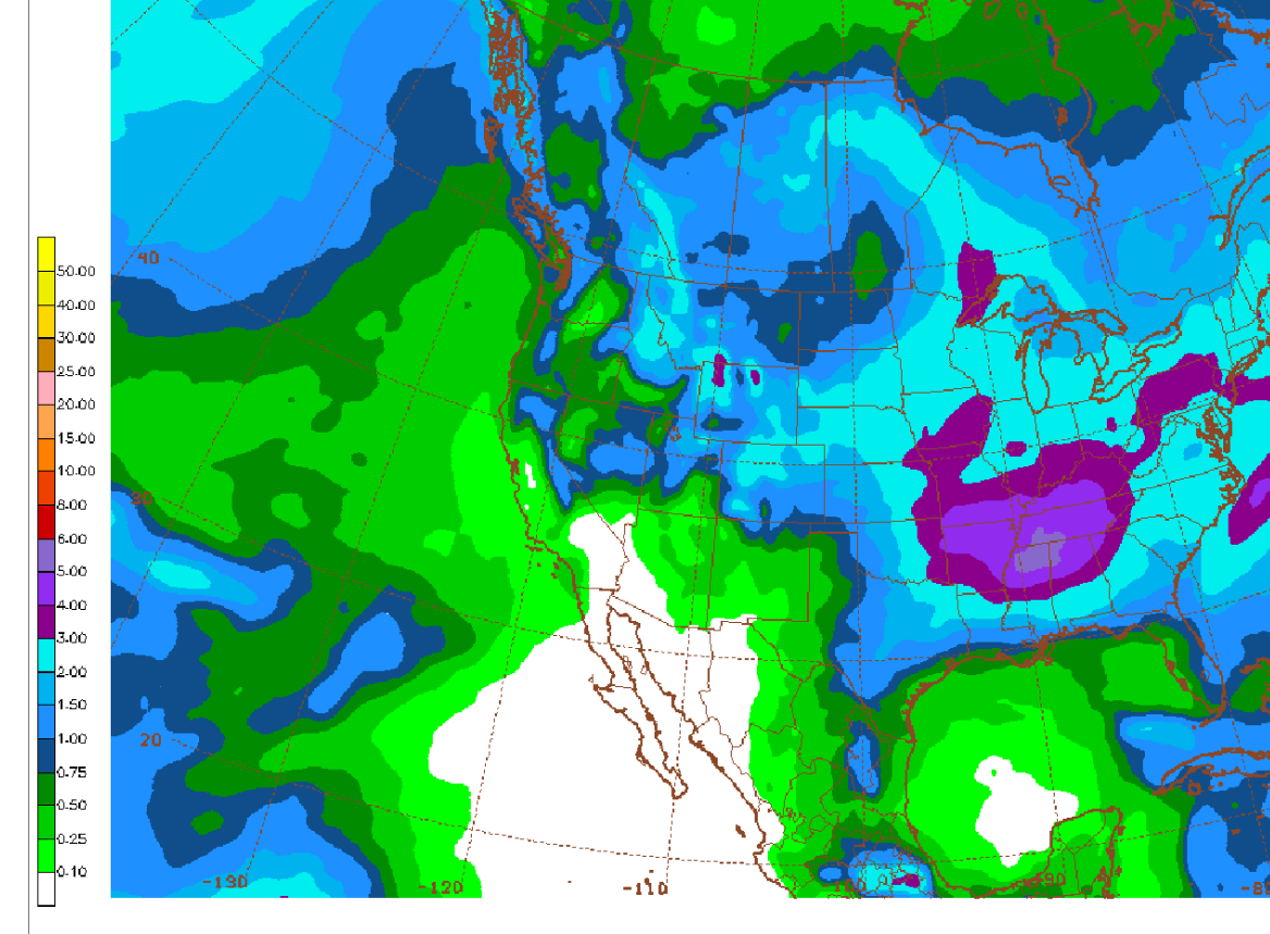
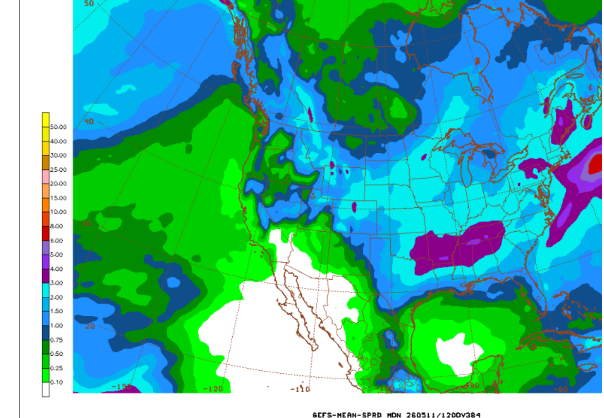
14.5-4-26:A tad wetter but same pattern of wet Southeast,dry Northwest.


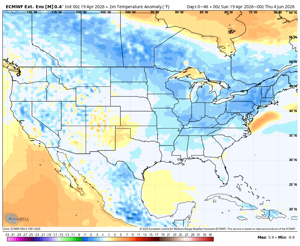
1. This was the last EE 46 day temperature anomaly from the 4-18-26 run. The last GEFS was also coolish.
2 . 4-19-26 temps. Not much change. Coolish.
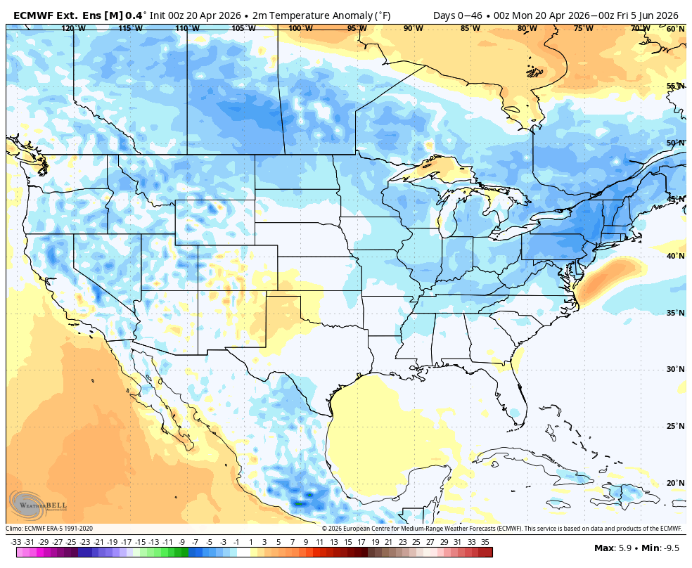
3. 4-20-26: Cool and wet El Nino Summer signature/analog!
4. 4-21-26: Maybe some heat in the Southern Plains.
5. 4-22-26: Heat ridge in the Southern Plains? Clouds/ heavy rain cooled air farther northeast.
6. 4-23-26: I used the 500 mb pattern today with the same analysis as yesterday.
7. 4-25-26: Heat ridge building S.Plains in early June? This is the days 39-46 temperature anomaly.
8. Temps the first week in June(days 39-46). Cooler now!
9. 4-28-26: First week in June. Cool Midwest/East, heating up West to Plains.
10. 4-29-26: First week in June. Heat out West, spreading to the Plains. Cool Northeast. This COULD turn bullish!
11. 4-30-26: First week in June. Heat West to S.Plains. Cool Northeast.
12. 5-1-26: Heat ridge building West/Plains. Mild Northeast
13. 5-2-26: Heat ridge building early/MID June!!! Turning bullish!
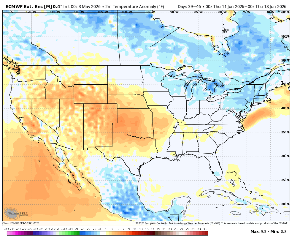
14. 5-3-26: Heat ridge stronger MID-June. Turning bullish??? Too far out for anything but low confidence.
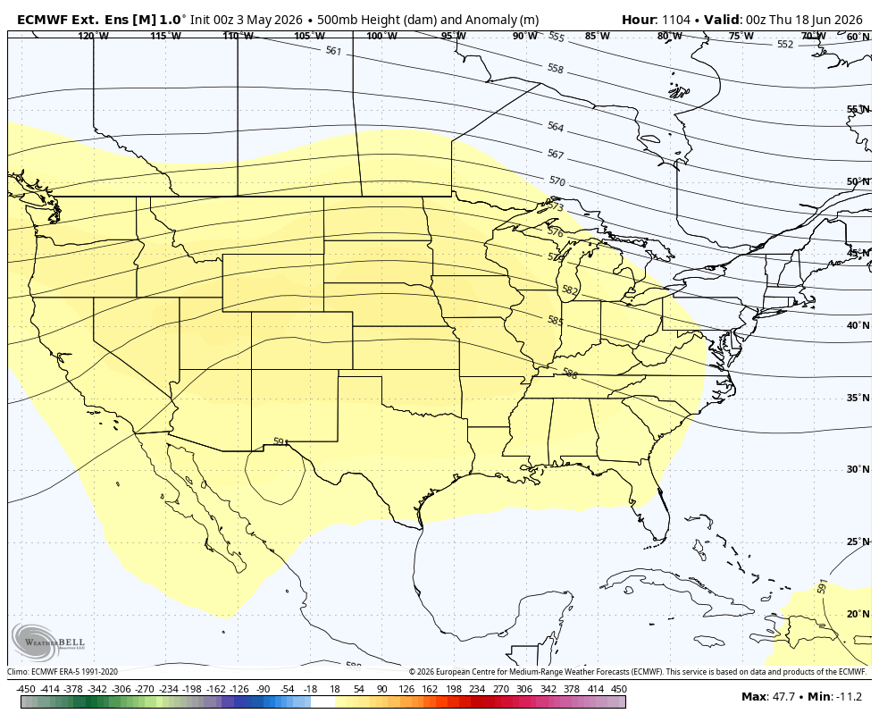
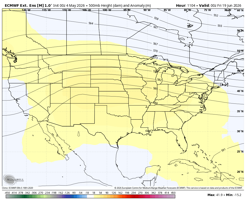
15. 5-4-26: This is the heat ridge on June 19th. Possible ring of fire storm pattern from perturbations after they round the top of the heat ridge and track southeast. 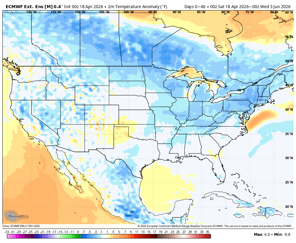


 This product is not updated until late PM.
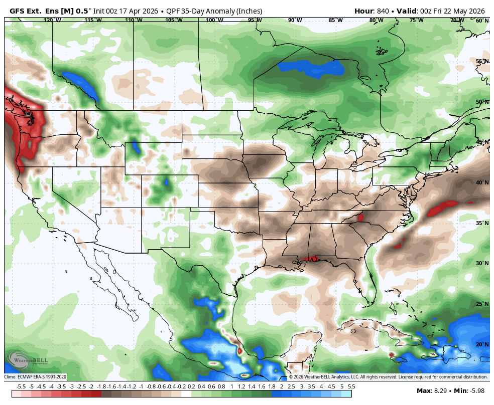
1. This was the GEFS 35 day rain anomaly map from 4-17-26, not updated yet on Saturday. Let's hope this changes for the South which currently has some serious drought to start the growing season so crops don't have much soil moisture to tap into unless it falls from the sky.
2. Updated 4-18-26 map on the right. HUUUUGE increase in needed rain in the South. A forecast this far out doesn't have high skill but the magnitude of the wet shift is extremely impressive.
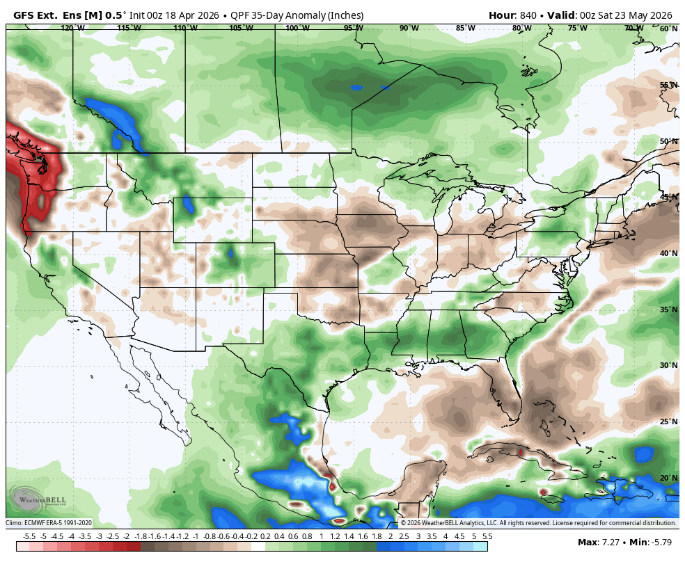
3. 4-19-25: Extremely dry in the Plains!!!! This solution doesn't make sense to me.
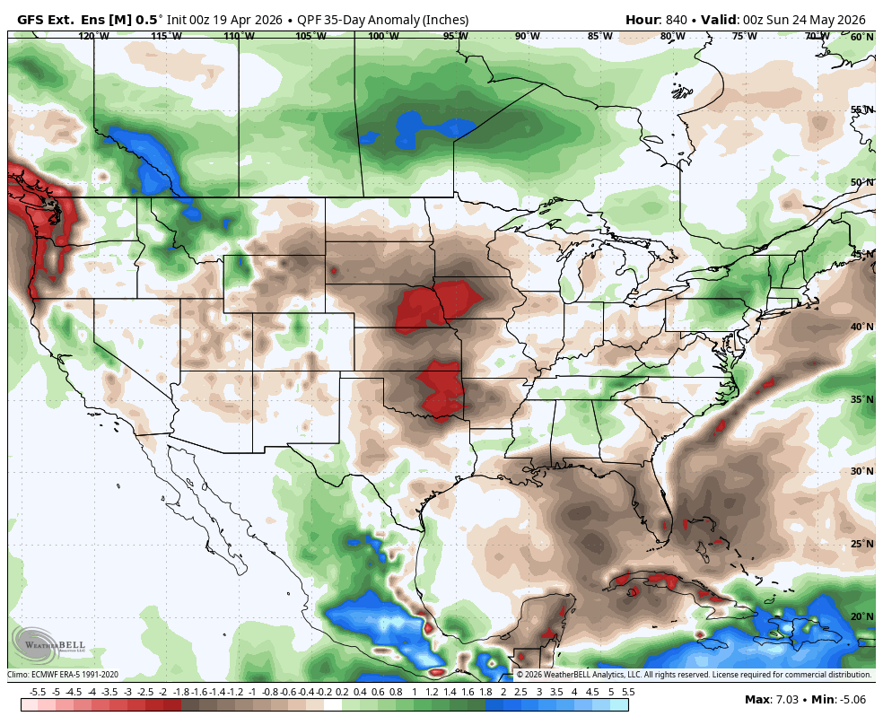
4. 4-20-26: This solution makes more sense but it still might not be wet enough!
5. 4-21-26: This is more like it. Look at how much wetter this last solution is compared to the ones above it!!!
6. 4-22-26: Southern Plains heat ridge with very active El Nino jet stream and numerous perturbations around the periphery. Narrow corridor of repeat, heavy rain storms.
7. 4-23-26: Yesterday's solution on steroids.
8. 4-25-26: Big changes which, unfortunately make sense based on the dry northwest flow from the northern stream. Still a narrow corridor of heavy rains likely pretty far south where they need it..
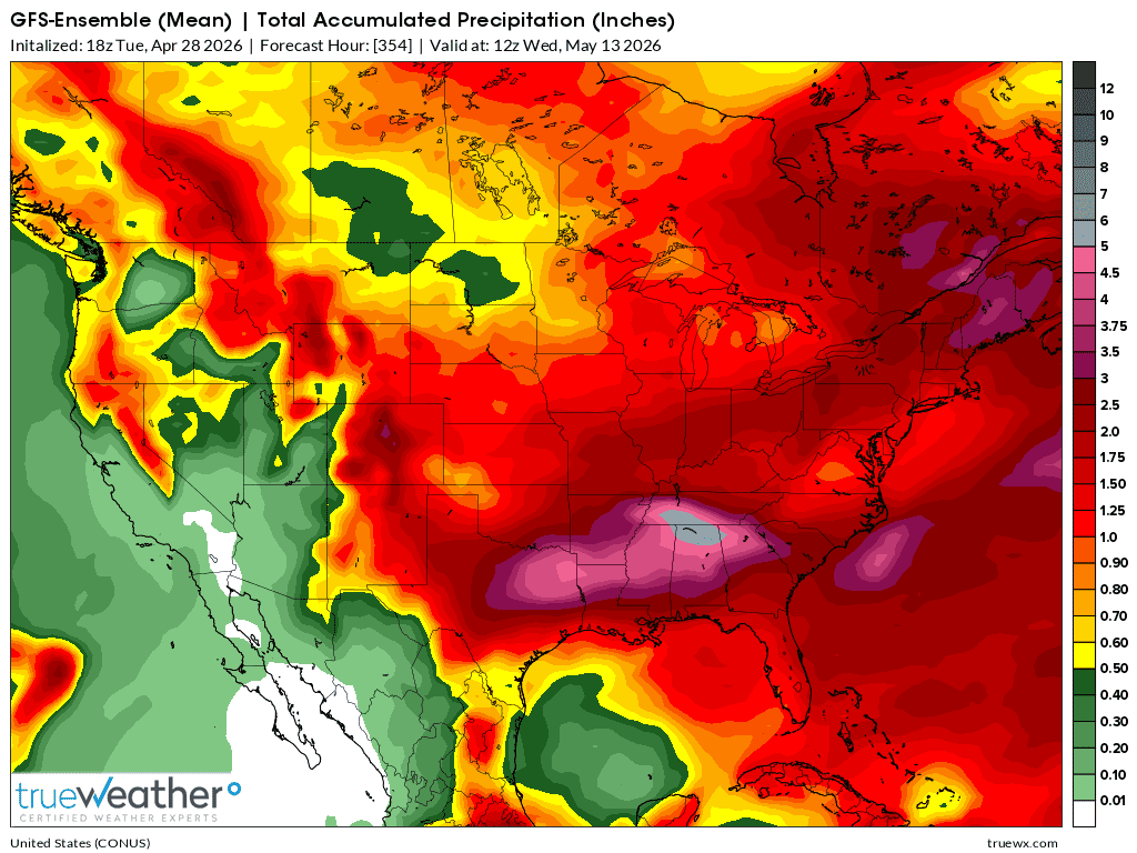
9. 4-28-26: Wet South. Dry north/central Plains, Western Cornbelt.
10. 4-29-26: Wet South. Dry Plains/Midwest
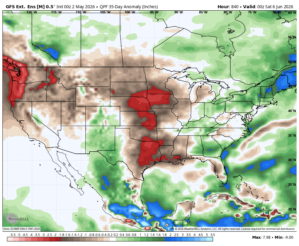
11. 4-30-26: DRY Plains/Midwest-BULLISH. A bit wet deep south. HEAT building from the west in late May!
12. 5-1-26; GEFS 35 day anomaly. Dry west of the Mississippi.
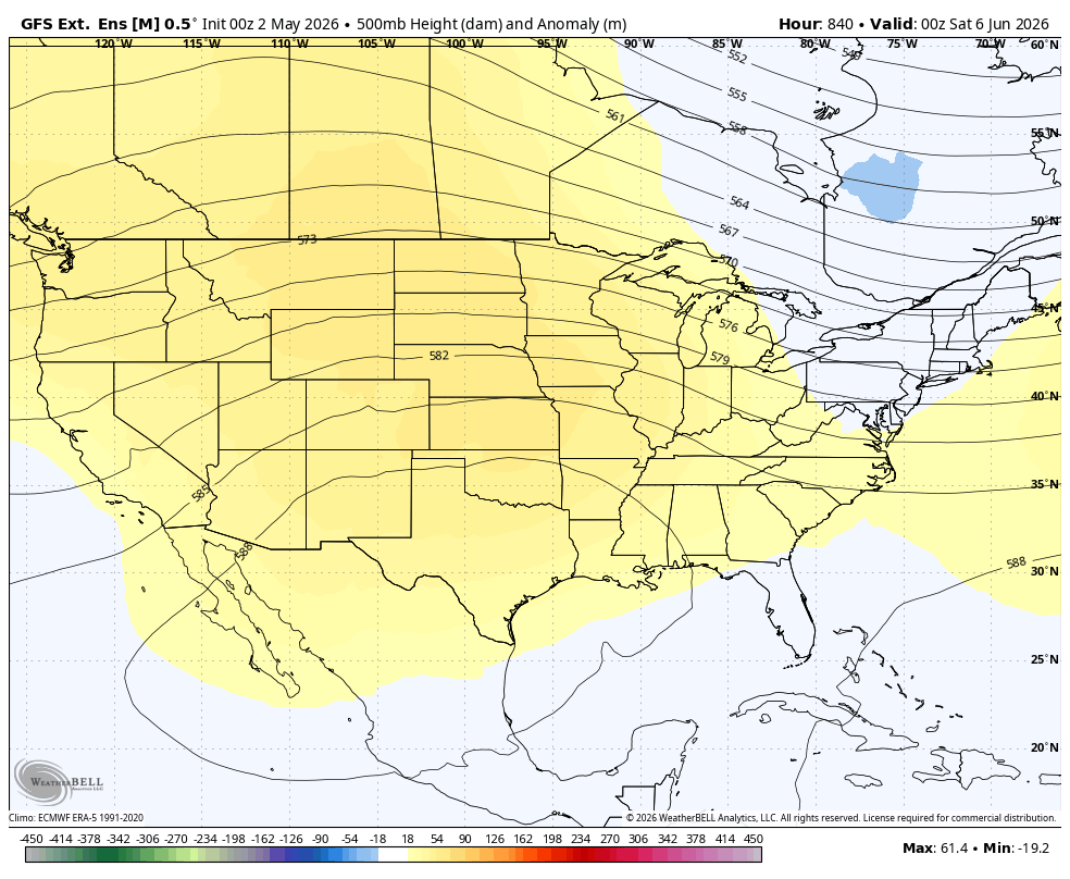
13. 5-2-26: Rains shut down Plains to Upper Midwest. Heat ridge builds in 2nd half of May, capping the atmosphere. Early June 500mb map.


Soil moisture is especially dry in the southeast 1/3rd of the country/cotton country(up the East Coast), back thru the ENTIRE South to the Plains/Rockies!
A huge pattern change, looks promising to greatly increase rains in many of those!!! See the updated rain maps above.
https://www.cpc.ncep.noaa.gov/products/Soilmst_Monitoring/US/Soilmst/Soilmst.shtml#
![]()

https://www.drought.gov/current-conditions
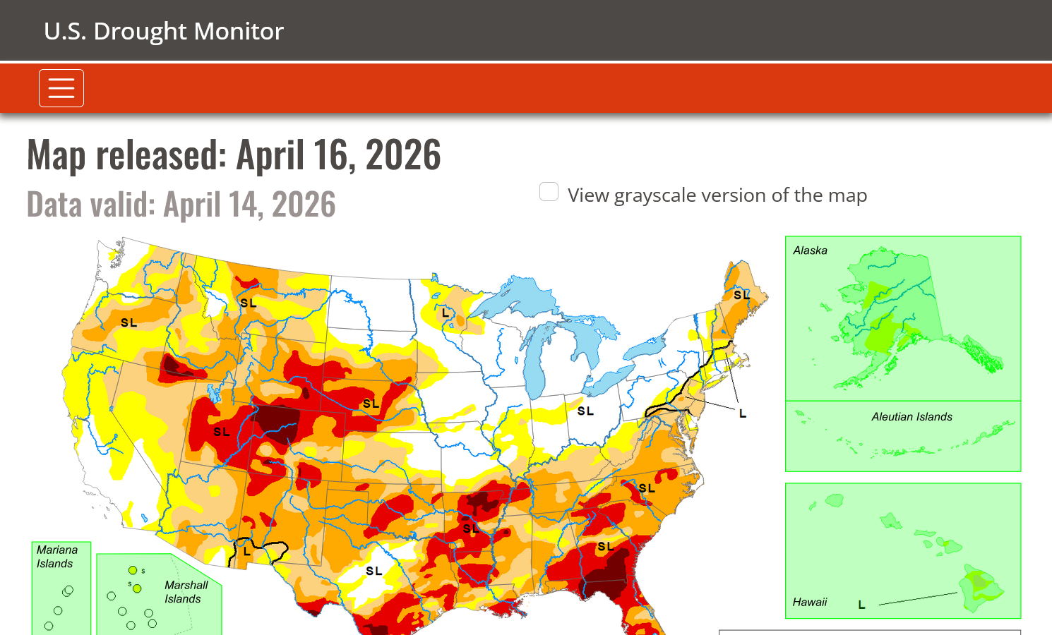
Drought eliminated some places but increasing in MORE places!
Thru April 16, 2026
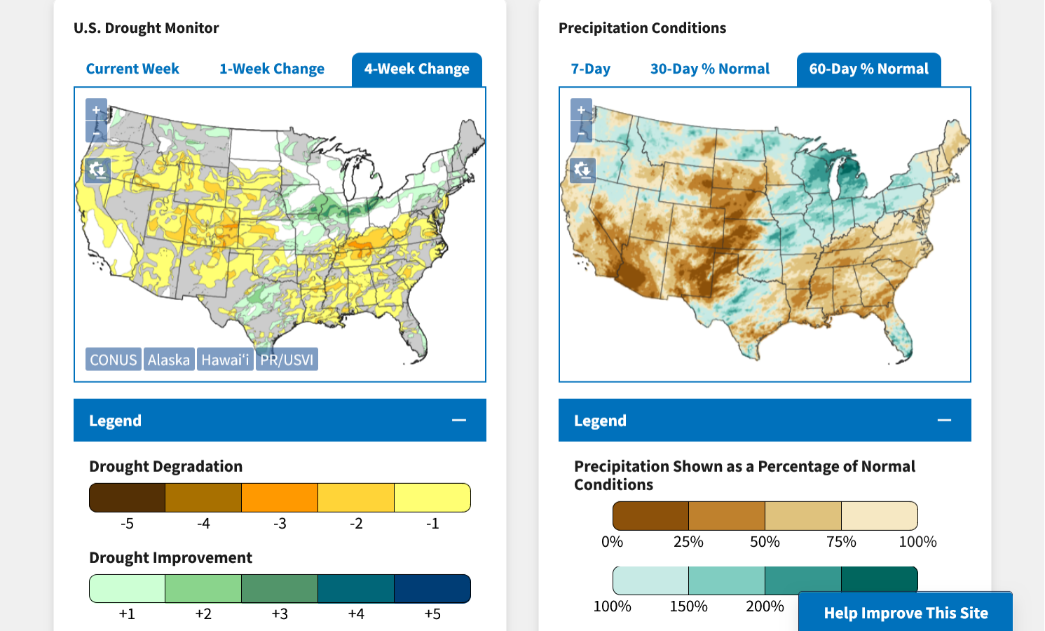
DROUGHT MONITOR
https://droughtmonitor.unl.edu/
Drought gone in the Midwest. Worse in the Plains, South and East.
Started today's updates: HIGH confidence in the pattern turning much wetter and greatly eroding the current drought!
https://www.marketforum.com/forum/topic/119657/#119658
The complete, longer range new European model isn't available until well into the PM and the GEFS longer range late evening.
Good rains finally coming to much of the SE US this weekend and quite possibly lasting on and off for 10+ days!
This is really awesome for much of GA and points westward and all the other states in severe drought that desperately need this rain to restore soil moisture and get the growing season off to a good start.
4-22-26: I hope that enough rain can get that far southeast, Larry. The heaviest rains may dry up in GA, especially the southern 1/2 of the state.
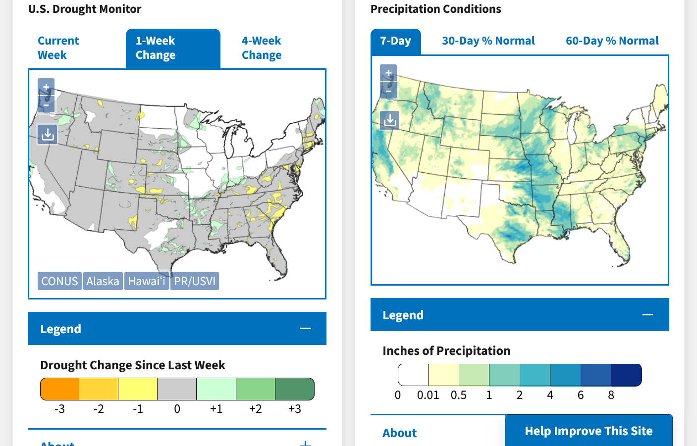
Updated, weekly drought metrics today:
Soilmoisture anomaly:
These maps sometimes take a day to catch up to incorporate the latest data(the bottom map is only updated once a week).
https://www.cpc.ncep.noaa.gov/products/Soilmst_Monitoring/US/Soilmst/Soilmst.shtml#
![]()

++++++++++++++++++++++++++++
Updated daily below:
https://mrcc.purdue.edu/cliwatch/watch.htm#curMonths
Snapshot below:
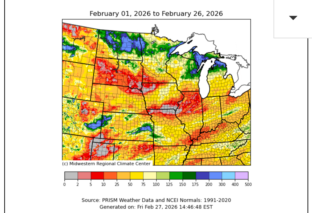
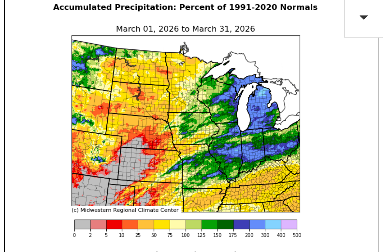
March rains have reduced drought from MO to N.OH.
NEW LINK:
https://www.drought.gov/current-conditions
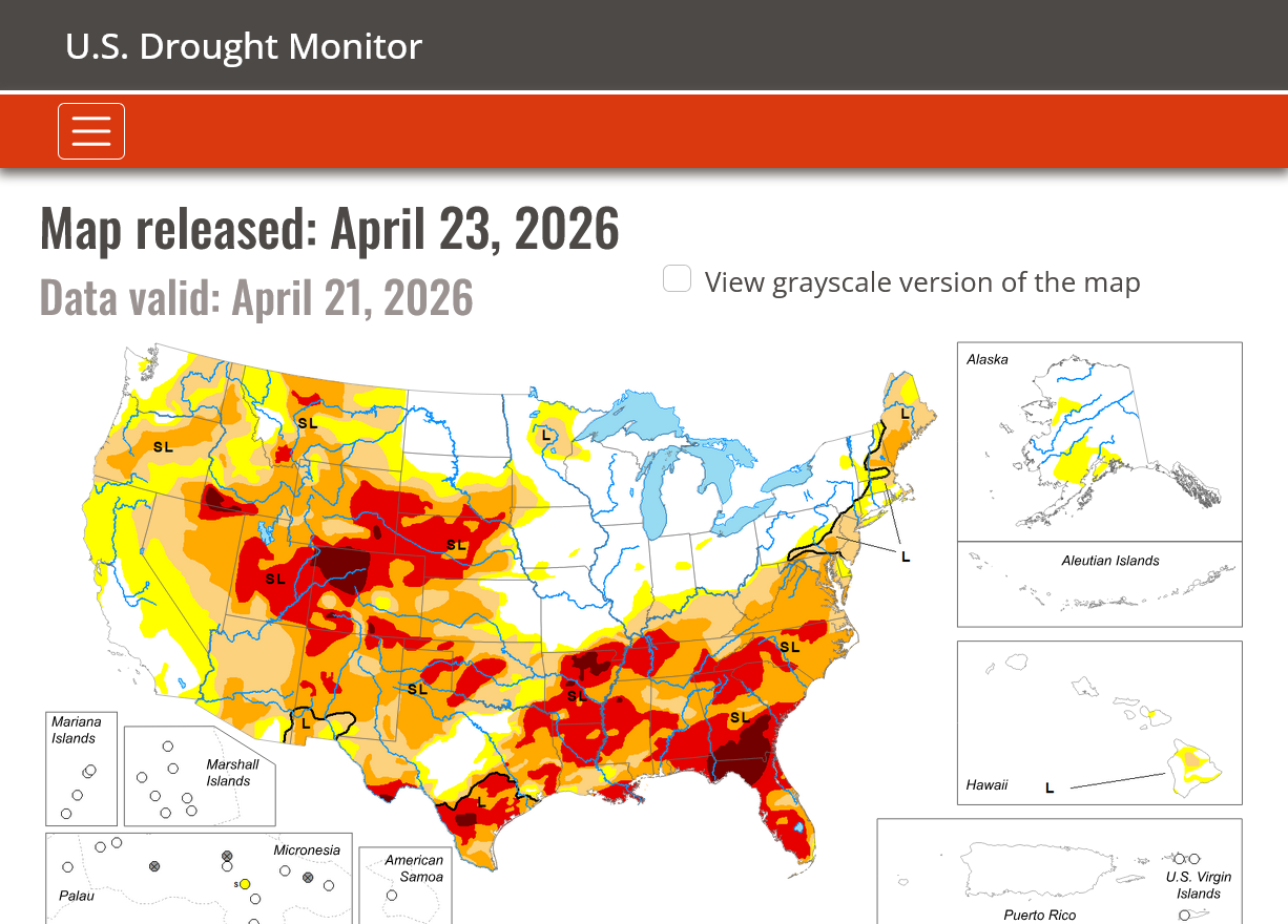
Drought eliminated in the Midwest but increased in the Plains/Southeast 1/3rd of the country!
Thru April 23, 2026
DROUGHT MONITOR
https://droughtmonitor.unl.edu/
Drought gone in the Midwest. Worse in most other areas from dry weather and early season heat!
Mike et al,
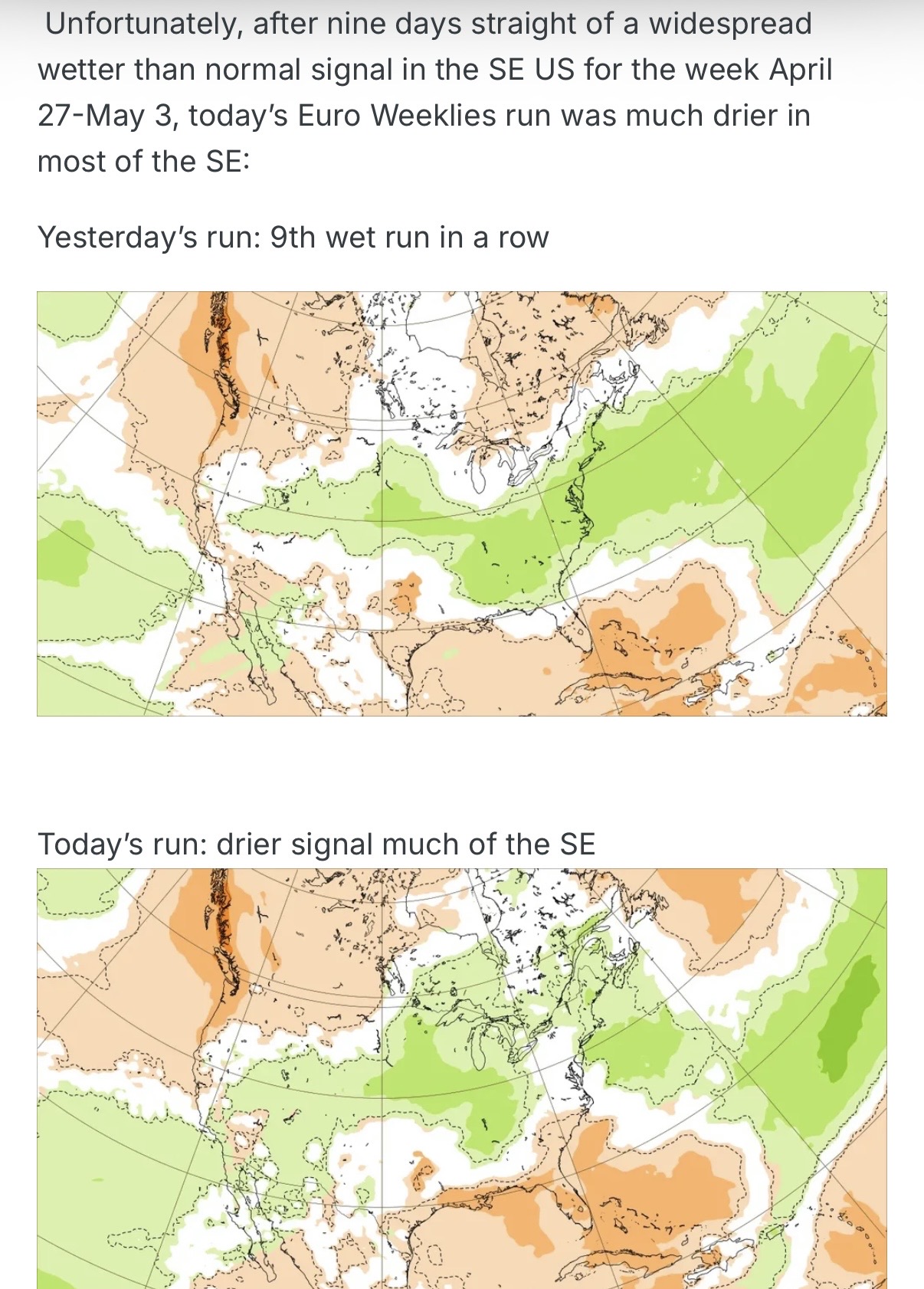
It doesn’t look as wet in the bulk of the SE per yesterday’s Euro Weeklies vs the prior 9 days. :(
Thanks very much, Larry.
I noted a concern over this 2 days ago. Despite the drier look to some forecasts right now in the far Southeast, we both know better than most people that changes are much more likely than no changes in upcoming forecasts.
However, I always tell the kids in our chess programs: "The most important move in the game is often what your opponent did last!"
Same thing with weather models. The most important run, is the last one which is using the latest, freshest empirical data.
The NWS agrees with this:
https://www.cpc.ncep.noaa.gov/products/predictions/WK34/
| Week 3-4 Outlooks | |
| Valid: 09 May 2026 to 22 May 2026 Updated: 24 Apr 2026 | |
Temperature Probability | Precipitation Probability |
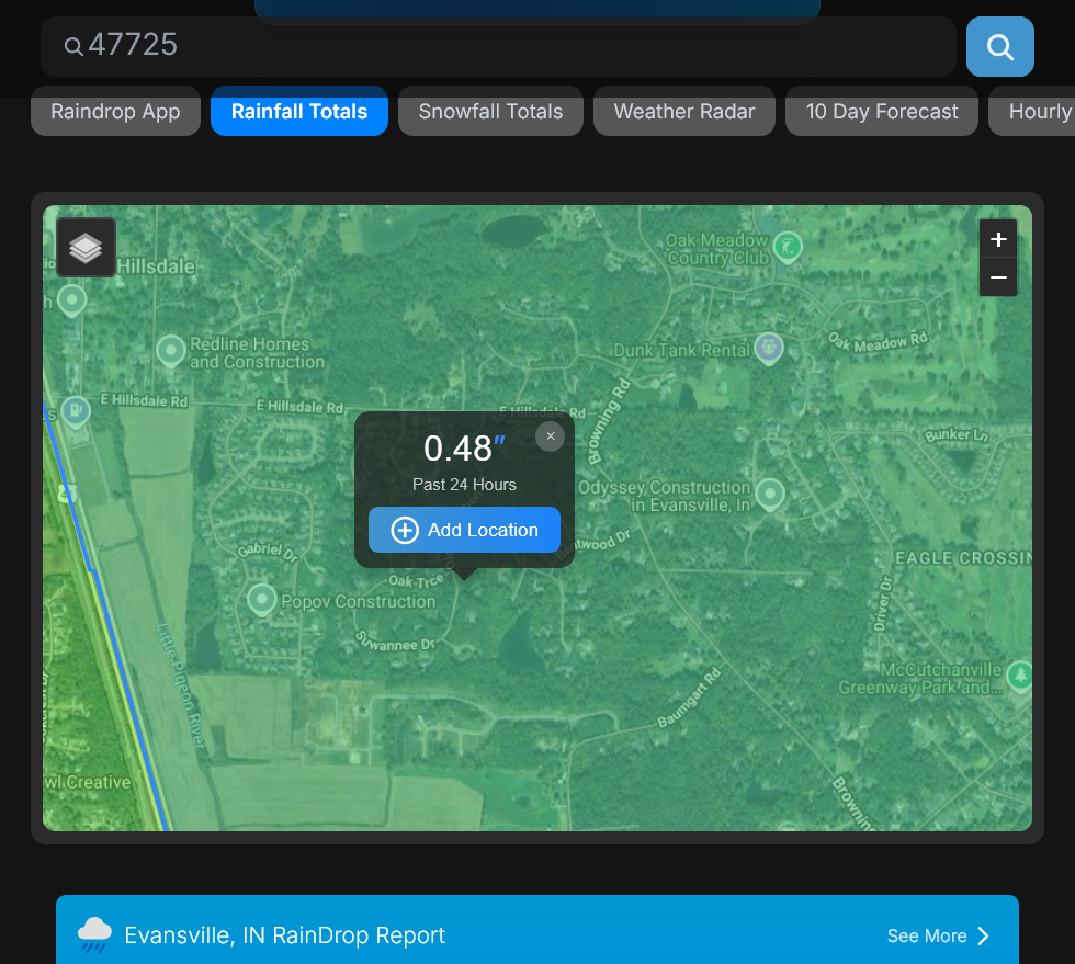
10am: We got another .48" overnight, so close to 1.7" total from this event!!!
Man, did we ever need that rain as Evansville was on the northern edge of the area hit with this MAJOR drought in the South. With the very cool temps, this will get us thru the next 2 weeks before needing another big rain.
Just put your zip code into the link below.
https://www.raindrop.farm/rainfall-totals/zipcode/47725#map
More potentially bullish longer range today!
Re: Rain/drought thread April 2026
By metmike - April 20, 2026, 10:38 a.m
+++++++++++++++++++++++++++++
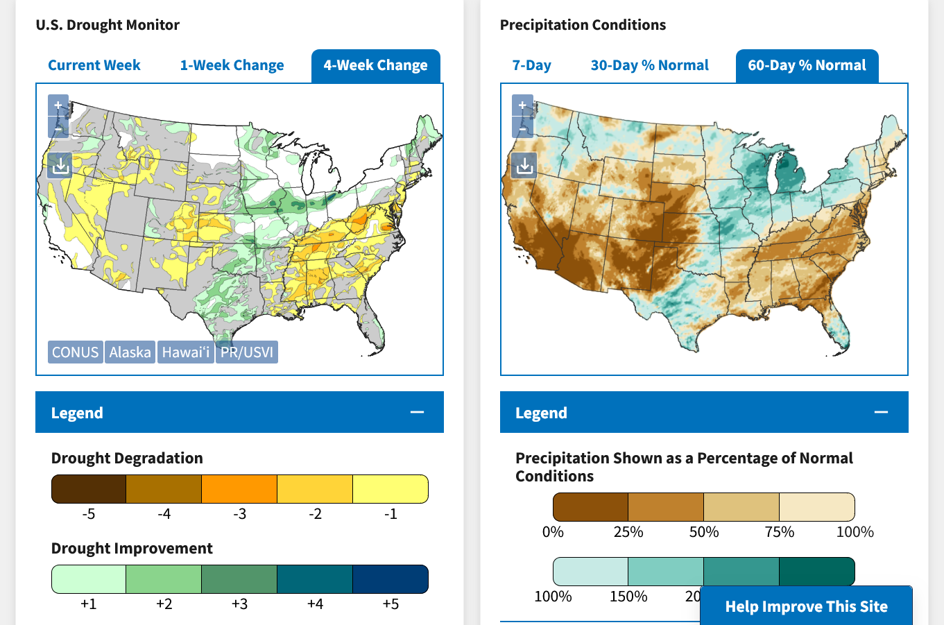
Soilmoisture anomaly:
These maps sometimes take a day to catch up to incorporate the latest data(the bottom map is only updated once a week).
https://www.cpc.ncep.noaa.gov/products/Soilmst_Monitoring/US/Soilmst/Soilmst.shtml#
![]()
++++++++++++++++++++++++++++
Updated daily below:
https://mrcc.purdue.edu/cliwatch/watch.htm#curMonths
Snapshot below:

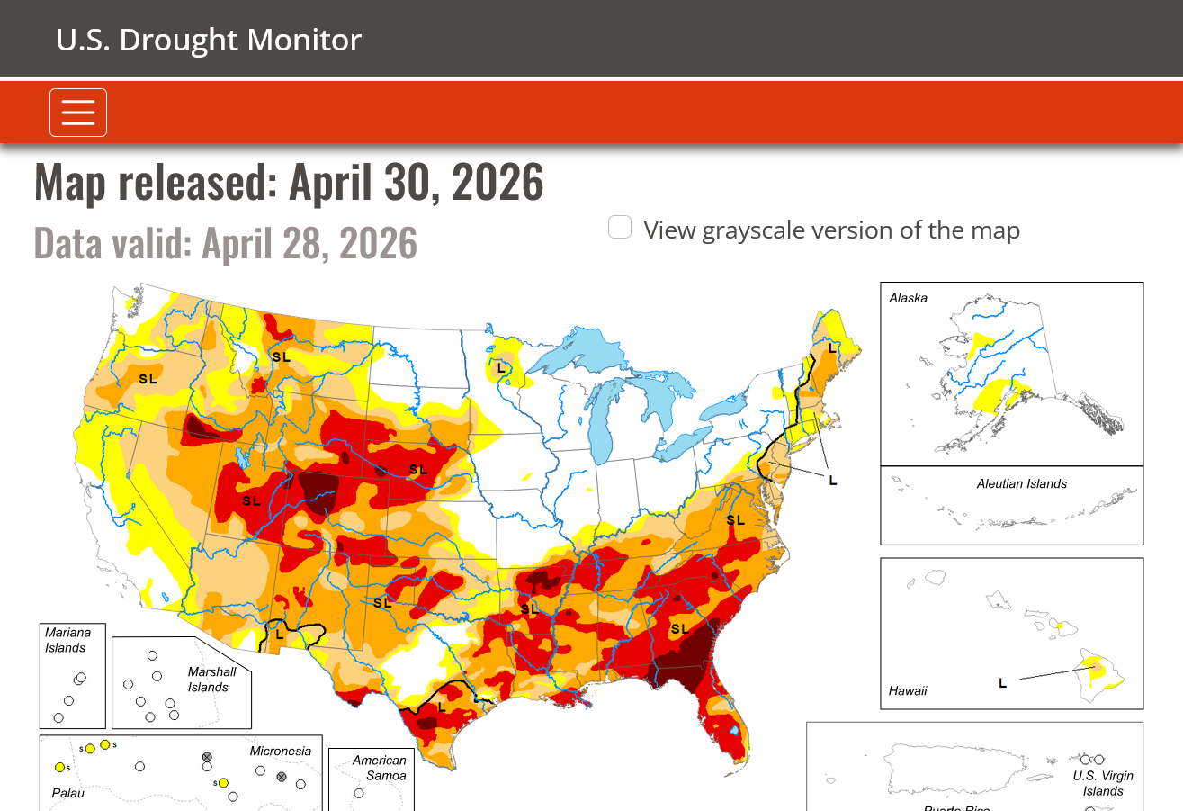
NEW LINK:
https://www.drought.gov/current-conditions
Drought eliminated in the Midwest but increased in the Plains/Southeast 1/3rd of the country!
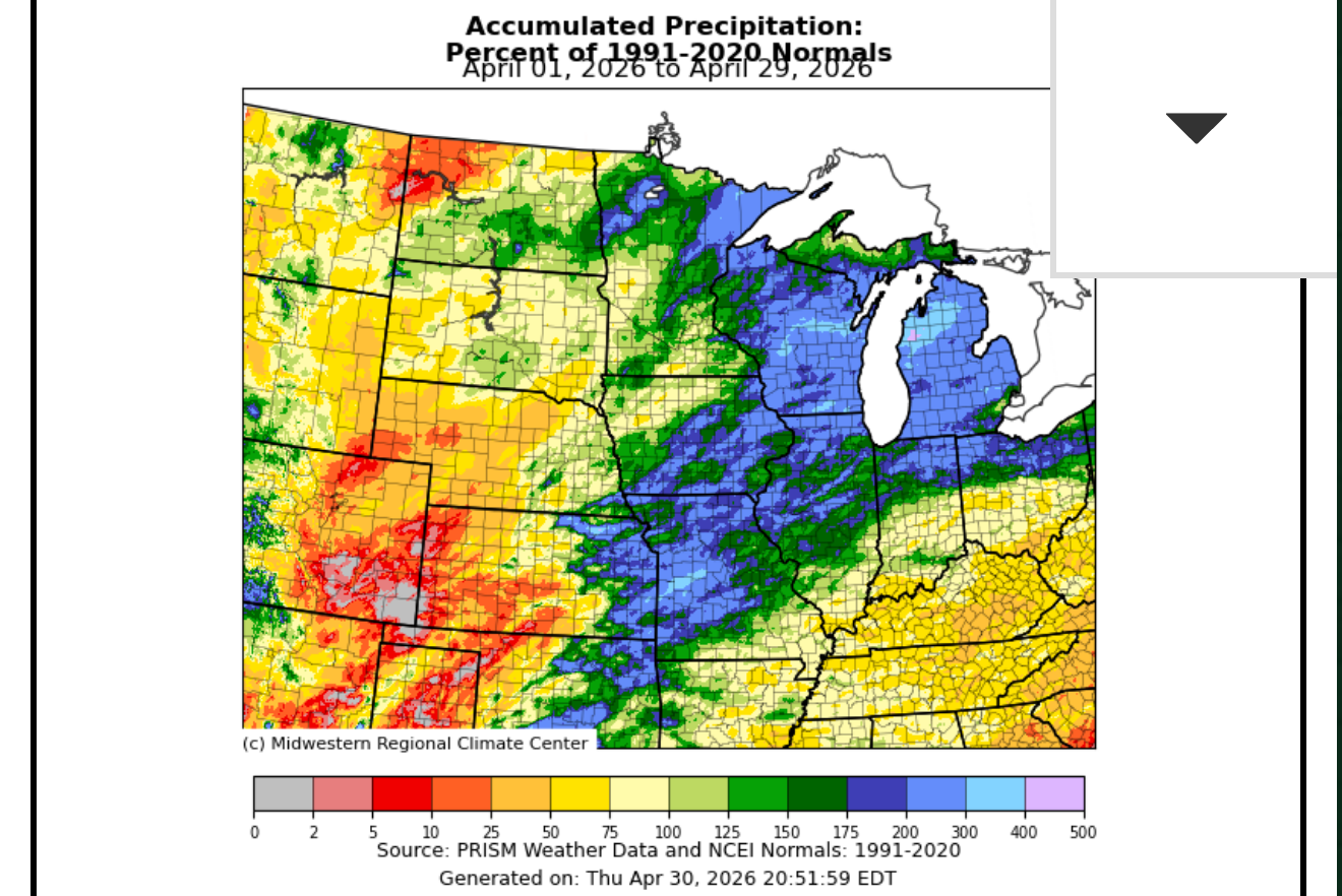
Thru April 28, 2026
DROUGHT MONITOR
https://droughtmonitor.unl.edu/
Drought gone in the Midwest. Much more rain needed elsewhere.
The NWS has a complete pattern change during the 2nd half of May!!!!
Looks like it's based on the rapidly developing El Nino kicking in later this month. I can't argue with that based on the analogs shown here this year.
https://www.cpc.ncep.noaa.gov/products/predictions/WK34/
| Temperature Probability | Precipitation Probability |
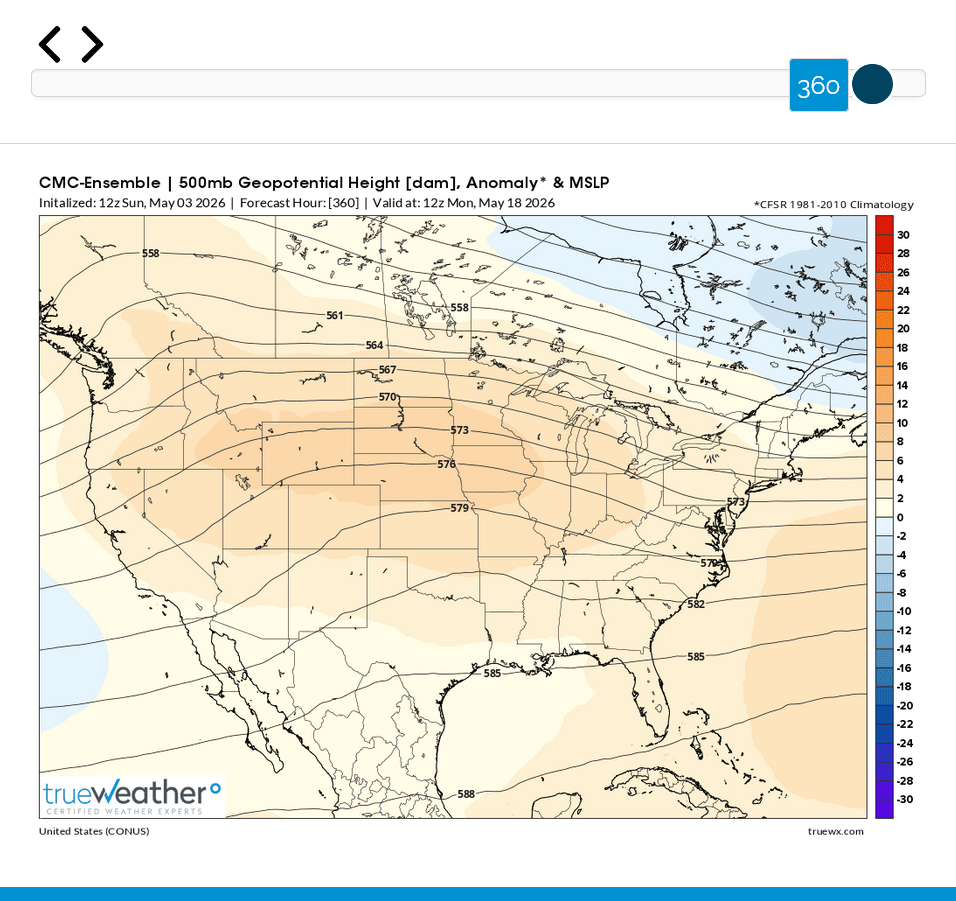
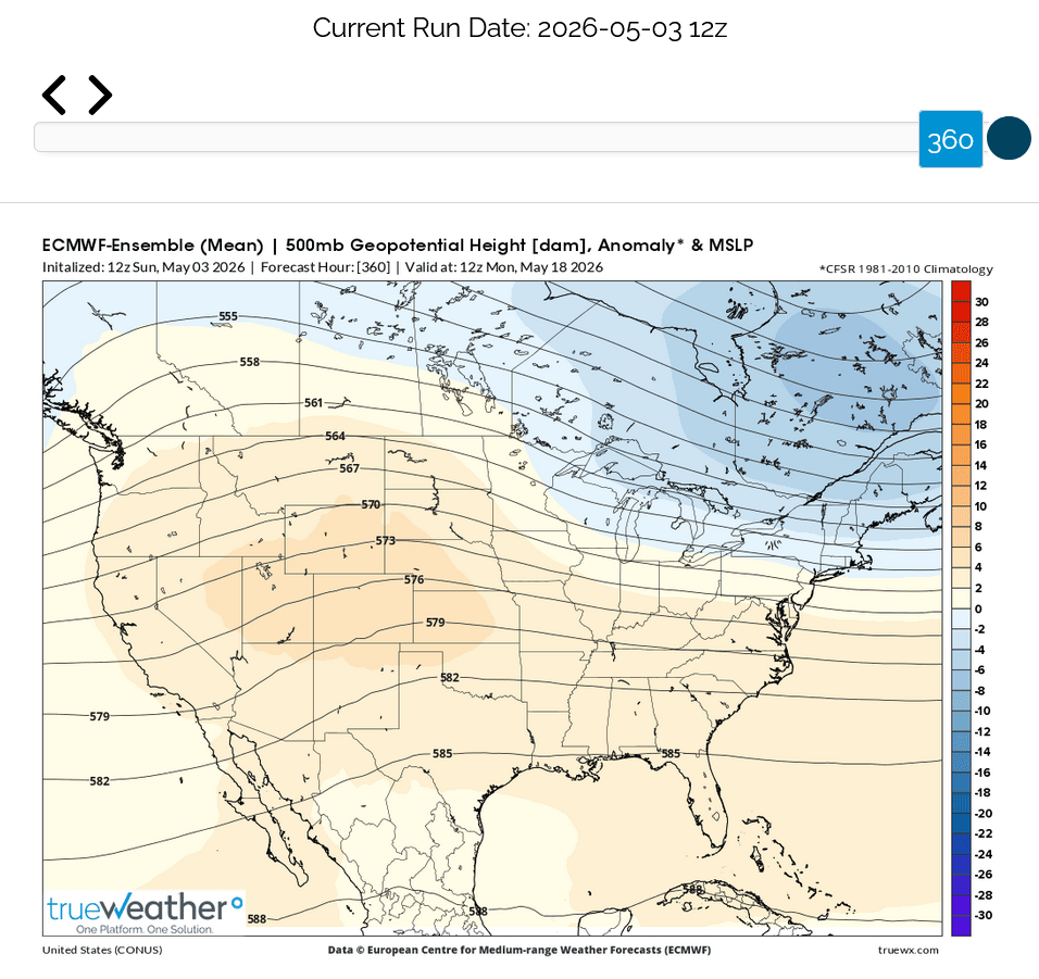
This is the upper level pattern in 15 days.
5-3-26 updates:
Very different!!!
1. The GEFS shifts/changes to a trough West, Ridge East pattern. Favorable for the NWS weeks 3-4 pattern above. Heat building East(mildly bullish natural gas). Rains increasing west.
2. The Canadian model builds the ridge farther west and stronger into the PLAINS and Western Corn Belt and is MUCH DRIER.
3. The European Model holds on to the current pattern into early week 3. Cool East, Heat West. Modest ridge building into the Plains
GEFS:
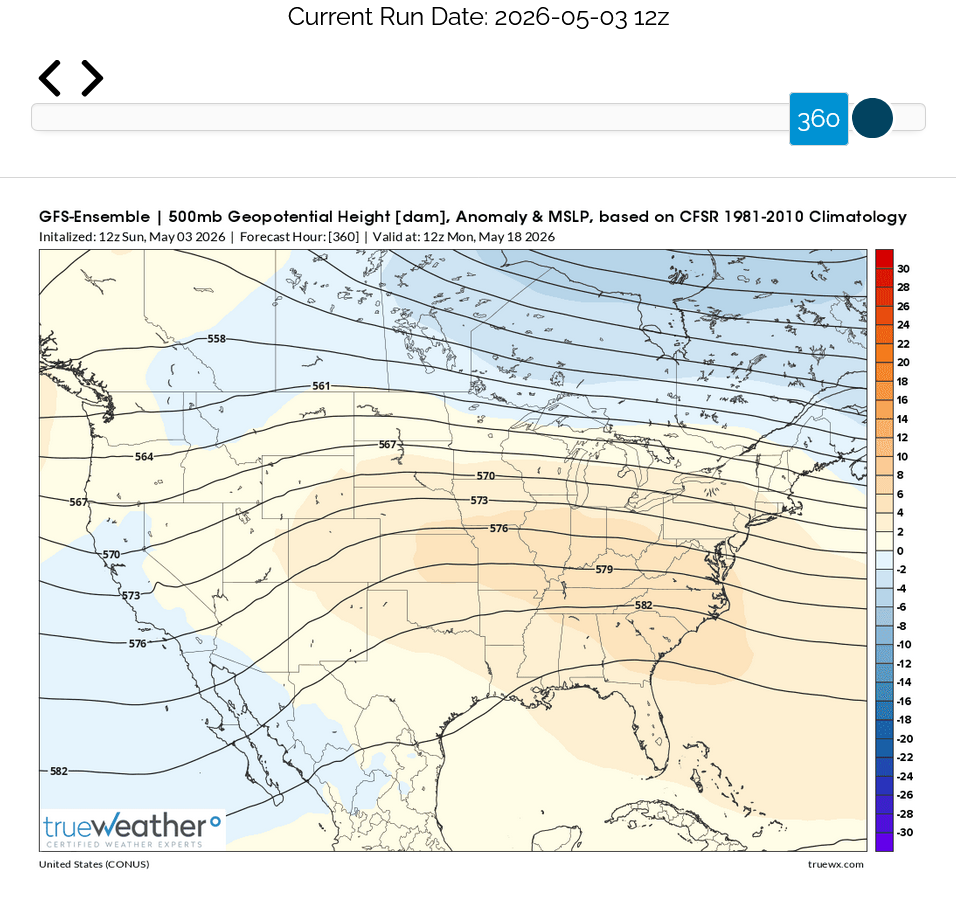
Canadian model:
European model:
Mostly updated maps:
Re: Rain/drought thread April 2026
By metmike - April 20, 2026, 10:38 a.m
Added new products 5-3-26.
+++++++++++
Updated upper level maps at the start of week 3 from the 3 main models: