
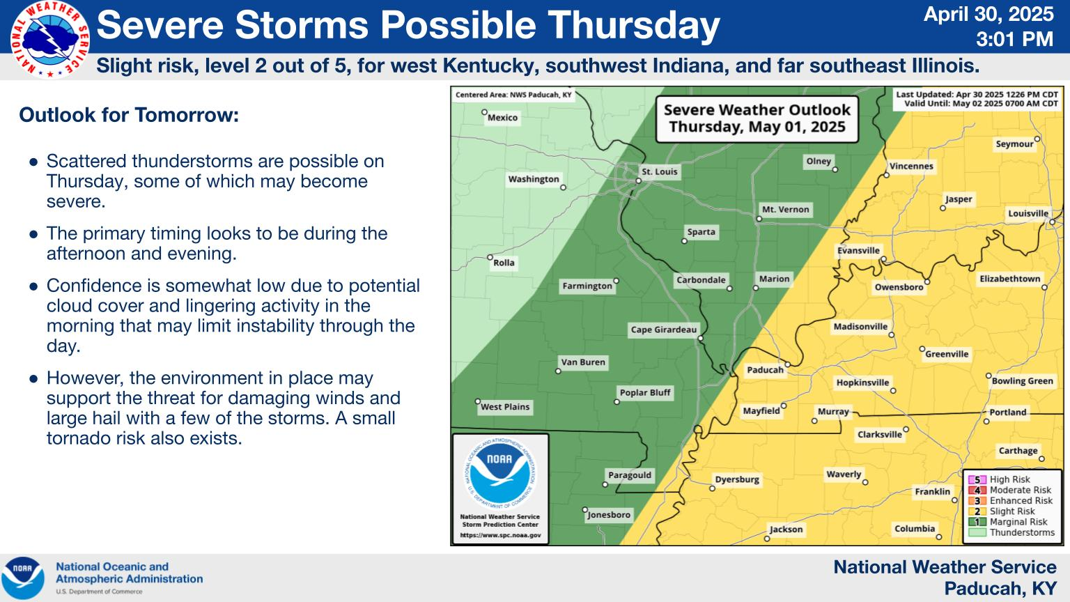
This is mainly for severe thunderstorms, NOT tornadoes.
https://www.spc.noaa.gov/products/outlook/day1otlk.html
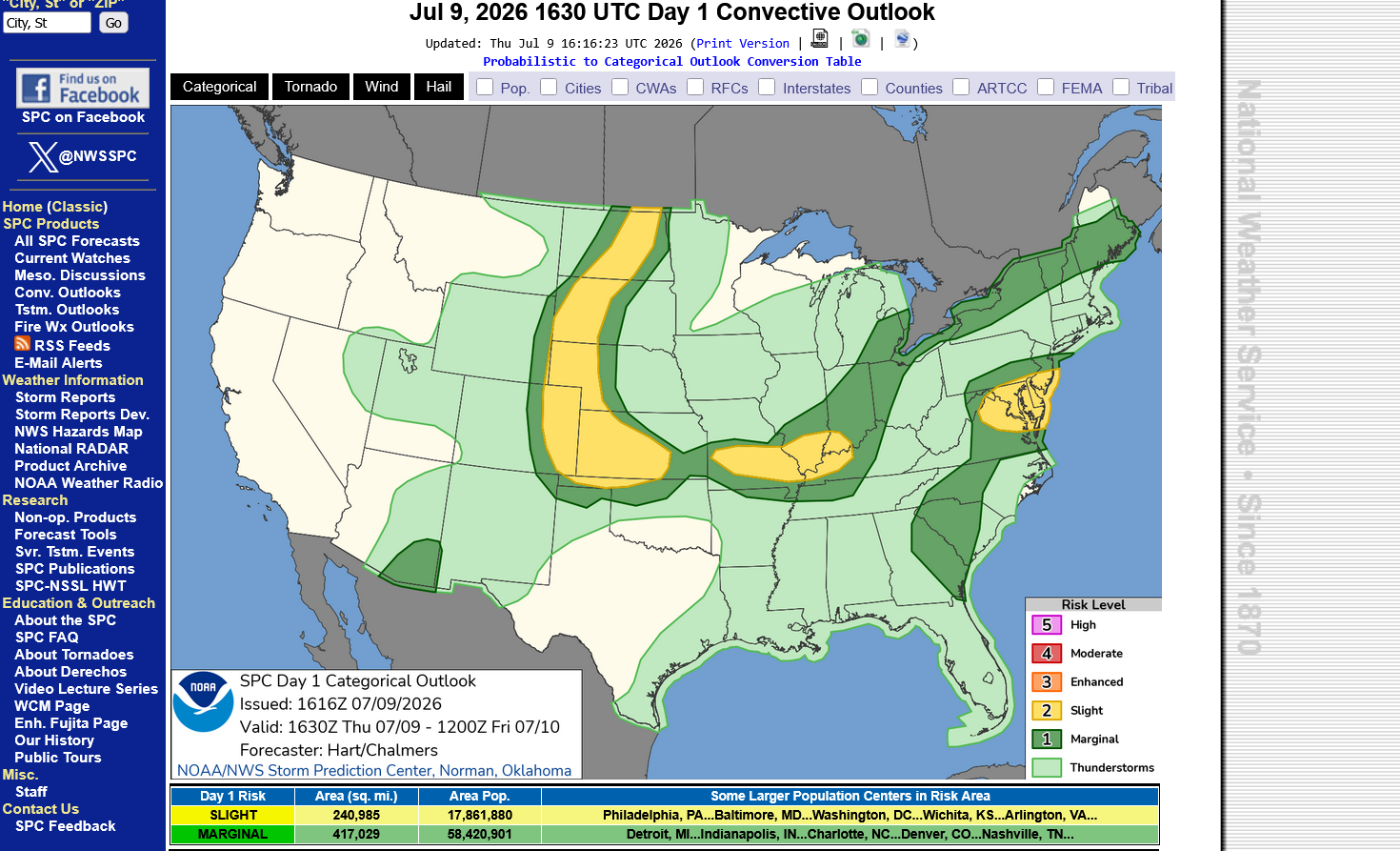
The Storm Prediction Center says there's a 40% chance of them issuing a severe thunderstorm watch box for severe storms up to 60 mph later this afternoon.
This type of risk is NOT life threatening like high end tornado threats. You should ALWAYS stay inside, away from windows during ALL thunderstorms.
You are safe/grounded from lighting in your car. During a severe/strong thunderstorm, avoid driving in a place where trees or flying debri can suddenly fall in front of your car!
Have your electronics charged up in case of a power outage.
https://www.spc.noaa.gov/products/md/md1554.html

We did just get a severe thunderstorm watch from the Storm Prediction Center. However, the location is in MO to far west KY/TN.
For 6 hours until Midnight.
Up to 70 mph wind and a WEAK tornado possible.
https://www.spc.noaa.gov/products/watch/ww0477.html

++++++++++++++
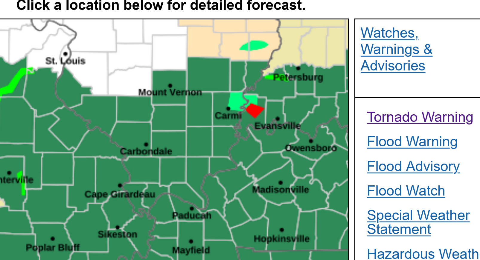
The Evansville, IN area is under a Flash Flood Watch for the next 2 days in green below.
Current Hazards at the link below.
For your NWS and county, go to the link below.
Then you can hit any spot on the map, including where you live and it will go to that NWS with all the comprehensive local weather information for that/your county.

6pm, 7-9-26 below frozen image below.
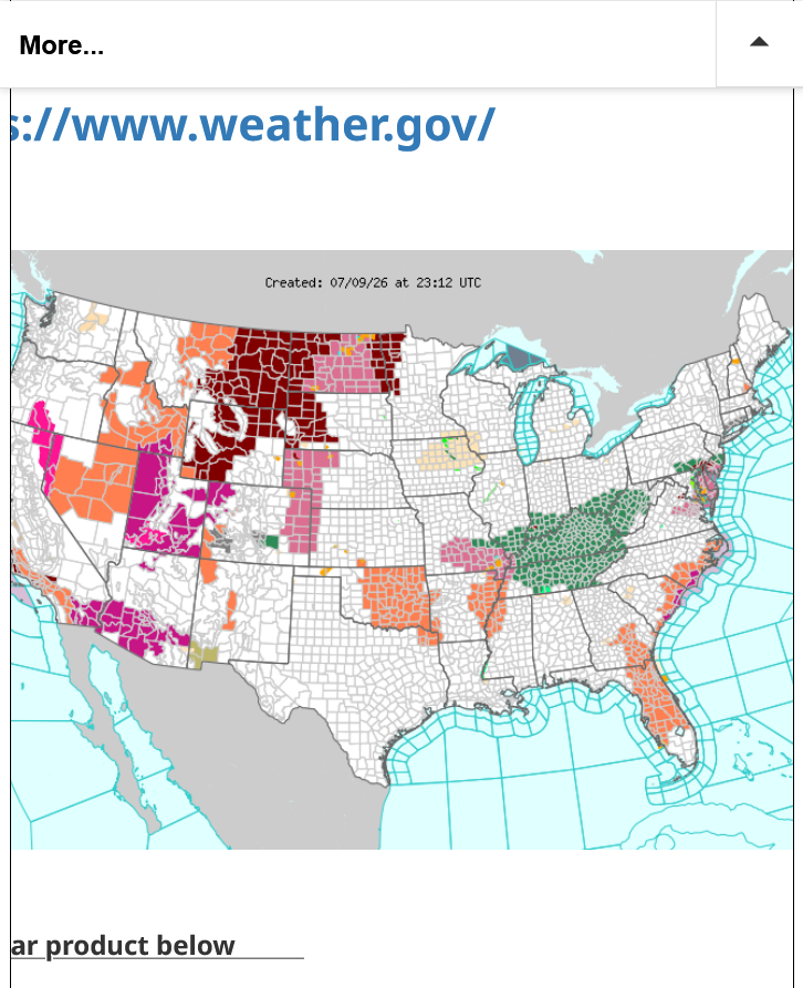
Another risk of severe storms and flashing flooding this evening! See the link above for graphics.
The risk is for winds gusting to 70 mph with no mention of a tornado.
This type of risk is NOT life threatening like high end tornado threats. You should ALWAYS stay inside, away from windows during ALL thunderstorms.
You are safe/grounded from lighting in your car. During a severe/strong thunderstorm, avoid driving in a place where trees or flying debri can suddenly fall in front of your car!
Have your electronics charged up in case of a power outage.
https://www.spc.noaa.gov/products/watch/ww0480.html

Great site for getting rainfall data. Just put in your zip code!
https://www.raindrop.farm/rainfall-totals/zipcode
++++++++++++++
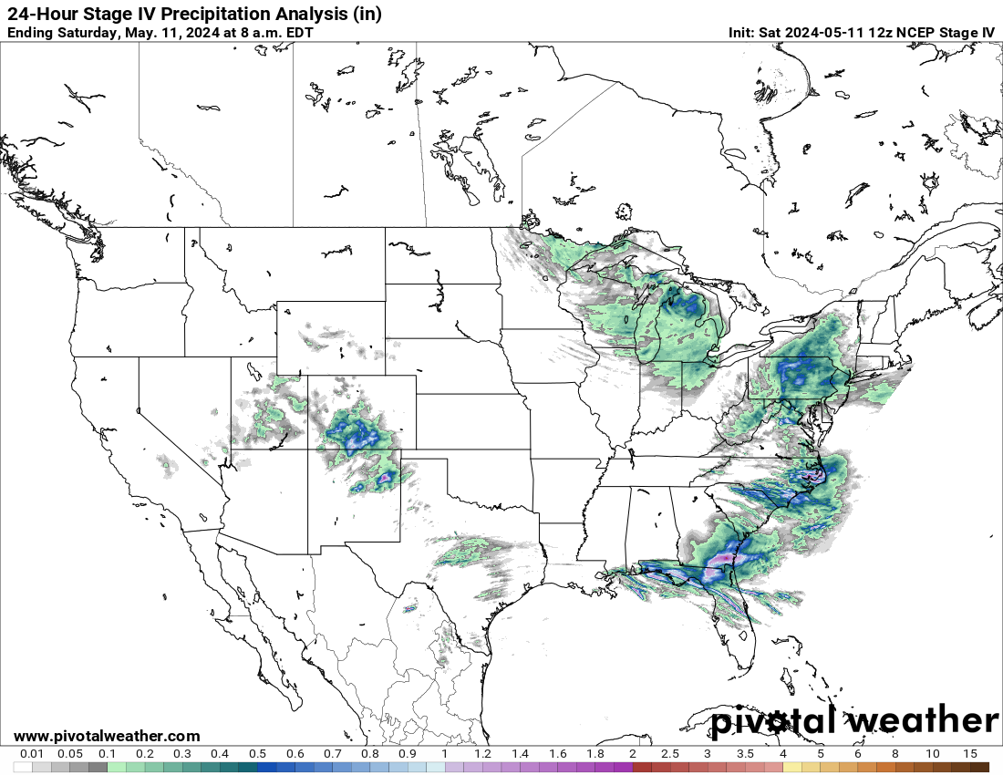
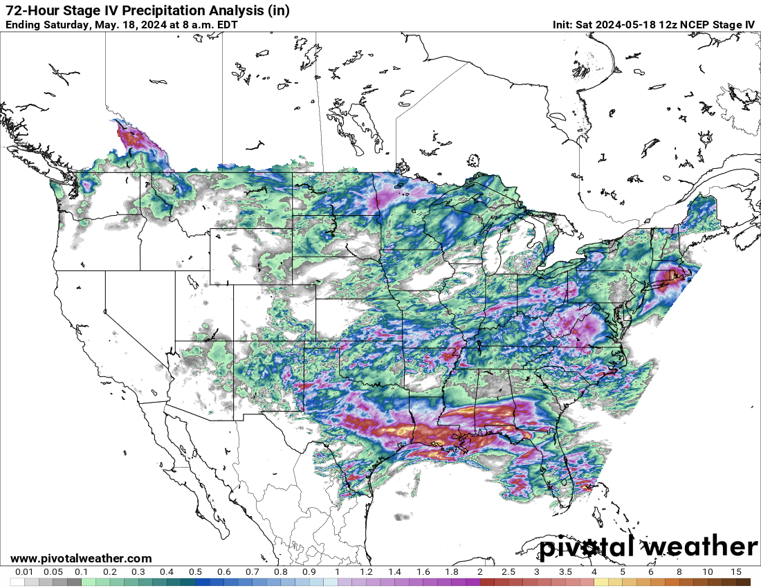
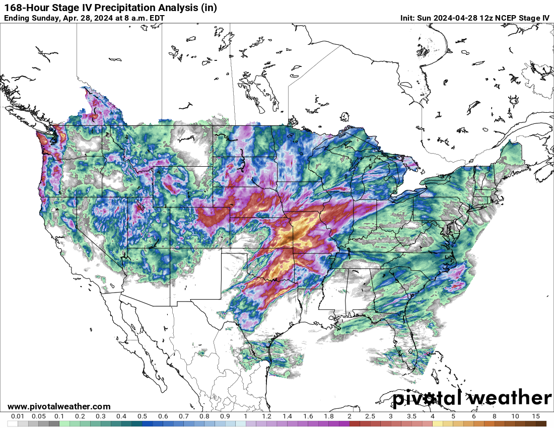
https://www.pivotalweather.com/maps.php?ds=stageiv&p=stageiv_qpe_168h_p&r=conus
Last 24 hours
Last 72 hours
Last 7 days:
Tornado warning for possible WEAK tornado from this isolated strong storm. Just treat it like a severe thunderstorm warning and stay away from windows in a building that has a foundation (never a mobile home).
NOT the type of tornado, IF it touched down that's life threatening.
 Weather Map