Get all the comprehensive weather here:
https://www.marketforum.com/forum/topic/83844/
Current Hazards at the link below.
For your NWS and county, go to the link below.
Then you can hit any spot on the map, including where you live and it will go to that NWS with all the comprehensive local weather information for that/your county.

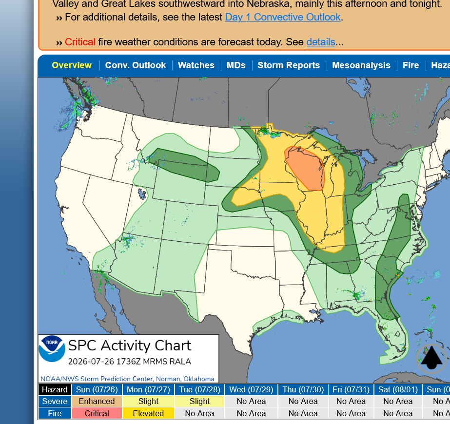
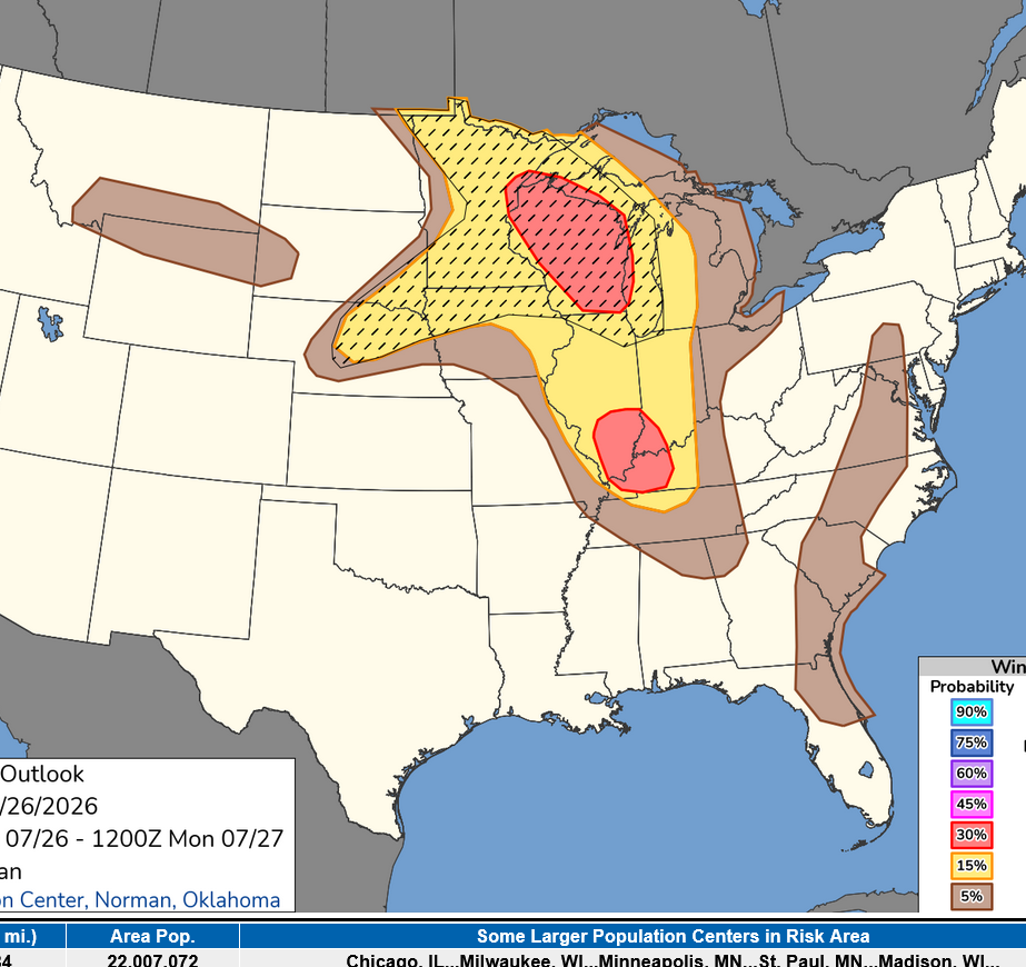
The Storm Prediction Center just updated the outlook to increase the chance of severe storms in a pocket to the south. Below is the risk for WINDS of 58+ mph. The hatched area is a 10% risk that those winds being 70+ mph.
https://www.colonieweatheronline.com/storm/outlook.php?id=us
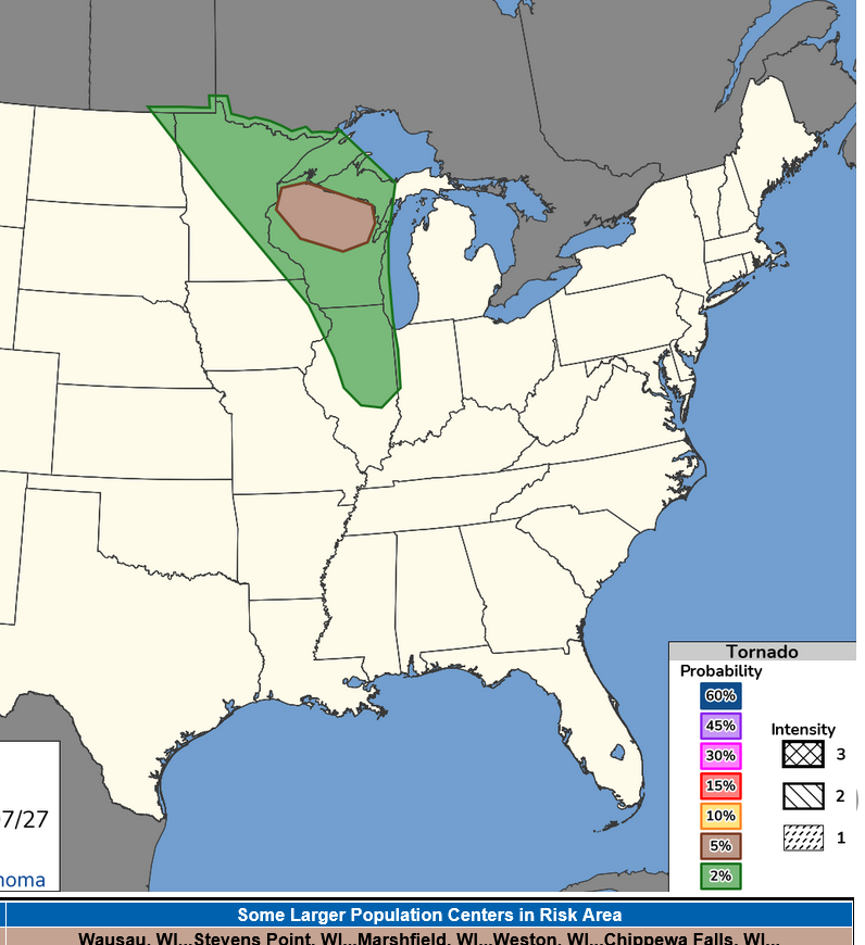
The chance of tornadoes is LOW this far south. Less than 2%. If/when we see a watch in Evansville, IN it will be a SEVERE THUNDERSTORM watch. Not a tornado watch.
By metmike - July 26, 2026, 11:29 a.m.
Scroll down from this link to see the forecast for individual days rains as well as risk for severe weather and excessive rain.
https://www.marketforum.com/forum/topic/83844/#83848
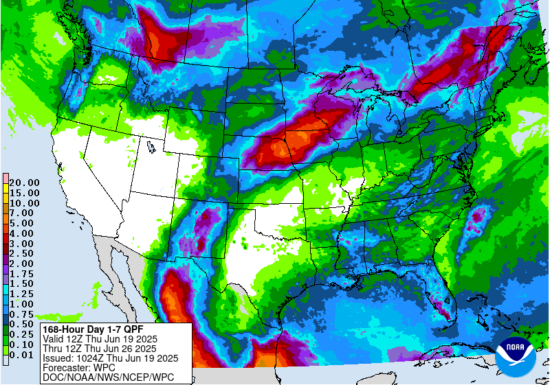
7 Day Total precipitation below:
http://www.wpc.ncep.noaa.govcdx /qpf/p168i.gif?1530796126
+++++++++++++++
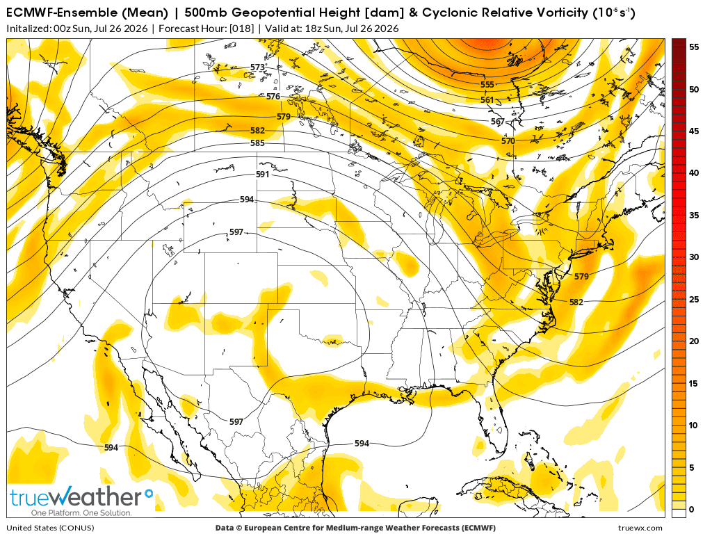
Below is the 500 mb map with vorticity from the last 0z European Ensemble model for Sunday afternoon.
I'm hoping a lobe of vorticity, coming around the periphery of the heat ridge and tracking in the nw to se flow late this afternoon/evening will trigger clusters of thunderstorms that get to Evansville, IN even though the strongest activity will likely be farther north, where other dynamics are more favorable.
++++++++++++++++++++++++++++
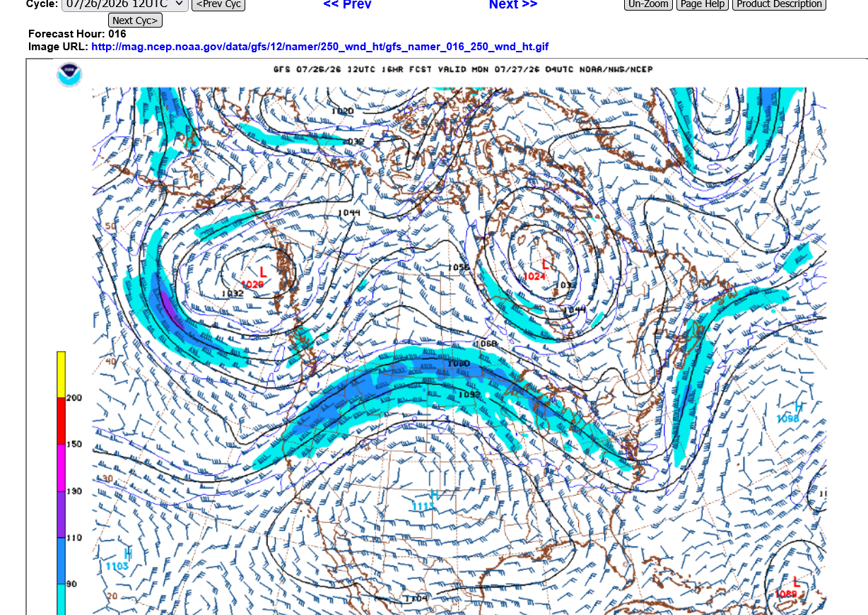
Below is the 250 mb level/steering currents up at 36,000 feet in the heat of Summer(warmer air expands the atmosphere upwards by x thousands of feet because it's less dense).
Note the wind barbs. They have a strong north to south component to the east of the heat ridge. So we should expect the storms that develop to track southeast, even curving more southward if they make it this far south because of our location with respect to the circulation around the heat ridge.
Wind barbs in the state of MO, for instance are almost all due south!
The Storm Forecast Center issued this Mesoscale outlook a couple of hours ago for our area, so a watch is likely at some point this evening.
Note the risk for any tornadoes would be those of 90 mph or weaker. Essentially not much worse than severe thunderstorm winds and NOT the type that kills many people. You just stay inside away from windows and NOT in a mobile home and you're fine.
In a car, with a warning try to stay away from areas with tall trees that could fall across the road.
https://www.spc.noaa.gov/products/md/md1742.html

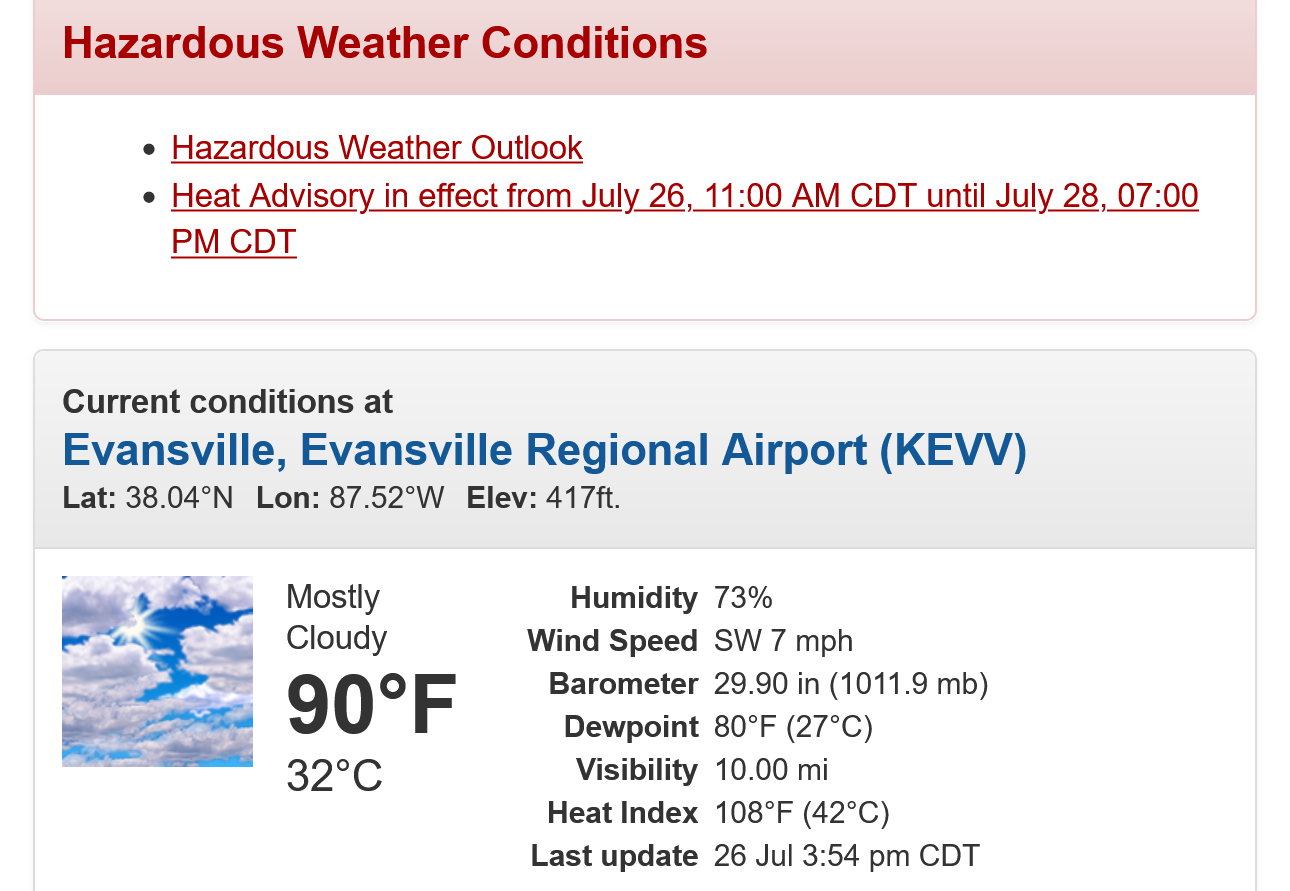
The dew point in Evansville, IN at 4pm was 80 deg. F!!
It hit that high 1 hour last week too. The highest in our history has been 81 deg. F which is it 4 different times.
It's only 90 deg. F on the thermometer but feels like 108 degrees on the Heat Index scale, 18 degrees hotter because of so much moisture in the air!!!
https://forecast.weather.gov/MapClick.php?x=282&y=89&site=pah&zmx=&zmy=&map_x=281&map_y=89
We're getting the expected action ahead of the short wave perturbation/lobe of vorticity mentioned earlier in this thread.
https://forecast.weather.gov/MapClick.php?x=285&y=86&site=pah&zmx=&zmy=&map_x=284&map_y=86
https://radar.weather.gov/station/kvwx/standard

We should note below that the HOTTEST temperatures are NOT where the highest heat index values are:
https://www.marketforum.com/forum/topic/83844/#83845
This was at 4pm below.
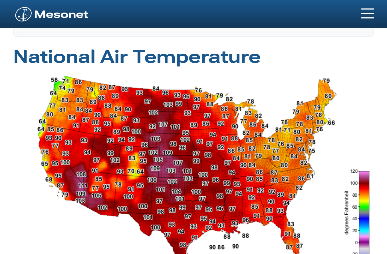
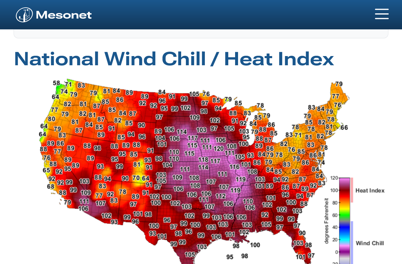
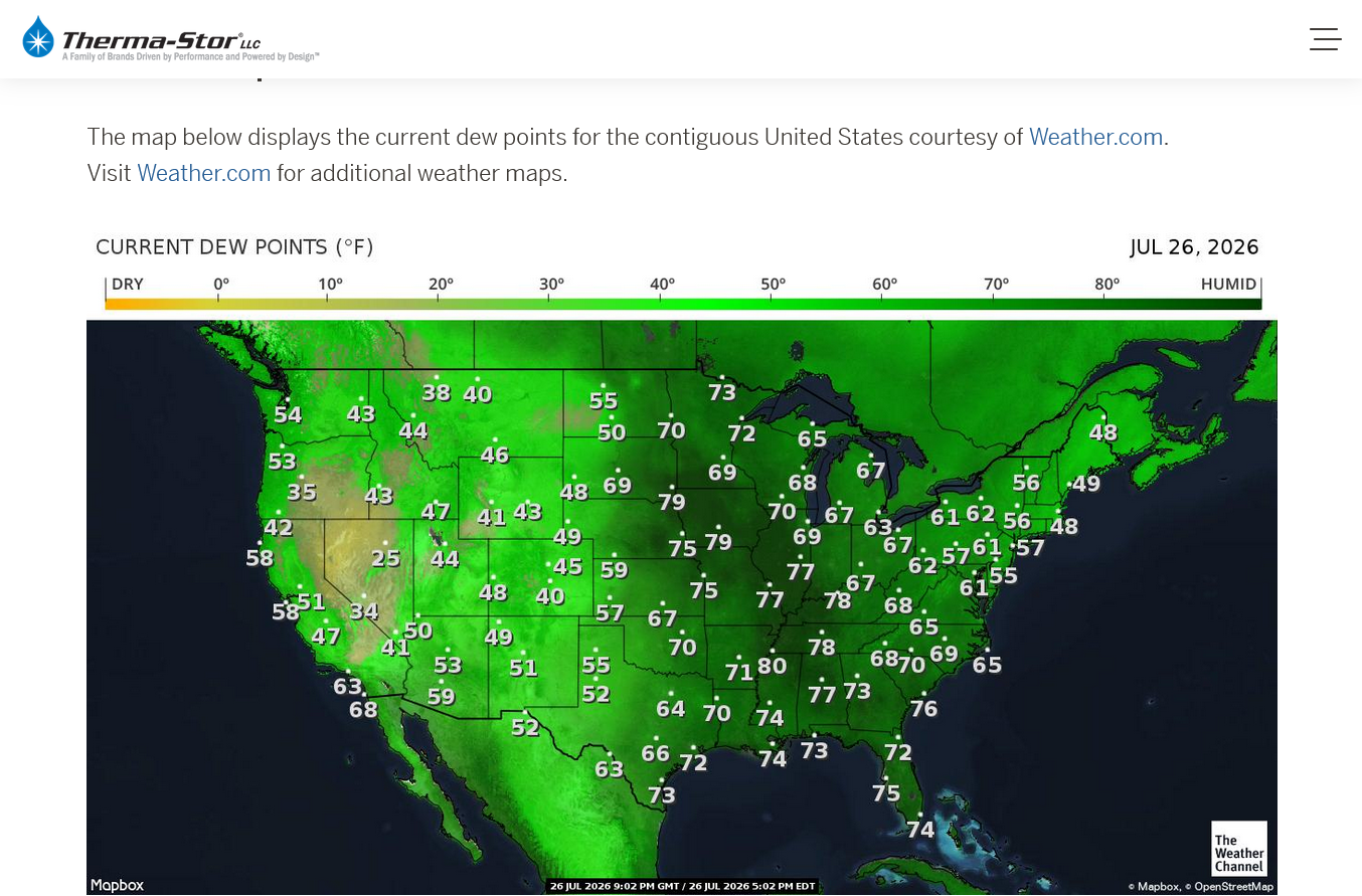
Apparently even some elite climate scientists don't understand this but extremely humid air with moist soils is extraordinarily difficult to heat above 100 degrees.
Some of the heat will go into evaporating moisture from the soils instead of heating the air and its dry air that has less heat capacity and is able to heat fast to extreme temperatures NOT humid air.
Dial in the surface being covered with densely packed rows of rapidly evapotranspirating corn plants and its even tougher to generate 100+ readings in the CORNbelt at this time of year.
All good meteorologists forecasting weather in this region, using observations, experience and NOT being biased by what climate models say should be happening know it well!
Viral graph on # of U.S. highs of 95+ dropping is misleading
26 responses |
Started by WxFollower - July 22, 2026, 2:02 p.m.
The storms are 1 county to our west but moving almost due south, hopefully they will get some eastward movement for us to get some rain.
A watch was just issued. We NOW have WARNINGS for several counties on these storms.
https://forecast.weather.gov/MapClick.php?x=285&y=86&site=pah&zmx=&zmy=&map_x=284&map_y=86
https://radar.weather.gov/station/kvwx/standard
Got the east development. Here we got with our first big rain in many weeks.
5:42pm: Now we have a severe thunderstorm warning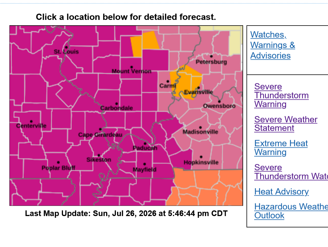
6:15pm frame of radar:
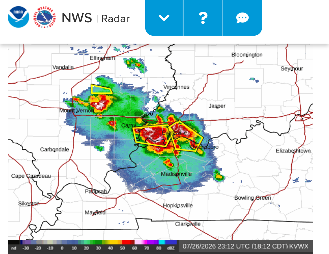
Go to this link below for rain totals where you live. Just put your zip code. You can zoom in and out and go anywhere in the country. We got .6 inches of wonderful welcome rain so far!
https://www.raindrop.farm/rainfall-totals/zipcode/47725#map
+++++++++++++++
Storms are south of the Ohio but the NWS is giving a special warning for 80 mph severe storm winds.
That is extremely unusual but with an near 80 deg dew point feeding these storms, it can happen!
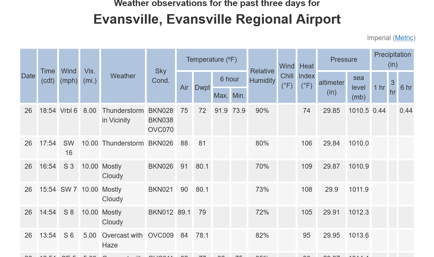
This was the observation in Evansville just before 6pm and just before the storms hit.
An 81 deg. F dew point ties the all time record for highest dew point in Evansville history. This is the 5th time we hit an 81 deg dew point.
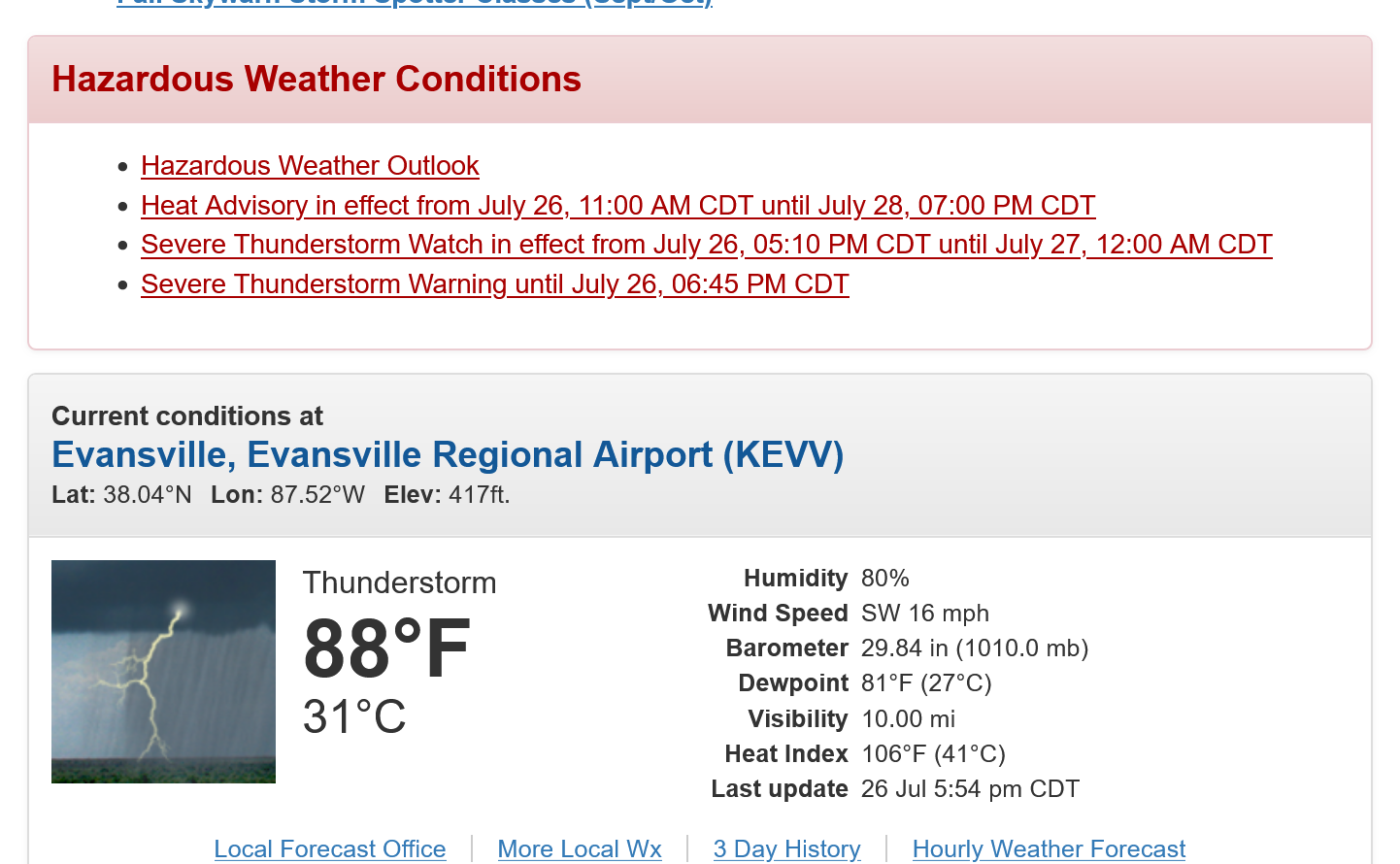
That high dew point fueling these storms is part of the reason these warnings indicated a potential for an 80 mph wind gust. It's all south of Evansville. I measured .65 just north of Evansville with no strong winds.
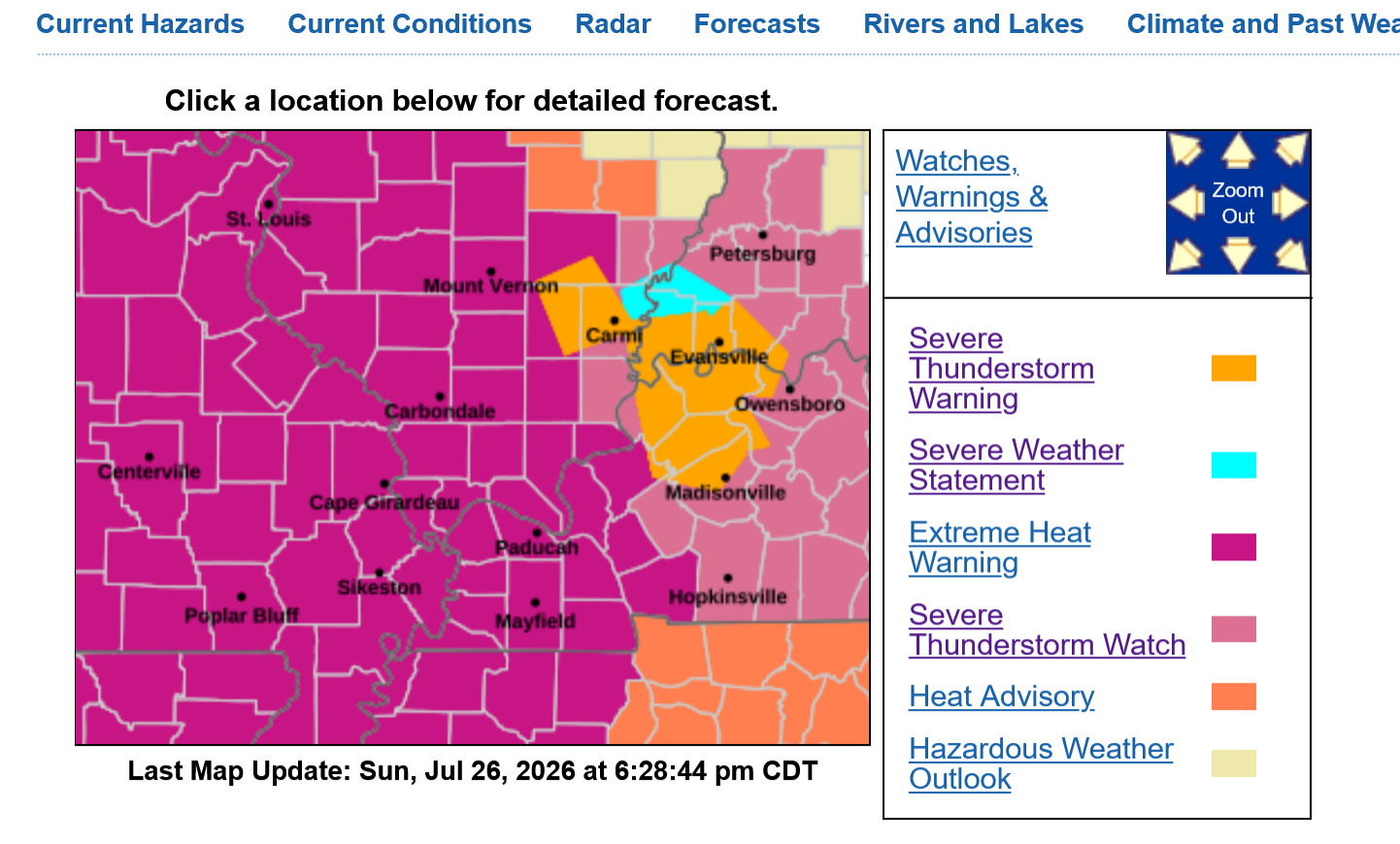
Surprisingly, there have not been any storms elsewhere, even in the higher risk areas to our far north.
That vorticity lobe(upper level wave) on the periphery of the heat ridge combined with incredibly unstable air from the 80 deg dewpoints were the reason here.
Trying to forecast an event like this, hours ahead of time for a specific location like we did is extremely tricky. Sometimes you get huge storms, other times not.
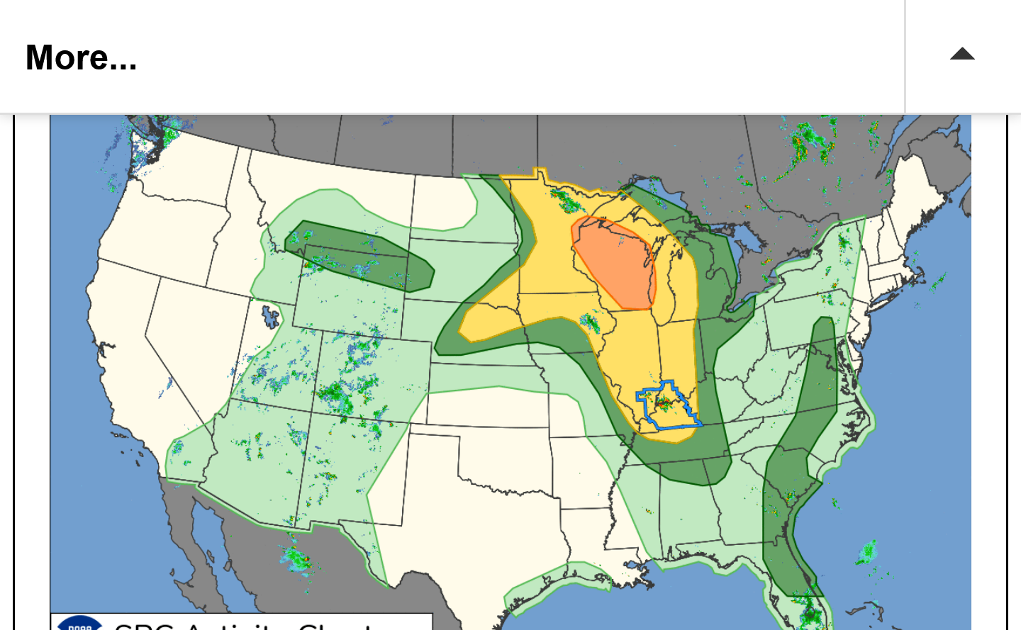

Severe storm reports map below has not caught up to the numerous reports of severe weather that clobbered areas in northern KY. 5%+ of Union County, KY is without power!
https://www.spc.noaa.gov/climo/reports/260726_rpts.html
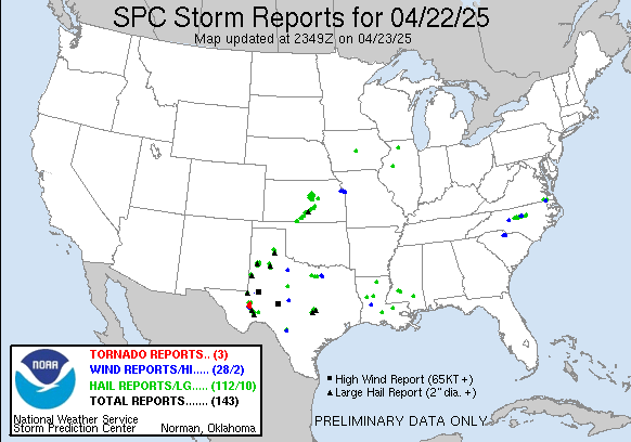
Still no storms other than this cluster which is now diving into TN.
https://www.spc.noaa.gov/products/md/md1749.html

For us, this was sweet after missing several recent rains that hit around us (cutworm knows how frustrating that is X 1,000 because he is making a living as a producer on the amount of rain that falls on his farm) AND the extremely high winds hit just south of us too.
Yippeee!
These were the observations at Evansville, IN for 4-5-6pm on July 26, 2026.
The dew point readings were 80-80 and 81.
The 81 deg. F dewpoint tied the record for highest dew point in history at this location. It happened on 4 previous occasions.
Was the 3 consecutive hours at 80 or higher a record???
I doubt I will be able to find that record.
Here we go again with another cluster of storms, some severe but not as strong as the previous round.
They are moving due south as seen on the 2nd image.
https://forecast.weather.gov/MapClick.php?x=285&y=86&site=pah&zmx=&zmy=&map_x=284&map_y=86
https://radar.weather.gov/station/kvwx/standard
1. Freeze frame at 10:30 pm below. Round 1 exiting the far south well into TN. Round 2 north of Evansville.
2. Freeze frame at 11:10 pm- Round 2 hitting Evansville with another .6" of rain
3. Freeze frame at 11:58pm-Round 2 shifting south of Evansville
4. Freeze frame 12:55pm- Round 2 well into KY. Holy Cow! it's ROUND 3 in IL/IN a bit farther west this time
5. Freeze frame 1:30pm-Round 3 causing several flash flood warnings from IL, to far sw IN(Posey County) to several counties in KY. There is obviously some sort of convergence zone that has set up with what's called "training of heavy thunderstorms" that continue to track along the same track. As the earlier storms move on (in this case moving S/SE) new storms develop upstream in the same place the ones before them did because of a stalled convergence zone over the same place. Those move on in the same direction and are replaced with more storms. Mt. Vernon, IN that's 1 county west of Evansville has had more than 4 inches of rain from these 3 rounds of storms. The storms will be training right on top of Mt. Vernon for at least a couple more hours, so they are likely to add a couple more inches to their rain total.
6. Live loop
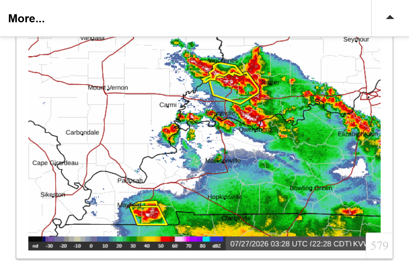
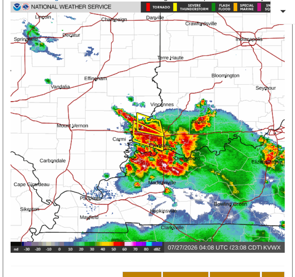
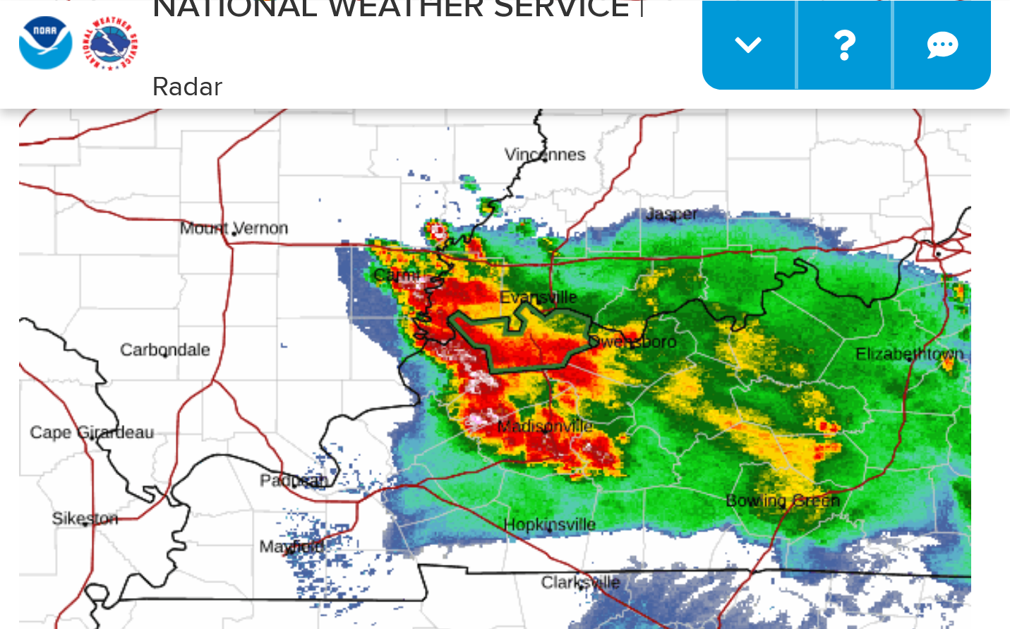
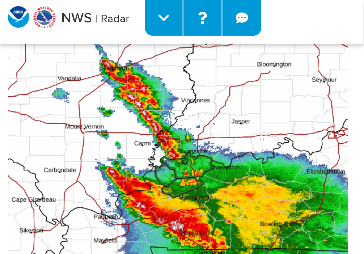
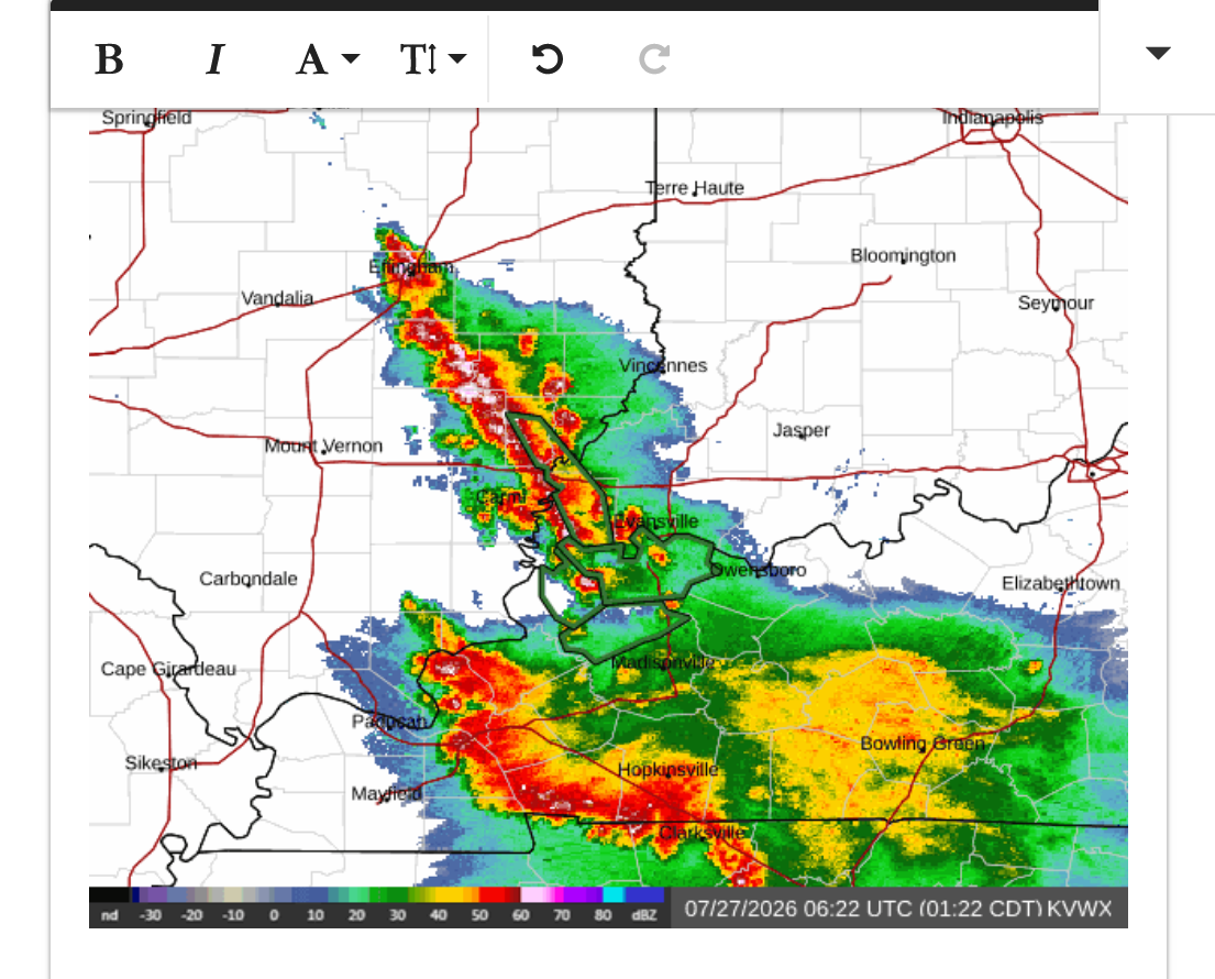
What's amazing about our 2 huge, separate clusters of heavy thunderstorms here along the IL/IN/KY borders is that there isn't much rain in the country right now.
The first round held together, moving S/SE thru central TN and seen below.
The 2nd round hitting some of the same areas but much less severe as it tracks into KY. Also moving S/SE on the eastern side of the heat ridge and being impacted by the steering currents.
Re: Re: Severe storm risk 7-26-26
By metmike - July 26, 2026, 1:56 p.m.
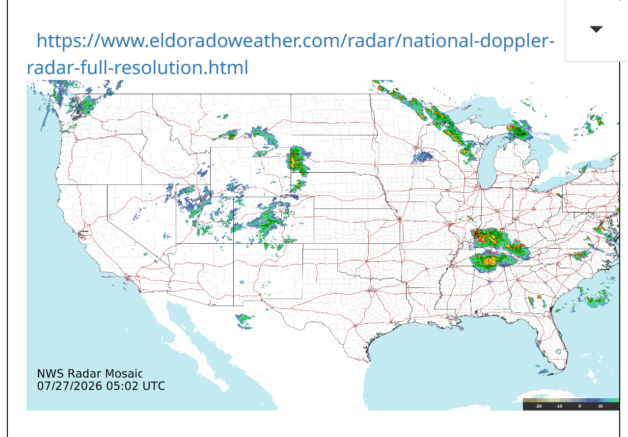
The last 24 hours below:
https://www.raindrop.farm/rainfall-totals/zipcode/47725#map
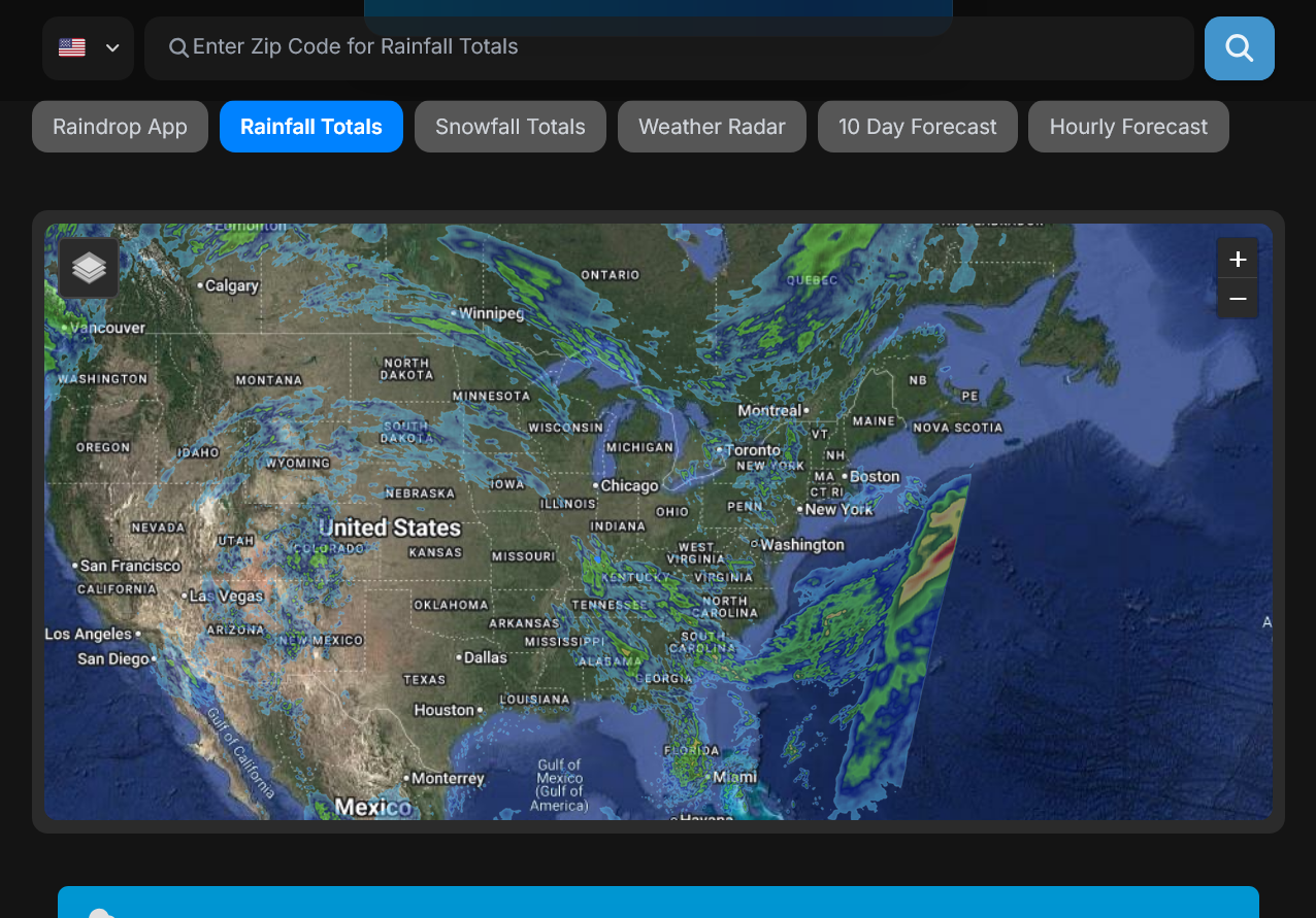
140 high wind reports yesterday from these storms and most of them were in the area covered in the posts above.
https://www.spc.noaa.gov/climo/reports/260726_rpts.html