
5 Days until Thanksgiving and 500 reasons to be thankful to be living in the best time of human history!
Scroll down and enjoy the latest comprehensive weather to the max...... occurring because of the natural physical laws in our atmosphere as life on this greening planet continues to enjoy the best weather/climate in at least 1,000 years(the last time that it was this warm) with the added bonus of extra beneficial CO2.
Potential for Sudden Stratospheric Warming event in December with the Polar Vortex being displaced far to the south(again) from natural causes. Extreme cold where/if this happens.
On Saturday, the potential for this is less.
More at the bottom later Saturday......sorry I forgot about that update on Friday.
Huge model changes in key late week 2 period from run to run.
Winter Weather Forecasts
https://www.wpc.ncep.noaa.gov/wwd/winter_wx.shtml
Snowfall the next 7 days below.
Here are the latest hazards across the country.
Purple/Pink/blue on land is cold/Winter weather. Brown is wind, Green is flooding. Gray is fog. Reddish is a red flag advisory.
Go to the link below, then hit the location/county on the map for details.
https://www.spc.noaa.gov/ Go to "hazards"
https://www.mesonet.org/index.php/weather/map/us_air_temperature/air_temperature

https://www.mesonet.org/index.php/weather/map/wind_chill_heat_index1/air_temperature

Current Weather Map
| NCEP Days 0-7 Forecast Loop | NCEP Short-Range Model Discussion | NCEP Day 3-7 Discussion |


Current Jet Stream

| Low Temperatures Tomorrow Morning |

Highs today and tomorrow.


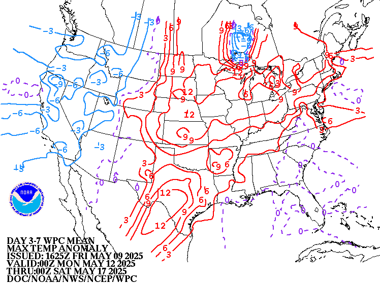
Highs for days 3-7:
Turning colder West but mild east of that with fluctuations.


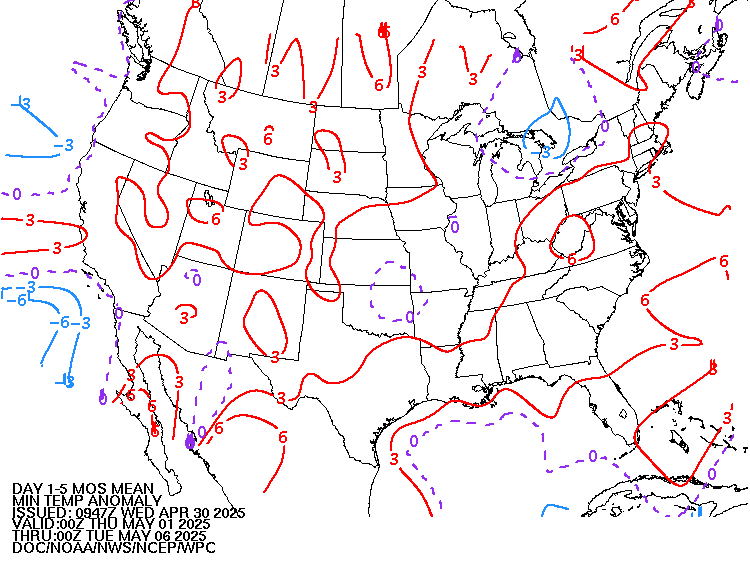
Temperatures vs average for days 3-7.
Cold West, South is mild/warm.
https://www.wpc.ncep.noaa.gov/medr/medr_mean.shtml
Weather features day 3-7:
Mostly quiet Midwest.

Liquid equivalent precip forecasts for the next 7 days are below.
Day 1 below:
http://www.wpc.ncep.noaa.gov/qpf/fill_94qwbg.gif?1526306199054

Day 2 below:
http://www.wpc.ncep.noaa.gov/qpf/fill_98qwbg.gif?1528293750112

Day 3 below
http://www.wpc.ncep.noaa.gov/qpf/fill_99qwbg.gif?1528293842764

Days 4-5 below:
http://www.wpc.ncep.noaa.gov/qpf/95ep48iwbg_fill.gif?1526306162

Days 6-7 below:
http://www.wpc.ncep.noaa.gov/qpf/97ep48iwbg_fill.gif?1526306162

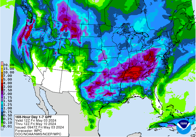
7 Day Total precipitation below:
https://www.wpc.ncep.noaa.gov/qpf/p168i.gif?1566925971
Last 24 hour precip top map
Last 7 day precip below that
https://www.wunderground.com/maps/precipitation/daily

Current Dew Points

Latest radar loop
http://www.nws.noaa.gov/radar_tab.php


| (3400x1700 pixels - 2.2mb) Go to: Most Recent Image |

Go to: Most Recent Image
You can go to this link to see precipitation totals from recent time periods:
https://water.weather.gov/precip/
Go to precipitation, then scroll down to pick a time frame. Hit states to get the borders to see locations better. Under products, you can hit "observed" or "Percent of normal"
+++++++++++++++++++++++++++++++++++++++++++++++
Precipitation compared to average for the last 7, 14, 30 and 60 days.
Some spots in Iowa and especially N/C Illinois have dried out!
Usually not updated for previous day until late the next day.
Soilmoisture anomaly:
These maps sometimes take a day to catch up to incorporate the latest data(the bottom map is only updated once a week).
https://www.cpc.ncep.noaa.gov/products/Soilmst_Monitoring/US/Soilmst/Soilmst.shtml#
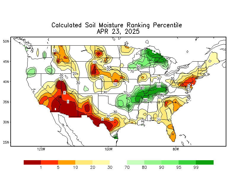

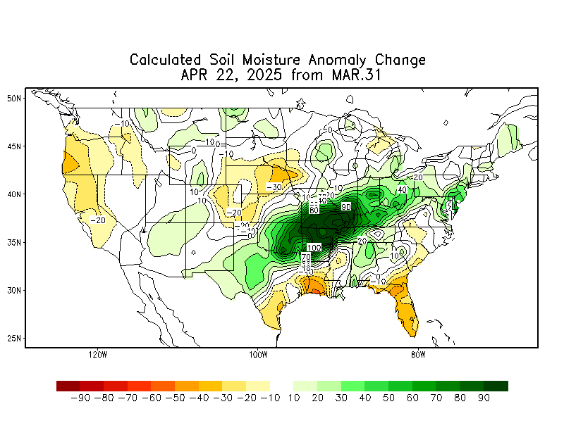
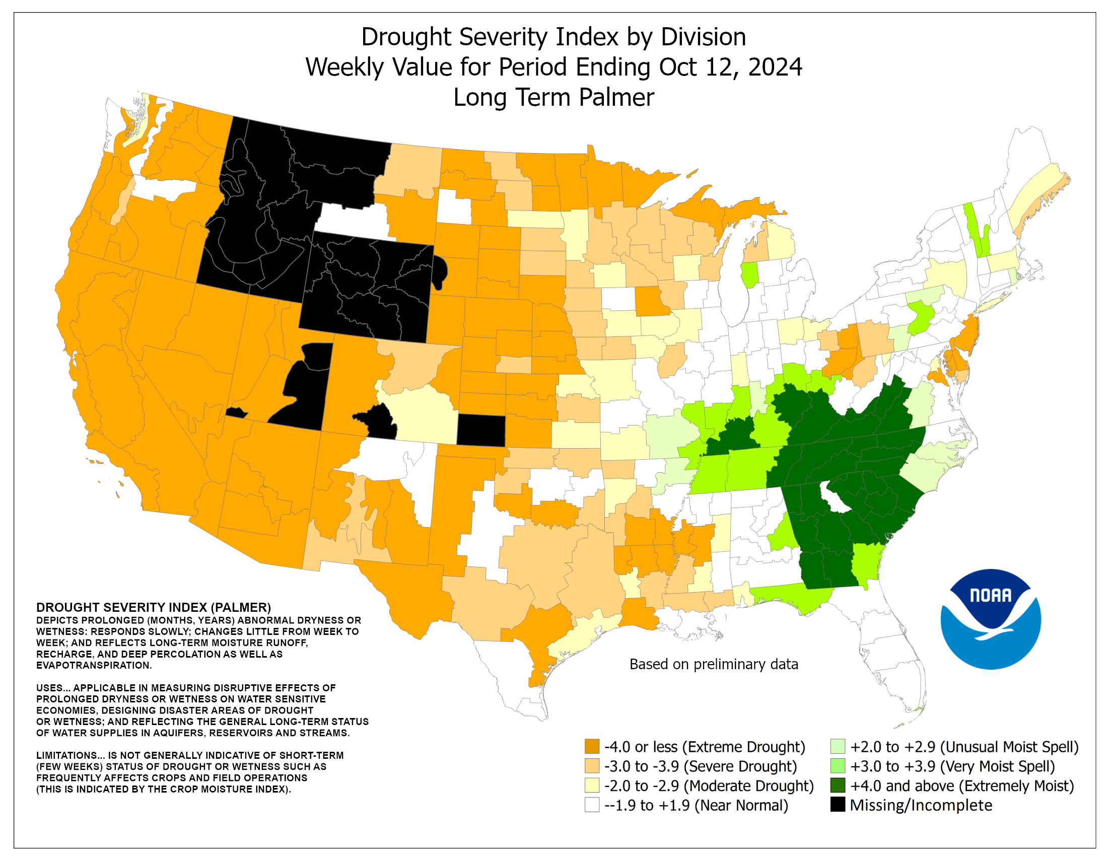

Latest: The first map below is the latest. The 2nd one is from last week.
In july/August/Sept/Oct, it's typical to see some increase in drought because of evaporation, seasonally exceeding low rainfall during those months. However, this year saw a HUGE increase in the Southeast!
November 21: DROUGHT the last month+ has really shrunk. One area to watch is sw Kansas for the Winter wheat crop.
The maps below are updated on Thursdays.
https://droughtmonitor.unl.edu/


The top map is the Canadian ensemble average, the maps below are the individual members that make up the average at the end of week 2.
+++++++++++++++++++++++++++++++++++++++++
Each member is like the parent, Canadian model operational model.......with a slight tweek/variation in parameters. Since we know the equations to represent the physics of the atmosphere in the models are not perfect, its useful to vary some of the equations that are uncertain(can make a difference) to see if it effects the outcome and how.
The average of all these variations(ensembles) often yields a better tool for forecasting. It's always more consistent. The individual operational model, like each individual ensemble member can vary greatly from run to run.........and represent an extreme end of the spectrum at times. The ensemble average of all the members, because it averages the extremes.............from opposite ends of the spectrum.........changes much less from run to run.
End of week 2....................0z Canadian ensembles:
Updated 12z maps available this late...........turning colder late week 2 vs previous solutions. Potential for another polar vortex incursion south...on some solutions, mainly this particular model!
360h GZ 500 forecast valid on Dec 08, 2019 00 UTC
Forecasts for the control (GEM 0) and the 20 ensemble members (global model not available)
0Z GFS(American model) Ensembles at 2 weeks:

GFS Ensemble mean(average of all the individual solutions above). The first map is a mid/upper level map. The 2nd one is a temperatures map at around 1 mile above the surface. These are anomalies(difference compared to average).
NCEP Ensemble t = 360 hour forecast
Friday: Much more powerful upper ridge/west, trough east couplet associated with a potential Stratospheric warming event(in the same area as the yellows on this map that show the greatest positive anonalies in the troposphere) that could displace the polar vortex pretty far south. Potenial! Where is goes and if it happens still uncertain but this would bring frigid air into large parts of the US........if it happens.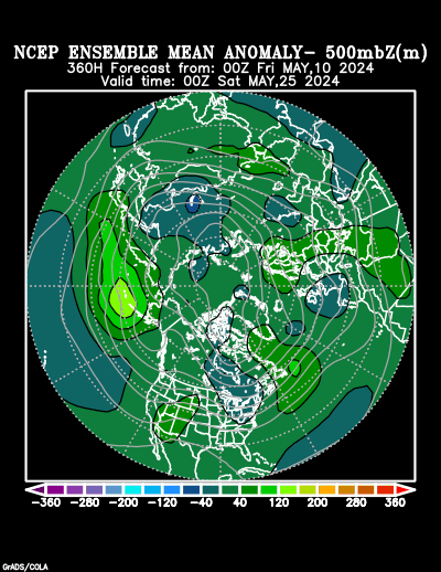
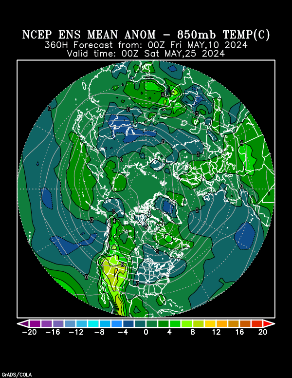
Latest, updated graph/forecast for AO and NAO here, including an explanation of how to interpret them...............mainly where they stand at the end of 2 weeks.
Previous analysis, with the latest day at the bottom for late week 2 period.
https://www.marketforum.com/forum/t
Discussions, starting with a week ago.
Sunday: Still negative AO but with huge spread from very negative up to around 0. NAO is falling in week 2 and negative but that too has a very wide spread meaning great uncertainty and potential for model to model changes. However, this strongly favors a warm West, very chilly East pattern with an upper level ridge/West and trough/East couplet that ushers Canadian air masses into the Eastern half(Midwest at times). Canada will be very mild, so the brand of cold will not be Arctic or frigid. PNA is near 0, not a factor.
Monday: Huge changes. AO increasing to close to zero(big spread in solutions), NAO just slightly negative and both are higher than recent values. Reduces cold risks but solutions are volatile..........low confidence. PNA drifts a bit lower, near 0 and neutral.
Tuesday: AO slight negative, with NAO and PNA near zero. No strong indications but the pattern looks like it could morph colder again. Low confidence.
Wednesday: Models overnight were colder
Thursday: AO and NAO closer to zero and not as cold. PNA also near zero.
Friday: Extreme spread in the AO today. Some are actually positive for the first time in awhile, while most are solidly negative and favorable for cold to move from high latitudes to mid latitudes but there is extremely high uncertainty. It can end up being very mild from just small changes vs intense cold. NAO slight negative...but a few are positive, PNA neutral. Enormous risk with temperature forecasts in the late week 2 period. Small changes can mean a 40 degree flip in the temperature.
Saturday: AO forecast to be a bit positive at the end of 2 weeks for the first time in quite awhile......less favorable for cold. NAO and PNA close to zero. Milder than Friday.
National Weather Service 6-10 day, 8-14 day outlooks.
Updated daily just after 2pm Central.
Temperature Probability
| the 8-14 day outlooks ArchivesAnalogsLines-Only FormatGIS Data | |
Temperature Probability | |
 | |
https://en.wikipedia.org/wiki/Sudden_stratospheric_warming
"In a usual northern-hemisphere winter, several minor warming events occur, with a major event occurring roughly every two years. One reason for major stratospheric warmings to occur in the Northern hemisphere is because orography and land-sea temperature contrasts are responsible for the generation of long (wavenumber 1 or 2) Rossby waves in the troposphere. These waves travel upward to the stratosphere and are dissipated there, decelerating the winds and warming the Arctic. This is the reason that major warmings are only observed in the northern-hemisphere, with one exception. In 2002 a southern-hemisphere major warming was observed.[5][6] This event to date is not fully understood."
metmike: These events were even more common during the 1970's during global cooling.