

It will be interesting to see how this impacts afternoon convection, thunderstorms. The layer of dust is warm and dry and you would think would enhance the cap, or put a lid on thunderstorm development. We have a good chance of afternoon storms in our area this weekend and if that dust layer moves farther north I would think we would be drier than expected. I look forward to seeing the soundings over the next few days.
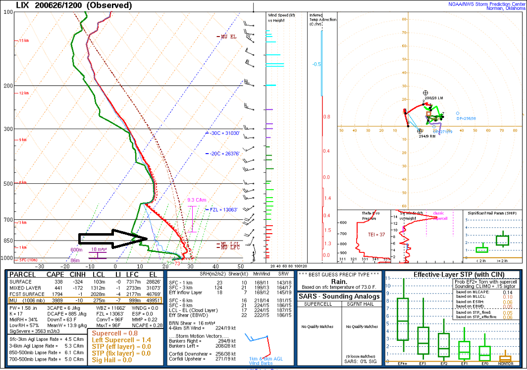
Shows up very nice from New Orleans this morning. Black arrow is pointing to the warm dry are aloft.
I was wondering the same thing Grant about pm convection.
I haven't looked at Skew T charts since............I can't remember the last time.
Time to review!
Or if others want to understand the graph that Grant just provided and learn something new:
https://weathertogether.net/weather-101/how-to-read-skew-t-charts/
Here’s a classic severe weather sounding from Oklahoma City that was taken 3 hours before the devastating 2013 Moore, OK EF-5 tornado. See if you can find the LCL, CCL, LFC, EL, CAPE, and CIN on this sounding!
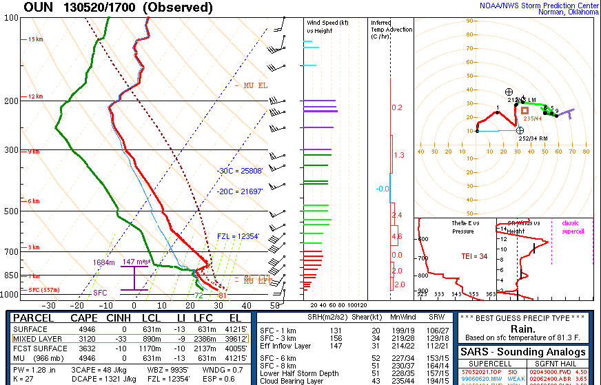
A CLASSIC severe weather sounding, with a pronounced “capping inversion” (CIN) that keeps convection from gradually occurring throughout the day, allowing it to explode all at once in the late afternoon/evening hours when the cap breaks. There is also a ton of CAPE and strong wind shear throughout the atmosphere. The 2013 Moore EF-5 tornado touched down 3 hours after this sounding was taken.
Grant,
Do you have a link to get Skew T diagrams to compare the region and even go back to see yesterday's charts to compare?
I note the incredible dry pocket at just below 850 mb/ 1km to above 700 mb(4+ km), where the dp is around 0 and dp depression is greater than 20 deg C(36 deg F) in the lower part of the dry pocket, which is incredibly dry for the Gulf coast with a Summer morning reading, correct?
So is the dust and dry air both just metrics based purely on the origin of the air mass(Saraha Desert) that was not diluted much crossing the Atlantic Ocean?
Has the extremely high dust content made a contribution from UV radiation/sun on the dust warming that level? while cooling the level below it from blocking sun?
Will this be sort of the same as a giant volcano eruption which blocks out the sun and affects photosyenthesis [sp] for crop development or will the haze disappear in a short time
Sorry for the delay, I was out fishing all weekend. I use the SPC site for archive soundings. I'll post a few from New Orleans.
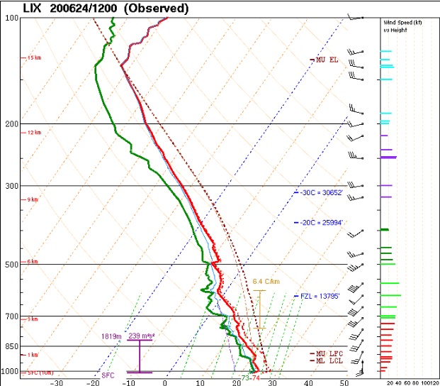
Here is Wednesday Morning before the dust cloud reached the area. You can see the moist atmosphere through most of the column, what you would expect along the Gulf Coast in June. I like to just look at the 12Z sounding to eliminate mixing issues.
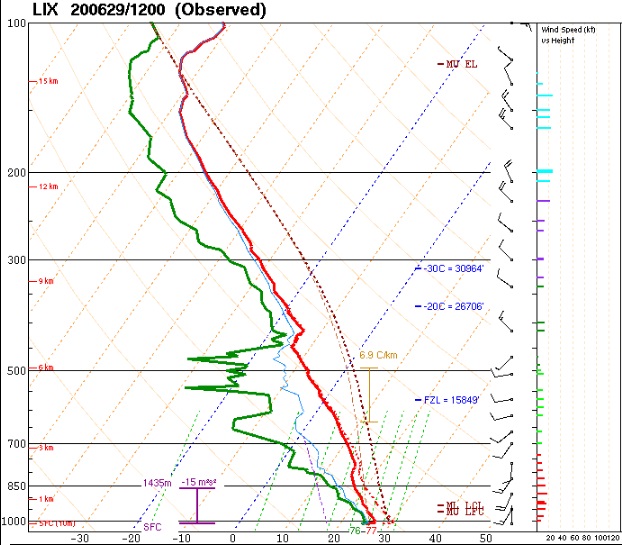
This was from this morning. Low levels starting to moisten up again.
"Will this be sort of the same as a giant volcano eruption which blocks out the sun and affects photosyenthesis [sp] for crop development or will the haze disappear in a short time"
Wayne,
This is nothing close to that. We have these Saharan dust plumes all the time but this last one was the biggest one in numerous decades.
It's limited in extent and is slowly being diluted and would only affect a very small % of the earth for a brief period. Hazy skies when these dust plumes arrive here and afternoon temps several degrees cooler in places with sunshine before the plume moves away.
Coverage of weather or other events in today's world makes everything seem like its 10 times worse and unprecedented. My wife was very concerned about the dust plume getting here this last weekend. We were very cloudy and didn't notice it.
Interestingly but not surprising, because we have the same weather pattern/winds, another dust plume is almost here.
More on that on the next page.
The next round of dust headed for the U.S. Gulf Coast is pushing from the Caribbean into the Gulf of Mexico, according to an analysis from NASA's GEOS-5 model. Dusty air also extends far out into the Atlantic to the coast of western Africa.
The GEOS-5 model shows this new area of dust approaching the Texas and

The last round of Saharan dust brought hazy skies and bad air quality as far north as the Midwest over the weekend.