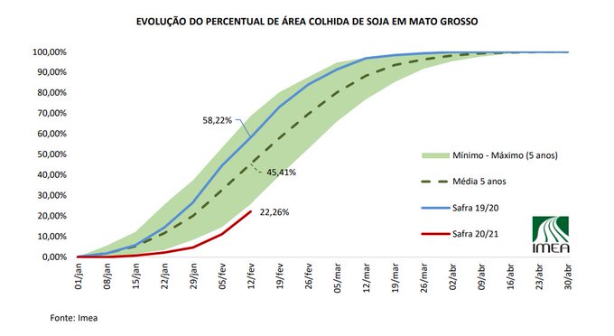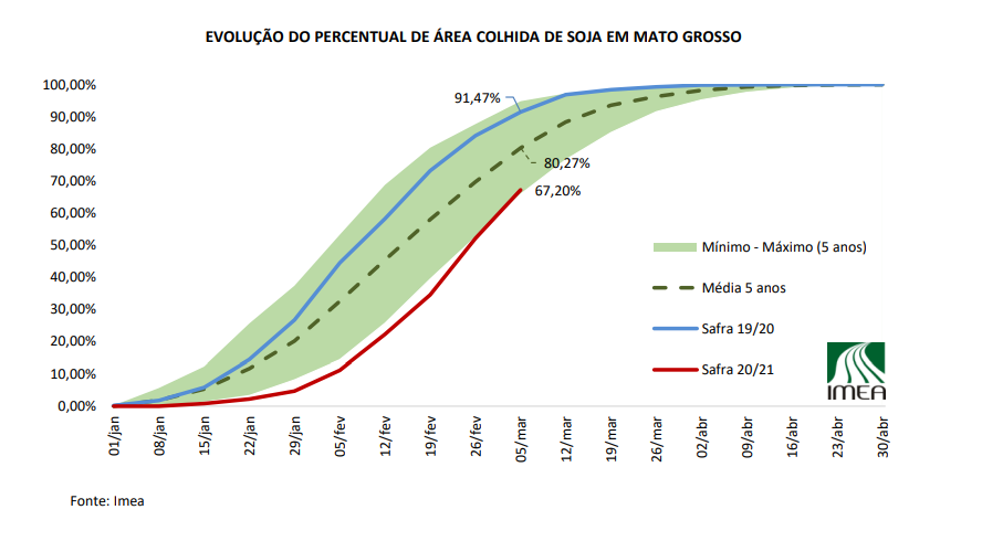
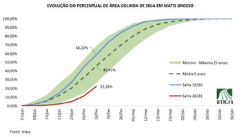
Soybean harvest in Mato Grosso at 22% complete, down from 5yr avg of 45% & down 36% v last yr. #soybeans
#Brazil
See these comprehensive posts for South America Oct/Nov 2020
https://www.marketforum.com/forum/topic/59680/
Scroll to the bottom for the latest....added March below.
Crop calendar for Argentina:
http://www.soybeansandcorn.com/Argentina-Crop-Cycles
Crop Calendar for Brazil:
http://www.soybeansandcorn.com/Brazil-Crop-Cycles
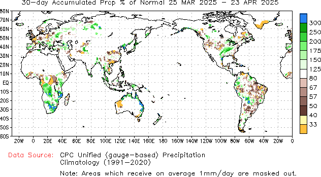
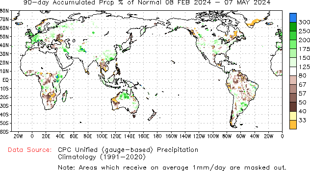
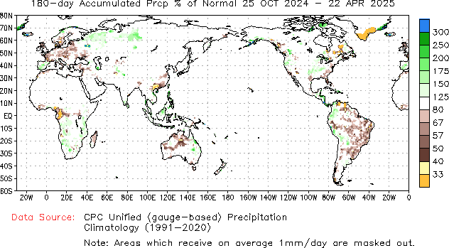
The maps below are for the past 30 days, 90 days and 180 days % of average precipitation.
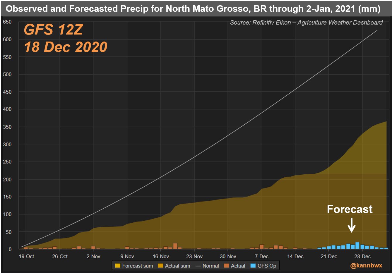
Soybean country of Brazil has been dry!!!
https://www.cpc.ncep.noaa.gov/products/Precip_Monitoring/Figures/global/n.30day.figb.gif
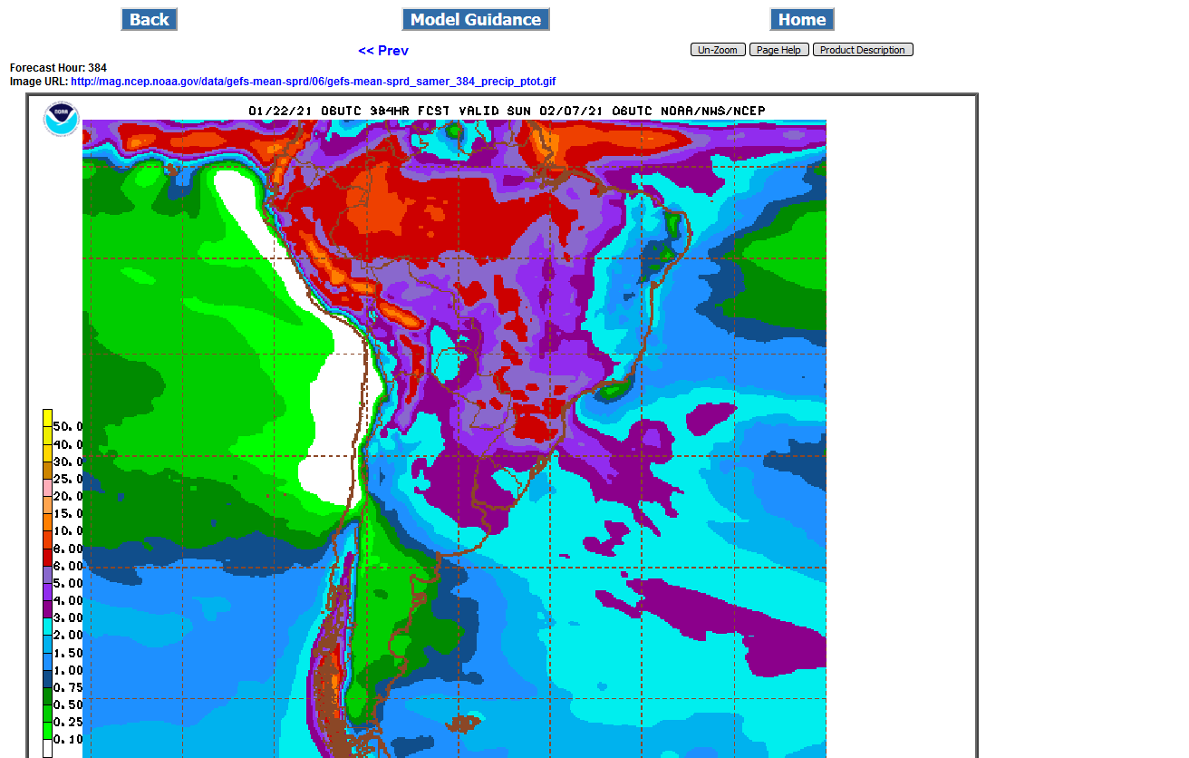
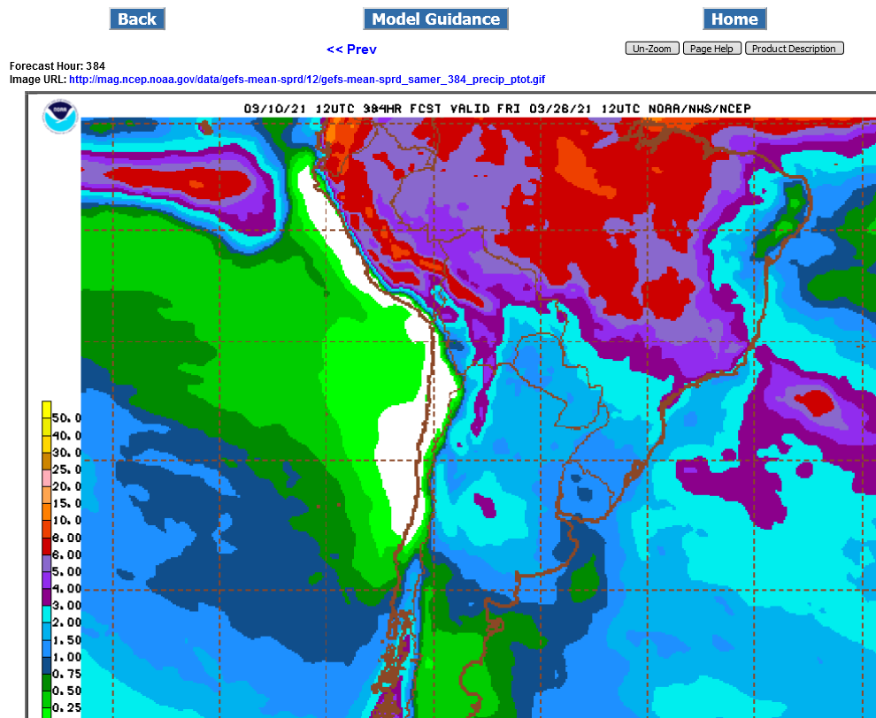
The forecasts below come from the GFS/US model. They are constantly updated every 12 hours.
The big weather story is the pattern change coming up that will feature huge, widespread rains, some in the drought areas. Soybean prices have fallen 40c the since Sunday Night ahead of this pattern change.
http://wxmaps.org/outlooks.php
The models, have over forecast rain amount recently but have alot coming up. The GFS Ensemble(just out 18z run below) has massive rains for parts of coffee land. Even a 10 inch contour. That would make a substantial dent in the drought and help to restore soil moisture there.
Southern Brazil beans might also get a bit too much rain.
But when you are still in a major drought, that is not going to be the interpretation this far out.
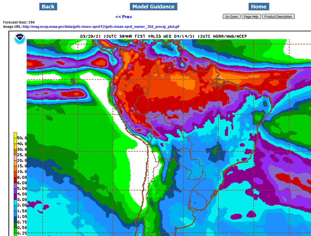
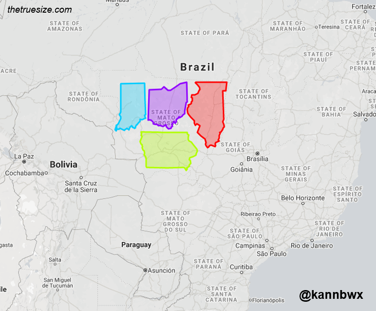
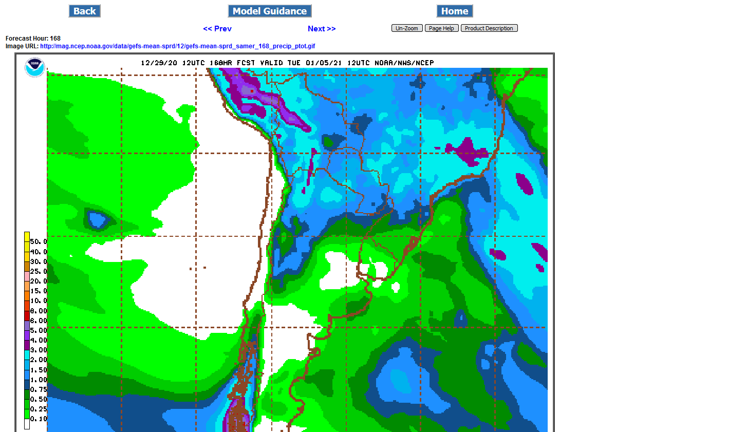
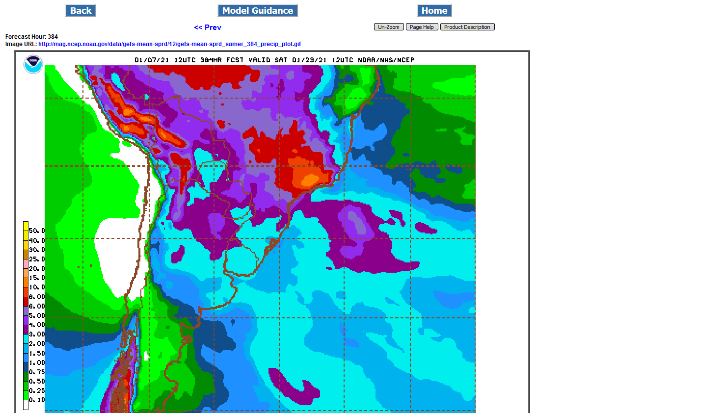
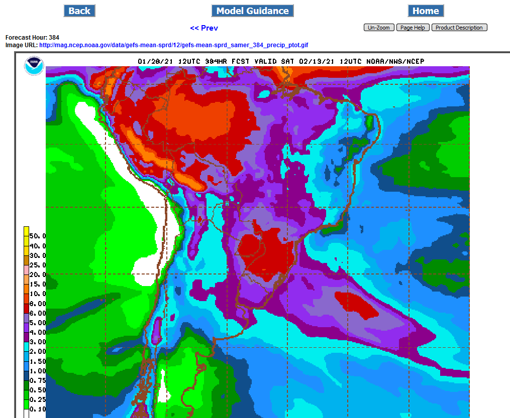
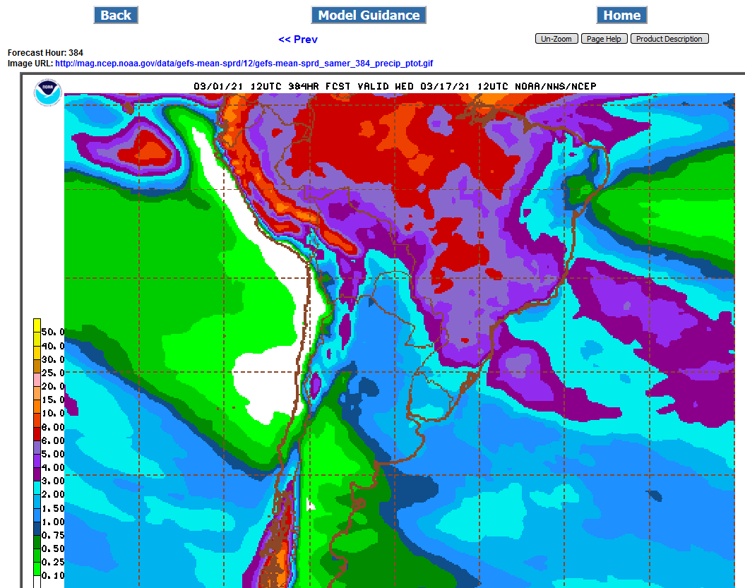
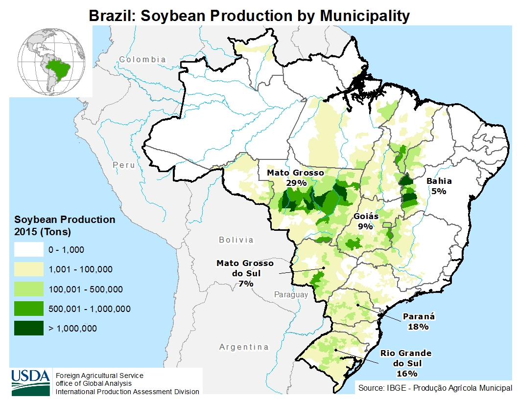
Central Brazil/Mato Grosso will get the least again. Maybe only 2-3 inches in the west. This is prime soybean growing country.
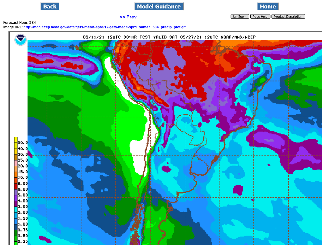
The latest model run actually has a bit less than the one from 18 hours ago(2nd map below) but the pattern change to much wetter is getting closer each day and its going to be awhile for these maps to start looking dry again.
.png)
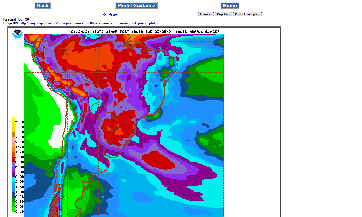
Still huge rains for S.Brazil and especially Eastern Brazil in coffee land but there is a small pocket of less than optimal rains in West/Central Brazil (Mato Grosso) that has grown slightly since yesterday that we should keep an eye on.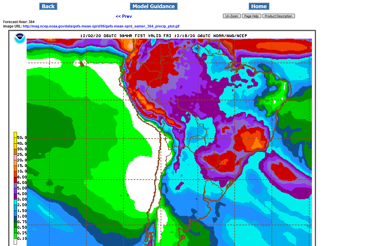
That little pocket of slightly less than ideal rain shrank on the mid day GFS products.(a tad wetter in that fairly small location).
Its not that big of a deal except to watch in case there starts to be a trend of the models getting drier.
This latest run still has at least 3 inches of rain everywhere during the next 2 weeks.
Argentina could start getting dry though.
.png)
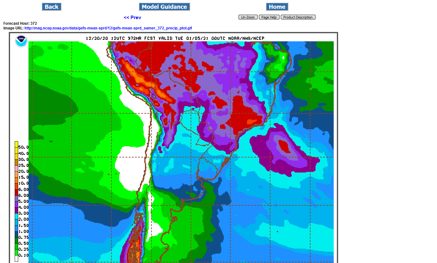
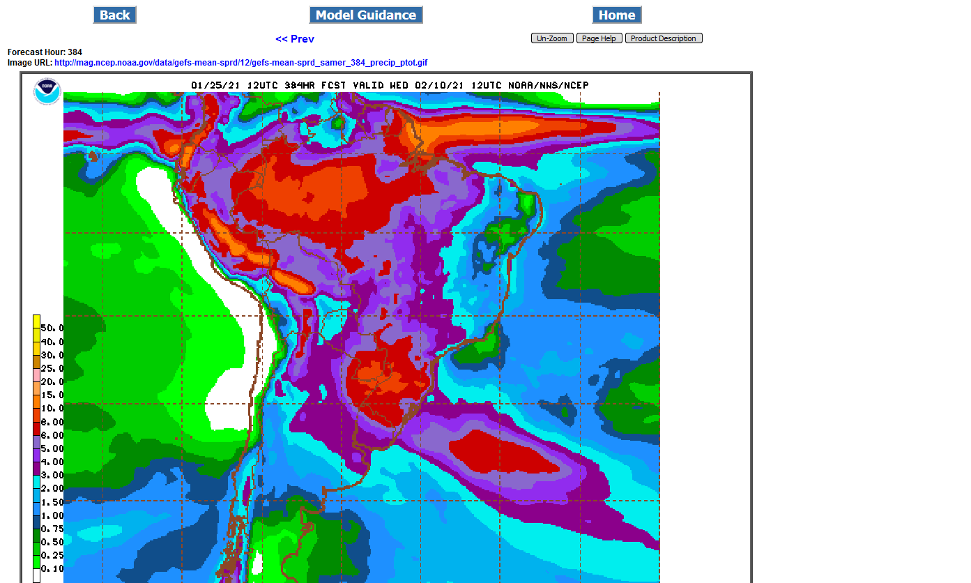
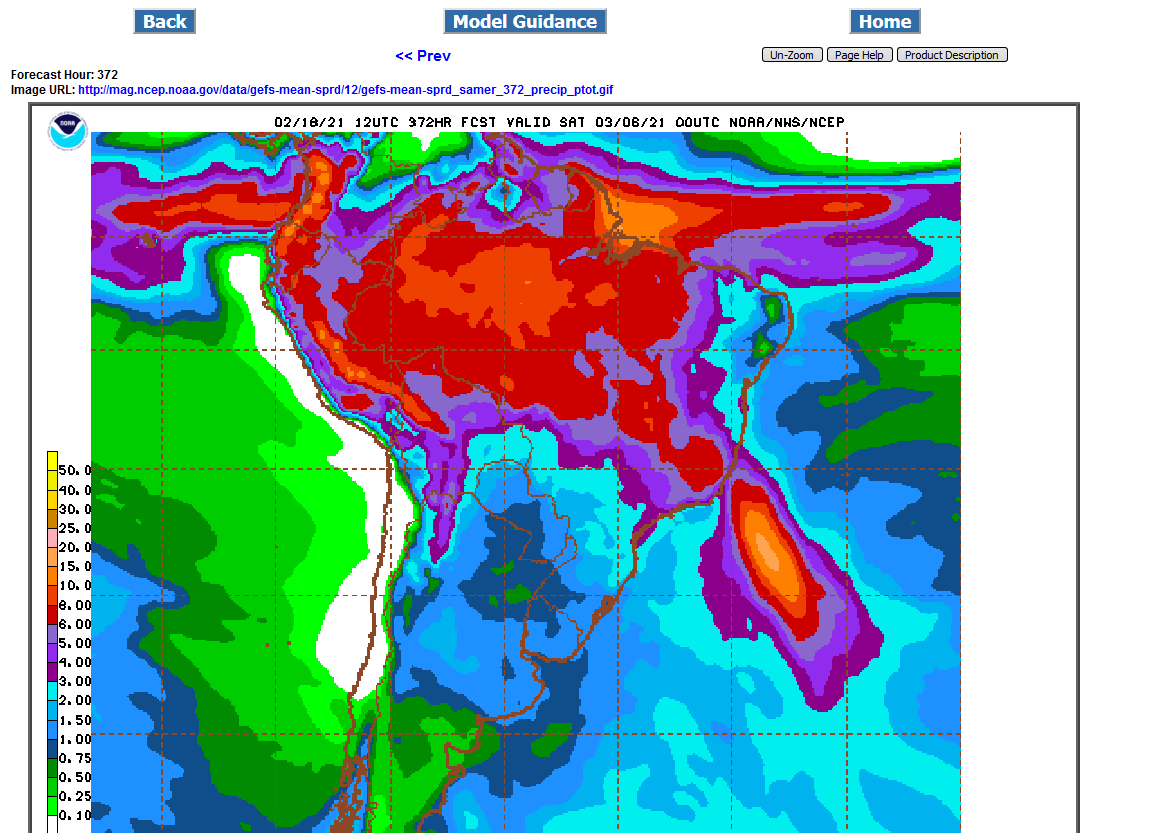
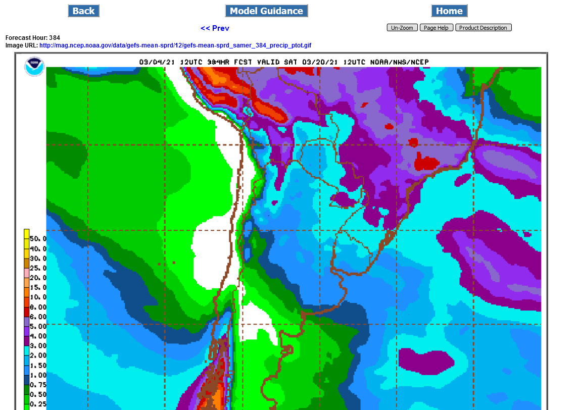
Still have pretty good rains in Brazil with the exception of Mato Grosso Do Sul and far Southern Mato Grosso-not a key production area(in the blue-not dry but below average).
Argentina is barely average rains
2 week rains below from the 12z GFS ensemble:
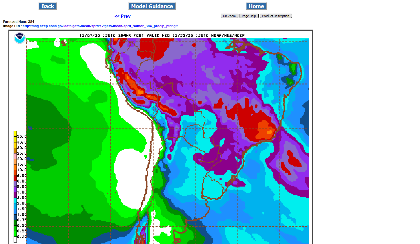
Decent rains still in most of South America but a bit less than normal rain in a small area in the blue of west/central Brazil........that has been growing the last day.
Also the southern parts of bean land in Argentina will have rains slightly below average the next 2 weeks.............so weather is becoming less bearish.
USDA crop report is out Thursday 11am.
.png)
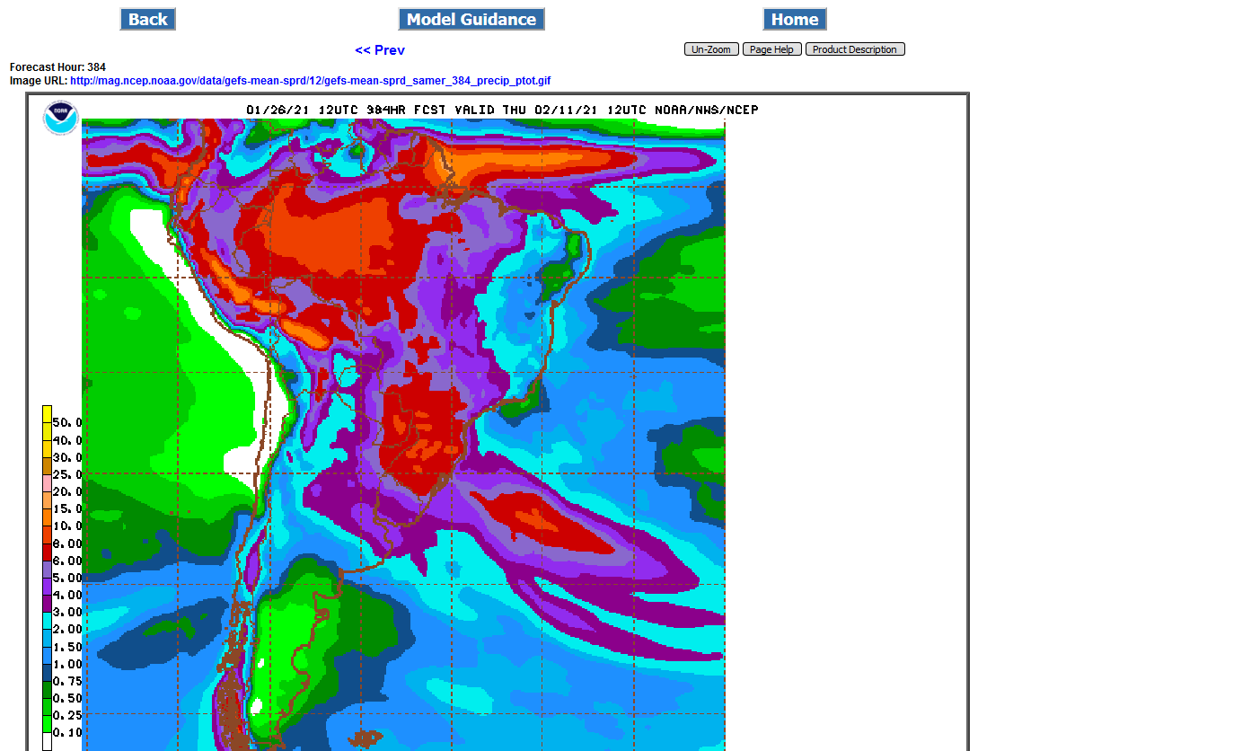
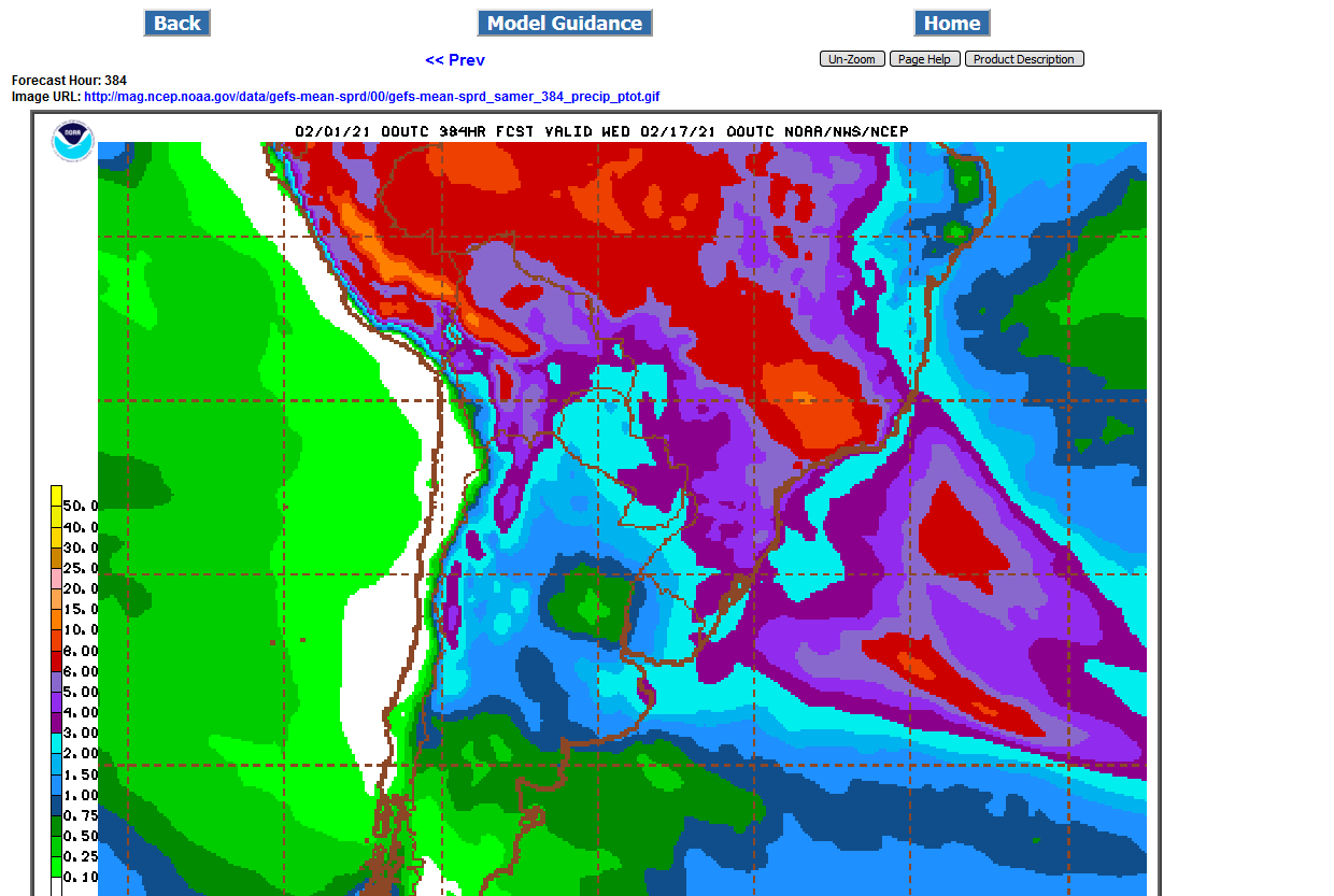
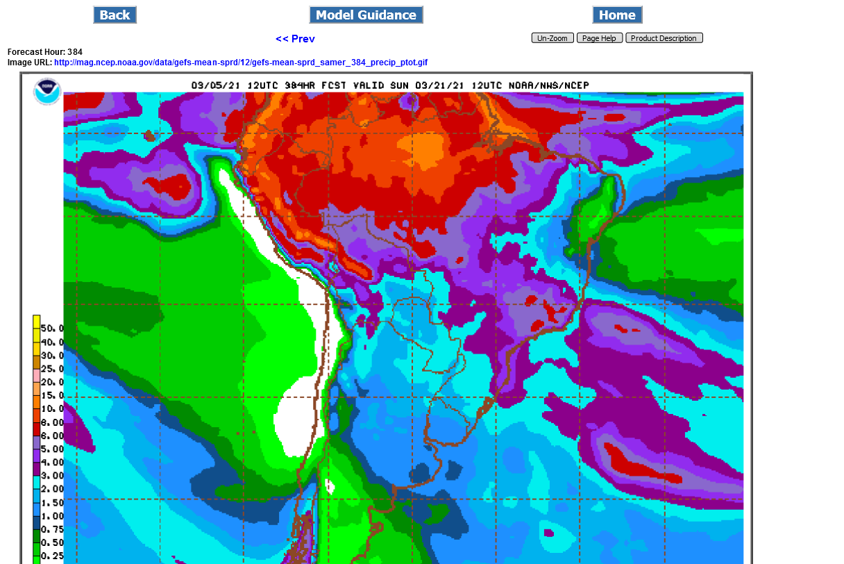
Not much change in the SA rain forecast the last 24 hours. Still the small area of less than optimal rains(just below average there-not dry) in WestCentral Brazil that might affect 10-15% of production at the most. Overall bearish. 2 week rains from 18z GFS ensemble below.
The USDA numbers tomorrow at 11am are mostly what matters though. .png)
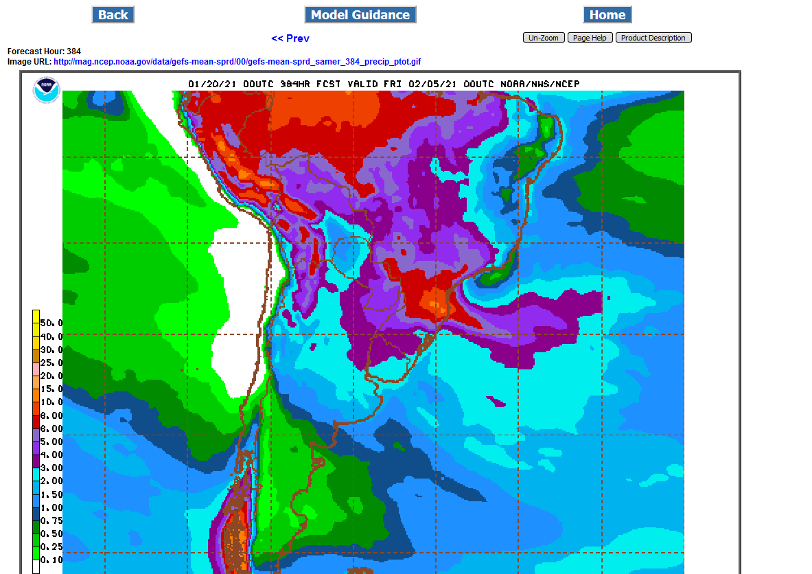
A bit less rain in the forecast for WestCentral Brazil (and most of it in week 2). Also a bit drier for N.Argentina compared to the end of last week.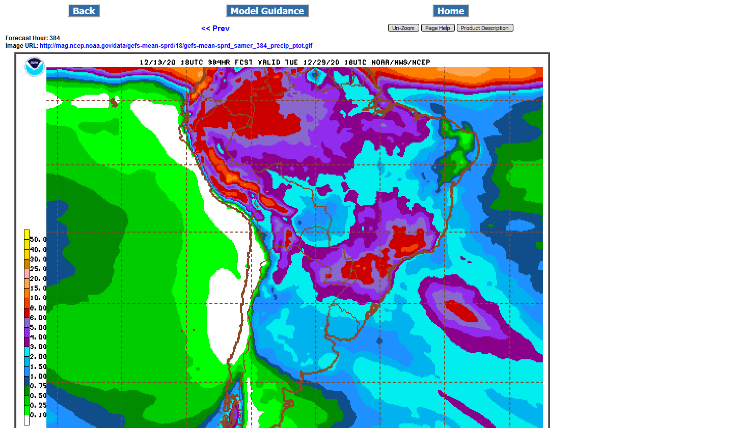
Rains in mainly S.Brazil in week 1, spreading to C. Brazil and increasing in week 2. The big story may be that Argentina looks like it will be drying out some.
1st map is Week 1 total rains below.
2nd map is 2 week total rains from the 0z Wed GFS Ensemble
_5WvSZLM.png)
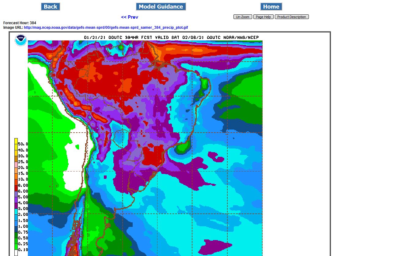
Total 2 week rains below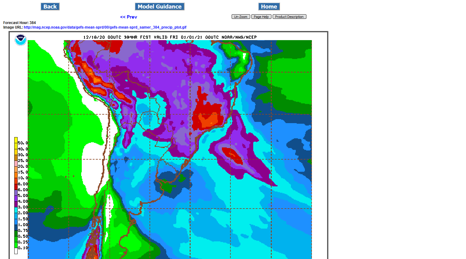
12z GFS ensemble had quite a bit more rain for west central Brazil,
Lots of rain for most of Brazil-bearish weather there.
However, Argentina is going to be drying out!
Beans are NOT trading SA weather right now. They are trading stocks running out and the need to ration the limited supply.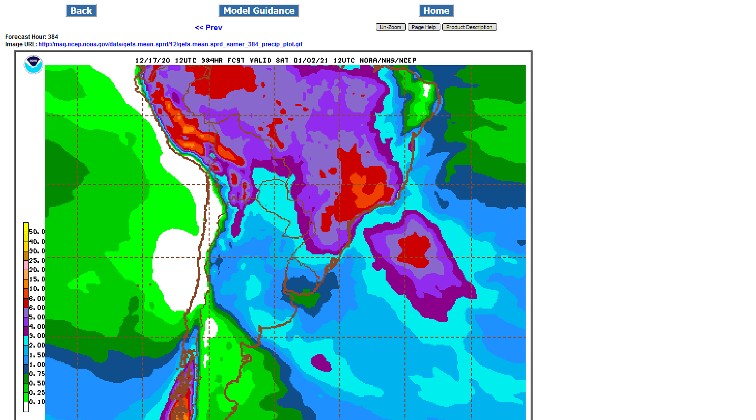
I think there is a strike going on in Argentina as well.
Good point Jim!
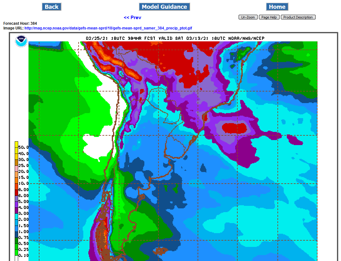
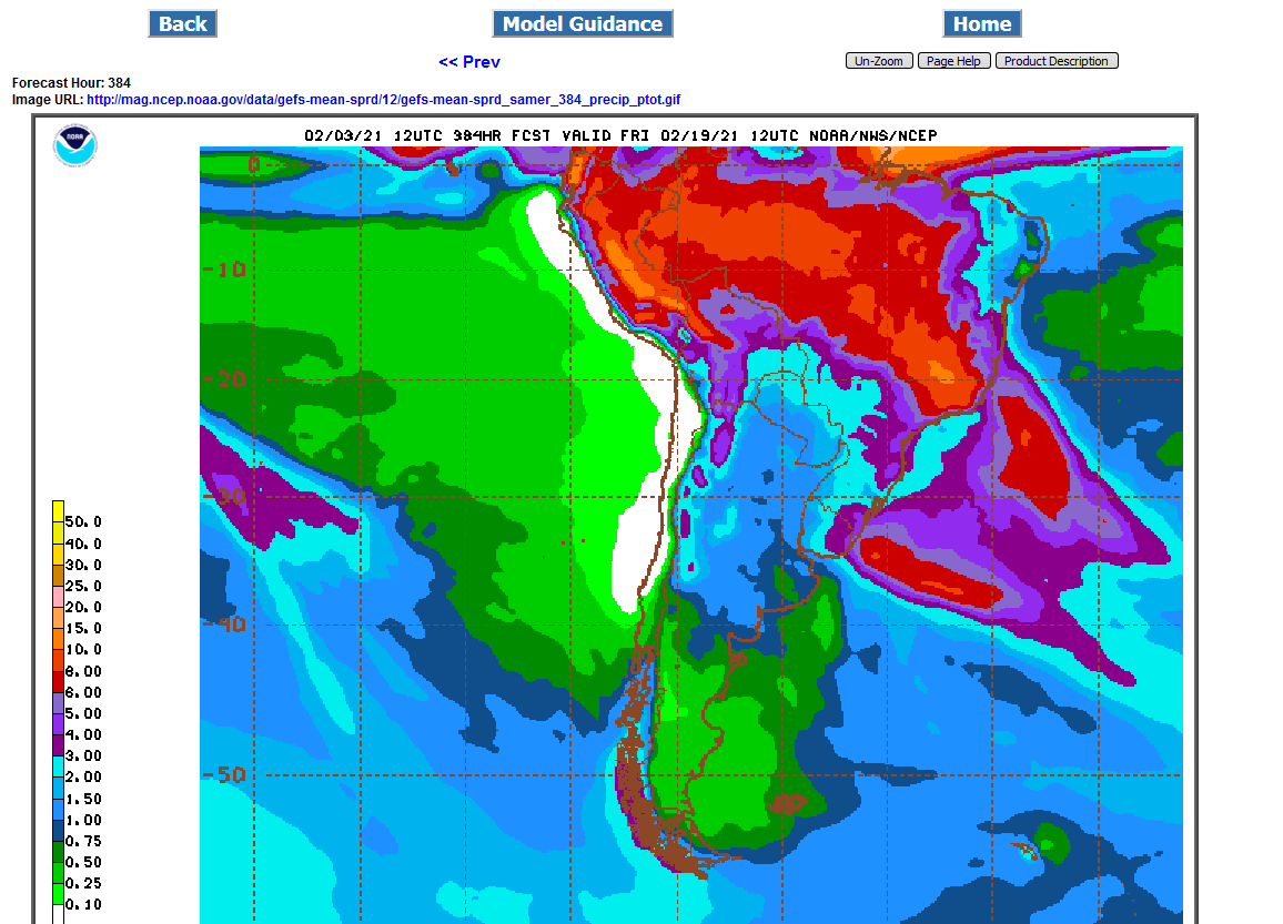
Here's the last forecast for SA. Brazil has plenty of rain. Argentina is on the dry side.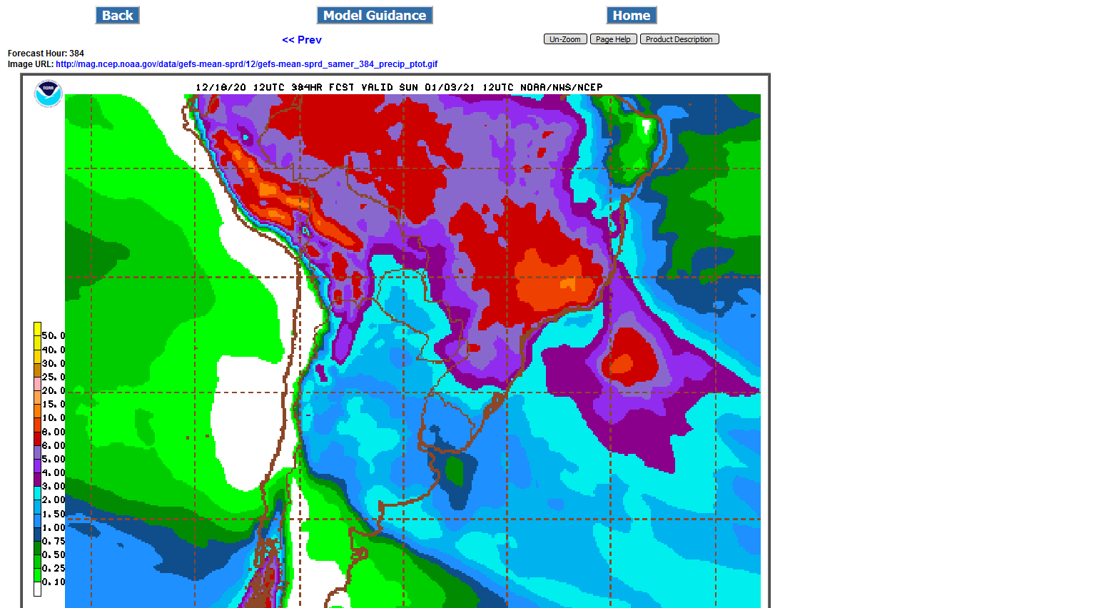
This is what Jim was talking about:
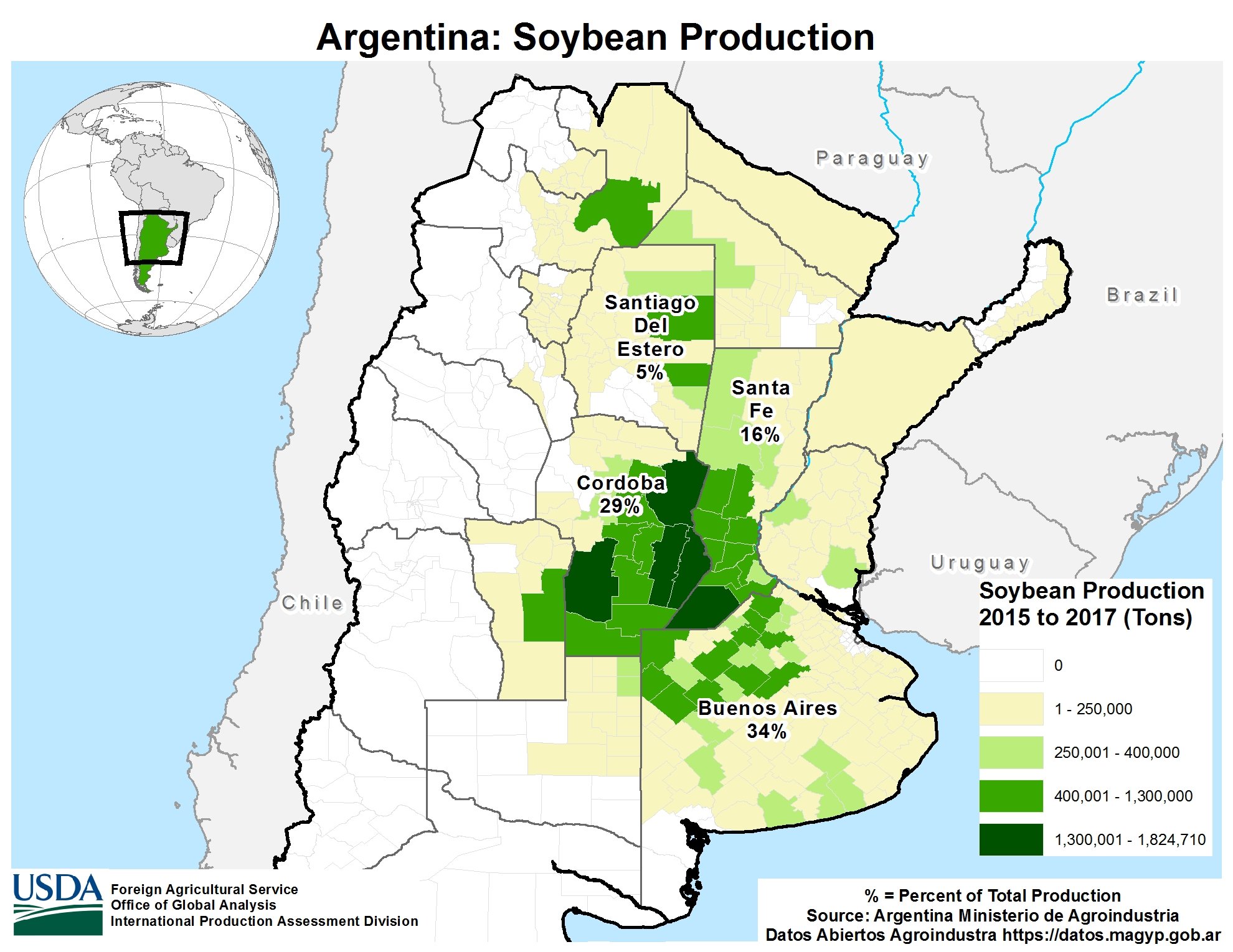
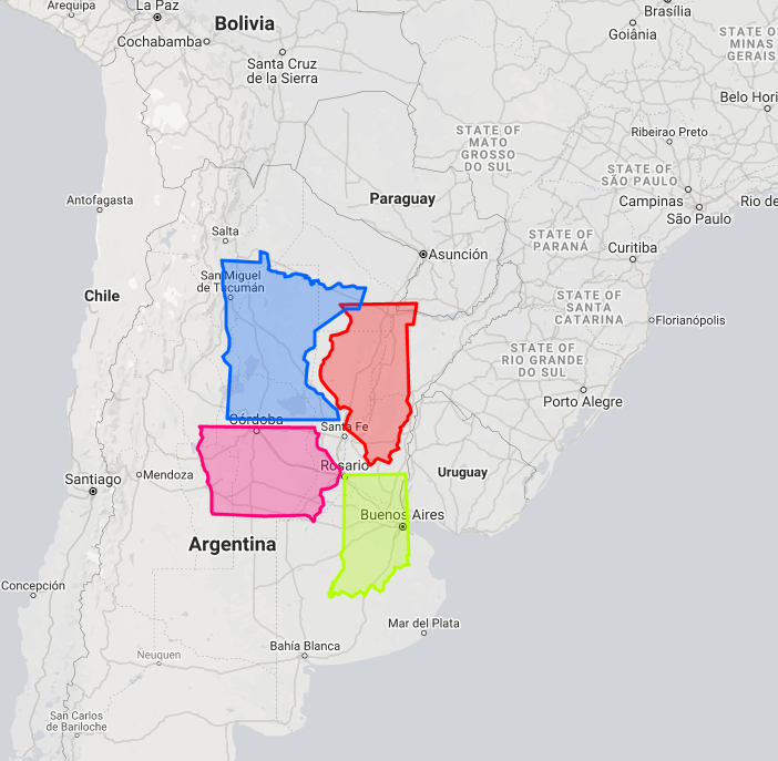
#Argentina's #soybeans are most concentrated in Cordoba, Santa Fe & Buenos Aires. The 2020/21 crop is pegged @ ~50 mln tonnes (1.84 bln bu). That is roughly the estimated 2020 crop of the U.S. I-states plus Minnesota. Speaking of, they fit quite nicely in Argentina's grain belt.
Just out 12z Sunday GFS ensemble 2 week rains:
Robust for Brazil but a bit low for Argentina, especially the far southern parts of their key growing region. To see that, scroll up.
Imagine where beans would be trading right now if the Brazil weather was bullish, instead of bearish!!!
This move up is not from SA weather but whats interesting is the amount of rain in central Brazil.
6"+ the next 2 weeks, a few recent model runs had as much as the 8 inch contour. The threat for TOO MUCH rain is much higher in Central Brazil right now than for drying out.....if weather mattered that much.

Close to average rain in much of Brazil but on the dry side for Argentina's corn/beans and farthest south areas of Brazil.
Just updated 18z GFS ensemble rain total for week one below.
Below that is the total for 2 weeks.
Beans are mostly going higher to ration too much demand of stocks(at this price) that will run out before the Brazil harvest in 2 months gives the market more.
.png)
Eric Snodgrass SA weather 12-28-2020
Nutrien Ag Solutions Ag Forecast for South America - Dec 28, 2020 - YouTube
Rains continue to get skimpier for Argentina beans.
1. Total 1 week rains below. Not much for Argentina 12z GFS Ensemble just updated
2. Total 2 week rains below. Rains return but below normal for Argentina and far S. Brazil. C. Brazil =good.
.png)
cutworm,
Thanks for that link to Eric!
Eric Snodgrass SA weather 12-31-2020
Nutrien Ag Solutions Ag Forecast for South America - Dec 31, 2020 - YouTube
Mike I thank you for all the work you do to bring all the weather info together here. To me You and Eric bring more understanding of what is happening. Thanks again!
YW very much cutworm!
It's a great pleasure sharing the Hoosier state/Indiana with you (-:
Appreciate all your positive contributions here!
mike
Eric is the best verbal weather communicator that I've seen............EVER!
Keep his video's coming please.
Rains week 1 top map 0z GFS ENSEMBLE MEAN
Rains total for 2 weeks bottom map...............picking up in very dry Argentina week 2.png)
Rains continue to pick up for very dry Argentina in week 2:
06Z GFS Ensemble below:
.png)
12Z GFS ensemble below
1. Map for Week 1......rains showing up at the end of this period in very dry Argentina
2. Map for 2 weeks total.............widespread robust rains in week 2 for very dry Argentina
.png)
.png)
Same forecast..........rains picking up in very day Argentina late week 1:
2 week totals below from the just out 12z GFSensemble:
Looks like a very nice rain event(s) late week 1 still but then turning dry again after early week 2 lingering rains.
Nice rain events Argentina days 5-10 then turning dry again. The market is trading "we're out of beans and can't wait for the Brazil harvest to get more" rather than just weather here..........although the weather could cause some additional volatility.
Total 2 week rains below:
2 week rains. Tons for Brazil, more than earlier this week for Argentina.
The incredible spike higher in corn and beans is not from the weather forecast. This is a demand led rally, featuring a huge drawdown in stocks.............that needs price rationing.
2 week rains from the just out 0z GFS Ensemble.
Plenty of rain C.Brazil. Maybe a tad below normal far S. Brazil. Pretty good in Argentina.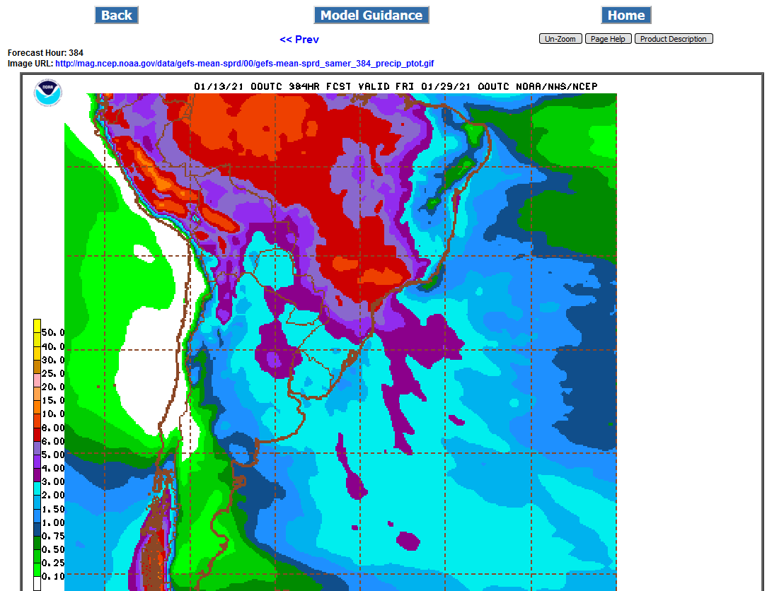
Weather is slightly more bearish in South America
2 week rains below from the 12z GFS Ensemble:.png)
Tons of rain coming to much of South America the next 2 weeks(especially all of Brazil and far N. Argentina. Just out GFS ensemble mean below:
.png)
Big rains almost everywhere in SA. 2 week rains from the just out 0z GFS ens.
3+ inches of rain the next 2 weeks for all of Brazil and Argentina on this latest 0z GFS Ensemble Mean.
Just out 12z GFS Ensemble Mean..............still plenty of rain in SA over the next 2 weeks.
.png)
Already big rains before today continue to increase for ALL of South America. Pretty unusual for so much rain EVERYWHERE and no dry spots in the forecast. Very bearish weather for beans during a key developmental time frame(flowering/pod filling).
3+ inches everywhere the next 2 weeks below.
Thanks for keeping us up to date Mike!
YW Jim!
Still massive rains everywhere in SA!
Rains amounts in the forecast have continued to increase in S.Brazil the past 24 hours, with the 8+ inch contour in bright red below(6+ inches is dark red). A foot of rain possible in some spots. Most of this rain will be coming up the next week which is why it TOO MUCH rain. The map below is for the next 2 weeks!
I thought we all learned a couple years ago when we had one of the wettest springs in history that there is no such thing as too much rain. After all the bs about late planted crops, crop switching, yellow corn , yellow beans, etc etc, we still had a big bean and corn crop.
The old myths are just that, old myths. Nothing kills these plants short of no water for weeks on end.
Too much CO2 to hurt them badly.
Still tons of rain everywhere in SA, too much in Southern Brazil.
Latest 12z GFS Ensemble mean rain totals for 2 weeks below.
This is not a weather market. It's a demand rationing market that has run out of supplies.
Great rains everywhere in South America. Not quite so excessive in S.Brazil today.
2 week rains from 12z GFS ensemble mean below.
MUCH less rain than previously, partly because alot of it has already fallen and Argentina really dries out after around day 6, with very little rain after that.
Below: SA 2 week rains from the just out 12z GFS ensemble, most of it in week 1 for Argentina:
Again, this is mostly a demand led market thats rationing limited supplies by hitting high enough prices to cut demand back so that it meets the lower supplies.....not a weather market.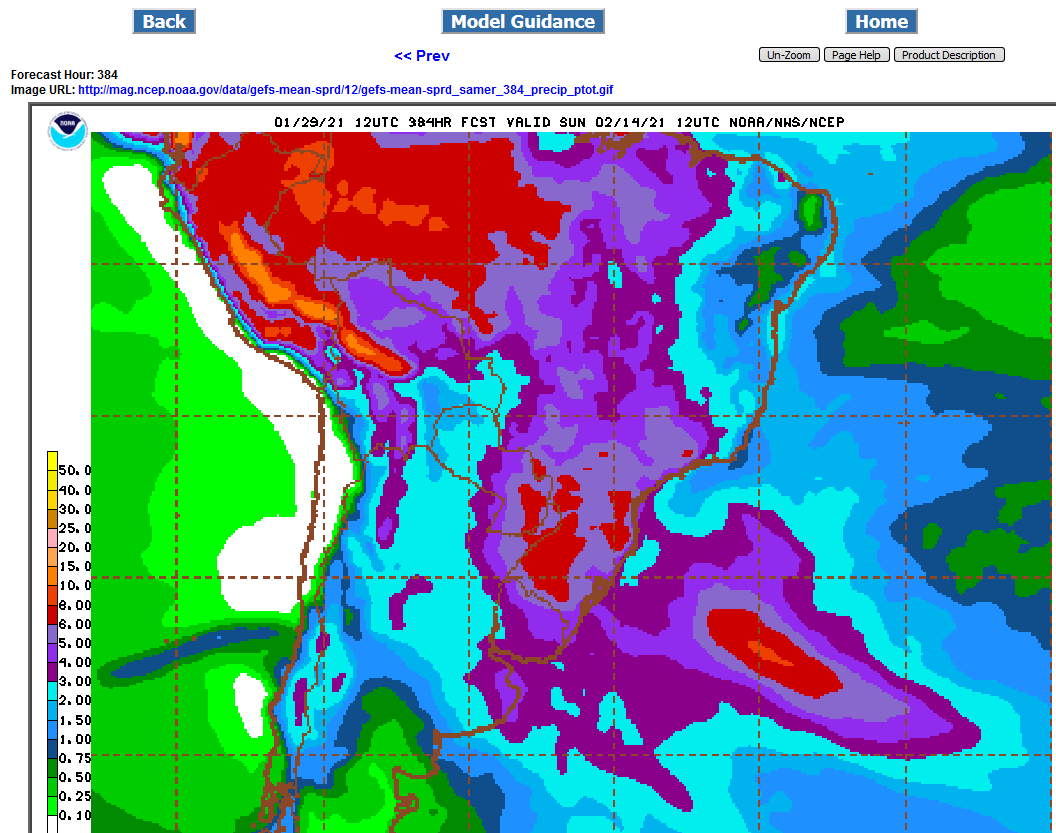
This is the reason for the corn demand led rally(from China)
Not much rain for Argentina the next 2 weeks!
edit.............make that for far northern Argentina....good rains elsewhere but its getting late in the growing season too and early into harvest is coming up.
Plenty of rain everywhere...........late in the growing season.
Too much in Central Brazil which may hinder early harvesting. 12z GFS ensemble rains for the next 2 weeks below:
The weather for this demand led rally happened in China last August/September!
2 weekcumulative rains for South American from the 12z GFS ensemble mean a bit wet for Central Brazil. 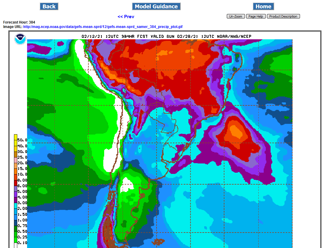
no wx problems for early harvest or late maturing beans.
A bit wet in Central Brazil for harvest.
A bit too wet in Central Brazil.......for harvest.
Too wet in much of Brazil for ideal harvesting.............had prices higher overnight.
The occasional pops from harvest scares are nothing more than selling opportunities. We all know that crops get harvested and with prices the way they are, they would get people out there pulling each bean off the pod if they had too.
My line in the sand is 1400 for SN21.
The beans will get harvested
No idea if true but rumours of sprouted beans in the combine bin. Does any body know if the rain has caused quality issues
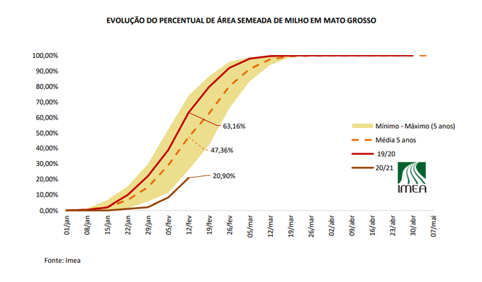
I am also wondering if the rain will affect timely planting of Safrina corn
I am sure rain has been an issue at harvest time before
Around here we don't follow with a second crop unless it be fall wheat. Rain can delay wheat planting and some times it is too late to plant the wheat
It usually takes a lot of rain to affect bean quality but we have cooler temps so sprouting could happen more quickly in Brazil.. Our bigger problem is the pods will eventually pop open spilling the beans on the ground. This is natural for the plant to continue the life cycle
You would think for all the years we have all been here chatting about this stuff, we would quit paying attention to it. Beans sprouting in the bins, it's too wet, harvest delayed, etc etc. It's always the last gasp of the bulls about to have their hats handed to them.
The ONLY thing I have seen that has aversely affected prices is something epic, like a drought or the pandemic. That stuff only comes along a couple times in a lifetime.
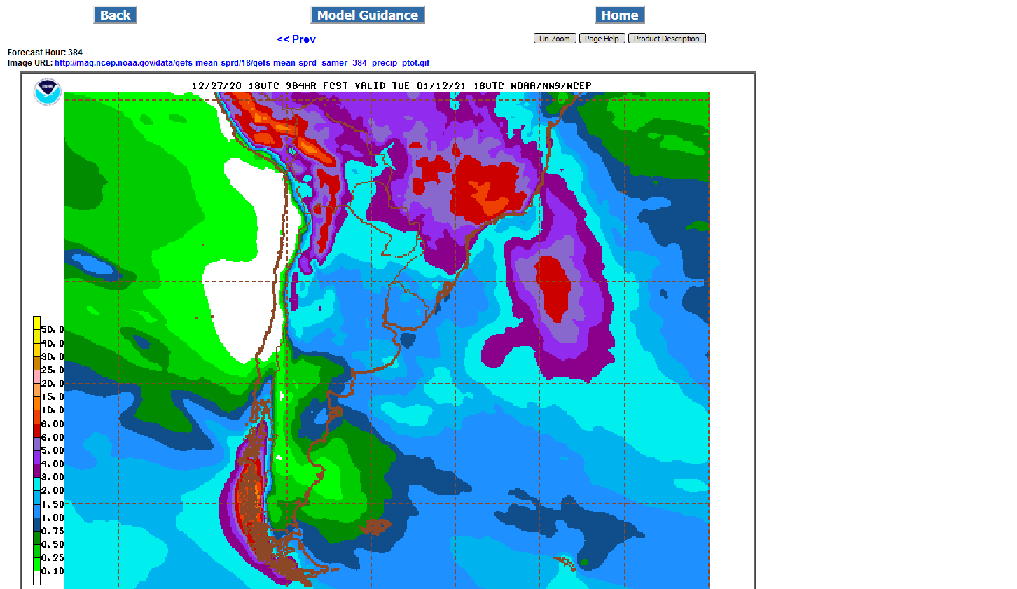
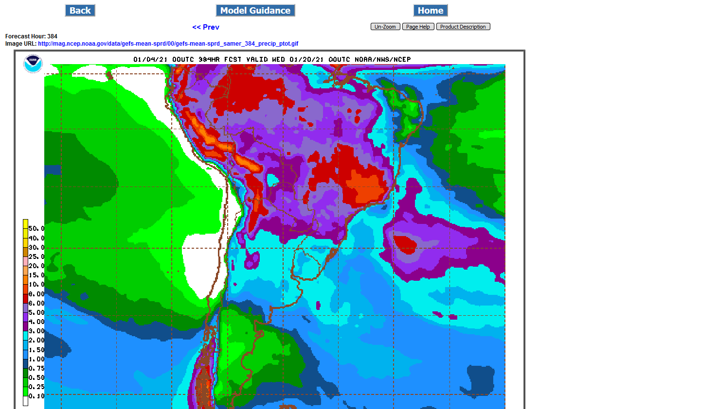
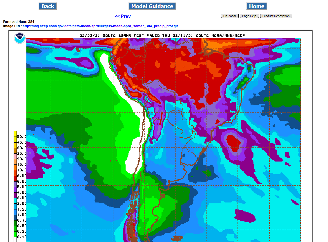
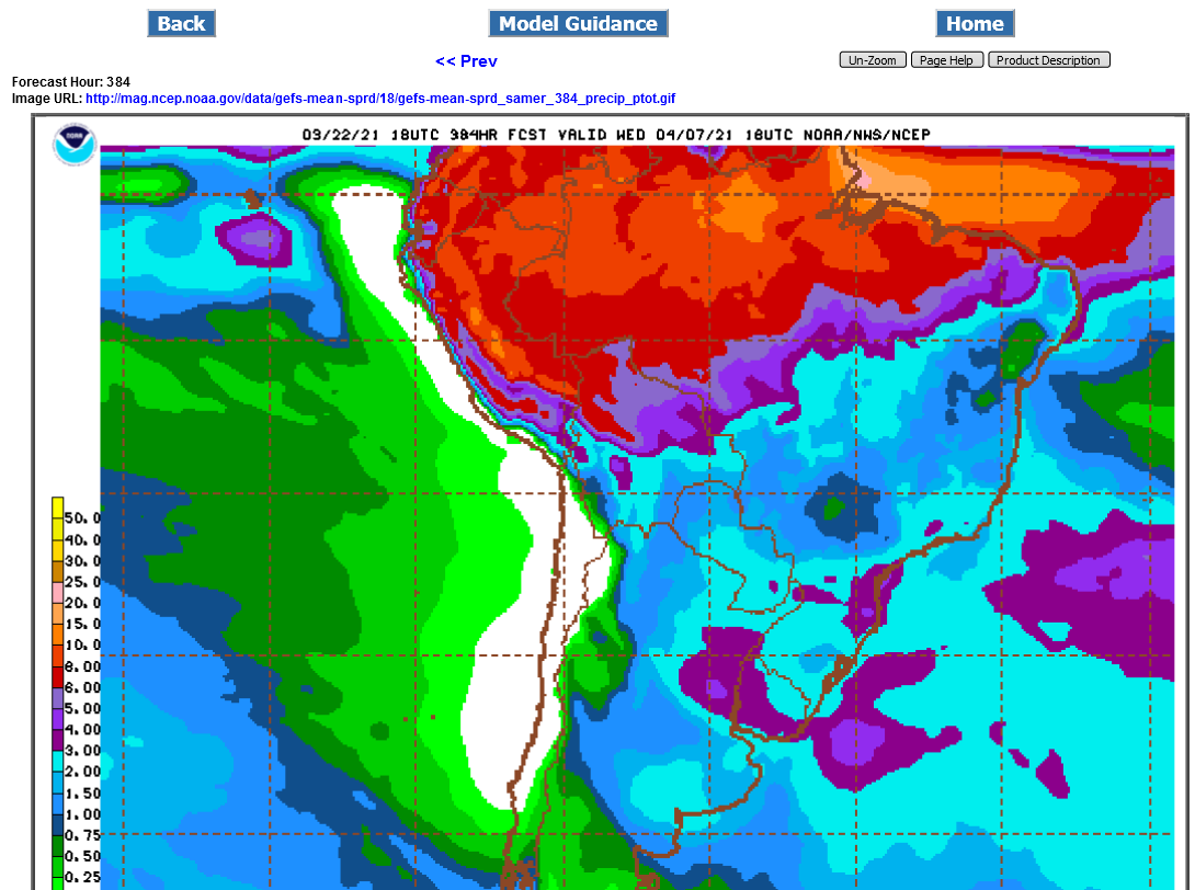
A bit on the wet side in Brazil but not excessive:
Eric Snodgrass South American weather 3-4-2021
Wonderful contribution cutworm!
SA weather.....a bit wet in CBrazil, mostly short term but this isn't a weather market. We have more demand than we have supply right now. Stocks are extremely low.
Red shades in Central Brazil are 6"+ of rain the next 2 weeks..............too wet for good harvesting.
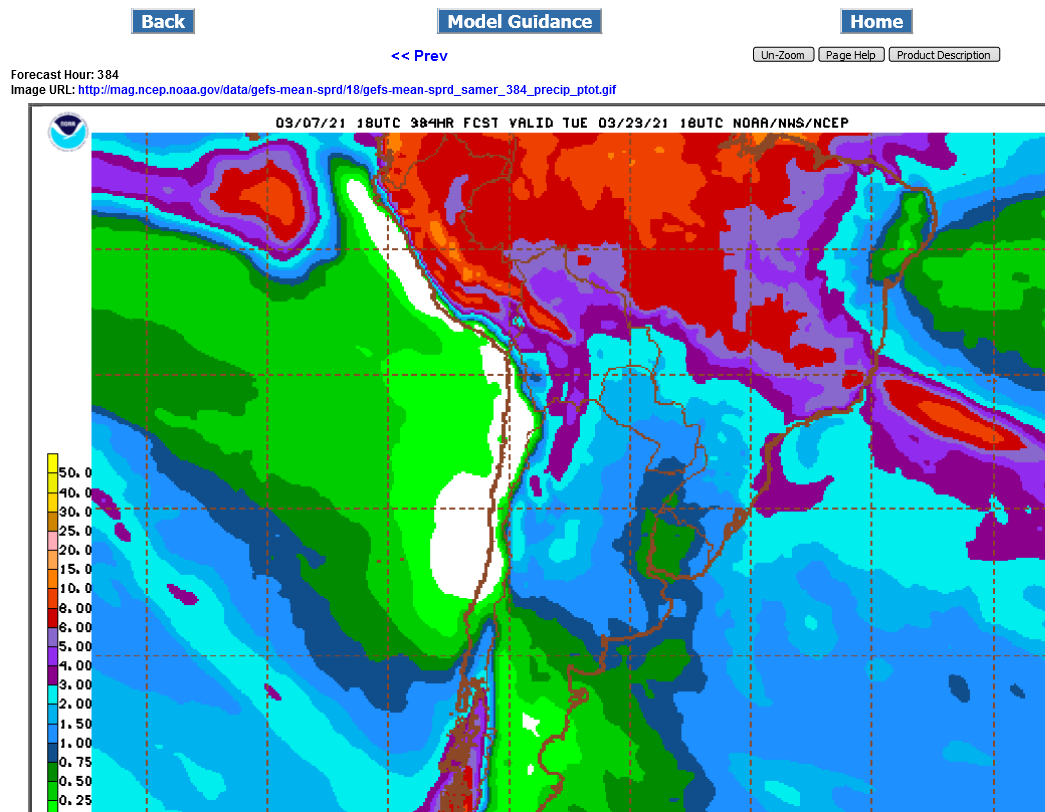
It's, especially high production Mato Grosso below that's too wet to harvest.
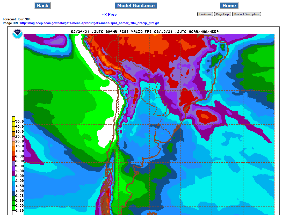
Still pretty wet in Central Brazil, 2 week rain totals below.
It's kind of hard not to think of this........ Though remember, temps get cooler in Parana toward mid-year while in the US they get warmer. Not exactly the same comparison but Parana's planting delays seem to be just as severe as 2019 US.
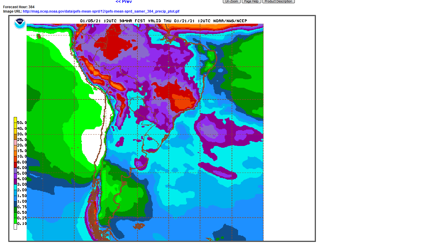
Still too wet in Central Brazil:
That is an interesting comparison. And I can't help but throw in, that even after that historical delay in getting the crop in the ground, the US still had pretty good production.
The rest of the 2019 growing season was almost perfect. There was a late frost and of course, the increase in CO2 is really helping crops(more the beans than corn).
Rains not quite as much in Central Brazil. A bit more in Southern Brazil.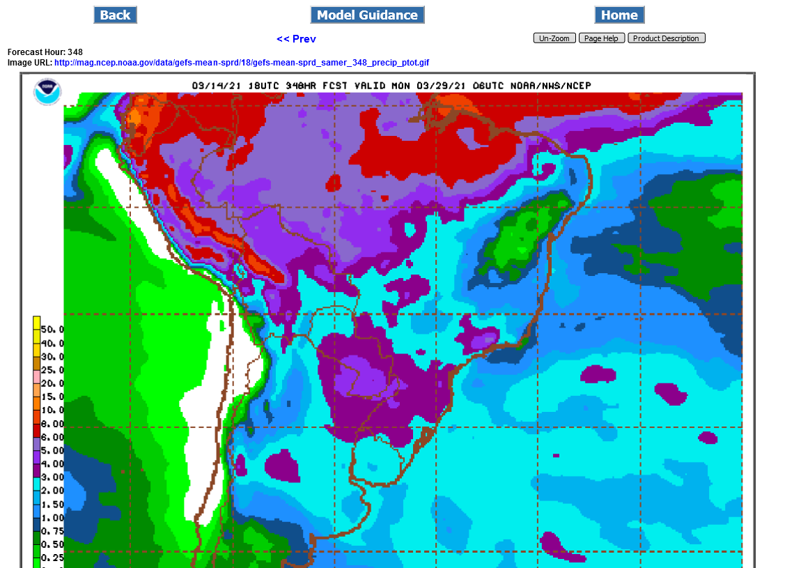
#Soybeans were 80% harvested (97% last year, 88% avg).
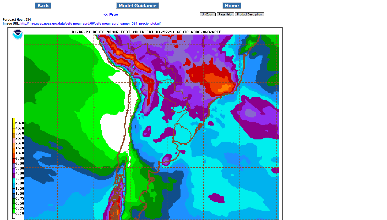
A bit less rain C.Brazil.......more for S.Brazil.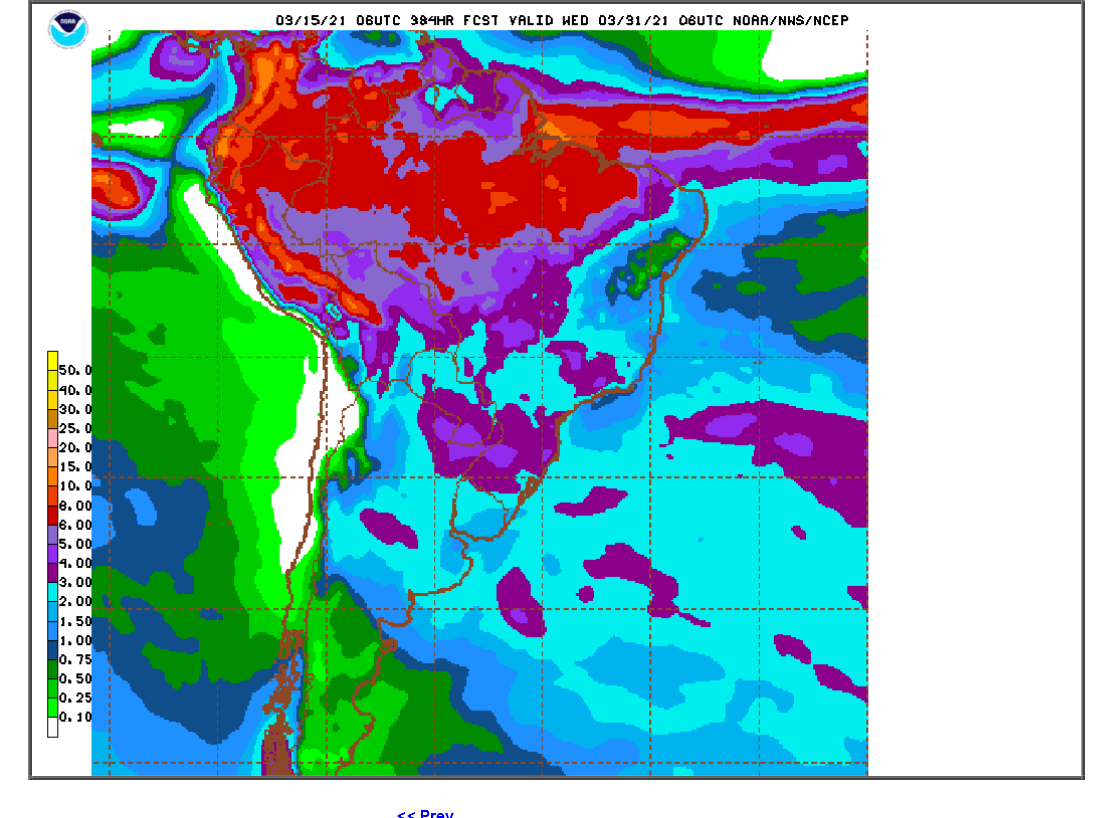
Rains continue to increase a bit in S.Brazil.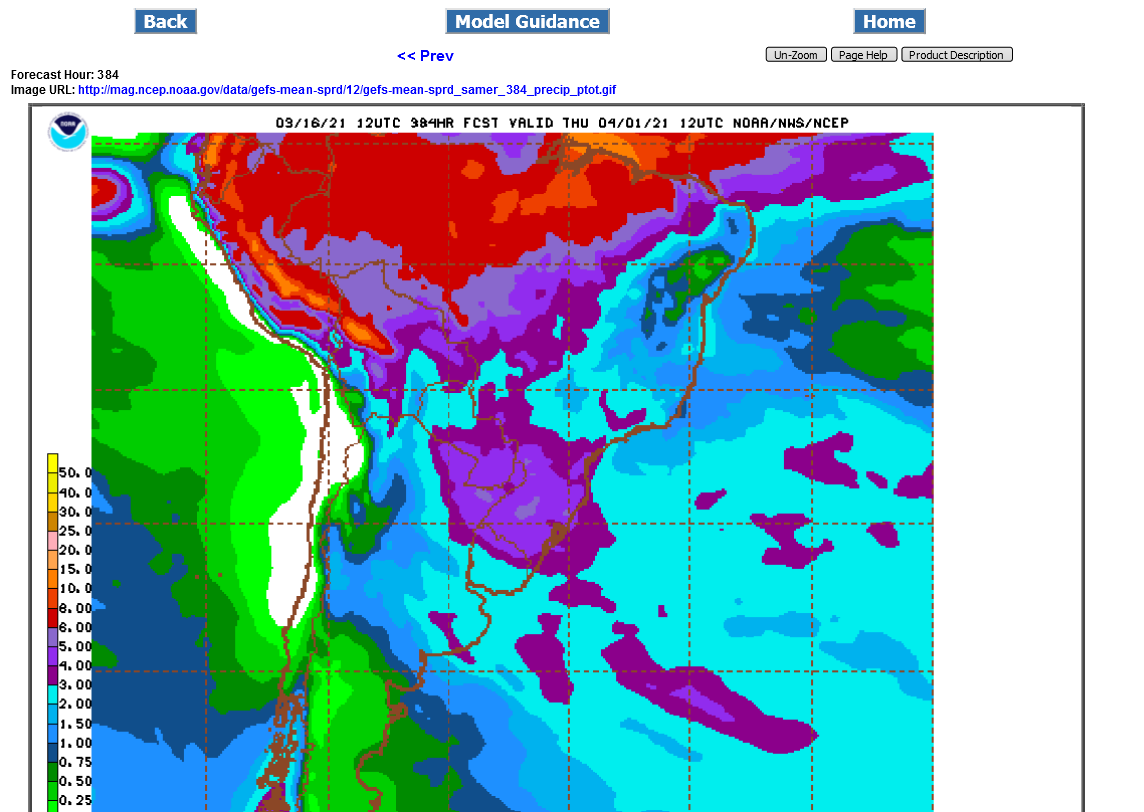
Weather in South America is no longer an issue. The market is beginning to focus on US weather!
Weather in South America is not a trading factor in prices right now. The heavier rains have shifted farther north, like they usually do this time of year in Brazil.