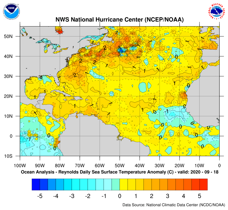
Invest 99L, which is in the SW Caribbean, appears to already be developing. Models have been unanimous on it forming for a few days along with a high threat to the western Gulf, namely TX and LA. This has the potential of being a very dangerous storm.
Regarding potential effects on commodities, I'd say NG, oil, gasoline, and CT. Then perhaps electricity and lumber.
Any others?
for alerting us to this Larry.
I'm working on an outdoor project this week and will try to stay on it. Please keep us updated with your latest valuable thoughts.
|
Tropical storm, then Hurricane Ida on the way.
https://www.nhc.noaa.gov/graphics_at4.shtml?start#contents
![[Key Messages]](https://www.nhc.noaa.gov/storm_graphics/AT09/refresh/AL092021_key_messages+png/144701_key_messages_sm.png)
Just 3 storms away from Larry after this one!
https://www.nhc.noaa.gov/aboutnames.shtml
Atlantic Pronunciation Guide (PDF)
| 2021 | 2022 | 2023 | 2024 | 2025 | 2026 |
|---|---|---|---|---|---|
| Ana Bill Claudette Danny Elsa Fred Grace Henri Ida Julian Kate Larry Mindy Nicholas Odette Peter Rose Sam Teresa Victor Wanda | Alex Bonnie Colin Danielle Earl Fiona Gaston Hermine Ian Julia Karl Lisa Martin Nicole Owen Paula Richard Shary Tobias Virginie Walter | Arlene Bret Cindy Don Emily Franklin Gert Harold Idalia Jose Katia Lee Margot Nigel Ophelia Philippe Rina Sean Tammy Vince Whitney | Alberto Beryl Chris Debby Ernesto Francine Gordon Helene Isaac Joyce Kirk Leslie Milton Nadine Oscar Patty Rafael Sara Tony Valerie William | Andrea Barry Chantal Dexter Erin Fernand Gabrielle Humberto Imelda Jerry Karen Lorenzo Melissa Nestor Olga Pablo Rebekah Sebastien Tanya Van Wendy | Arthur Bertha Cristobal Dolly Edouard Fay Gonzalo Hanna Isaias Josephine Kyle Leah Marco Nana Omar Paulette Rene Sally Teddy Vicky Wilfred |
Since 1953, Atlantic tropical storms had been named from lists originated by the National Hurricane Center. They are now maintained and updated through a strict procedure by an international committee of the World Meteorological Organization.
Latest forecast from the NHC below:
https://www.nhc.noaa.gov/text/refresh/MIATCDAT4+shtml/270322.shtml?
Ida predicted to hit the LA border late Sunday, peaking around 120 mph.
Hit the link below to get the satellite loop:
https://www.star.nesdis.noaa.gov/GOES/sector_band.php?sat=G16§or=gm&band=13&length=96

Ida will pop up in the southern part of the surface pressure and wind map below on Friday and grow greatly over the weekend! This map is updated constantly.
https://www.spc.noaa.gov/exper/mesoanalysis/new/viewsector.php?sector=18

+++++++++++++++++++++++++++++++++
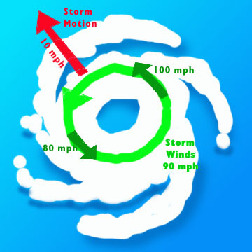
Areas to the east/northeast or right side of Ida or any hurricane(the dirty side of the hurricane) because of the counterclockwise spin, will have the speed of the storm adding to the velocity of the wind.
On the west/southwest/left side of Ida or any hurricane, the opposite occurs. Winds will be less by the amount of forward speed of the hurricane.
If Ida is traveling at 10 mph in the north direction for instance, we subtract 10 mph from the hurricane winds on its west/left side with respect to the ground/ocean. So a 90 mph wind circulation actually becomes 90- 10 = an 80 mph wind.
On the right/east side, the speed ADDS 10 mph to the circulating wind speed and we get 90 +10 =100 mph.
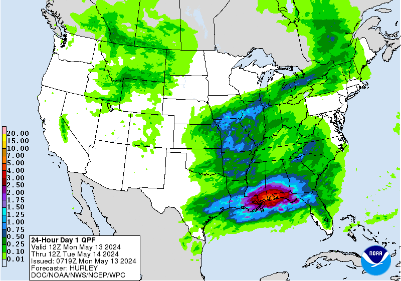
The latest rain forecasts are below.
Day 1 below:
http://www.wpc.ncep.noaa.gov/qpf/fill_94qwbg.gif?1526306199054

Day 2 below:
http://www.wpc.ncep.noaa.gov/qpf/fill_98qwbg.gif?1528293750112

Day 3 below:
http://www.wpc.ncep.noaa.gov/qpf/fill_99qwbg.gif?1528293842764

Days 4-5 below:
http://www.wpc.ncep.noaa.gov/qpf/95ep48iwbg_fill.gif?1526306162

Days 6-7 below:
http://www.wpc.ncep.noaa.gov/qpf/97ep48iwbg_fill.gif?1526306162

7 Day Total precipitation below:
http://www.wpc.ncep.noaa.govcdx /qpf/p168i.gif?1530796126

Excessive rain threat.
https://www.wpc.ncep.noaa.gov/qpf/excess_rain.shtml
Current Day 1 Forecast
Day 1 Threat Area in Text Format
Current Day 2 Forecast |

++++++++++++++++
Severe Storm Risk.
https://www.spc.noaa.gov/products/outlook/
Current Day 1 Outlook | |
Current Day 2 Outlook | |
Current Day 3 Outlook | |
Current Day 4-8 Outlook |
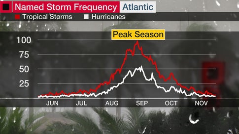
We are around 2 weeks before the historical peak for named storms in the Atlantic basin, which is around September 10th but each year is different.
Ida adjusted to 120 mph in forecast for late Sunday, when hitting LA Coast.
https://www.nhc.noaa.gov/text/refresh/MIATCDAT4+shtml/270322.shtml?
NHC forecast up to 140 mph!
Down a notch to 130 mph but alot can happen during the next 24+ hours! Scroll up for more!
https://www.nhc.noaa.gov/text/refresh/MIATCDAT4+shtml/270322.shtml?
https://www.star.nesdis.noaa.gov/GOES/sector_band.php?sat=G16§or=gm&band=13&length=96
Last forecast was still 130 mph.
seems like when ever we are so desperate as to look for water from a hurricane here all we get are low hanging clouds, big wind, and rain that wraps around the core and misses us to the east and west. north or south. In other words the same since 7/16
Ida at 130 mph.
You can see the eyewall clobbering the LA coast right now! Maps below are constantly updated. Today is the 16 year anniversary of Katrina.
https://www.nhc.noaa.gov/text/refresh/MIATCDAT4+shtml/270322.shtml?
https://www.star.nesdis.noaa.gov/GOES/sector_band.php?sat=G16§or=gm&band=13&length=96

Lots of coverage. Making landfall............RIGHT NOW!
https://www.youtube.com/watch?v=vcbk3NcScRM
https://www.cnn.com/us/live-news/hurricane-ida-updates-08-29-21/index.html
Ida will be slowly weakening to below hurricane strength on Monday morning.
https://www.marketforum.com/forum/topic/74215/#74358
https://weather.com/news/news/2021-08-29-hurricane-ida-louisiana-new-orleans-mississippi-news
Ida down below hurricane strength, moving north, in southwest MS.
Use this radar loop for an awesome view with 240 images
https://www.star.nesdis.noaa.gov/GOES/sector_band.php?sat=G16§or=gm&band=13&length=240
Radar loop from Jackson MS.............the one to follow on Monday.

https://www.spc.noaa.gov/exper/mesoanalysis/new/viewsector.php?sector=15#

https://www.spc.noaa.gov/exper/mesoanalysis/new/viewsector.php?sector=15#

Ida about to drop below tropical storm strength:
https://www.nhc.noaa.gov/graphics_at4.shtml?start#contents
![[Key Messages]](https://www.nhc.noaa.gov/storm_graphics/AT09/refresh/AL092021_key_messages+png/152146_key_messages_sm.png)

Radar loop from Jackson MS.............the one to follow on Monday.
Use this radar loop for an awesome view with 240 images
https://www.star.nesdis.noaa.gov/GOES/sector_band.php?sat=G16§or=gm&band=13&length=240
These data pages will track Ida for the next several days. They are updated every few minutes.
https://www.spc.noaa.gov/exper/mesoanalysis/new/viewsector.php?sector=17

https://www.spc.noaa.gov/exper/mesoanalysis/new/viewsector.php?sector=17#

Awesome 3 day images/loop!
https://www.iweathernet.com/satellite-images-and-loops/high-res-enhanced-water-vapor-loop-3-days
Yesterdays Ida rains hit cutworms farms!
https://www.marketforum.com/forum/topic/74200/#74473
By cutworm - Sept. 1, 2021, 9:43 a.m.
I hope that mcfarm received some rain last night. I had 1.5 inches of very timely rain last night 8-31
By metmike - Sept. 1, 2021, 12:55 p.m.
This is wonderful cutworm.
Compliments of Ida!(just barely). We missed this last one.....barely but were in good shape from getting lucky with several previous rains. 24 hour rains below.
https://water.weather.gov/precip/
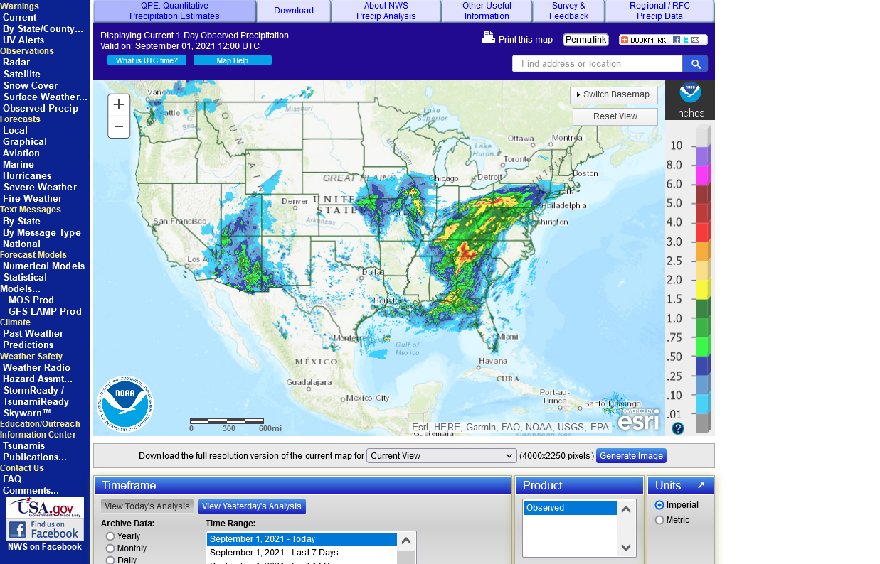
Just about every color in the rainbow on the Philly NWS map!

https://www.spc.noaa.gov/exper/mesoanalysis/new/viewsector.php?sector=17
https://www.spc.noaa.gov/exper/mesoanalysis/new/viewsector.php?sector=17#
Ida remnants hitting the Northeast tonight.
High risk for flash flooding.

https://www.spc.noaa.gov/exper/mesoanalysis/new/viewsector.php?sector=16

https://www.spc.noaa.gov/exper/mesoanalysis/new/viewsector.php?sector=16#


A look at Ida's impact and climate change:
Hurricane Ida Update
10 responses |
Started by mikempt - Sept. 2, 2021, 8:20 a.m.
