Very Happy last day of July!
Scroll down and really enjoy the latest comprehensive weather.
Drying out southwestern half of the Cornbelt.
The latest rain forecasts are below...........broken down into each period coming up. Then the 1 week totals.
Day 1 below:
http://www.wpc.ncep.noaa.gov/qpf/fill_94qwbg.gif?1526306199054

Day 2 below:
http://www.wpc.ncep.noaa.gov/qpf/fill_98qwbg.gif?1528293750112

Day 3 below:
http://www.wpc.ncep.noaa.gov/qpf/fill_99qwbg.gif?1528293842764

Days 4-5 below:
http://www.wpc.ncep.noaa.gov/qpf/95ep48iwbg_fill.gif?1526306162

Days 6-7 below:
http://www.wpc.ncep.noaa.gov/qpf/97ep48iwbg_fill.gif?1526306162

7 Day Total precipitation below:
http://www.wpc.ncep.noaa.govcdx /qpf/p168i.gif?1530796126

Excessive Rainfall threat shifting southeast/east and lasting a few days.........see the maps below:
Current Day 1 Forecast |
Day 1 Threat Area in Text Format
Current Day 2 Forecast |
Day 3 forecast below

Severe Storm Risk. Hit the map for full screen. Not very high. Jet stream not that strong.
https://www.spc.noaa.gov/products/outlook/
Current Day 1 Outlook | Forecaster: Hart/Kerr Issued: 18/1240Z Valid: 18/1300Z - 19/1200Z Forecast Risk of Severe Storms: Slight Risk |
Current Day 2 Outlook | Forecaster: Bunting Issued: 18/0600Z Valid: 19/1200Z - 20/1200Z Forecast Risk of Severe Storms: Marginal Risk |
Current Day 3 Outlook | Forecaster: Bunting Issued: 18/0731Z Valid: 20/1200Z - 21/1200Z Forecast Risk of Severe Storms: Marginal Risk |
Current Day 4-8 Outlook |
High Temperatures today and Wednesday....... still pleasant Midwest.
Blast furnace in the Southwest..........even Pacific Northwest feels the heat(records)!!!


Dew points. 70+ on this scale makes it feel uncomfortable(sticky air)! Very Comfortable air N/C Plains to Northeast!

Highs days 3-7.
Gradually heating back up during this period.
Cooling West!!!!!


How do these days 3-7 temperatures compare to average at this time of year? We have now past the the climatological time of year when temperatures are the hottest.
Above average in the Plains to Midwest to Northeast.
Heat in the West shifts a bit east.
High temperature departures:

Low Temperature Departures:

Rains the past 24 hours. East and South.
![]()
Missouri/Arkansas to S.Plains in bad shape....bone dry(this is why they were singing in the recent rains-now they will dry out even more).
Recent drying has extended into S.IA/IL/IN/OH. Eastern Cornbelt getting good rains right now.
NE to s.MN/n. IA...........wet soils recently but drying out.

You can go to this link to see rain totals from recent time periods:
https://water.weather.gov/precip/
Go to precipitation, then scroll down to pick a time frame. Hit states to get the borders to see locations better. Under products, you can hit "observed" or "Percent of normal"
Below are rains compared to average of the last 7, 14, 30 and 60 days.
See how dry it's been in the Central Cornbelt for over a week and some negative departures for 14 and 30 days over the southern and eastern belt. This map is not updated for the last 24 hours at the moment.
https://www.atmos.illinois.edu/~snodgrss/Ag_Wx.html


Drought Monitor. This product is updated every Thursday.
http://droughtmonitor.unl.edu/Maps/CompareTwoWeeks.aspx

Temperature Anomalies from GFS ensembles(fairly reliable product) going out 2 weeks. These maps show the Northern Hemisphere. The map of the US is front center. Look for the state borders in white.
Today: Cool in C Plains and Midwest.
In 5+ days:
Heat West moves east to Plains/Upper Midwest/Northeast. Below average temperatures West.
In 10+ days Hot Plains and eastward.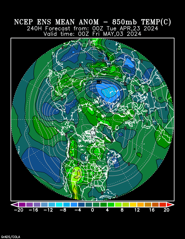
Day 15 Hot West/N-C Plains/Midwest to Northeast.
.
Last 0Z run of Canadian ensembles. Impressive heat ridge dominates much of the country but exactly where will it be centered?
Still several members that like the idea of a trough in the Northeast which splits the big ridges in the W.Atlantic and the one farther west in the US.
360h GZ 500 forecast valid on Jul 28, 2018 00UTC


The low skill, longer range CFS model for weeks 3 and 4. Looks similar to the last 2 days.
Cool in the Plains, then Midwest. Heat back out West.
Wet in much of the country.

Precip below:

Weather forecast
Started by Jim_M - July 30, 2018, 9:47 p.m.
The NWS forecast is like a 180 degree flip from last week. Stay long NG and grains.
12Z GFS is MUCH cooler early in the week 2 part of the solution!!
It also has better rain chances but is still pretty dry in the southwestern belt.
Below is the last one just out, then below that, the previous one.........a hot 6Z operational GFS.
gfs_namer_237_200_wnd_ht | gfs_namer_237_500_vort_ht |
gfs_namer_237_1000_500_thick | gfs_namer_237_850_temp_ht |
Previous 6z GFS below.....it was hot! to start week 2.
gfs_namer_240_200_wnd_ht | gfs_namer_240_500_vort_ht |
gfs_namer_240_1000_500_thick | gfs_namer_240_850_temp_ht |
Last 12Z GFS total rains for 2 weeks below:

Many of the the just updated 12z Canadian model ensembles have an impressive heat ridge............and disagree with this last 12z GFS operational model. It's actually a bit more bullish than its previous 0z run.
360h GZ 500 forecast valid on Aug 15, 2018 12UTC


The last 12z European model actually looks similar to the last 12z GFS at 10 days. Pretty strong cold front... but not likely to have much rain because the Gulf moisture will be absent. Moisture for this system to work with will be VERY scarce:
The 12z GFS ensemble mean has a pretty stout heat ridge in the Plains at 10 days. This makes the solution of a strong wave digging into that same area suspicious.

As expected, the NWS extended maps based on the overnight guidance came out hot and dry.
This is what launched, especially the beans and corn much higher.
August is considered THE key yield determining weather month for beans as they fill pods. Most people consider July the most critical for corn because of pollination during that month but corn kernels fill in August based on temperatures......the hotter it is, the smaller the kernels.
6-10 day Temperature Probability | |
Precipitation Probability | |
8-14 day Temperature Probability | |
Precipitation Probability | |
Extreme weather days 3-7:
Heat ridge builds into Southwest Cornbelt with temps approaching 100 degrees in some spots. Around the periphery of the heat ridge, we could have a system that ignites a cluster of heavy rain producing storms in the Upper Midwest.

A continuation of the excessive heat........temperatures flirting with the century mark will target the same location early in week 2(Southwest to possibly the Central Cornbelt).
There is a near zero chance of rain underneath the heat ridge...........so crops in this area will deteriorate.

Mike et al,
My take on NG today is that it was up earlier on slightly warmer 2 week model consensus/forecasts, but that it fell back significantly (back to morning lows) on cooler 12Z GFS, 12Z GFS ensemble, and 12Z Euro because it had been up for several days in a row thus inducing rather robust selling/profit-taking.
Mike,
I just learned that the CFS model is outperformed by the 30-year normal as early as day 10. So, it is little more than a crapshoot by mid week 2! That means that weeks 3-4 have virtually no more skill than a coin flip. Furthermore, it has so far this summer had a significant cool bias with an average of 2.2 CDD/day too cool within the 16-20 day period! Week #4 is likely even larger. These stats just emphasize what we already knew, that the CFS weeks 3-4 are mainly for entertainment value and have very little forecast value.
Larry,
I believe you because you are a statistics/data master, especially regarding the weather but am shocked at how really bad the model has performed this Summer.
I am sure that the market does trade these week 3 and 4 forecasts at times........and, according to NGI today was one of those times(though it could just have been an excuse to explain the drop).
I understand the lack of usefulness in this product for having a forecast that you or me would give, in which the forecast verification mattered. However, its also something that the speculative markets have decided to trade on based on the constant need to be able to see as far out as possible with weather forecasts.
El Nino's or La Nina's can often play a significant role in trading positions for expectations of weather months ahead.
A forecast for a strong El Nino for an upcoming Winter in the month of October/November can have alot of weather traders leaning strongly towards being short......becasuse of the increased odds of mild cold season temps.
The CFS model is a bit different but its the same idea............just another tool used by the weather community to project out beyond the usual 2 week forecasts from our more reliable models.
Let me put it another way.
I did the weather on television for 11 years. I used sometimes included the 6-10 day outlooks during my weather casts, which, 25 years ago was shortly after they just started coming out(Just on M-W-F 3 times a week back in those days)
I did that because I believed there was enough skill to show it as useful and sort of put my reputation behind them.
If I was doing weather on tv today, I can't imagine using the week 3-4 CFS model forecast.
It would mislead people for one thing.....into believing it too much and if I tried to explain the value and low skill and to take it with a grain of salt, it would make no sense.
You only get 2-3 minutes to show all the weather and why waste time with something that is not going to provide useful information to most people?
Viewers don't care that much about the weather in 3 weeks or a month. Weather trades REALLY care about it. Being early on the right position for the next weather pattern change is how weather traders make a living.
The latest 18z GFS still shows the very substantial system at around day 10 crashing into the heat ridge. In fact, it's even stronger than the previous 12Z run, when it first showed up.
The vast majority of its 12z ensembles had a stout heat ridge holding pretty strong at that time frame.
Natural gas spiked down to the weeks lows on the open this evening, which was probably just hitting all the sell stops sitting just below that strong support/lows. Might be related to this MUCH, MUCH cooler surge for the early week 2 period vs previous forecasts for that same period, going back for numerous days.
Because the change is so different from 12 hours ago, I'm putting the solution from 12 hours ago at the bottom so that you can see the difference. A deep cut off low now, where a heat ridge was before WOW!
What do you think Larry?
gfs_namer_234_200_wnd_ht | gfs_namer_234_500_vort_ht |
gfs_namer_234_1000_500_thick | gfs_namer_234_850_temp_ht |
Solution from 12 hours ago below:
| gfs_namer_240_200_wnd_ht | gfs_namer_240_500_vort_ht |
| gfs_namer_240_1000_500_thick | gfs_namer_240_850_temp_ht |
Just wanted to add my thanks, mike, for a great job here.
Here in Terrace, we've been fishing from about 5am to about 10, and then staying cool in the trailer. I'm hoping for the anticipated cool down in the next couple of days here. It seems like in BC, when we have one extreme temperature, the midwest has the opposite. In a few days, it is forecast to be in the mid 60s for highs here.
i might put up a picture in the NTR section for you.
That would be wonderful cfdr!
No coincidence that very often the "general" weather pattern, especially when its a big departure from the average, that you have in that part of the world is the opposite of what we have downstream, here in the US.
The spacing between large scale upper level features is such that when you have an extreme feature in one place, usually a couple thousand miles away, the opposite extreme will be present.
The upper level heat ridge in the West recently.........thats been built well north into Canada has had a corresponding downstream upper level trough a couple thousand miles east........in the Midwest.
The fact that you are cooling down is from the same pattern change that will a deep trough/low with strong Pacific get stream crashing into the West Coast up dislodging the heat ridge.......pumping it up farther downstream.....into the Plains and Midwest.
So things do a complete flip flop.
Mike, I also was amazed at how much the 12Z and later the 18Z GFS changed vs the earlier runs by late week 1. So, even week 1 wasn’t dependable on the GFS, much less week 2.
Edit: Actually, by mid week 1 there were already pretty drastic changes well up in Canada from the 6Z to the 12Z+ runs! And it appears that the new 0Z will follow suit.


