I perceive the market 'underestimated' actual rain AND today/tonight rain for C and S, which would result in lower open for C, S, and W. (Canola and Oat regions remain dry?, so firm to higher?)
Would appreciate your expertise!
Hi tjc!
I'll try to bring a bunch of stuff before I leave here shortly.
Here are the amounts of rain since Friday. Doesn't look greater than forecast to me.
https://www.iweathernet.com/total-rainfall-map-24-hours-to-72-hours
The forecast for the last week has been above rains and mild temps for 2 weeks and its pretty much the same right now.
This is why we had the extremely bearish downside break away gap lower last Sunday Night for C and S that remains way above the market and wide open.
Without a great deal of change in the weather forecast, I can't weigh into a guess on the open, other than when its this bearish in early August, the weather is usually a huge negative.
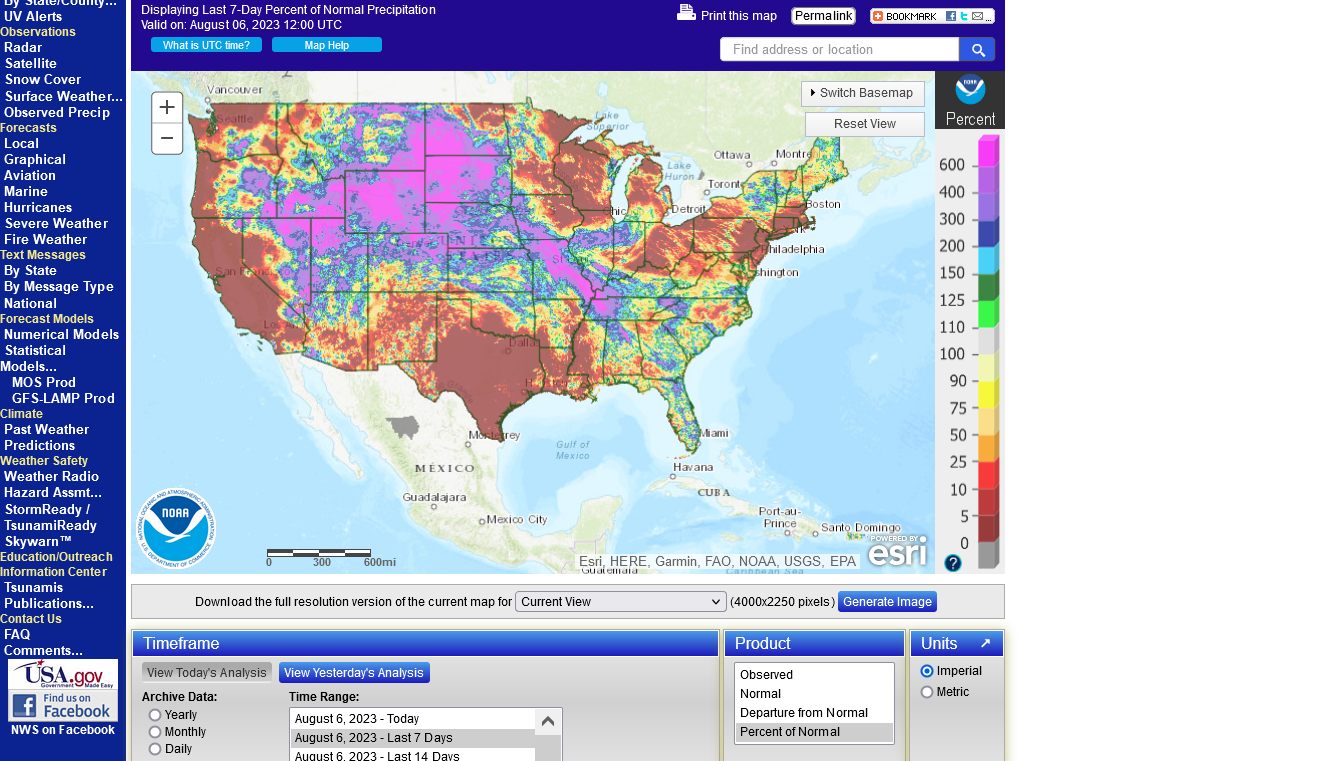
% average rains the last 7 days.
Huge difference between have's and have nots because much of the rain occurred from waves tracking around the periphery of the heat dome in TX.
The Upper Midwest to the ECB missed in many places because they were too far from the dome and in the cooler, drier air.
https://water.weather.gov/precip/
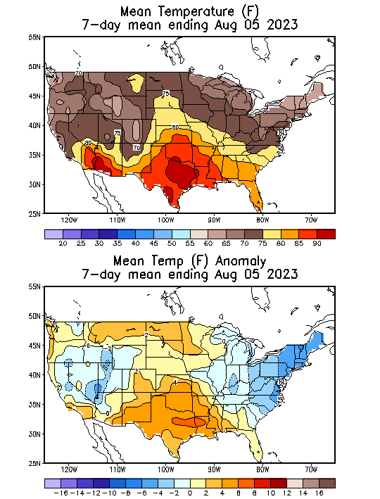
https://www.cpc.ncep.noaa.gov/products/tanal/temp_analyses.php
The latest 7 day precip forecasts are below.
Day 1 below:
http://www.wpc.ncep.noaa.gov/qpf/fill_94qwbg.gif?1526306199054

Day 2 below:
http://www.wpc.ncep.noaa.gov/qpf/fill_98qwbg.gif?1528293750112

Day 3 below:
http://www.wpc.ncep.noaa.gov/qpf/fill_99qwbg.gif?1528293842764

Days 4-5 below:
http://www.wpc.ncep.noaa.gov/qpf/95ep48iwbg_fill.gif?1526306162

Days 6-7 below:
http://www.wpc.ncep.noaa.gov/qpf/97ep48iwbg_fill.gif?1526306162

7 Day Total precipitation below:
http://www.wpc.ncep.noaa.govcdx /qpf/p168i.gif?1530796126

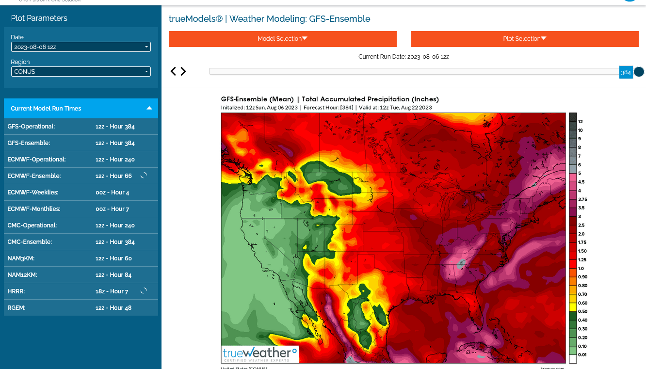
This was the last 12z GEFS solution.
1. Total rains
2. 500 mb-heat ridge southern US with perturbations around the periphery triggering periodic, organized tstorm clusters best depicted by the path of the dark reds on the rain map. Some could generate heavy rain events.
TWO WEEKS AGO, I COULD SIULL SEE THE GROUND AROUND EACH SOYBEAN PLANT, IN THE FIELD ACROSS THE ROAD FROM ME.
WE GOT 1 1/2" OF RAIN LAST WEEK & 1", YESTERDAY/OVERNITE.
LAST WEEK THERE WAS NO GROUND VISIB;E & THE PLANTS ARE BEAUTIFUL. THEY WILL ONLY BENEFIT FROM YESTERDAYS' RAIN ~ AND... IF THE FORECAST HOLDS, WE'RE IN FOR ANOTHER 1/2". TONIGHT/OVERNIGHT.
N.W. OHIO
Thanks, Jean!
WE'VE HAD NO RAIN THAT WAS FORECAST & THEY'VE TAKEN OUT ALMOST ALL OF THE RAIN FOR THIS WEEK
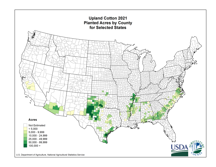
Weather will continue brutal for the TX cotton crop.
https://www.marketforum.com/forum/topic/83844/
https://www.nass.usda.gov/Charts_and_Maps/Crops_County/ctu-pl.php